The best MTB trails around Saint-Merd-Les-Oussines
4.4
(56)
254
riders
36
rides
Mountain bike trails around Saint-Merd-Les-Oussines are set within the diverse landscapes of the Plateau de Millevaches in Corrèze, France. The region features hilly terrain, extensive forests covering 42% of its area, and unique peat bogs. This environment provides a variety of marked trails suitable for mountain biking, ranging from moderate to difficult. The area is part of a large certified network, offering over 1,000 km of marked circuits.
Best mountain bike trails around Saint-Merd-Les-Oussines
- The most popular mountain bike trail…
Last updated: July 1, 2026
4.7
(3)
24
riders
52.0km
04:29
980m
980m
Hard mountain bike ride. Very good fitness required. Advanced riding skills necessary.
4.0
(1)
19
riders
28.6km
02:25
430m
430m
Moderate mountain bike ride. Good fitness required. Advanced riding skills necessary.

Sign up for free
4.9
(7)
17
riders
27.1km
02:15
400m
400m
Moderate mountain bike ride. Good fitness required. Suitable for all skill levels.
4.0
(1)
9
riders
25.4km
02:07
380m
380m
Moderate mountain bike ride. Good fitness required. Advanced riding skills necessary.
4.1
(7)
16
riders
19.9km
01:25
300m
300m
Moderate mountain bike ride. Good fitness required. Suitable for all skill levels.
Get access to more routes and recommendations from other explorers.
Sign up for free
Already have an account?
Our route recommendations are based on thousands of hikes, rides, and runs completed by other people on komoot.
Start today with a free account
Your next adventure awaits.
Login or Signup

Tips from the Community

An iconic and relatively well-preserved cross depicting a ram, although called a sheep cross, at the foot of a Templar cross. This building is located on the edge of the road and near a bridge spanning the Vienne River.
0
0
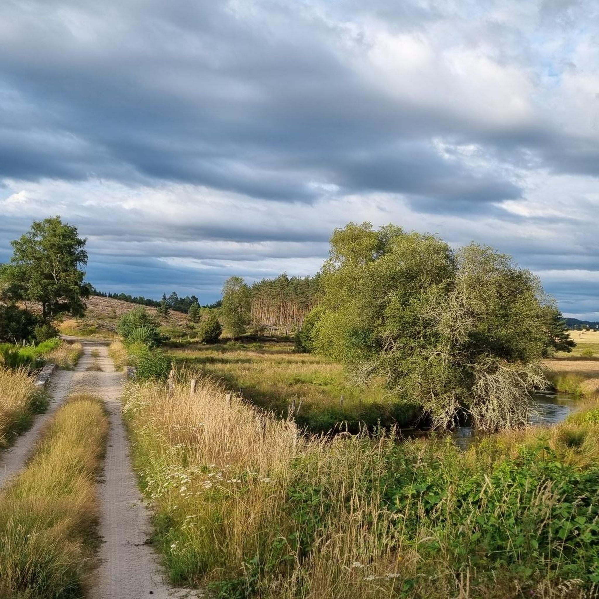
It's clear that access to the Chamboux mills will have to be on foot. After a few hundred meters, regardless of which way you approach them, you'll discover two magnificent, well-restored mills. One of the mills was used to grind grain, while the other was used to generate electricity. Unfortunately, it's not possible to go inside these buildings. A few benches allow you to take a break and appreciate the beauty and tranquility of the place. You can barely hear the sound of the water powering the mills.
0
0

Pérols-sur-Vézère is a beautiful little village on the Millevaches plateau. It is crossed by what is today a departmental road, but which was a very important Gallo-Roman axis during ancient Rome.
0
0
A vestige of the Carolingian era, this bridge extends the rural path that leads from Varieras to Pérols-sur-Vézère, and has now become a must-see hiking destination. It is thus used by many hikers. Its construction, typical of the period, presents itself as follows: a low-arched arch, three water crossings on the left side, and a small fore-beak made of cut granite blocks. Architecture enthusiasts will appreciate it.
0
0
The hamlet of Variéras is made up of dwellings covered with thatched roofs. This gives it the appearance of a Gallic village, which contributes to your journey through time with the Gallo-Roman site of Les Cars, not far from here.
0
0
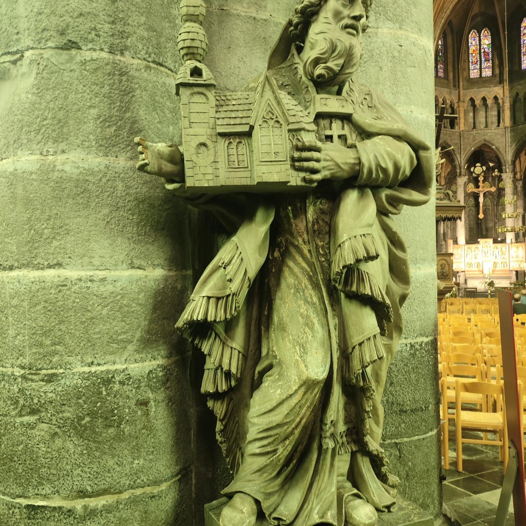
Nestled on the banks of the Vézère River, Bugeat offers all local amenities, making it convenient for starting a hike or stopping off for a short break. The village is known for its church, with its characteristic bell tower, and its sports training center, founded by Olympic champion Alain Mimoun.
0
0
Relatively well-preserved Templar cross. Very low, it's easy to miss.
0
0
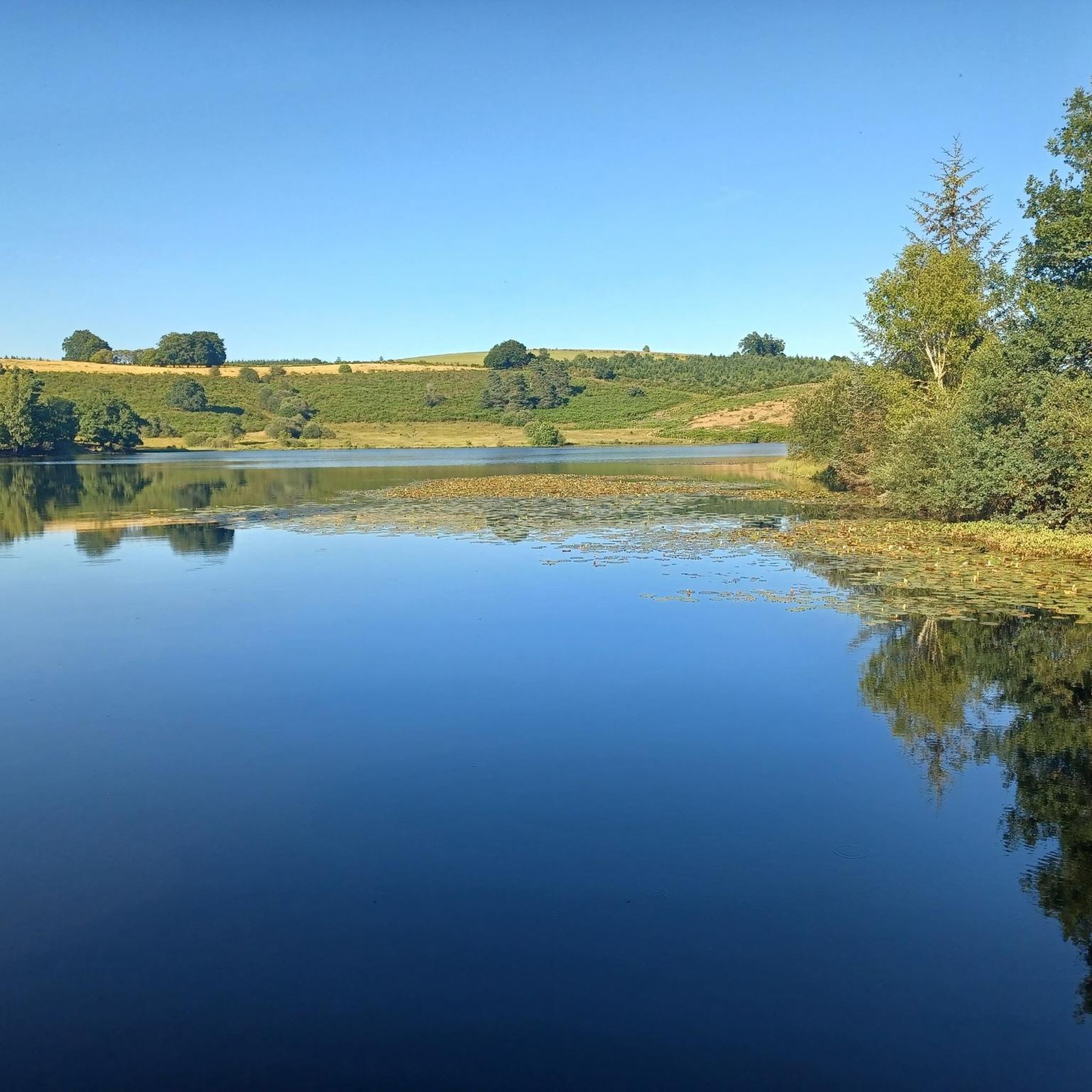
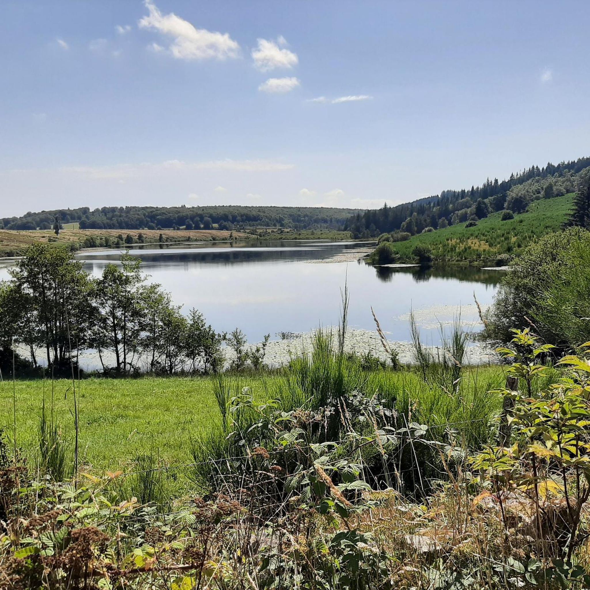
A hydroelectric dam offers a view of Lake Chamet and the golf course located on the hill opposite. It's also a beautiful cycle path with beautiful views.
0
0
Frequently Asked Questions
How many mountain bike trails are available around Saint-Merd-Les-Oussines?
There are over 30 mountain bike routes available around Saint-Merd-Les-Oussines, offering a wide range of experiences within the diverse landscapes of the Plateau de Millevaches.
What kind of terrain can I expect on the mountain bike trails in this region?
The trails primarily feature hilly landscapes and dense forests, characteristic of the Plateau de Millevaches. You'll also encounter unique natural features like peat bogs, offering varied and engaging terrain for mountain biking.
Are there any easy or beginner-friendly mountain bike trails?
The routes around Saint-Merd-Les-Oussines are generally rated as moderate to difficult. While there are no trails specifically classified as 'easy' in our current selection, many of the moderate routes can be enjoyed by riders with some experience, offering a good balance of challenge and scenic beauty.
What is the longest mountain bike trail in the area?
One of the longer routes is the Moulin de Luguet – The mills of Chamboux loop from Peyrelevade, which spans 32.2 miles (51.9 km) and typically takes around 4 hours 30 minutes to complete. This trail features significant elevation gain through varied terrain.
Are there any circular mountain bike routes?
Yes, many of the mountain bike trails in the region are circular. For example, the Varias bridge loop from Bugeat is a 29.3 miles (47.1 km) circular trail that takes you through hilly landscapes and dense forests.
What are some notable landmarks or attractions I might see while mountain biking?
While riding, you might pass by interesting points such as the Moulin de Luguet. The wider region also features historical sites like the Gallo-Roman ruins of Les Cars and natural attractions like the Lac de Viam and the unique Longeyroux peat bog.
What is the best time of year for mountain biking in Saint-Merd-Les-Oussines?
The region's diverse natural environment, with its forests and hilly terrain, makes it enjoyable for mountain biking through much of the year. Spring and autumn offer pleasant temperatures and vibrant scenery, while summer provides longer daylight hours. Always check local weather conditions before heading out.
Are dogs allowed on the mountain bike trails?
The Saint-Merd-Les-Oussines area is part of the Millevaches Regional Nature Park, a protected area. While many trails are generally accessible, it's always recommended to keep dogs on a leash to protect local wildlife and respect other trail users, especially in sensitive ecosystems like peat bogs.
What do other mountain bikers say about the trails in Saint-Merd-Les-Oussines?
The mountain bike trails in Saint-Merd-Les-Oussines are highly rated by the komoot community, with an average score of 4.4 stars from over 50 reviews. Riders often praise the varied terrain, the extensive network of marked trails, and the natural beauty of the Plateau de Millevaches.
Are there any routes that offer views of Mont Bessou?
Yes, some routes provide opportunities to experience the area around Mont Bessou, the highest peak in Corrèze. For instance, the Puy Pendu – Mont Bessou and surroundings loop from Mont Bessou is a moderate 38.7 km trail that offers views and challenges in this elevated landscape.
How long do mountain bike rides typically take in this area?
The duration of rides varies significantly depending on the trail and your pace. Many moderate routes, like the Bugeat – Café de la Place loop from Pérols-sur-Vézère (17.7 miles / 28.6 km), can be completed in around 2 hours 25 minutes, while longer, more difficult trails can take over 4 hours.
What is the elevation gain like on these trails?
The trails in Saint-Merd-Les-Oussines are known for their hilly landscapes, so you can expect significant elevation changes. For example, the Moulin de Luguet – Rat Chapel loop from Peyrelevade, a moderate 27.1 km route, features an elevation gain of nearly 400 meters.
Most popular routes around Saint-Merd-Les-Oussines
Most popular attractions around Saint-Merd-Les-Oussines

Get inspired with the komoot mobile app


Explore more
Browse the best MTB trails in other regions.
