The best running trails around Berg (Pfalz)
4.3
(360)
8,802
runners
475
runs
Jogging around Berg (Pfalz) offers routes through a landscape characterized by gentle river paths, small wooded areas, and open countryside. The region features minimal elevation changes, making it suitable for various fitness levels. Many trails follow the Lauter river, providing flat and accessible running opportunities.
Best jogging routes around Berg (Pfalz)
- The most popular jogging route is Customs Pavilion Neulauterburg – small wood - fishing spot loop from Lauterbourg, a 5.2 miles (8.4 km) trail that takes about 53…
Last updated: September 28, 2026
5.0
(1)
53
runners
Moderate run. Good fitness required. Mostly paved surfaces. Suitable for all skill levels.
5.0
(1)
46
runners
Moderate run. Good fitness required. Mostly paved surfaces. Suitable for all skill levels.

5.0
(1)
17
runners
9.81km
01:01
20m
20m
Moderate run. Good fitness required. Mostly paved surfaces. Suitable for all skill levels.
16
runners
Moderate run. Good fitness required. Mostly paved surfaces. Suitable for all skill levels.
13
runners
7.93km
00:49
20m
20m
Moderate run. Good fitness required. Mostly paved surfaces. Suitable for all skill levels.
Get access to more routes and recommendations from other explorers.
Already have an account?
Our route recommendations are based on thousands of hikes, rides, and runs completed by other people on komoot.
Start today with a free account
Your next adventure awaits.
Tips from the Community

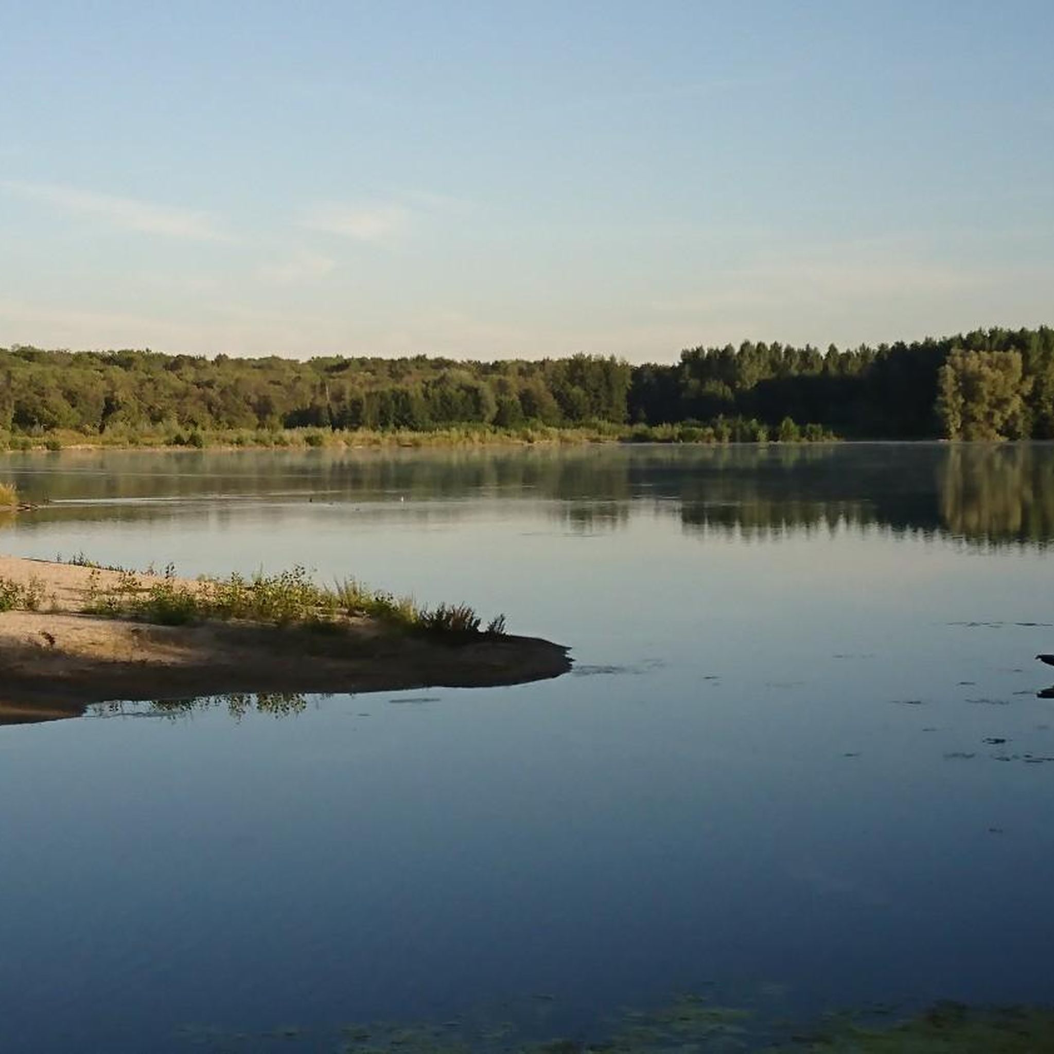
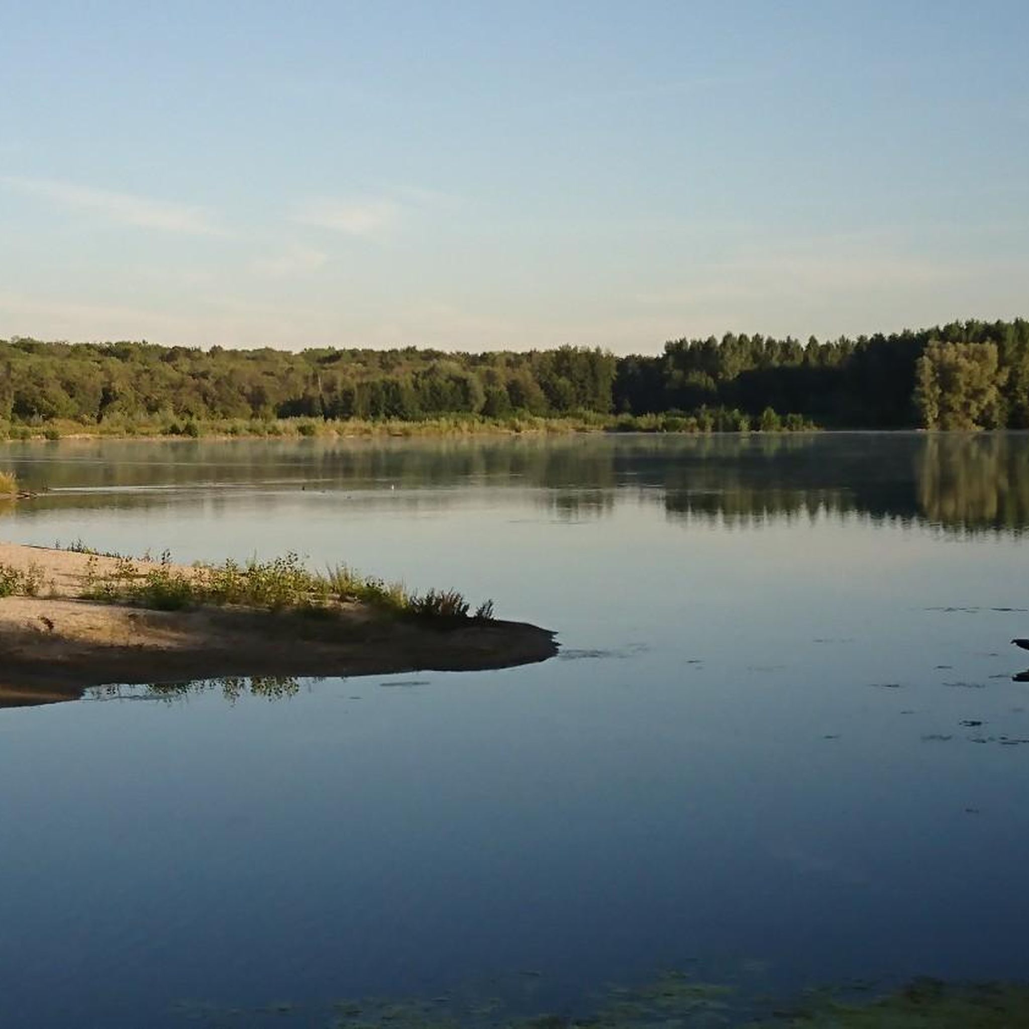
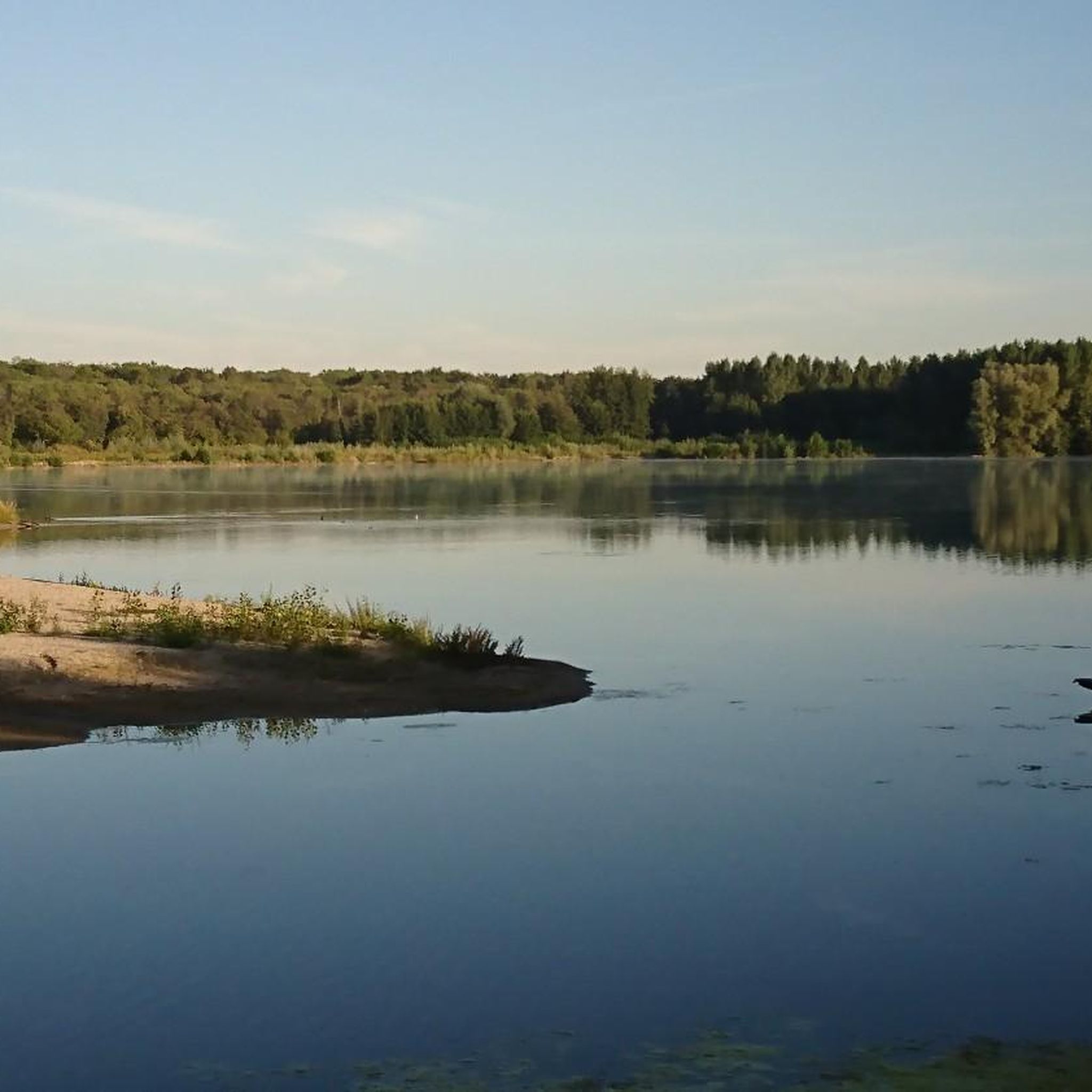
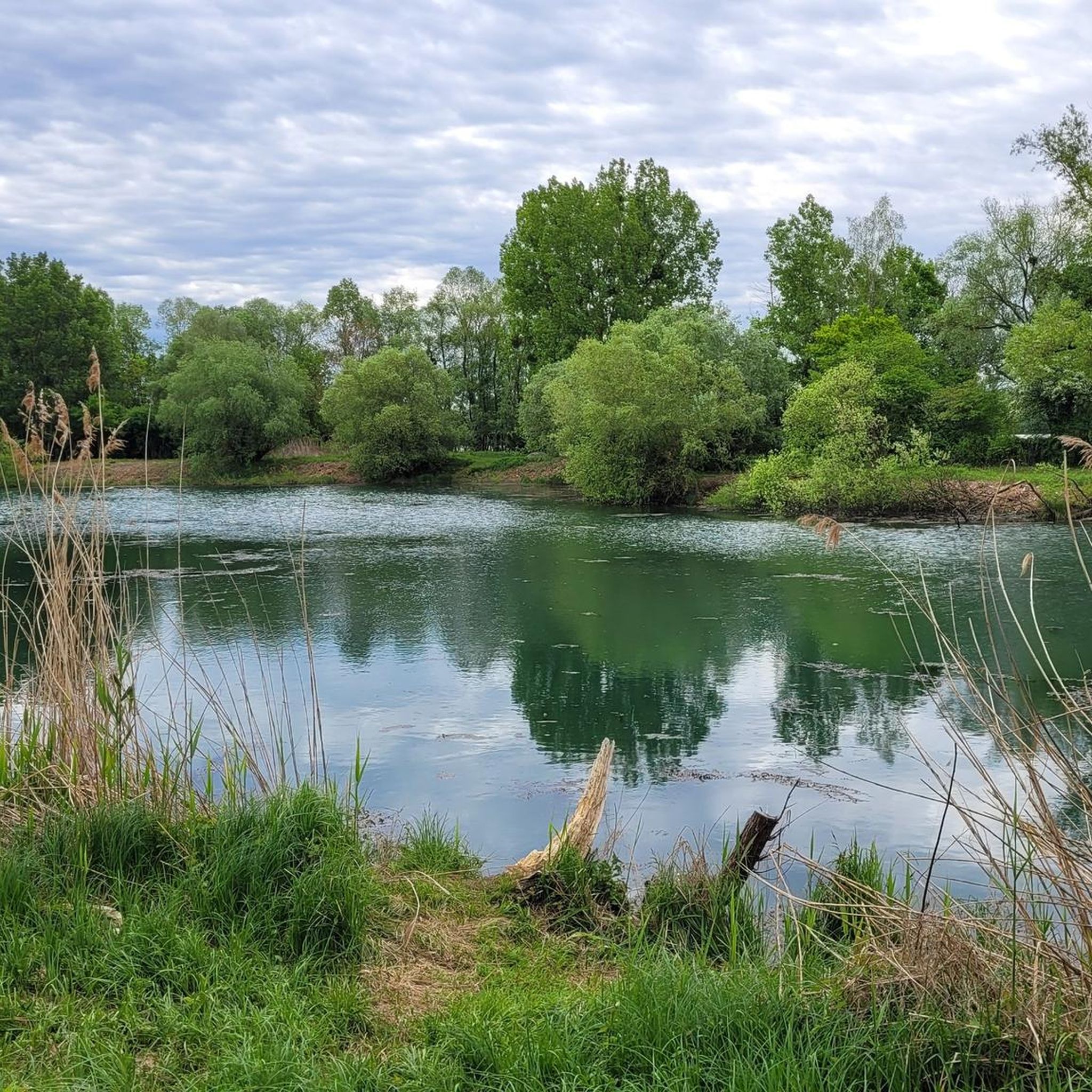
The small fishing pond was the busiest today. Some fishermen were standing or sitting around the pond, trying to make a good catch.
8
0
Large artificial fishing pond named Bassin des Mouettes. Not far from the large parking lot is the generously designed angler's home.
8
0
The Lauterbourg Town Hall serves a community of about 2350 inhabitants. It is the French side and the name comes from the river Lauter. The northernmost part of the town politically belongs as Neulauterburg to the German municipality of Berg (Pfalz).
6
0
The Metzgerturm was built under Jaiser Otto III as the first fortification of the city of Lauterburg. The Metzgerturm was also called Gabrielsturm because a condemned man named Gabriel once managed to escape from it. The tower served as a citizens' prison until the year 1761.
7
0

A good starting point for a walk or a bike tour along the Rhine. Unfortunately, the restaurant there is closed.
0
0

The Rhine is one of Europe's most important rivers and has a length of approximately 1,233 km. Its source lies in the Swiss Alps, where it originates from several mountain streams. From there, it first flows through Switzerland and then partly forms the border between Germany and France, before continuing through Germany and finally the Netherlands. At Rotterdam, the Rhine divides into several distributaries and finally reaches the North Sea. Its drainage basin is very large (approx. 185,000 km²) and includes many tributaries such as the Moselle, Main, or Neckar. The Rhine is of great importance to Europe: Shipping: One of the world's most important waterways for trade and transport Economy: Connection of many industrial and port cities Nature: Habitat for numerous animal and plant species Energy: Utilization through hydropower in the Alpine regions Due to its location and use, the Rhine is considered one of Central Europe's most vital lifelines.
0
0
The Rhine is one of the most important rivers in Europe and has a length of approximately 1,233 km. Its source lies in the Swiss Alps, where it originates from several mountain streams. From there, it first flows through Switzerland and then partly forms the border between Germany and France, before continuing through Germany and finally the Netherlands. Near Rotterdam, the Rhine divides into several distributaries and finally reaches the North Sea. Its catchment area is very large (approx. 185,000 km²) and includes many tributaries such as the Moselle, Main, or Neckar. The Rhine has great importance for Europe: Shipping: One of the most important waterways in the world for trade and transport Economy: Connection of many industrial and port cities Nature: Habitat for numerous animal and plant species Energy: Utilization through hydropower in the Alpine regions Due to its location and use, the Rhine is one of the most important lifelines of Central Europe.
0
0
The Rhine is one of the most important rivers in Europe and has a length of approximately 1,233 km. Its source lies in the Swiss Alps, where it originates from several mountain streams. From there, it first flows through Switzerland and then partly forms the border between Germany and France, before continuing through Germany and finally the Netherlands. Near Rotterdam, the Rhine divides into several distributaries and finally reaches the North Sea. Its drainage basin is very large (approx. 185,000 km²) and includes many tributaries such as the Moselle, Main, or Neckar. The Rhine has great importance for Europe: Shipping: One of the most important waterways in the world for trade and transport Economy: Connection of many industrial and port cities Nature: Habitat for numerous animal and plant species Energy: Utilization through hydropower in the Alpine regions Due to its location and use, the Rhine is considered one of the most important lifelines of Central Europe.
1
0
Frequently Asked Questions
What kind of terrain can I expect on the running routes around Berg (Pfalz)?
The region offers a mix of gentle river paths, small wooded areas, and open countryside. The terrain is generally flat with minimal elevation changes, making it suitable for various fitness levels. Many trails follow the Lauter river, providing accessible running opportunities.
Are there easy running routes suitable for beginners in Berg (Pfalz)?
Yes, Berg (Pfalz) has a good selection of routes for beginners. Out of over 400 running routes, 42 are classified as easy, offering gentle paths through the landscape. These are ideal for those new to running or looking for a relaxed jog.
Can I bring my dog on the running trails in Berg (Pfalz)?
Many of the trails in Berg (Pfalz) are suitable for running with dogs, especially those through open countryside and wooded areas. It's always recommended to keep your dog on a leash, especially near wildlife or in more populated sections, and to check local regulations for specific areas.
Are there family-friendly running options in the Berg (Pfalz) area?
Absolutely. The generally flat and accessible nature of many routes, particularly those along the Lauter river, makes them great for families. Look for routes with minimal elevation and well-maintained paths for a pleasant family outing.
Are there circular running routes available around Berg (Pfalz)?
Yes, many of the running routes in Berg (Pfalz) are designed as loops, allowing you to start and finish in the same location. For example, the Lauter Cycle Path – Berg Water Tower loop from Berg (Pfalz) is a moderate 9.7 km (6 miles) option that takes you through varied scenery.
What do other runners say about the trails in Berg (Pfalz)?
The running routes in Berg (Pfalz) are highly rated by the komoot community, with an average score of 4.35 stars from over 290 reviews. Runners often praise the peaceful river paths, the charming wooded sections, and the overall accessibility of the trails.
Are there any interesting landmarks or attractions to see along the running routes?
While running, you might encounter various points of interest. For example, the At de Buewe Bridge – Old Mill Wheel on the Lauter loop from Lauterbourg offers riverside scenery. If you're interested in exploring more, highlights like the Naturfreundehaus Kandel or the Jakobshäusche are nearby and can be visited before or after your run.
When is the best time of year to go running in Berg (Pfalz)?
Spring and autumn generally offer the most pleasant conditions for running in Berg (Pfalz), with mild temperatures and beautiful natural scenery. Summer can also be enjoyable, especially in the mornings or evenings, while winter runs are possible on cleared paths, though some trails might be muddy or icy.
Are there options for parking near the running trails in Berg (Pfalz)?
Yes, many starting points for running routes in Berg (Pfalz) offer convenient parking. For instance, routes originating from Lauterbourg often have parking available, making it easy to access trails like the Customs Pavilion Neulauterburg – Lauterbourg town centre loop.
Can I find places to eat or drink near the running routes?
Yes, especially in and around the towns like Lauterbourg and Berg (Pfalz) itself, you'll find cafes and restaurants. Some routes, like the Strandbar Alsasurf67 – small wood - fishing spot loop, even pass by spots where you can refuel or relax after your run.
How many running routes are there in total around Berg (Pfalz)?
There are over 400 running routes available around Berg (Pfalz), offering a wide variety of distances and difficulty levels to explore.
Are there less crowded running routes for a more peaceful experience?
While popular routes can see more activity, the extensive network of trails means you can often find quieter paths, especially during off-peak hours or by exploring some of the less-trafficked wooded sections away from the main river paths. The region offers plenty of space to find your solitude.
Most popular routes around Berg (Pfalz)
Most popular attractions around Berg (Pfalz)

Get inspired with the komoot mobile app


Explore more
Browse the best Running Trails & Routes in other regions.
