The best running trails around Wernersberg
4.3
(229)
2,237
runners
14
runs
Jogging routes around Wernersberg traverse the Palatinate Forest, a region characterized by distinctive red sandstone cliffs, dense woodlands, and serene valleys. The area offers a diverse environment for outdoor activities, with significant elevations such as the Rothenberg and Höllenberg contributing to a varied and often hilly terrain. This natural landscape provides a captivating backdrop for runners seeking both moderate and challenging routes.
Best jogging routes around Wernersberg
- The most popular jogging route is Geiersteine Rock Formation – Cat rock loop from Wernersberg, a 7.4 miles (11.9 km) trail that takes 1 hour 21 minutes to complete, offering views of the prominent Geiersteine rock formation.
- Another top favourite among local runners is Running loop from Wernersberg, a difficult 3.8 miles (6.1 km) path that winds through the region's forests and hills.
- Local runners also love the 4-Burgen-Blick" shelter – Rötzen Cliffs loop from Wernersberg, an 8.8 miles (14.2 km) trail leading through the Palatinate Forest and past the Rötzen Cliffs, often completed in about 1 hour 42 minutes.
- Jogging around Wernersberg is defined by red sandstone cliffs, dense woodlands, and hilly terrain. The extensive network of paths offers options for various ability levels, from moderate forest paths to challenging trail runs with significant elevation changes.
- The routes in Wernersberg are highly rated by the komoot community with an average score of 4.4 stars from over 190 reviews. More than 2600 runners have used komoot to explore Wernersberg's varied terrain.
Last updated: October 8, 2026
5.0
(2)
47
runners
11.9km
01:22
250m
250m
Moderate run. Good fitness required. Mostly paved surfaces. Suitable for all skill levels.
5.0
(1)
33
runners
6.11km
00:40
100m
100m
Hard run. Good fitness required. Sure-footedness, sturdy shoes and alpine experience required.

4.5
(2)
18
runners
14.2km
01:43
350m
350m
Hard run. Very good fitness required. Sure-footedness, sturdy shoes and alpine experience required.
16
runners
24.1km
02:38
300m
290m
Hard run. Very good fitness required. Sure-footedness, sturdy shoes and alpine experience required.
13
runners
10.5km
01:23
390m
390m
Hard run. Very good fitness required. Sure-footedness, sturdy shoes and alpine experience required.
Get access to more routes and recommendations from other explorers.
Already have an account?
Our route recommendations are based on thousands of hikes, rides, and runs completed by other people on komoot.
Start today with a free account
Your next adventure awaits.


Tips from the Community

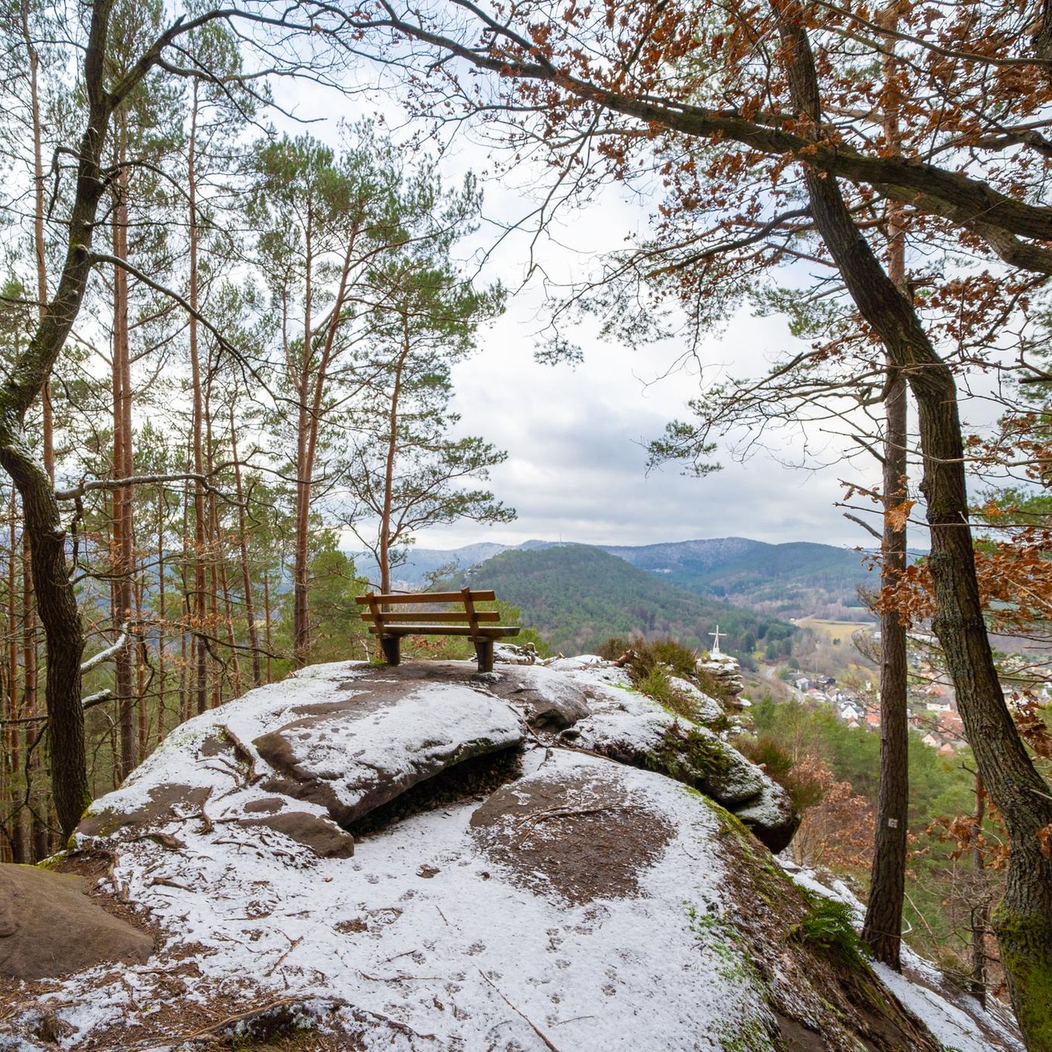
The Geierturm is one of the most impressive rocks in the Dahner Felsenland, which is not exactly poor in bizarre formations. Even more breathtaking than the view from the top is the feeling when you look up from below at this enormous sandstone wall, interrupted by a crevice. You involuntarily wonder why this structure doesn't simply collapse at the slightest gust of wind.
0
0

beautiful view and not the last of the three castles on the way to the Wachtfels and further over the Rödelstein and Heimelstein
0
0

You pass by the Katerfelsen when you go to the Hornstein viewpoint or come from it.
0
0
You pass the Katzenfelsen when you go to the Hornstein viewpoint
0
0

Behind the church is the cemetery, and next to the church is the mortuary.
0
0

The view of the Trifels is omnipresent in Annweiler.
0
0

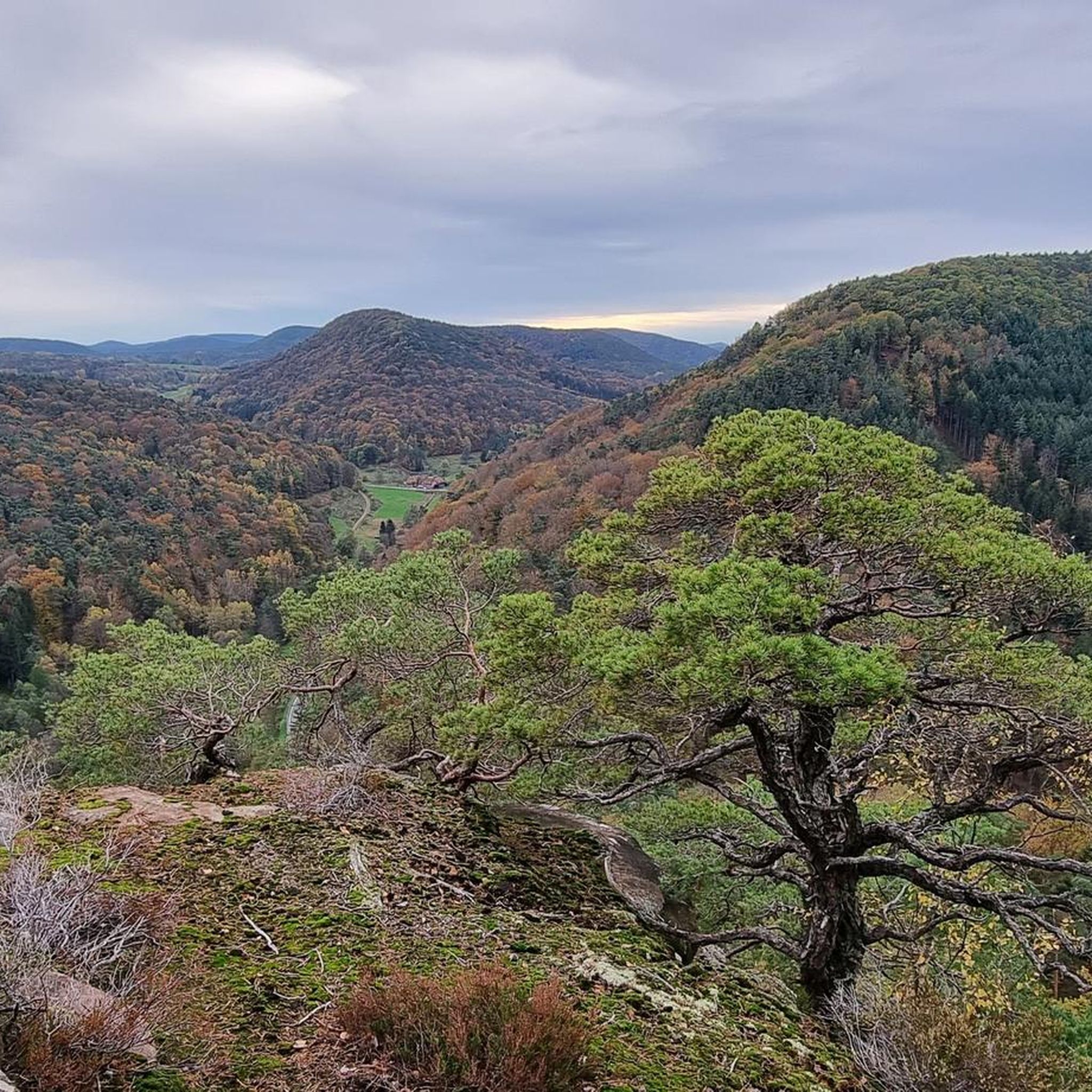
The Rötzenberg near Gossersweiler in the Southern Palatinate district of Weinstraße is a 459.1 m above sea level mountain in the northern Wasgau region of the Palatinate Forest. Numerous red sandstone rock formations are found on it. The Rötzenberg is located in the Palatinate Forest Nature Park, a typical Wasgau conical hill in the northern part of the Dahner Felsenland and the Wasgauer Felsenland. Its summit rises 1.1 km west-southwest of Gossersweiler, the larger district of the municipality of Gossersweiler-Stein, to whose district the mountain belongs. North of the almost entirely forested mountain rises the Triebborn stream, which drains via the Rimbach into the Queich, a tributary of the Rhine. To the south, the Klingbach stream flows directly into the Rhine plain and flows into the Rhine via the Michelsbach. The most important rock formations of the Rötzenberg are the Isselmannsteine on the north side and the imposing Rötzenfels south of the summit, which reaches a considerable height of up to 55 meters. From the rocky plateau, which can be climbed via a hiking trail (Dimbacher Buntsandstein-Höhenweg), there are excellent views to the south over the entire Wasgau region, with the Lindelbrunn ruins in the foreground, as well as to the northeast to the Rehberg, the Ebersberg, the Asselstein, and the Reichsburg Trifels. The Rötzenberg can be reached via marked hiking trails from the east, such as the Staudernheim–Soultz-sous-Forêts long-distance trail from Gossersweiler, from the north from Dimbach, and from the south from Lindelbrunn. It is traversed by the "Dimbacher Buntsandstein-Höhenweg" circular hiking trail, which was certified as a premium trail by the German Hiking Institute and inaugurated in 2013. Source: https://de.wikipedia.org/wiki/R%C3%B6tzenberg
0
0

Impressive sculpture commemorating the brothers Carl-August and Anton Seibel, who founded Hauenstein's first shoe factory here in 1886.
0
0
Frequently Asked Questions
How many running routes are available around Wernersberg, and what are their difficulty levels?
Wernersberg offers a diverse selection of over 10 running routes. You'll find 1 easy route, 2 moderate routes, and 10 challenging trails, catering to various fitness levels and preferences.
What kind of terrain can I expect on the jogging trails in Wernersberg?
The terrain around Wernersberg is characterized by the distinctive red sandstone cliffs, dense woodlands, and serene valleys of the Palatinate Forest. Runners can expect a varied and often hilly landscape, with significant elevations like the Rothenberg and Höllenberg. This provides a captivating backdrop for both moderate forest paths and challenging trail runs with considerable elevation changes.
Are there any circular running routes in Wernersberg?
Yes, Wernersberg features several excellent circular running routes. For example, the Geiersteine Rock Formation – Cat rock loop from Wernersberg is a popular 11.9 km loop offering views of the prominent Geiersteine rock formation. Another option is the 4-Burgen-Blick" shelter – Rötzen Cliffs loop from Wernersberg, which is a 14.2 km trail through the Palatinate Forest.
What are some scenic viewpoints or natural landmarks I can see while running in Wernersberg?
The region is rich in natural beauty and viewpoints. You can run past the prominent Geiersteine rock formation, which offers magnificent views across the Trifelsland. The Wachtfels, another significant viewpoint, provides stunning panoramic vistas over Wernersberg and the surrounding Palatinate Forest, including views of Trifels Castle. The Löchelfelsen is also a notable viewpoint in the area.
Are there any historical sites or attractions near the running paths?
Absolutely. The proximity to historical sites like Trifels Castle and Landeck Castle means you can combine your run with cultural exploration. Some routes, such as the Austraße Along the Queich – View of Trifels Castle loop from Wernersberg, offer views of Trifels Castle. You might also encounter interesting features like the Ramburg Castle Ruins.
What do other runners say about the trails in Wernersberg?
The running routes in Wernersberg are highly rated by the komoot community, with an average score of 4.4 stars from over 190 reviews. More than 2600 runners have used komoot to explore Wernersberg's varied terrain, often praising the scenic views, diverse landscapes, and well-maintained paths.
Are there any huts or places to stop for refreshments along the routes?
Yes, the area around Wernersberg has several huts that can serve as good stopping points. You might find the Landau hut at the Zimmerbrunnen (PWV), the Ringelsberghütte (PWV Frankweiler), or the Trifelsblick Hut (PWV Gleisweiler) along various trails. These often offer refreshments or a place to rest.
Can I bring my dog on the running trails in Wernersberg?
While specific regulations can vary, generally, the natural trails and forest paths in the Palatinate Forest are suitable for running with dogs. It's always recommended to keep your dog on a leash, especially in nature reserves or near wildlife, and to be mindful of other trail users. Always carry water for your dog and clean up after them.
Are there any beginner-friendly jogging routes in Wernersberg?
Yes, while many routes are challenging, there is at least one easy route available for beginners. These typically feature gentler inclines and well-maintained paths, allowing new runners to enjoy the beautiful Palatinate Forest scenery without excessive difficulty. Look for routes marked as 'easy' on komoot.
What is the longest running route I can find in Wernersberg?
For those looking for a longer run, the Austraße Along the Queich – View of Trifels Castle loop from Wernersberg is a challenging 24.1 km (15 miles) path. This route offers a significant distance and elevation, perfect for endurance training or a long scenic jog.
Is Wernersberg suitable for trail running?
Absolutely. Wernersberg is an excellent destination for trail running. The region's diverse landscape, with its hills, valleys, and distinctive rock formations, provides challenging terrain. You'll find routes with significant elevation changes, such as the 'Höllenberg Trail Run' mentioned in local information, which boasts 550 positive and negative meters of elevation over 10 kilometers, making it ideal for experienced trail runners.
What is the best time of year to go jogging in Wernersberg?
Wernersberg is beautiful year-round, but spring and autumn often offer the most pleasant conditions for jogging. In spring, the forests burst with new growth, and in autumn, the foliage provides stunning colors. Summer can be warm, so early morning or late afternoon runs are advisable. Winter running is also possible, with the landscape taking on a serene, quiet beauty, though some trails might be slippery or muddy.
Most popular routes around Wernersberg
Most popular attractions around Wernersberg

Get inspired with the komoot mobile app


Explore more
Browse the best Running Trails & Routes in other regions.
