The best walks and hikes around Tremblois-Lès-Rocroi
4.4
(496)
2,569
hikers
87
hikes
Hiking around Tremblois-Lès-Rocroi offers access to a landscape characterized by rolling hills, dense woodlands, and historical mining areas. The region features a network of trails that traverse forests and open countryside, often revealing remnants of its industrial past. Elevations are generally moderate, providing accessible hiking experiences.
Best hiking trails around Tremblois-Lès-Rocroi
- The most popular hiking route is Daudece Tower loop from Murtin-et-Bogny, a 4.4 miles (7.0 km) trail that takes 1 hour 55 minutes to complete, offering views of…
Last updated: June 26, 2026
4.6
(5)
11
hikers
11.1km
02:59
130m
130m
Moderate hike. Good fitness required. Easily-accessible paths. Suitable for all skill levels.
4.0
(2)
8
hikers
4.76km
01:19
90m
80m
Easy hike. Great for any fitness level. Easily-accessible paths. Suitable for all skill levels.

Sign up for free
4.0
(1)
5
hikers
6.51km
01:44
70m
70m
Easy hike. Great for any fitness level. Easily-accessible paths. Suitable for all skill levels.
5.0
(1)
5
hikers
14.1km
03:52
220m
220m
Moderate hike. Good fitness required. Easily-accessible paths. Suitable for all skill levels.
5.0
(1)
3
hikers
13.8km
03:42
170m
170m
Moderate hike. Good fitness required. Easily-accessible paths. Suitable for all skill levels.
Get access to more routes and recommendations from other explorers.
Sign up for free
Already have an account?
Our route recommendations are based on thousands of hikes, rides, and runs completed by other people on komoot.
Start today with a free account
Your next adventure awaits.
Login or Signup
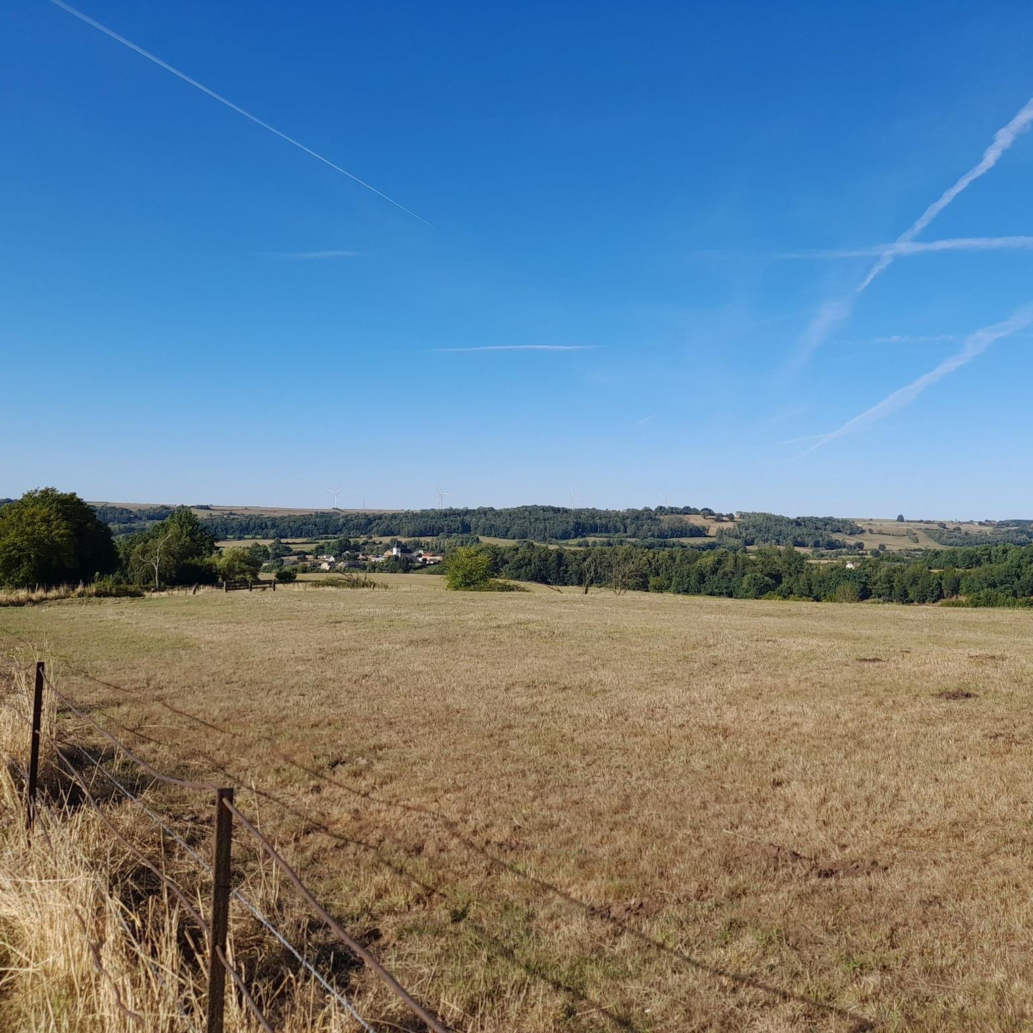

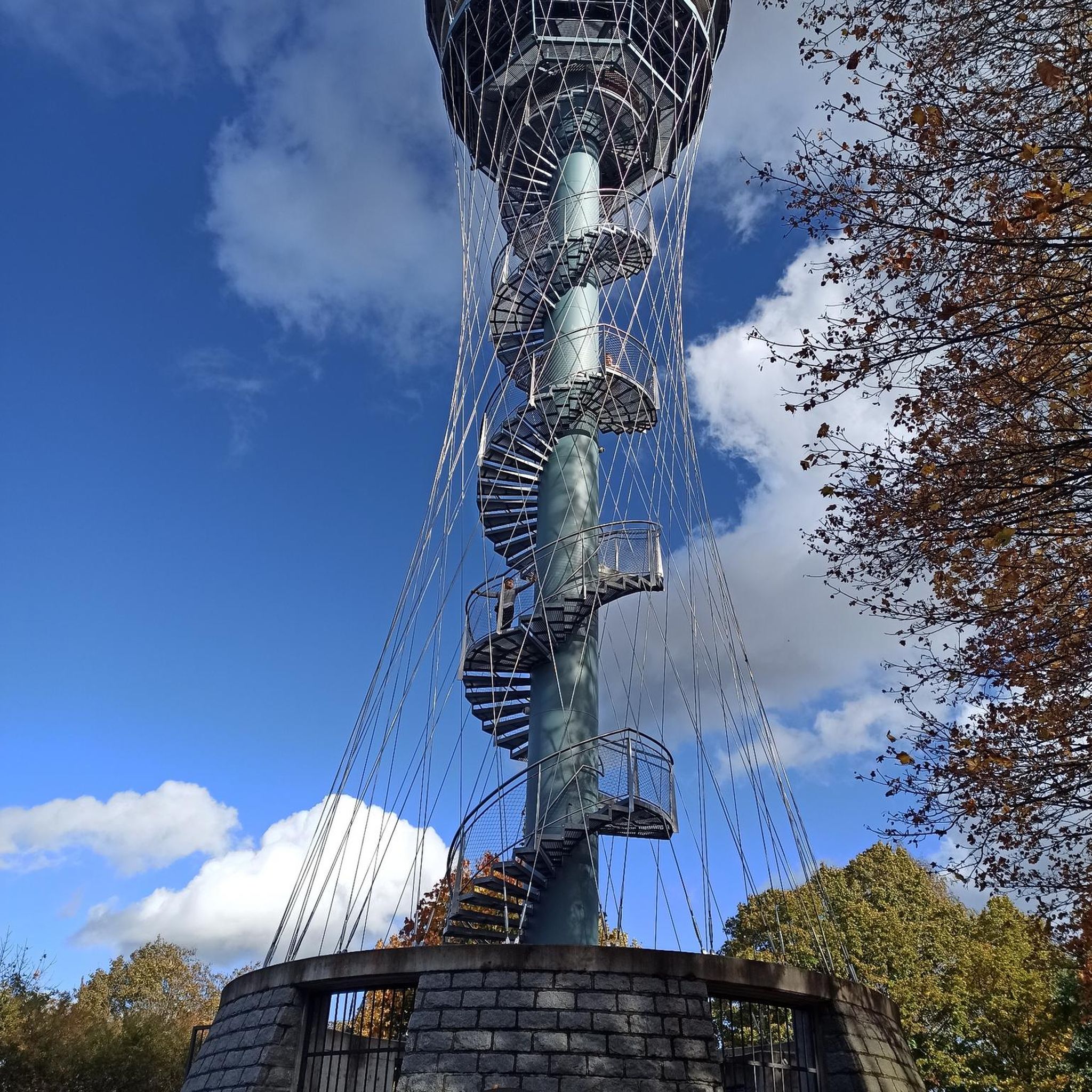
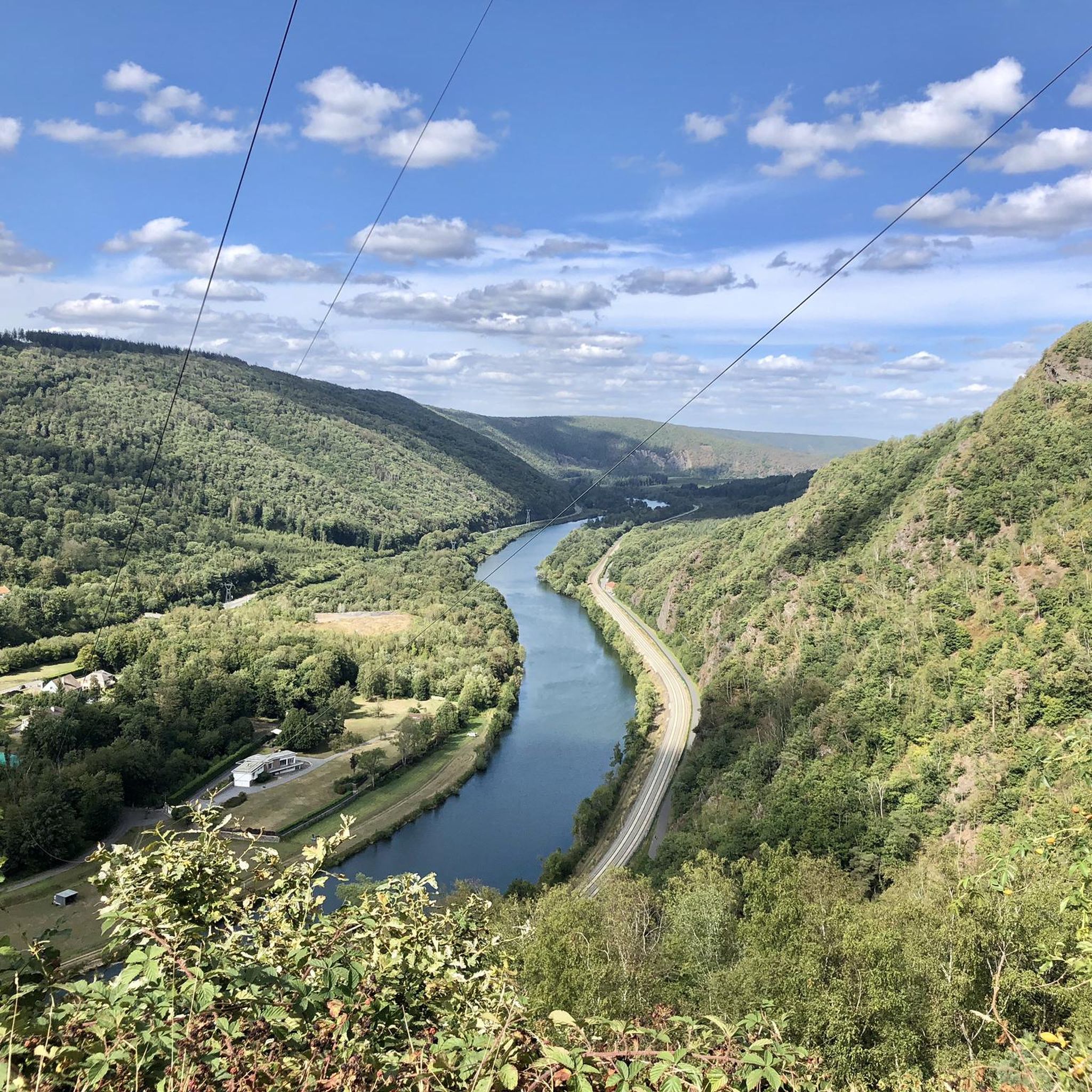
Tips from the Community

Very nice building with large picnic tables for a break
0
0

A very pleasant walk with a few climbs, including one in a grassy area requiring suitable footwear.
0
0

On the site some explanation about the slate mining and a small park with playground
0
0

Located in the heart of the territory of the commune of the Ardennes Thiérache, near the forest of Pothées, it was recognized by the Charter of Milon de Nanteuil in 1208. Crossed by the departmental road 8043 halfway between Charleville-Mézières and Hirson and 10 minutes from the A304 it is a lively town center with various shops, businesses, artisans and services. A dozen sports and cultural associations animate Maubert-Fontaine all year round. Maubert-Fontaine is home to many monuments: Saint Nicholas Church, with inside the war memorial, sculpted by a Mauberian, Henri Migeot; Fountain; the private high school, with its lime tree, which was requisitioned by the Germans as a hospital during the 14/18 war; the war memorial; the Stele of Saint Remi. From this, along the forest alley of the dead girl, we arrive at the crusher where in 1915 the Germans exploited important quarries. Several personalities originating from Maubert-Fontaine have passed through the history of France and their names have been given to certain places: Jardin Bidois, former Jean-Marie Carré college. Other important characters were part of Maubert's story, such as Nicolas de Caruel and Napoleon Bonaparte who came to rest at the Hôtel du Grand Turc on the night of Waterloo. The proximity of the forest allows beautiful walks with certain points of interest: the 2-legged oak and the oak of the Franco-Belgian friendship. In the town you will find various sports facilities for all ages: playground, multi-sports ground, petanque ground, fitness room, sports complex, fishing pond. Source: https://www-ardennes--thierache-com.translate.goog/fr/directory/entry/maubert-fontaine?_x_tr_sl=fr&_x_tr_tl=nl&_x_tr_hl=nl&_x_tr_pto=sc
2
0

This church was dedicated to Saint Peter (Saint Pierre). Simon, nicknamed Petrus (rock), was a fisherman on Lake Genesareth when he - together with his brother Andreas - was called by Jesus Christ to be a "fisherman of men". According to the Catholic understanding he is the highest apostle, and the two millennia long line of popes - currently Francis - are in his successor. On statues and paintings Peter is almost always shown with two keys in his hand, this attribute refers to the Bible verse in Matthew: “I will give you the keys of the kingdom of heaven; what you will bind on earth will be bound in heaven, and what you will loosen on earth will be loosened in heaven ”(Chapter 16, verse 19). Together with Paul, Peter is also known as the "princes of the apostles", their common feast day in the saints' calendar is on June 29th.
2
3

This church is very striking because of its tower. Some parts of the current church appear to have been repaired in the 13th century. The choir may have had a pointed arch, as is still the case in the northern arm of the transverse chief. The classical church hall indicates that certain changes took place in the 17th century, probably after the fire in the village in 1642. The sundial on the south side of the nave bears the year 1611. Source: at the church on information board
2
0
A first castle, probably founded in the 13th century, adjoined the Potées estate, which belonged to the Reims cathedral chapter. A group of Armagnacs settled there in the 15th century and over time spread across the region. Duke Antoine de La Marche, who was governor of Sedan from 1599 to 1640, became lord of L'Echelle through his marriage to Anne de Maucourt in 1594. He rebuilt the castle to give it a more up-to-date appearance. The square stilt in the northwest corner dates from this period. Antoine de La Marche des Contes died in September 1740 at the age of 74. On September 28, 1642, at dawn, Spanish troops sacked the village and attacked the castle. The walls of the castle still show the traces of the cannon balls. In 1730, L'Échelle Castle was acquired by the Reims Cathedral Chapter, and the building was subsequently rededicated as a farm. During the French Revolution, the building was sold to Simon Pottier, the hat maker from L'Echelle. He then handed over a large part of it to the community, installed the town hall as well as the school and the teachers' accommodation. Part of the residential buildings of the north wing have been converted into a school history museum, for the nostalgic community (the elementary school from the 1900s to 1960s), with the inkwell, the sergeant major pens (which preceded the pens), the slates, etc. Source: according to Wikipedia
4
1
The village was founded at the beginning of the 13th century by the cathedral chapter of Reims Cathedral. During the Franco-Spanish War (1635-1659), the site was completely destroyed in the Battle of Rocroi in 1643. The crosses in their own shape are fascinating. Source: according to Wikipedia
2
1
Frequently Asked Questions
How many hiking trails are available around Tremblois-Lès-Rocroi?
There are over 80 hiking trails around Tremblois-Lès-Rocroi, offering a variety of experiences. These include 37 easy routes, 39 moderate, and 7 more challenging options, catering to different fitness levels.
Are there easy hiking trails suitable for beginners in Tremblois-Lès-Rocroi?
Yes, Tremblois-Lès-Rocroi offers many easy trails perfect for beginners. For example, the Daudece Tower loop from Murtin-et-Bogny is an easy 4.4-mile (7.0 km) route that provides pleasant views without significant elevation gain. Another accessible option is the Rimogne Mining Heritage loop from Rimogne, which is 2.4 miles (3.8 km) long.
What kind of terrain can I expect on hikes in Tremblois-Lès-Rocroi?
The terrain around Tremblois-Lès-Rocroi is characterized by rolling hills and dense woodlands, often traversing through forests and open countryside. You'll also find remnants of the region's industrial past, particularly its historical mining areas. Elevations are generally moderate, making most trails accessible.
Are there any circular hiking routes around Tremblois-Lès-Rocroi?
Yes, many of the trails in the area are circular, allowing you to start and end at the same point. A popular choice is the Notre-Dame Church loop from Tremblois-lès-Rocroi, an 8.5-mile (13.6 km) trail that takes you through varied landscapes.
Can I bring my dog on the hiking trails in Tremblois-Lès-Rocroi?
Most trails in the Tremblois-Lès-Rocroi region are dog-friendly, but it's always recommended to keep your dog on a leash, especially when passing through agricultural areas or near wildlife habitats. Be sure to check local signage for any specific restrictions.
Are there family-friendly hiking options in Tremblois-Lès-Rocroi?
Absolutely. Many of the easy and moderate trails are suitable for families. The gentle slopes and well-maintained paths through woodlands make for enjoyable outings with children. The St. Quentin Slate Mine Shaft loop from Tremblois-lès-Rocroi, for instance, is an easy 4.0-mile (6.5 km) path that explores mining heritage and is a good option for families.
What historical sites or attractions can I see while hiking near Tremblois-Lès-Rocroi?
The region is rich in history. You can explore sites like the fortified town of Rocroi, the ruins of Montcornet Castle, or the King's Bastion. The Stone Crusher Ruins of Maubert-Fontaine also offer a glimpse into the area's industrial past.
Where can I find parking for hiking trails in Tremblois-Lès-Rocroi?
Many trailheads in and around Tremblois-Lès-Rocroi offer designated parking areas, especially near villages or popular starting points. It's advisable to check the specific tour details on komoot for parking information related to your chosen route.
What is the best time of year to go hiking in Tremblois-Lès-Rocroi?
Spring and autumn are generally ideal for hiking in Tremblois-Lès-Rocroi, with pleasant temperatures and beautiful foliage. Summer also offers good conditions, though some trails might be busier. Winter hiking is possible, but be prepared for colder weather and potentially muddy or icy conditions.
What wildlife might I encounter on the trails?
The dense woodlands and natural areas around Tremblois-Lès-Rocroi are home to various wildlife. You might spot deer, wild boar, foxes, and a wide array of bird species. Keep an eye out for smaller mammals and insects, especially during warmer months.
Are there any hikes that feature the region's mining heritage?
Yes, the area has a strong connection to its mining past. The St. Quentin Slate Mine Shaft loop from Tremblois-lès-Rocroi is a great example, taking you through forested terrain and past remnants of the slate mining industry. Another option is the Rimogne Mining Heritage loop from Rimogne.
What do other hikers say about the trails in Tremblois-Lès-Rocroi?
The hiking trails in Tremblois-Lès-Rocroi are highly rated by the komoot community, with an average score of 4.4 stars from over 400 reviews. Hikers often praise the quiet woodlands, the well-marked paths, and the opportunity to explore both natural beauty and historical sites.
Are there options for longer, more challenging hikes?
While many routes are easy to moderate, there are options for longer and more challenging hikes. For instance, the .. loop from Harcy is a moderate 8.7-mile (14.1 km) trail with more significant elevation changes, offering a good workout for experienced hikers.
Most popular routes around Tremblois-Lès-Rocroi
Most popular attractions around Tremblois-Lès-Rocroi

Get inspired with the komoot mobile app


Explore more
Browse the best Hikes in other regions.
