The best road cycling routes around Marly-Sur-Arroux
4.3
(16)
707
riders
174
rides
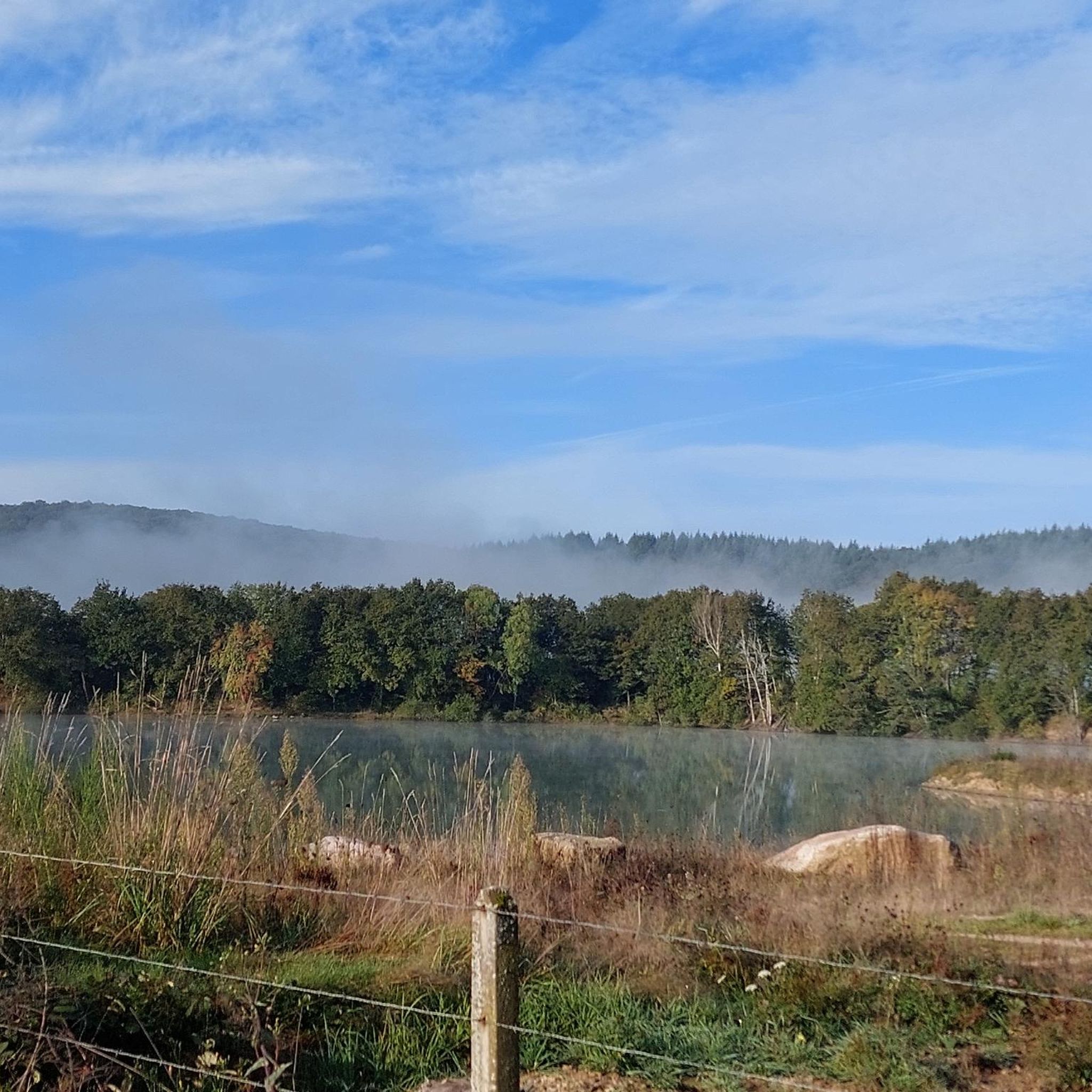
Road cycling around Marly-Sur-Arroux features a landscape of gentle river valleys, agricultural plains, and rural roads. The region is influenced by the Arroux river and the Canal du Centre, offering a mix of flat sections and rolling terrain. Road cyclists can expect routes that pass through small villages and open countryside, with occasional gentle ascents. This area provides opportunities for both easy road bike routes and longer distance cycling trails.
Best road cycling routes around Marly-Sur-Arroux
- The most popular road…
Last updated: July 3, 2026
16
riders
50.4km
02:06
230m
230m
Moderate road ride. Good fitness required. Mostly well-paved surfaces and easy to ride.
18
riders
Moderate road ride. Good fitness required. Mostly well-paved surfaces and easy to ride.

Sign up for free
9
riders
44.5km
01:55
320m
320m
Moderate road ride. Good fitness required. Mostly well-paved surfaces and easy to ride.
10
riders
37.3km
01:34
200m
200m
Easy road ride. Great for any fitness level. Mostly well-paved surfaces and easy to ride.
9
riders
26.9km
01:16
170m
170m
Easy road ride. Great for any fitness level. Mostly well-paved surfaces and easy to ride.
Get access to more routes and recommendations from other explorers.
Sign up for free
Already have an account?
Our route recommendations are based on thousands of hikes, rides, and runs completed by other people on komoot.
Start today with a free account
Your next adventure awaits.
Login or Signup


Tips from the Community

Cyclist-friendly hotel with bicycle garage, large rooms, simple but good breakfast
0
0

Cyclist-friendly hotel with a garage for bicycles, large rooms, and a simple but good breakfast
0
0

The Pont-Levis is a bascule bridge that crosses the beginning of the disused Rigole de l'Arroux (Arroux gully).
2
0


Impressive "canal bridge" over the Loire, which was built over 180 years ago.
0
0
A special lifting bridge is located where the Rogole d'Arroux meets the Canal du Centre.
1
0

A large number of flint leaf tips dating from the Solutrean (Paleolithic) period were found near Digoin, in Volgu, indicating very early human settlement. Further Gallo-Roman and Merovingian traces of a settlement have been found. The place was known by the Latin name Denegontium, later Digonium. For several centuries, the city's activities developed on the banks of the river, where a port had been established on the Loire. From there, wine from the Mâcon and Chalon-sur-Saône area, wood from the Morvan, and stone blocks were exported to the Loire Valley and Paris. At the end of the 18th century, the construction of the Canal du Charolais (today: Canal du Centre) was pushed forward from Burgundy to connect the Saône with the Loire. This canal became navigable from 1794, intensifying the problems with the Loire's unreliable navigability. With the construction of the Roanne-Digoin Canal (1832) and the Loire Side Canal, shipping on the Loire itself gradually reduced and ceased completely during the second half of the 19th century. A stone canal bridge 243 meters long (eleven arches) enables the central canal to be linked to the Loire side canal. At the end of the 19th century, water from the Arroux River was diverted near Gueugnon and channeled into the Canal du Center via a supply canal east of the city in order to improve the canal's water supply. At that time, this canal was navigable for small ships. In the 1950s, the port of Gueugnon was closed and shipping on this supply channel ceased. Even after the decline of inland shipping, Digoin was an important transport hub for rail and road connections due to its central length. Thanks to good transport links, Digoin was able to expand its economy by establishing potteries and the Sarreguemines earthenware industry. Source: Wikipedia
2
0
Since the upper Loire was not without problems for shipping due to its irregular water level, a side canal running parallel to the river was built between 1827 and 1838. The Canal latéral à la Loire also represents the link between the Canal de Briare and the Canal du Centre. Inland vessels can travel from the English Channel via Paris and Lyon to the Mediterranean via four consecutive canals. Under the direction of Jean Joseph Pierre Vigoureux, the engineer Adolphe Jullien built one of the first large canal bridges in France near Digoin from 1834 onwards. It was completed in 1837[1] and opened to shipping at the same time as the canal was opened. The bridge was widened in 1870. From 1890 to 1896 it was reworked again by Léonce-Abel Mazoyer to adapt it to the dimensions of ships of the Freycinet class, with the water depth being increased by raising the trough walls. (Source: Wikipedia)
2
1
Frequently Asked Questions
What kind of terrain can I expect when road cycling around Marly-Sur-Arroux?
The region offers a varied landscape, characterized by gentle river valleys, agricultural plains, and rural roads. You'll find a mix of flat sections, particularly along the Canal du Centre, and rolling terrain with occasional gentle ascents through open countryside and small villages.
Are there road cycling routes suitable for beginners or families in Marly-Sur-Arroux?
Yes, Marly-Sur-Arroux has options for all skill levels. There are 25 easy road cycling routes available, many of which feature gentle gradients and pass through tranquil rural settings, making them ideal for beginners or family outings. Consider routes that follow the Canal du Centre for flatter sections.
What are some longer distance road cycling trails in the Marly-Sur-Arroux area?
For those seeking longer rides, the region offers several options. One notable route is the Château de Digoine – Canal du Centre greenway loop from Gueugnon, which covers approximately 36.4 miles (58.5 km) and includes varied terrain.
What are the best seasons for road biking in Marly-Sur-Arroux?
The most pleasant seasons for road cycling in Marly-Sur-Arroux are typically spring and autumn, when temperatures are mild and the landscape is vibrant. Summer also offers good conditions, though it can be warmer, while winter may present colder weather and potentially less favorable road conditions.
What do other road cyclists enjoy most about the routes in Marly-Sur-Arroux?
The road cycling routes in Marly-Sur-Arroux are highly rated by the komoot community, with an average score of 4.4 stars from over 16 reviews. Cyclists often praise the peaceful rural roads, the scenic views of agricultural plains, and the gentle ascents that provide a rewarding challenge without being overly strenuous.
Are there any challenging road bike routes for experienced cyclists?
Yes, for more experienced cyclists looking for a challenge, there are 15 difficult routes available. These routes typically feature more significant elevation gains and longer distances, providing a more demanding experience through the region's rolling hills. An example is the Water Tower – Former Post Office of Digoin loop from Gueugnon, which offers varied terrain with notable ascents.
What interesting landmarks or attractions can I see along the road cycling routes?
While cycling, you can explore several points of interest. Consider routes that pass near the historic Château de Digoine, or follow sections of the Canal du Centre, which offers picturesque views. The region also features the Demarcation Line Interpretation Center for those interested in local history.
How many road cycling routes are available around Marly-Sur-Arroux?
There are over 150 road cycling routes available around Marly-Sur-Arroux, offering a wide variety of distances and difficulties to suit different preferences and fitness levels.
Are there any circular road cycling routes in Marly-Sur-Arroux?
Many of the road cycling routes in Marly-Sur-Arroux are designed as loops, allowing you to start and finish in the same location. For example, the Water Tower loop from Vendenesse-sur-Arroux is a popular circular trail leading through open countryside.
Where can I find cafes or places to stop for refreshments along the routes?
The routes often pass through small villages and towns like Palinges. While specific cafe locations aren't detailed for every route, these settlements are good places to look for local establishments to refuel and rest during your ride.
What is a popular easy road cycling route in the area?
A popular easy route is the Hotel des Docks – Digoin cycling route loop from Gueugnon. This 29.6-mile (47.7 km) trail features gentle ascents through the rural landscape and is often completed in under two hours.
What kind of access points are there for road cycling trails in Marly-Sur-Arroux?
Access to road cycling trails in Marly-Sur-Arroux is generally convenient, with routes often starting from or passing through various villages and towns in the region. You can typically find parking in these areas to begin your ride.
Most popular attractions around Marly-Sur-Arroux

Get inspired with the komoot mobile app


Explore more
Browse the best Road cycling routes in other regions.
