The best road cycling routes around Pontorson
4.5
(79)
2,825
riders
32
rides
Road cycling around Pontorson is characterized by its strategic location near the Mont Saint-Michel Bay, offering views of the iconic abbey. The terrain is largely flat, featuring extensive marshlands and polders, which are coastal lands reclaimed from the sea. The Couesnon River flows through the area, providing a dedicated greenway that leads directly to Mont Saint-Michel. This region offers varied landscapes suitable for road cycling, from river valleys to open bay views.
Best road cycling routes around Pontorson
- The most…
Last updated: August 15, 2026
5.0
(3)
322
riders
42.4km
01:57
170m
170m
Moderate road ride. Great for any fitness level. Some segments of this route may be unpaved and difficult to ride.
4.8
(4)
195
riders
Moderate road ride. Good fitness required. Mostly well-paved surfaces and easy to ride.

Sign up for free
70
riders
15.9km
00:38
30m
30m
Easy road ride. Great for any fitness level. Mostly well-paved surfaces and easy to ride.
5.0
(1)
26
riders
114km
04:49
730m
730m
Moderate road ride. Good fitness required. Some segments of this route may be unpaved and difficult to ride.
19
riders
Moderate road ride. Good fitness required. Some segments of this route may be unpaved and difficult to ride.
Get access to more routes and recommendations from other explorers.
Sign up for free
Already have an account?
Our route recommendations are based on thousands of hikes, rides, and runs completed by other people on komoot.
Start today with a free account
Your next adventure awaits.
Login or Signup
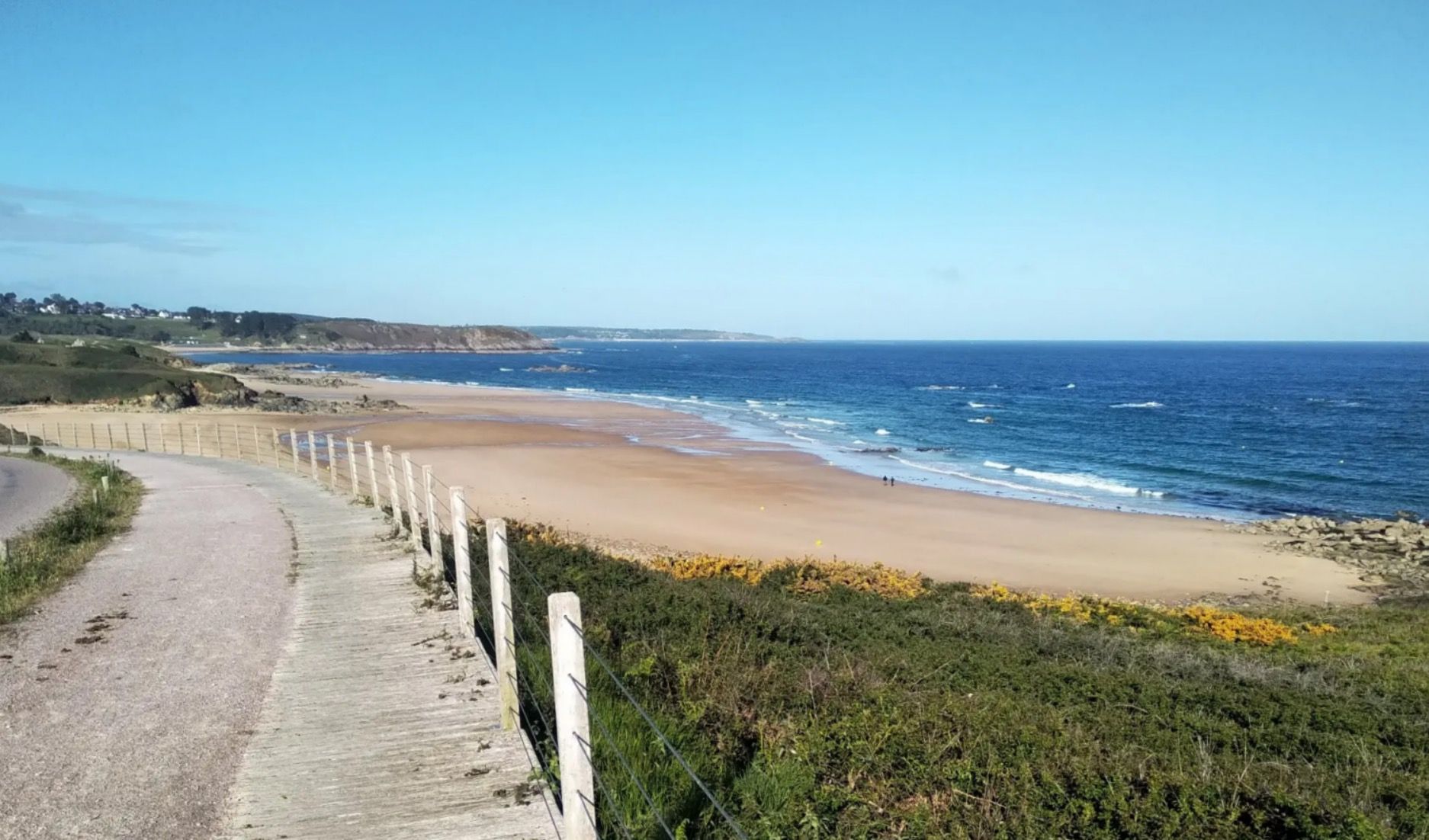
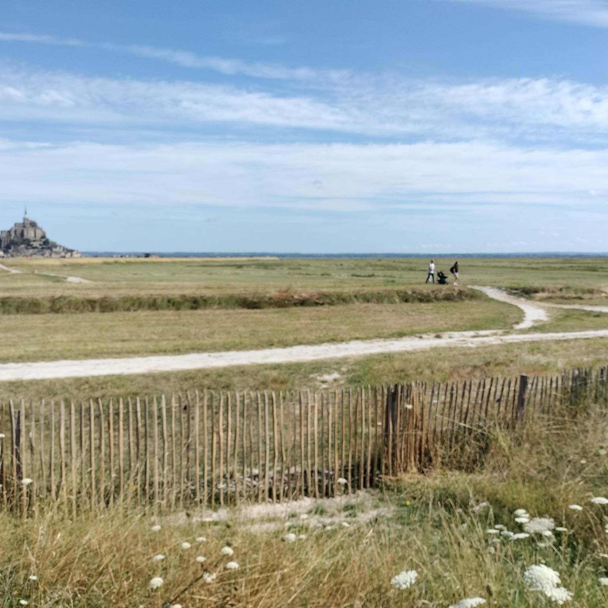
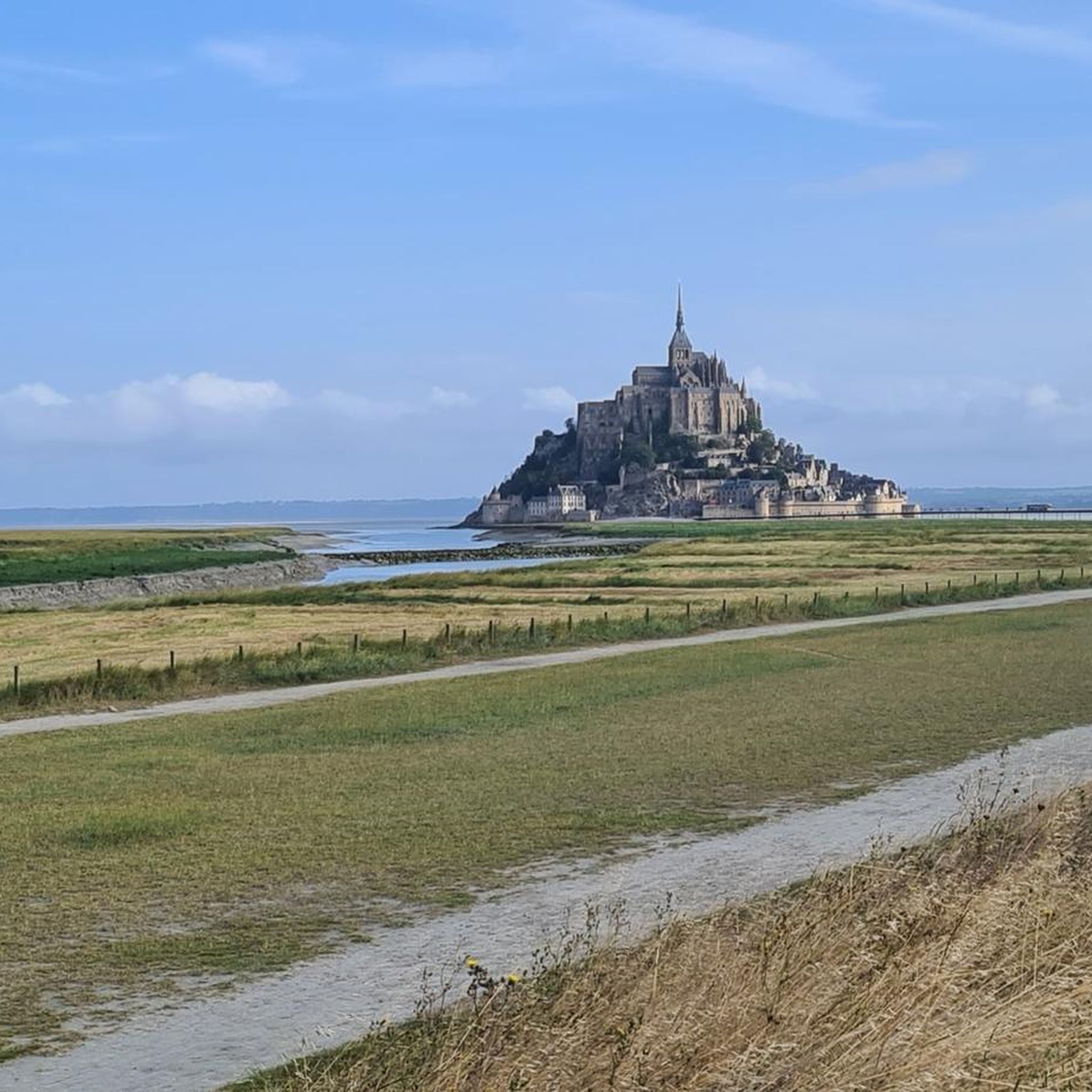

Other adventures around Pontorson

Tips from the Community

The narrow streets of Intra-Muros, the old town of Saint-Malo, are lined with bistros, crêperies, international restaurants, boutiques, and souvenir shops. The Saint-Vincent Cathedral has artistic stained-glass windows. In contrast, the walkable ramparts offer sea views and access to Plage du Môle and Plage de Bon Secours beaches. At low tide, visitors can walk to the 1689 Fort National, located on a rock in the sea, as well as to the islands of Grand Bé and Petit Bé.
1
0
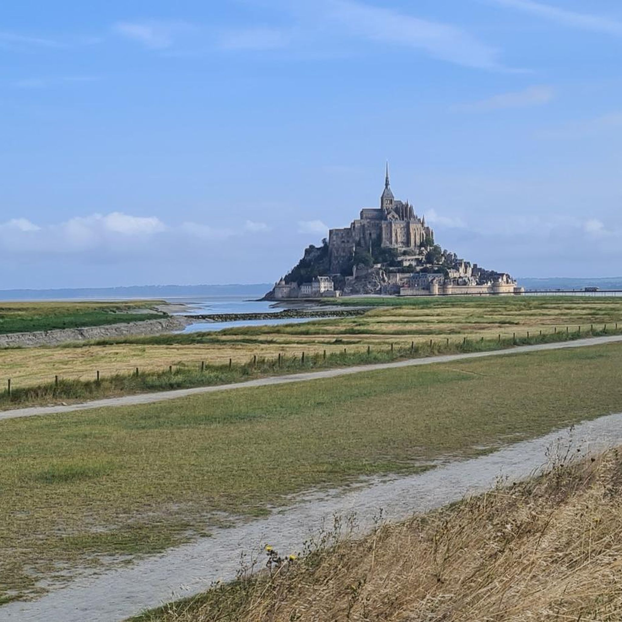
Mont-Saint-Michel is a world-famous rocky island and commune on the border between Normandy and Brittany in France. Crowned by a monumental, medieval Benedictine abbey, this architectural marvel has been a UNESCO World Heritage site since 1979. The bay of the mount is also known for Europe's strongest tides, with a tidal range of up to 14 meters.
1
0

The footpath along the Couesnon to the dam already offers an impressive view of Mont-Saint-Michel. From here, the path with an unobstructed view leads across the salt marshes and the bay, with the landmark of Normandy impressively rising against the wide landscape. Especially in calm weather and with changing light, atmospheric views emerge of Mont-Saint-Michel, the course of the Couesnon river, and the tide-shaped surroundings.
10
0
The Couesnon dam (Barrage du Couesnon) was completed in 2009 and is part of the measures to preserve the bay of Mont-Saint-Michel. The facility regulates the water flow of the Couesnon and supports the natural removal of sediments by the tides. This is intended to counteract the increasing silting up of the bay and preserve the special character of Mont-Saint-Michel as a tidal island. The dam also offers a popular viewpoint with a view of Mont-Saint-Michel and the surrounding salt marshes.
1
0

From there it looks the strongest !!!
1
0

Practice for going to the train station
0
0

Parts of the route along the sea do not exist or are forbidden for bicycles
0
0

If there's a remarkable site that's worth a detour, it's Mont St Michel!
1
0
Frequently Asked Questions
How many road cycling routes are available around Pontorson?
There are over 30 road cycling routes around Pontorson. These include 7 easy routes, 19 moderate routes, and 4 more challenging options, offering a variety of experiences for different skill levels.
Are there easy road cycling routes suitable for beginners or families in Pontorson?
Yes, Pontorson offers several easy routes, perfect for beginners or family outings. The terrain is largely flat, especially along the Mont Saint-Michel Bay and the Couesnon River. A notable option is The dam on the Couesnon – Mont St Michel loop from Pontorson, which is an easy 9.6-mile (15.4 km) trail through the Couesnon River valley.
What are some scenic road cycling routes with views of Mont Saint-Michel?
Many routes in the area offer breathtaking views of Mont Saint-Michel. The View of Mont Saint-Michel – View of Mont Saint-Michel loop from Ardevon is a popular 25.9-mile (41.7 km) route that provides continuous vistas of the iconic abbey. Another excellent choice is The dam on the Couesnon – View of Mont Saint-Michel loop from Pontorson, which follows the Couesnon River with scenic bay views.
Are there any challenging road cycling routes for experienced riders?
While much of the terrain around Pontorson is flat, there are routes that offer more challenge. For instance, the Mont-Dol – Saint-Suliac loop from Pontorson-Mont-Saint-Michel is a moderate 71.2-mile (114.6 km) route with significant elevation gain, providing a more demanding ride. Routes extending towards areas like "Suisse Normande" also offer rugged terrain and panoramic views for those seeking a greater challenge.
What kind of landmarks or attractions can I see along the road cycling routes?
The routes around Pontorson are rich with historical and natural landmarks. You can cycle past the iconic Mont Saint-Michel, explore the Saint Aubert Chapel, or enjoy views from Grouin du Sud. The Couesnon at Beauvoir and the Banks of the Sélune at Pontaubault also offer picturesque natural sights.
Are there circular road cycling routes available in Pontorson?
Yes, many of the road cycling routes around Pontorson are designed as loops, allowing you to start and end in the same location. Examples include the popular View of Mont Saint-Michel – View of Mont Saint-Michel loop from Ardevon and The dam on the Couesnon – View of Mont Saint-Michel loop from Pontorson, both offering scenic circular journeys.
What is the best season for road cycling in Pontorson?
The region around Pontorson is generally pleasant for road cycling from spring through autumn. The mild coastal climate makes it enjoyable, with spring offering blooming landscapes and autumn providing comfortable temperatures and beautiful colors. Summer is also popular, but can be busier, especially near Mont Saint-Michel.
What do other road cyclists enjoy most about road cycling in Pontorson?
The area is highly rated by the komoot community, with an average score of 4.9 stars from over 20 reviews. Reviewers often praise the continuous views of Mont Saint-Michel, the mostly flat and well-maintained paths, and the diverse landscapes ranging from marshlands to river valleys. The accessibility of routes for all skill levels is also frequently highlighted.
Are there options for long-distance road cycling trails from Pontorson?
Yes, Pontorson is part of the wider Véloscénie cycling route, which offers opportunities for longer distances. Routes like the Sélune Riverbank – View of Mont Saint-Michel loop from Pontorson-Mont-Saint-Michel, spanning 64.8 miles (104.3 km), provide an excellent option for those looking for extended rides and exploring more of the surrounding region.
Is it possible to rent bicycles in Pontorson?
Yes, Pontorson is well-equipped for cyclists. The Base de loisirs de Pontorson (Couesnon outdoor leisure center) provides bike rentals, making it convenient for visitors who do not bring their own equipment to explore the local routes.
Are there road cycling routes accessible by public transport in Pontorson?
Pontorson itself is a key transport hub, making many routes accessible. The town has a train station (Pontorson-Mont-Saint-Michel) which connects to regional services, allowing cyclists to arrive with their bikes and easily access the numerous routes that start directly from or near the town center, including the greenway to Mont Saint-Michel.
Where can I find parking for road cycling routes in Pontorson?
Pontorson offers various parking options, especially in and around the town center, which serves as a convenient starting point for many routes. For routes heading towards Mont Saint-Michel, designated parking areas are available closer to the bay, often with facilities for cyclists. It's advisable to check local signage for specific parking regulations.
Most popular attractions around Pontorson

Get inspired with the komoot mobile app


Explore more
Browse the best Road cycling routes in other regions.
