The best cycling routes around Moneydorragh More Upper
4.1
(8)
211
riders
19
rides
Touring cycling around Moneydorragh More Upper offers diverse routes set against the backdrop of the Irish Sea and the Mourne Mountains. The region features a landscape of rolling hills, farmland, and coastal plains, providing varied terrain for cyclists. It serves as a gateway to the High Mournes, presenting opportunities for both challenging climbs and scenic coastal rides. The area is characterized by its natural beauty, including the Annalong Valley and views stretching towards the Isle of Man.
Best touring cycling…
Last updated: May 10, 2026
3
riders
55.3km
03:43
710m
710m
Embark on the Slievenaman loop from Newcastle, a challenging touring bicycle route that spans 34.4 miles (55.3 km) and features a significant elevation gain of 2319 feet (707 metres). This…
3
riders
62.2km
03:51
360m
360m
Embark on the St John's Point Lighthouse loop from Newcastle for a moderate touring cycling experience across the scenic Lecale Peninsula. This route covers 38.7 miles (62.2 km) with an…

Sign up for free
1
riders
43.2km
03:13
730m
730m
This difficult 26.9-mile touring cycling loop takes you from Carrick Little to Tollymore Forest, offering coastal views and forest trails.
2
riders
32.5km
02:03
310m
310m
Embark on the Newcastle to Clough Castle loop, a touring bicycle route spanning 20.2 miles (32.5 km) with an elevation gain of 1014 feet (309 metres). This moderate ride typically…
1
riders
24.7km
01:34
300m
300m
Cycle Route 6 - The Head Road Route, a moderate 15.4-mile (24.7 km) touring cycling trail in the Mourne Area of Outstanding Natural Beauty.
Get access to more routes and recommendations from other explorers.
Sign up for free
Already have an account?
Our route recommendations are based on thousands of hikes, rides, and runs completed by other people on komoot.
Start today with a free account
Your next adventure awaits.
Login or Signup
Other adventures around Moneydorragh More Upper

Tips from the Community

Silent Valley Reservoir, nestled in the Mourne Mountains, is a peaceful retreat surrounded by sweeping granite peaks and heathered slopes. Built in the early 20th century to supply water to Belfast and much of County Down, the reservoir combines striking engineering with natural beauty. Visitors can stroll along well-kept paths, admire the Victorian-style dam and impressive Mourne Wall, or simply enjoy the quiet atmosphere by the lakeshore.
4
1

The vast coastline stretches out endlessly before you, and the panorama with the majestic Mourne Hills in the background creates a scene that is hard to put into words. The gentle waves touching the sand and the silence of the surroundings make you feel the vastness and freedom of this place.
1
0
This historic 12th century building is a typical example of an Anglo-Norman motte with a kidney-shaped bailey. The 7.6m high mound, which once housed a wooden tower, was later replaced by a stone tower house, the ruins of which can still be seen today. Access is via Clough's main road; there is a small car park, but it is not always well signposted. Access is usually permitted. The surrounding countryside, with views of the Mourne Mountains, offers a tranquil atmosphere that invites you to linger.
1
0
This picturesque spot is located between Dundrum Bay and Murlough Bay and offers impressive views of the surrounding countryside. The paths there lead through the Murlough National Nature Reserve, a 6,000-year-old dune system that is great for cycling. However, some sections can become slippery in wet weather, so care must be taken. A particular highlight is the Downshire Bridge, which connects the village of Dundrum with the nature reserve and provides a charming crossing over the bay.
1
0
The route takes you along the Silent Valley Reservoir on a well-developed, asphalt road that is also suitable for less experienced drivers. However, it can be slippery in wet weather, so caution is advised. A special highlight is the impressive dam wall of the Ben Crom Reservoir, which blends harmoniously into the surrounding mountain landscape. Please note, however, that access to the park is subject to a fee.
0
0
The well-maintained trails take you through impressive scenery, surrounded by the striking peaks of the Mournes. The view of the Mourne Wall, which stretches for 35 kilometers and connects 15 peaks, is particularly impressive. However, some sections can become slippery in wet weather, so caution is advised. A highlight is a visit to Ben Crom Reservoir, which can be reached via an extension of the route. Note that there is a fee to enter the park.
1
1
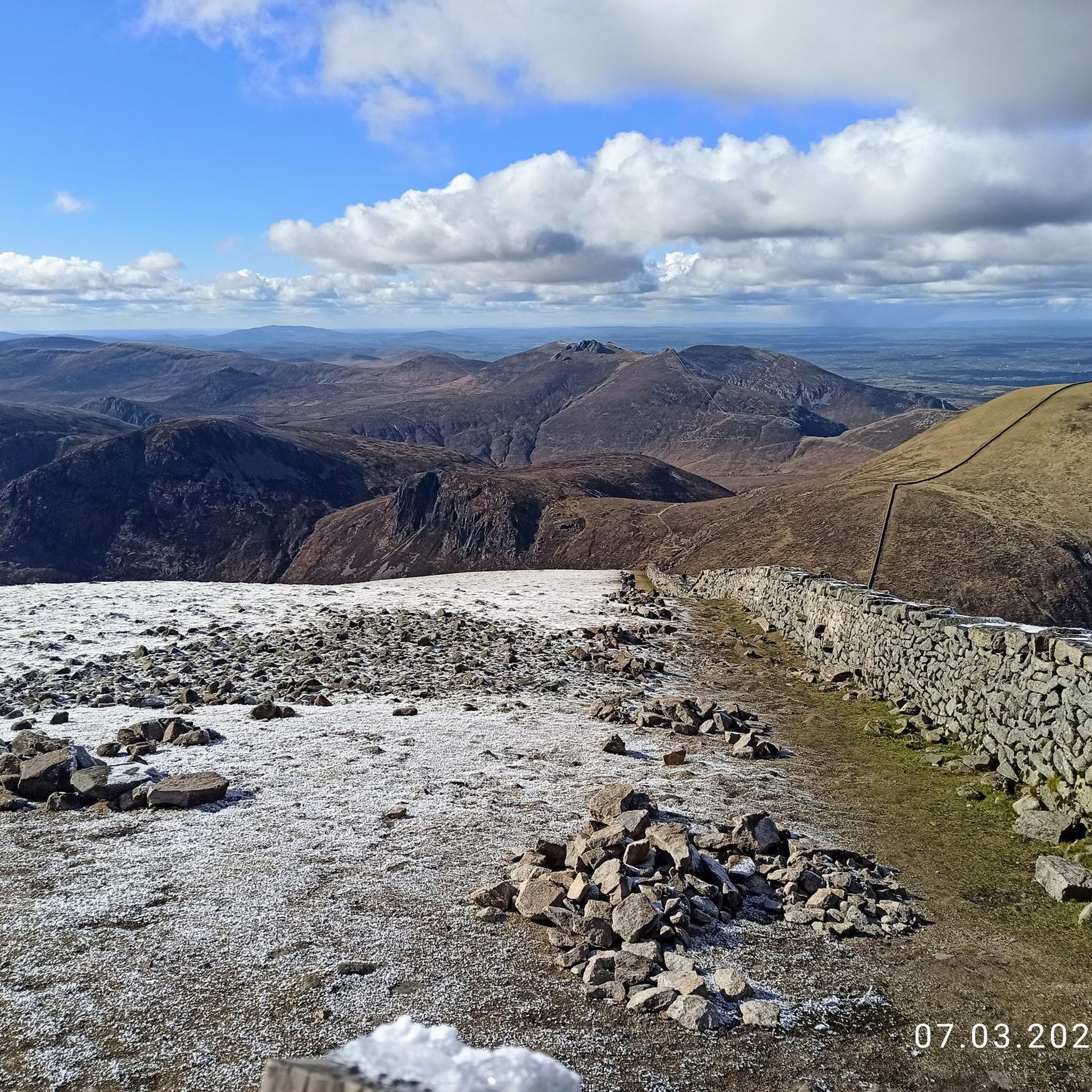
The gently ascending road winds through a wide, open landscape, surrounded by grassy hills and breathtaking silence. Only the wind and the quiet hum of the tires accompany you here as your gaze wanders into the distance. The climb may be challenging, but the view that opens up with every meter of altitude is worth the effort. Once at the top, you feel free and rewarded, as if you have conquered a piece of nature and then the reward comes with the descent.
0
0
Suddenly this ancient monolith rises before you, a silent witness to times gone by and myths. It stands alone on the green meadow, surrounded by a peaceful, almost mysterious silence.
1
0
Frequently Asked Questions
What types of terrain can I expect on touring cycling routes around Moneydorragh More Upper?
The region offers a diverse landscape for touring cyclists. You'll encounter rolling hills and farmland, often featuring traditional stone walls, providing scenic charm. Routes also rise towards the majestic Mourne Mountains, offering opportunities for challenging climbs and rewarding descents. Additionally, many paths provide impressive coastal views of the Irish Sea, stretching towards the Isle of Man. Some routes may include unpaved segments, adding to the variety.
Are there touring cycling routes suitable for beginners or families in Moneydorragh More Upper?
Yes, there are routes suitable for various fitness levels. While some routes are challenging, the area offers at least 3 easy touring cycling routes. These often feature mostly paved surfaces and more gentle gradients, making them ideal for leisurely rides or family outings. For example, routes like Route 6 - The Head Road Route offer accessible distances and elevation profiles.
What are some challenging touring cycling routes for experienced cyclists?
For experienced cyclists seeking a challenge, Moneydorragh More Upper provides several difficult routes with significant elevation gains. One such route is the Slievenaman loop from Newcastle - Mournes, a 34.4-mile (55.3 km) trail with over 700 meters of ascent, offering strenuous climbs and dramatic vistas of the Mourne Mountains. Another demanding option is the Carrick Little to Tullymore Forest loop, which covers 26.9 miles (43.2 km) through forest and mountain landscapes with similar elevation.
What kind of views can I expect along the touring cycling routes?
Cyclists can enjoy a magnificent panorama of the coastal plain with the Irish Sea stretching towards the Isle of Man. As you climb through the Moneydorragh townlands, you'll be rewarded with great views of the surrounding rolling hills and farmland. Routes also offer dramatic vistas of the majestic Mourne Mountains, including iconic landmarks like View of the Mourne Mountains and the Mourne Wall.
Are there any circular touring cycling routes in the area?
Yes, many of the touring cycling routes around Moneydorragh More Upper are designed as loops, allowing you to start and finish at the same point. Examples include the popular Slievenaman loop from Newcastle - Mournes, the St John's Point Lighthouse loop from Newcastle, and the Newcastle to Clough Castle loop — Mourne.
What natural landmarks or points of interest can I visit along the cycling routes?
The area is rich in natural beauty. You can cycle past the Silent Valley Reservoir, a significant feature in the Mourne Mountains. Other natural highlights include Blue Lough and the Slieve Bearnagh peak. The Annalong Valley and River also contribute to the area's natural appeal.
Are there any historical sites or man-made landmarks to see while cycling?
Yes, the region features several interesting man-made landmarks. The iconic Mourne Wall, a dry-stone wall traversing the Mourne Mountains, is a prominent feature. You might also encounter sites like Slieve Meelmore summit shelter, and one route specifically mentions the Clough Castle.
How long do the touring cycling routes typically take to complete?
The duration of routes varies depending on their distance and difficulty. For example, the Slievenaman loop from Newcastle - Mournes, a difficult 34.4-mile route, typically takes around 3 hours 42 minutes. A moderate 38.7-mile route like the St John's Point Lighthouse loop from Newcastle takes approximately 3 hours 51 minutes. Shorter routes, such as Route 6 - The Head Road Route (15.4 miles), can be completed in under 2 hours.
What do other touring cyclists say about the routes in Moneydorragh More Upper?
The touring cycling routes in Moneydorragh More Upper are highly regarded by the komoot community, holding an average rating of 4.1 stars from over 9 reviews. Cyclists often praise the majestic Mourne Mountains, expansive coastal views, and picturesque rolling hills that define the area. The diverse terrain and options for different ability levels are also frequently highlighted.
Are there any specific roads known for their scenic beauty for cyclists?
Yes, roads like the Head Road, which leads towards the Silent Valley reservoir, are particularly noted for offering splendid views of the surrounding natural beauty. This road is part of Route 6 - The Head Road Route, providing cyclists with a memorable experience through diverse terrain, including forest and mountain landscapes.
How many touring cycling routes are available in Moneydorragh More Upper?
There are approximately 20 touring cycling routes available in Moneydorragh More Upper. These routes cater to a range of abilities, with about 3 easy, 10 moderate, and 7 difficult options, ensuring there's something for every cyclist.
Most popular routes around Moneydorragh More Upper
Most popular attractions around Moneydorragh More Upper

Get inspired with the komoot mobile app


Explore more
Browse the best Cycling routes in other regions.
