The best mountain hikes around Steinbach an der Steyr
4.5
(42)
732
hikers
16
hikes
Mountaineering routes Steinbach an der Steyr are situated in the Upper Austrian Pre-Alps, offering a diverse landscape for outdoor activities. The region is characterized by numerous peaks, including Hohe Dirn and Hochbuchberg, and is close to the Kalkalpen National Park. Deeply carved river canyons, extensive forests, and agricultural meadows contribute to varied terrain suitable for mountaineering.
Best mountaineering routes around Steinbach an der Steyr
- The most popular mountaineering route is Schobersteinhaus – Wooden Gnome Fountain loop from Paragleiten Schoberstein Landeplatz…
Last updated: October 5, 2026
4.5
(2)
174
hikers
Hard mountaineering route. Good fitness required. Sure-footedness, sturdy shoes and alpine experience required.
4.6
(9)
145
hikers
6.83km
03:20
590m
590m
Moderate mountaineering route. Good fitness required. Mostly accessible paths. Sure-footedness required.

4.7
(7)
88
hikers
9.47km
04:57
850m
850m
Moderate mountaineering route. Good fitness required. Mostly accessible paths. Sure-footedness required.
4.9
(8)
77
hikers
11.5km
05:03
830m
830m
Hard mountaineering route. Very good fitness required. Mostly accessible paths. Sure-footedness required.
4.7
(3)
49
hikers
11.2km
05:10
900m
900m
Hard mountaineering route. Very good fitness required. Mostly accessible paths. Sure-footedness required.
Get access to more routes and recommendations from other explorers.
Already have an account?
Our route recommendations are based on thousands of hikes, rides, and runs completed by other people on komoot.
Start today with a free account
Your next adventure awaits.
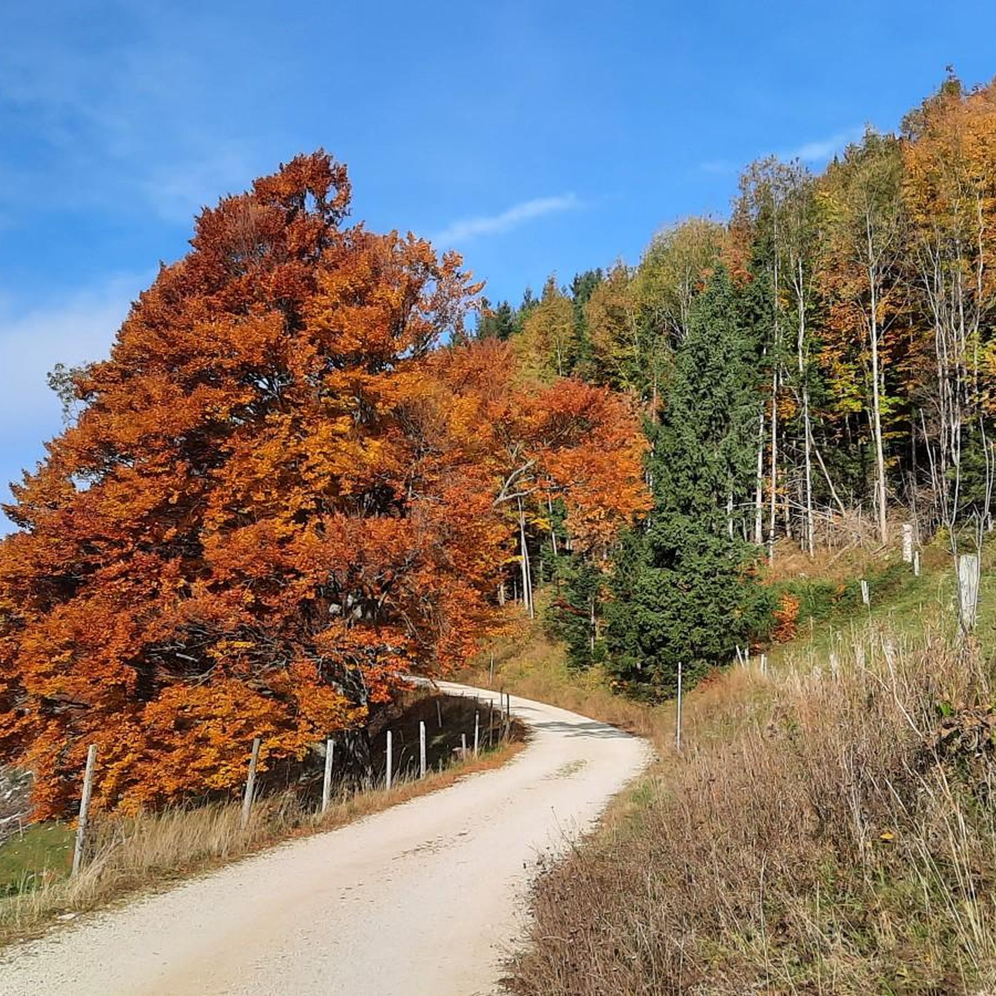
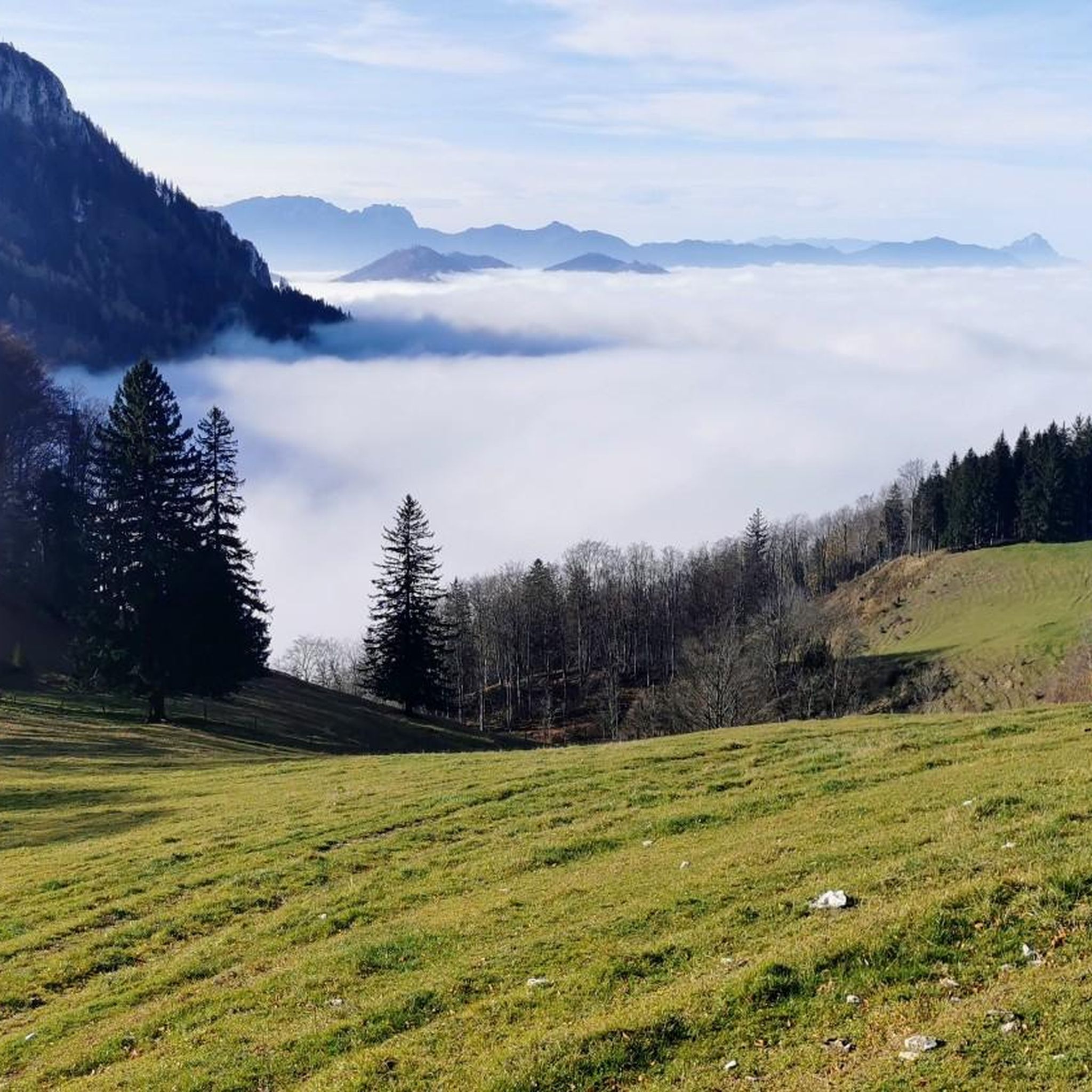
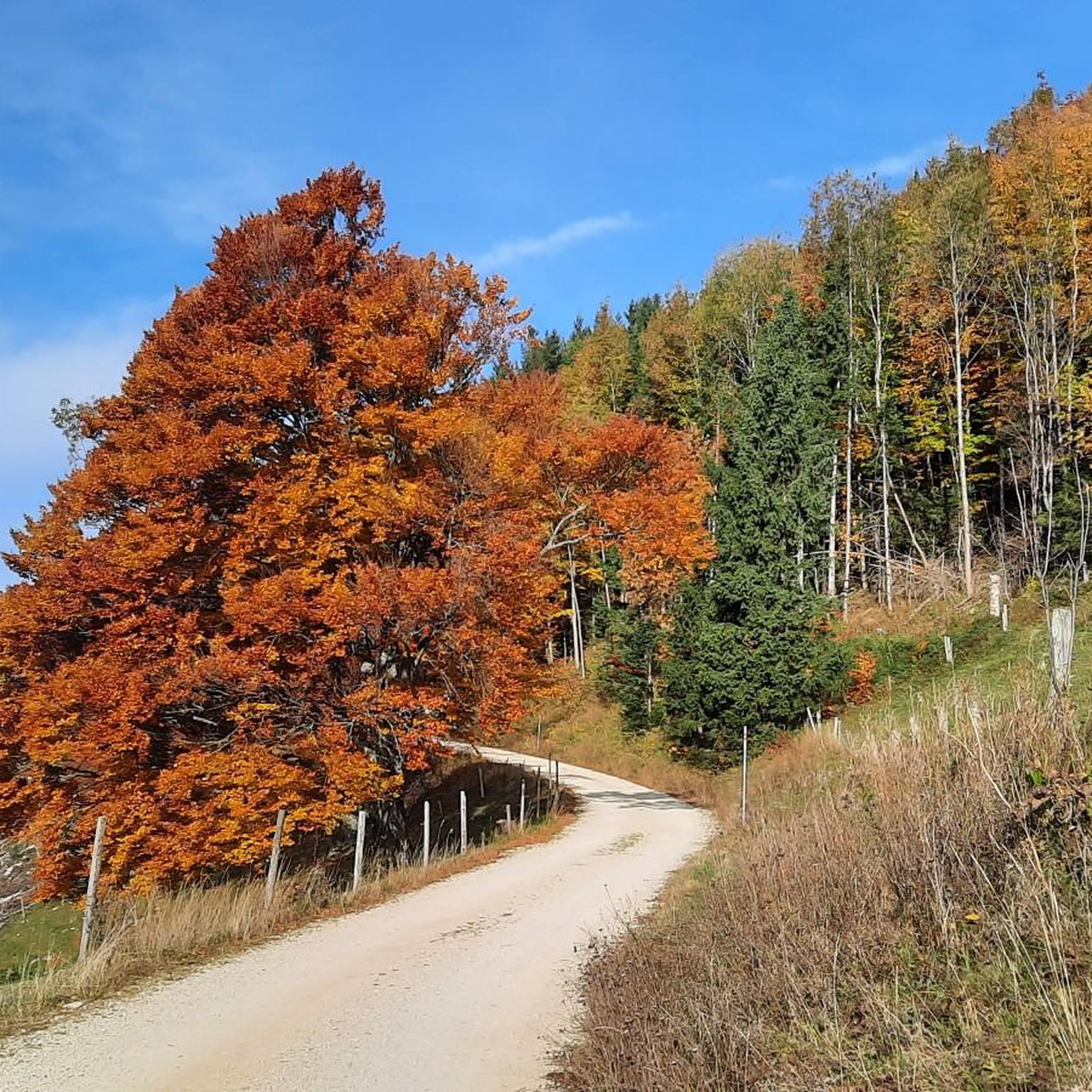
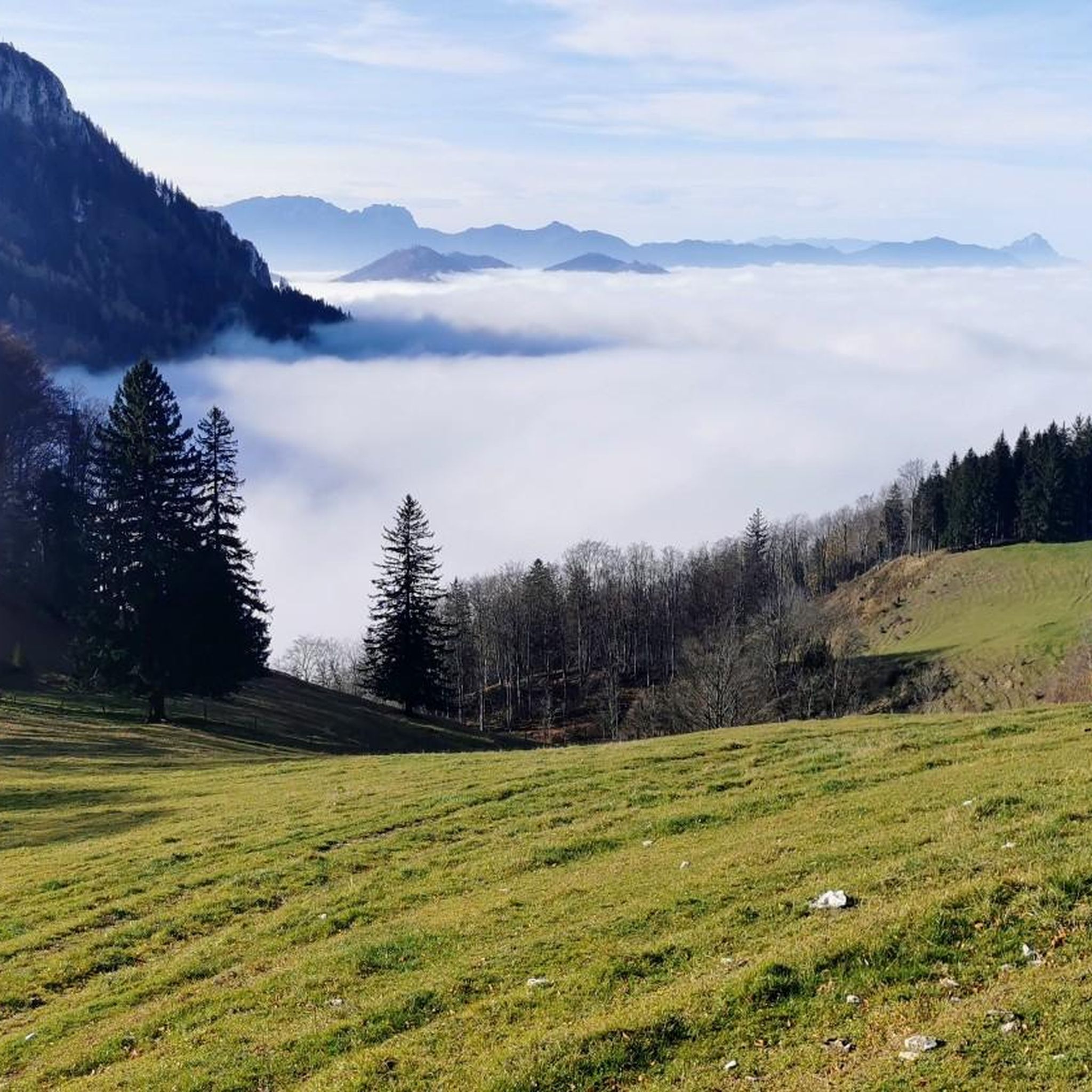
Tips from the Community


For the hiker lingering before the summit cross of the Gaisberg, I offer the viewer, who does not just want to enjoy the view, a core quote from Clive Staples Lewis (1898-1963), whom Wikipedia honors as "one of the most influential Christian apologists of modern times": + "I believe in Christianity as I believe that the sun has risen, not only because I see it, but because by it I see everything else."
0
0

The multi-peaked mountain ridge of the Schoberstein group stretches from west to east.
6
0
The multi-peaked mountain ridge of the Schoberstein group stretches from west to east.
5
0
Magnificent views of the Steyrtal National Park region
5
0
The memorial plaque is a visible sign of the early alpine work of the nature enthusiasts and a popular resting point on the way to the summit.
5
0
Frequently Asked Questions
How many mountaineering routes are available around Steinbach an der Steyr?
There are 16 mountaineering routes around Steinbach an der Steyr listed on komoot. These routes offer a mix of moderate and difficult challenges, with 7 moderate and 9 difficult options to explore.
Are there any circular mountaineering routes in the Steinbach an der Steyr region?
Yes, many of the mountaineering routes in the Steinbach an der Steyr region are circular, allowing you to start and end at the same point. For example, the Schobersteinhaus – Wooden Gnome Fountain loop from Paragleiten Schoberstein Landeplatz 3 is a popular circular option leading to the Schobersteinhouse.
What are some scenic viewpoints or summits I can reach on a mountaineering tour?
The region offers several rewarding summits with panoramic views. The Schoberstein Summit and the Schobersteinhaus are popular destinations, offering expansive vistas. The Hohe Dirn also provides magnificent views of the Ennstal, and the Dürrer Eck offers wonderful views of the Steyrtal and the Dead Mountains.
Are there any family-friendly mountaineering trails in Steinbach an der Steyr?
While many mountaineering routes are moderate to difficult, the broader region offers the 'Energy Adventure Hiking World' with four family-friendly circular routes. These are designed with 16 interactive stations and are largely barrier-free or stroller-friendly, providing a great outdoor experience for families, though they may not be classified as mountaineering routes themselves.
What kind of natural features can I expect to see along the mountaineering routes?
Mountaineering routes in Steinbach an der Steyr traverse diverse landscapes. You'll encounter extensive forests, agricultural meadows, and notable peaks. The Steyr River flows through a deeply carved canyon on the west side of the community, offering dramatic natural backdrops and opportunities for waterside exploration.
Are there any huts or places for refreshments along the trails?
Yes, there are several huts in the region where you can find refreshments. The Schobersteinhaus is a very popular destination, and the Anton-Schosser-Hütte is located near Hohe Dirn. The Grünburger Hut is also a nearby lodge, located at 1,080 meters.
What do other mountaineers say about the routes in Steinbach an der Steyr?
The mountaineering routes in Steinbach an der Steyr are highly rated by the komoot community, with an average score of 4.1 stars from over 30 reviews. Over 700 mountaineers have used komoot to explore the varied terrain, often praising the diverse landscapes and rewarding views.
Can I find challenging mountaineering routes in this area?
Absolutely. The Steinbach an der Steyr region is known for its challenging terrain. Out of the 16 routes available, 9 are classified as difficult. An example of a challenging route is the Schoberstein – Schobersteinhaus loop from Beisteinmauer, which features significant elevation gain.
Are there any historical or cultural landmarks near the mountaineering trails?
While the focus is on natural beauty, the broader region around Steinbach an der Steyr does have historical sites. You can find several castles, such as Burg Altpernstein and Losenstein Castle Ruins, which offer a glimpse into the area's past. These are typically found slightly off the main mountaineering paths.
What is the highest point I can reach on a mountaineering tour in the direct municipality area?
The highest hill within the direct municipality area of Steinbach an der Steyr is Hochbuchberg, reaching 1,273 meters. While specific mountaineering routes to its summit are not detailed here, it represents the highest point for exploration in the immediate vicinity.
Are there opportunities for rock climbing in the wider Steyr region?
Yes, for climbers, the broader Steyr region and Kalkalpen National Park boast over 1000 routes on natural rock faces, along with indoor and outdoor climbing centers. For more information on climbing opportunities, you can visit the Steyr National Park website.
What is the best way to access the mountaineering routes, and is parking available?
Access to mountaineering routes often involves reaching trailheads by car. While specific parking details for each route vary, popular starting points like Paragleiten Schoberstein Landeplatz 3 for the Schobersteinhaus – Wooden Gnome Fountain loop typically have designated parking areas. It's advisable to check individual route descriptions for precise parking information.
Most popular routes around Steinbach an der Steyr
Most popular attractions around Steinbach an der Steyr

Get inspired with the komoot mobile app


Explore more
Browse the best Mountain Hikes & Routes in other regions.
