The best MTB trails in the Aosta Valley
4.5
(4531)
30,164
riders
783
rides
Mountain biking in the Aosta Valley offers diverse terrain within the Italian Alps, characterized by dramatic landscapes and extensive trail networks. The region features high peaks such as Mont Blanc and the Matterhorn, alongside deep valleys, dense forests, and alpine meadows. Mountain bikers can navigate ancient mule tracks, winding singletracks, and challenging descents through rocky sections and root-filled paths. This varied topography provides a wide range of experiences for all skill levels.
Best mountain bike trails in the Aosta Valley
- The most popular mountain bike trail is Invergneux Pass Loop from Cogne, a 19.2 miles (30.9 km) difficult trail that takes 3 hours 52 minutes to complete, offering challenging climbs and alpine views.
- Another top favourite among local mountain bikers is Col des Chavannes — Giro ad anello, a difficult 30.4 miles (49.0 km) path. This route traverses high mountain passes with panoramic vistas of the surrounding peaks.
- Local mountain bikers also love the Val Ferret from Courmayeur, a 17.7 miles (28.5 km) trail leading through the picturesque Val Ferret, often completed in about 3 hours 58 minutes.
- Mountain biking in the Aosta Valley is defined by majestic alpine peaks, deep valleys, and varied forest paths. The network offers options for easy rides, moderate explorations, and advanced technical descents.
- The routes in Aosta Valley are highly rated by the komoot community with an average score of 4.5 stars from over 3,800 reviews. More than 28,000 mountain bikers have used komoot to explore Aosta Valley's varied terrain.
Last updated: October 4, 2026
4.8
(128)
1,218
riders
30.9km
03:53
1,400m
1,410m
The Invergneux Pass Loop from Cogne offers a challenging mountain biking experience through high-altitude alpine scenery. You will navigate picturesque valleys, cross alpine meadows, and ride through coniferous forests, all while enjoying panoramic views of the Gran Paradiso. This difficult route covers 19.2 miles (30.9 km) with a significant elevation gain of 4597 feet (1401 metres), typically taking around 3 hours and 52 minutes to complete.
Before you set out, be aware that this route demands excellent physical fitness and advanced riding skills. The terrain becomes progressively more technical as you climb, especially near Passo Invergneux, where sections are very steep and exposed; you may need to push or carry your bike. The best time to tackle this loop is during the warmer months when the high-alpine passes are clear of snow.
Located within Gran Paradiso National Park, this trail is a notable adventure in the Cogne Valley. As you ascend towards Passo Invergneux, keep an eye out for local wildlife; there are often opportunities to spot animals like ibex and marmots in their natural habitat.
4.6
(31)
245
riders
49.0km
05:16
1,710m
1,710m
The Col des Chavannes — Giro ad anello is a difficult mountain biking loop that takes you on a 30.4-mile (49.0 km) journey through Italy's Aosta Valley. You will climb a significant 5599 feet (1707 metres) over approximately 5 hours and 16 minutes, experiencing diverse terrain from asphalt and gravel to challenging singletrack. The route offers spectacular panoramic views of the Mont Blanc massif and Roc d'Enfer, winding through the Dora di Verney river valley and past the picturesque Lago Combal.
This challenging route demands advanced riding skills and a very good level of fitness, especially for its S3 sections where pushing or carrying your bike may be necessary. You will find sections rated S1 and S2, but also very exposed and stony parts suitable only for experts. The best time to undertake this ride is typically from early June to mid-October, depending on snow conditions.
The trail is a key point along the renowned Alta Via della Valle d'Aosta n. 2, offering an immersive high alpine experience. Along the way, you can stop at mountain huts like Rifugio Elisabetta, which provides a restaurant, terrace, and excellent views. This strategic location and its breathtaking vistas make it a memorable journey through one of the most beautiful regions of the Alps.

4.6
(27)
222
riders
28.5km
03:58
1,010m
1,010m
Embark on a challenging mountain biking adventure through Val Ferret from Courmayeur, a difficult route spanning 17.7 miles (28.5 km). You will conquer a significant 3319 feet (1012 metres) of elevation gain, with an estimated duration of 3 hours and 57 minutes. As you ride, you'll experience diverse terrain, from paved sections to unpaved gravel paths and dirt roads, all while enjoying stunning views of the Mont Blanc massif, including the impressive Grandes Jorasses, and passing through picturesque forests and expansive alpine meadows. You will also catch glimpses of the Dora di Ferret river winding through the valley.
This specific mountain biking route is rated difficult, demanding very good fitness and advanced riding skills. Some segments may even require you to dismount and push your bike, so be prepared for a demanding physical challenge. While the broader Val Ferret area offers trails for various skill levels, this particular journey is best suited for experienced mountain bikers seeking a rigorous ride. Plan your visit accordingly, ensuring you have the necessary equipment and experience for such a challenging endeavor.
The Val Ferret area is renowned for its dramatic alpine scenery, and this route showcases its rugged beauty. The trail offers a unique perspective of the Mont Blanc massif, allowing you to immerse yourself in the high-mountain environment. It's a journey that highlights the natural grandeur of the region, providing a memorable experience for those who appreciate challenging mountain biking amidst breathtaking landscapes. This trail stands out for its combination of physical demand and unparalleled scenic rewards.
4.7
(76)
353
riders
30.5km
03:28
1,160m
1,160m
Prepare for a difficult mountain biking journey to Lago Ponton and Rifugio Sogno di Berdzè, a challenging 18.9-mile (30.5 km) route with 3799 feet (1158 metres) of elevation gain. This adventure typically takes around 3 hours and 28 minutes to complete. You will ride through diverse terrain, from asphalt and gravel farm roads to dirt paths and mule tracks, often requiring you to push your bike on poorly rideable sections, especially the final 300 meters to the refuge. As you ascend, the landscape opens up around 2200 meters, revealing impressive views of the Urtier valley, Nordic forests, and green, rolling hills reminiscent of Scotland. The highlight is reaching the picturesque Ponton Lake and the mountain hut itself.
To best experience this route, plan your visit between June and October, when conditions are most favorable for mountain biking in the Gran Paradiso National Park. This trail is designed for riders with very good fitness and advanced skills, as it includes technical sections and steep inclines. While some parts of the Urtier valley are moderate-easy with an e-bike, they become significantly harder with a regular bike. Be ready for sections where you will need to dismount and push your bike, particularly near the lake and the refuge.
This trail is a favorite among local mountain bikers and is highly regarded within the Komoot community for its rewarding experience. The Sogno di Berdzè mountain hut, situated at 2,526 meters, is a significant destination, located along the Alta Via 2 of the Aosta Valley at the crossroads of the Cogne and Champorcher valleys. Despite the demanding ascents and hike-a-bike sections, many riders find the
4.6
(49)
201
riders
23.2km
02:25
580m
580m
Embark on the Tour degli alpeggi di Torgnon, a challenging yet rewarding mountain biking loop in the Aosta Valley. This moderate route spans 14.4 miles (23.2 km) with a significant elevation gain of 1907 feet (581 metres), typically taking around 2 hours and 24 minutes to complete. You will navigate varied terrain, including asphalt, dirt roads, and natural paths, as you pass through alpine pastures and larch forests. From viewpoints like Gilliarey, you can enjoy expansive vistas of iconic peaks such as Monte Cervino, the Plateau Rosa glacier, and Breithorn.
This trail is rated as "MD - Mediamente Difficile," requiring good fitness and advanced riding skills, though it is 100% cyclable. The best time to experience this tour is from May to October. To make your visit easier, a chairlift is available to transport bikes, and you can also rent e-bikes in the area. Consider visiting an alpeggio in Champlong between June and September to observe the traditional process of milk transformation and enjoy local product tastings.
The Tour degli alpeggi di Torgnon stands out for showcasing the authentic rural alpine lifestyle and the natural beauty of the Torgnon alpeggi. The path traverses ancient Mesozoic rocks, gneisses, and limestone formations, offering insights into the region's unique geology. You will also encounter picturesque spots like the serene Lo Ditor pond and Gorzà Lake, adding to the diverse landscapes you will experience on this memorable ride.
4.5
(27)
109
riders
28.5km
03:23
1,090m
1,090m
Prepare for a challenging mountain biking adventure on the Rifugio Chaligne Loop from Arpuilles. This difficult route spans 17.7 miles (28.5 km) and demands a significant 3563 feet (1086 metres) of elevation gain, typically taking around 3 hours and 22 minutes to complete. As you ride, you will encounter varied terrain, from gravel farm tracks and old military roads to refreshing singletrack winding through larch forests. The highlight is undoubtedly the magnificent views of the Grand Combin and the entire Valpelline, offering a truly immersive alpine experience.
To make the most of this demanding loop, plan your visit between May and October when conditions are most favorable. Remember that helmet use is mandatory for your safety on this itinerary, so come prepared. While specific parking details are not provided, you can generally find suitable parking areas within the Gran San Bernardo Valley, which serves as a convenient starting point for your ride.
This route is ideal for experienced mountain bikers seeking a rewarding challenge and authentic alpine panoramas. You can also plan a well-deserved stop at the Chaligne Hut, a perfect spot to take a break and soak in the stunning surroundings. The diverse landscape and the opportunity to witness the grandeur of the Grand Combin make this loop a notable option for those exploring the Valle del Gran San Bernardo.
4.7
(46)
209
riders
27.8km
03:26
1,160m
1,160m
Prepare for a challenging mountain biking adventure on the Rifugio Sogno di Berdzé and Colonna Mine Loop from Lillaz. This difficult route spans 17.3 miles (27.8 km) and demands advanced riding skills, with a significant elevation gain of 3806 feet (1160 metres). You can expect to complete the loop in about 3 hours and 26 minutes, riding through the scenic Urtier valley where waterfalls near Lillaz add to the landscape. The trail offers panoramic views of Cogne, Gran Paradiso, and Mont Blanc as you navigate its varied terrain.
Before you set out, be aware that this difficult mountain biking trail requires advanced riding skills and good physical fitness. You should be prepared for technical sections and potentially pushing your bike on some parts of the route. The starting point in Lillaz is easily accessible from Cogne, a well-known hub for outdoor activities in Valle d'Aosta. Parking is generally available in Lillaz, making it convenient for your visit.
This loop is notable for combining natural beauty with a touch of history. As you ride, you will encounter the historic Colonna Mine, which adds a unique cultural element to your journey through the Gran Paradiso National Park. The technical descent from the mine provides an engaging challenge, making this route a memorable experience for experienced mountain bikers seeking both scenic views and a historical context.
4.5
(32)
208
riders
21.5km
02:02
400m
400m
Embark on the challenging "La valle di Cogne – giro ad anello" mountain bike trail, a difficult 13.3-mile (21.5 km) loop that takes approximately 2 hours and 2 minutes to complete. You will gain about 1313 feet (400 metres) in elevation as you ride through the stunning Cogne Valley, set against the backdrop of the high mountains of Gran Paradiso National Park. Expect diverse alpine landscapes, including Nordic forests of conifers and birch trees, along with a network of dirt routes, forest paths, and mule tracks.
This hard mountain bike ride demands good to very good fitness and advanced riding skills. Some sections are highly technical, featuring rough passages and high steps, so be prepared to push your bike during certain portions. Before you go, it is advisable to check with local tourist offices, as some routes in the Cogne valley have experienced changes due to flood events in 2024.
The trail is located within the renowned Gran Paradiso National Park, offering breathtaking high-mountain scenery and a chance to spot local wildlife like chamois and ibex. The Cogne area is a well-regarded mountain biking destination, with this route being part of a larger network that attracts many riders. It provides a significant challenge for experienced mountain bikers seeking a memorable ride in a spectacular alpine setting.
4.7
(11)
76
riders
15.9km
02:07
710m
700m
Embark on the Escursione al Lago delle Rane — Giro ad anello, a difficult mountain biking loop in Italy's Valle d'Aosta. This challenging 9.9-mile (15.9 km) route demands good training, featuring a long uphill section on a dirt road that climbs 2324 feet (708 metres). You will be rewarded with fantastic panoramic views as you make your way to the picturesque Lago delle Rane, situated at 2376 meters, completing the tour in about 2 hours and 6 minutes.
This difficult mountain bike tour requires advanced riding skills, especially if you choose the very technical single-trail variant for the descent. The main route's descent is considered easier, but be prepared for physically taxing sections where you might need to push your bike. The best time to undertake this excursion is between June and September, when the conditions are most favorable for mountain biking.
What makes this trail truly stand out are the spectacular panoramic views that compensate for the strenuous ascent, leading you to the scenic Lago delle Rane. Near the Rifugio Mont Fallère, located at 2350 meters, you can discover a unique open-air museum featuring wooden sculptures by artist Siro Vierin, adding a cultural element to the natural beauty of the Valle d'Aosta.
4.8
(24)
103
riders
31.8km
02:52
760m
760m
Get ready for a difficult mountain biking adventure on the Tour of Testa di Comagna, a challenging route spanning 19.8 miles (31.8 km). You will climb a significant 2489 feet (759 metres) over approximately 2 hours and 52 minutes of riding. As you tackle the ascent, expect to navigate through ancient fir forests that offer welcome shade, eventually opening up to expansive views. Reaching the Testa di Comagna summit rewards you with panoramic vistas across the high Val d'Ayas and the central valley. Be prepared for some sections with high gradients that will test your endurance.
Plan your mountain biking trip for the best conditions, typically between May and October. It is always wise to check current trail conditions before you head out, especially if you are riding in autumn, to avoid unexpected snow. While the trail is generally ridable, some parts of the climb to Testa di Comagna can have steep gradients, which might be more manageable with an e-bike. Consider your fitness level and bike choice before setting off.
This route offers a unique blend of natural beauty and historical elements. You will ride alongside ancient irrigation canals, known locally as "ru," adding a distinctive cultural touch to your journey. Keep an eye out for the beautiful Arlaz Waterfalls, a natural feature you might pass along the way. This combination of challenging terrain, stunning views, and historical context makes the Tour of Testa di Comagna a memorable experience in the Aosta Valley.
Get access to more routes and recommendations from other explorers.
Already have an account?
Our route recommendations are based on thousands of hikes, rides, and runs completed by other people on komoot.
Start today with a free account
Your next adventure awaits.
Other adventures in the Aosta Valley


Tips from the Community

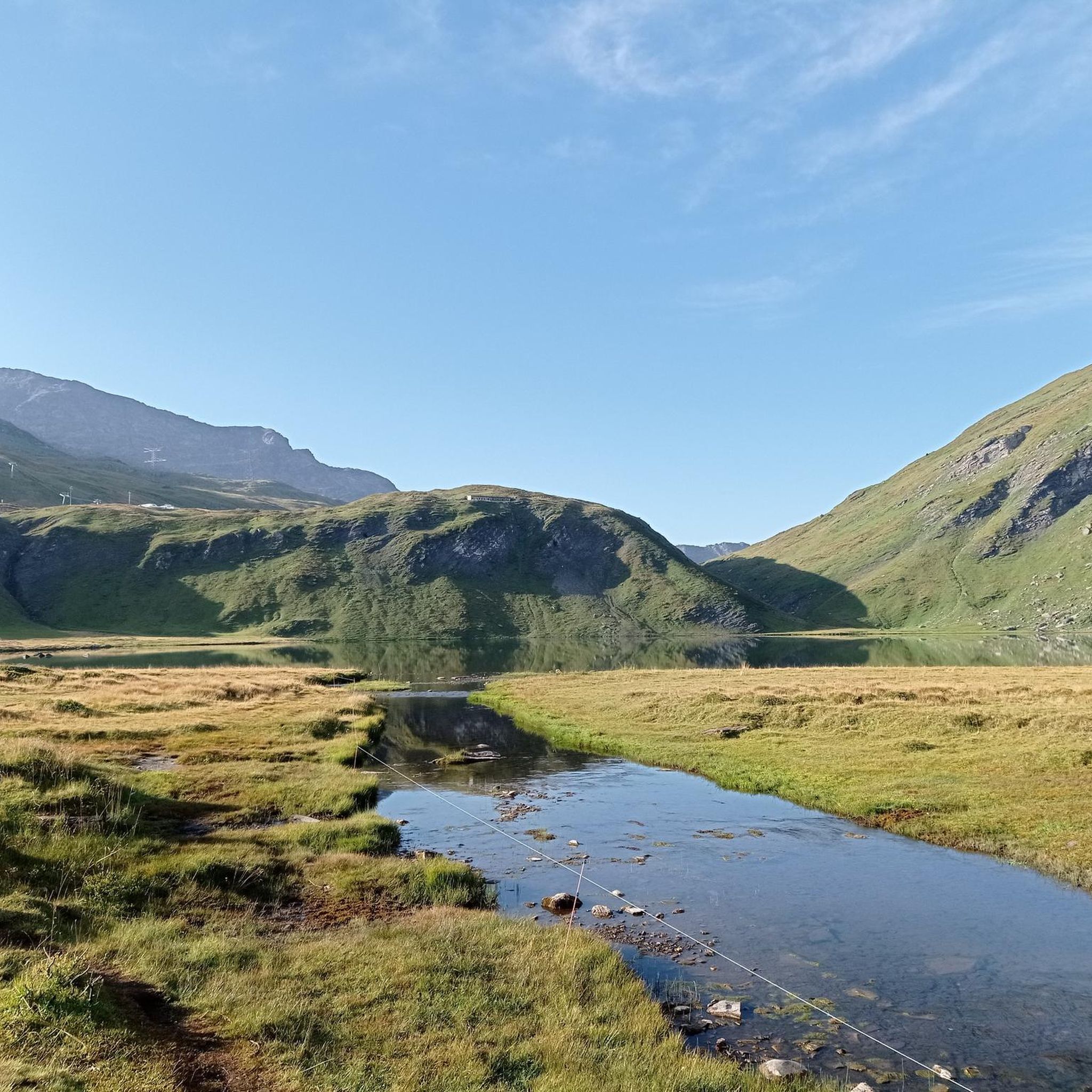
Lake Ponton is a small alpine lake nestled among high-altitude pastures, reachable with a short detour from the main road. Perfect for a break immersed in alpine tranquility.
0
0

Carved out of the eco-sustainable renovation of a typical stone and wood hut at an altitude of 1,943 meters, Rifugio Chaligne in Gignod offers 32 beds and a cuisine based on dairy products from local pastures. Reachable on foot in just over an hour from Buthier or by mountain bike along the rural road, the structure is part of the famous Tour du Mont Fallère hiking circuit.
1
0

The Gorza mountain pasture and lake are an ideal destination for those seeking a scenic walk immersed in nature. The mountain pasture offers vast pastures and splendid views of the surrounding mountains, while the nearby alpine lake offers a quiet haven perfect for a relaxing break.
1
0

ski area, even in summer it's a postcard
0
0

https://youtu.be/KdsaBL0twzY?si=-LI75WFE57aHMvCE First gravel roads, then 2km of singletrack, the remaining 300m of pushing, and the endless descent. Ride the trail counterclockwise.
0
0
https://youtu.be/KdsaBL0twzY?si=-LI75WFE57aHMvCE It's not very difficult to reach, but you'll have to push the last few meters. The descent is easy. The landscape doesn't feel high alpine, but since it's all green, rolling hills, it's like being in Scotland or Ireland.
0
0
Frequently Asked Questions
How many mountain bike trails are there in Aosta Valley, and what are their difficulty levels?
The Aosta Valley offers a vast network of over 760 mountain bike trails. These cater to all skill levels, with approximately 47 easy routes, 179 moderate routes, and over 530 challenging routes for experienced riders. This diverse range ensures options from leisurely rides through alpine meadows to technical descents.
Are there any easy or family-friendly mountain bike trails in the Aosta Valley?
Yes, the Aosta Valley provides options for less experienced riders and families. While many routes are challenging, there are around 47 easy trails available. These often follow forest paths or ancient mule tracks, providing a gentler introduction to mountain biking amidst the stunning alpine scenery. Look for routes with lower elevation gain and smoother terrain.
What is the best time of year for mountain biking in the Aosta Valley?
The best time for mountain biking in the Aosta Valley is typically once the snow melts, usually from late spring through early autumn. Summer offers ideal conditions with warmer weather and full access to the extensive trail network, including high-altitude paths. Always check local conditions, especially for higher passes, as snow can linger into early summer.
Are there mountain bike trails in the Aosta Valley that offer panoramic viewpoints?
Absolutely. The Aosta Valley is surrounded by iconic peaks like Mont Blanc, the Matterhorn, and Monte Rosa, providing spectacular panoramic views from many trails. Routes traversing high mountain passes, such as Col des Chavannes — Giro ad anello, offer breathtaking vistas of the surrounding alpine landscape. Many trails wind through open alpine meadows, ensuring frequent opportunities to enjoy the scenery.
Can I find circular mountain bike routes in the Aosta Valley?
Yes, many mountain bike routes in the Aosta Valley are designed as circular tours, allowing you to start and finish in the same location. Examples include the challenging Invergneux Pass Loop from Cogne or the moderate Tour degli alpeggi di Torgnon — Giro ad anello. These loops are ideal for exploring diverse terrain without needing shuttle services.
What kind of natural attractions can I see along mountain bike trails in the Aosta Valley?
The Aosta Valley's trails often lead past stunning natural attractions. You can encounter serene alpine lakes, such as Lake Arpy, or breathtaking waterfalls like the Lillaz Waterfalls. The region is also home to national parks like Gran Paradiso, offering opportunities to observe wildlife and pristine landscapes. Some routes, like Lago Ponton e Rifugio Sogno di Berdzè, combine lake views with mountain hut experiences.
Are there any specific bike parks in the Aosta Valley for gravity-fed mountain biking?
Yes, the Aosta Valley is renowned for its bike parks, offering gravity-fed thrills. Pila Bike Park, easily accessible from Aosta via gondola, provides dusty downhill tracks and challenging jumps. La Thuile, a host of the Enduro World Series, is considered one of the world's best and most technical natural bike parks. The Matterhorn Bike Park also offers an extensive network suitable for various levels, with lifts widely available to enhance the downhill experience.
What do other mountain bikers say about the trails in the Aosta Valley?
The mountain bike trails in the Aosta Valley are highly rated by the komoot community, with an average score of 4.5 stars from over 3,800 reviews. Reviewers often praise the region's diverse terrain, from flowy forest sections to technical rocky descents, and the stunning alpine backdrops provided by peaks like Mont Blanc. Over 28,000 mountain bikers have used komoot to explore the Aosta Valley's varied landscape.
Are e-bikes a good option for exploring the Aosta Valley's mountain bike trails?
Yes, e-biking is a very popular option in the Aosta Valley. The region's challenging climbs and extensive network of trails make e-bikes an excellent choice for riders who want to cover more ground, reach more remote and beautiful places, or simply enjoy the ascents with less effort. E-bikes allow a wider range of riders to experience the stunning alpine environment.
What kind of terrain can I expect on mountain bike trails in the Aosta Valley?
Mountain bike trails in the Aosta Valley offer incredibly diverse terrain. You can expect to ride on ancient mule tracks, winding singletracks through flower-filled alpine meadows, forest paths, and farm roads. More challenging routes feature steep chutes, rocky descents, and root-filled sections, providing technical and engaging experiences. Some trails even follow characteristic 'ru,' ancient irrigation channels.
Are there any trails that pass through the picturesque Val Ferret?
Yes, the picturesque Val Ferret, located at the foot of Mont Blanc, offers well-marked trails for mountain biking. A popular option is Val Ferret from Courmayeur, a 17.7-mile (28.5 km) trail that leads through this stunning valley, providing incredible views of the surrounding peaks.
What are some of the historical features I might encounter on Aosta Valley mountain bike trails?
Beyond its natural beauty, the Aosta Valley has a rich history. Many mountain bike trails follow ancient pathways originally used by people and animals for navigation and farming. While the city of Aosta boasts Roman ruins, and numerous medieval castles are scattered across the valley, the trails themselves often offer a sense of historical passage through these traditional routes.
Most popular routes in the Aosta Valley
Most popular attractions in the Aosta Valley

Get inspired with the komoot mobile app


Didn’t find what you were looking for?
Check out more MTB trails throughout Aosta Valley below and find the perfect route in your destination.
Explore more
Browse the best MTB trails in other regions.
