The best running trails around Woodbank
4.3
(59)
15,017
runners
572
runs
Jogging around Woodbank offers routes through varied landscapes, including open farmland and riverside paths. The terrain is generally flat with minimal elevation changes, making it suitable for a range of running abilities. Many routes traverse rural areas, passing by farms and plantations, providing a mix of natural and agricultural scenery. The region's running trails are characterized by their accessible nature and gentle gradients.
Best jogging routes around Woodbank
- The most popular jogging route is Alpaca Farm – Capenhurst Pinfold loop…
Last updated: July 7, 2026
46
runners
5.79km
00:36
10m
10m
Moderate run. Good fitness required. Mostly paved surfaces. Suitable for all skill levels.
42
runners
5.69km
00:35
10m
10m
Moderate run. Good fitness required. Mostly paved surfaces. Suitable for all skill levels.

Sign up for free
39
runners
4.89km
00:30
10m
10m
Easy run. Great for any fitness level. Mostly paved surfaces. Suitable for all skill levels.
33
runners
Moderate run. Good fitness required. Mostly paved surfaces. Suitable for all skill levels.
10
runners
3.49km
00:21
0m
0m
Easy run. Great for any fitness level. Mostly paved surfaces. Suitable for all skill levels.
Get access to more routes and recommendations from other explorers.
Sign up for free
Already have an account?
Our route recommendations are based on thousands of hikes, rides, and runs completed by other people on komoot.
Start today with a free account
Your next adventure awaits.
Login or Signup
Tips from the Community

A 'tip' rather than a 'highlight' "The station is not staffed and only has basic amenities (departure screens, waiting shelters and timetable poster boards on each platform). Step-free access is available to both platforms, but transfer between them requires the use of a level crossing at the end of the platforms towards the bridge. The Chester Millennium Greenway cycle route runs adjacent to the station and provides access to the northbound platform. The route also connects the station to Shotton." You can't buy tickets at the station but you can buy them online or on board from the ticket inspector. From Bidston, where the trains terminate in one direction, you can join the Merseyrail network to travel onwards to the Wirral and Liverpool. Sources; https://tfw.wales/places/stations/hawarden-bridge https://en.m.wikipedia.org/wiki/Hawarden_Bridge_railway_station
1
0
"The Jubilee Bridge (also known as the Blue Bridge) is a double leaf rolling bascule bridge which spans the River Dee at Queensferry, Wales. The bridge was built by Sir William Arrol & Co. between 1925 and 1927. It takes its name from an earlier bridge on the same site which was completed during the Diamond Jubilee of Queen Victoria in 1897. The abutments of the old bridge are still visible at both sides to the left (facing north) of the current bridge. The remains can be seen at low tide near the abutments. By the 1960s shipping had ceased on the River Dee. The bridge's lifting mechanism was removed and the roadway fixed permanently in place. In 2005 the Jubilee Bridge was awarded Grade II Listed building status by Cadw." Source: https://en.m.wikipedia.org/wiki/Jubilee_Bridge_(Queensferry)
1
0
"Hawarden Bridge (/ˈhɑːrdən/; Welsh: Pont Penarlâg) is a railway bridge over the River Dee, near Shotton, Flintshire, Wales. It was built by the Manchester, Sheffield and Lincolnshire Railway (which later became the Great Central Railway), as part of the Chester & Connah's Quay Railway. It opened on 3 August 1889. During the 1880s, the Manchester, Sheffield and Lincolnshire Railway Company undertook the construction of a line between Chester Northgate and what is now known as Hawarden Bridge Junction. The most significant geographical feature of the route to overcome was the River Dee. It was decided to opt for a 165 meter-long bridge to cross over the river; this structure was complicated by the need to incorporate a means of passage for the tall ships that traversed the Dee at this time. The Board of Trade, advised by Sir George Nares, decreed that the envisioned bridge would need a single navigable opening of at least 140 feet. Hawarden Bridge was designed by the civil engineer C.A. Hobson. The bridge was officially opened to traffic on 3 August 1889; the opening ceremony was officiated by Catherine Gladstone, the wife of Prime Minister William William Gladstone. A key feature of the Hawarden Bridge was its central section, which was referred to as Span 10; this allowed it to function as a swing bridge. As originally built, it was able to rotate through 90-degrees to enable the passage of tall ships on the River Dee. At the time of its completion, this was the largest opening span of any swing bridge in the United Kingdom. Presently, the bridge can no longer open, the span having been welded shut decades ago. The last time that Span 10 was opened was during 1960. The remains of the rotating mechanism – hydraulic cylinders attached to a drive chain and sprocket – are still visible beneath the bridge. Both pedestrians and cyclists may also traverse Hawarden Bridge via a dedicated walkway. The walkway, which connected between the Wales Coast Path and the Chester Greenway Railway Path section of National Cycle Route 5, is the responsibility of registered charity Sustrans Cymru." You can read more about the bridge here; https://en.m.wikipedia.org/wiki/Hawarden_Bridge
1
0
"The John Summer Clock Tower building opened in 1907 and was the headquarters of Shotton Steelworks, before closing in 2009 and falling into serious disrepair after being sold by the company. Wilsons Auctions have now taken on the restoration project, with a view to securing the future of the historic and Grade II listed site." You can read more about the history of the building, Shotton Point and surrounding areas here; https://www.wilsonsauctions.com/news/history-of-shotton-point/
1
0

Handy if you spot a stray animal and need to put it somewhere safe
0
0


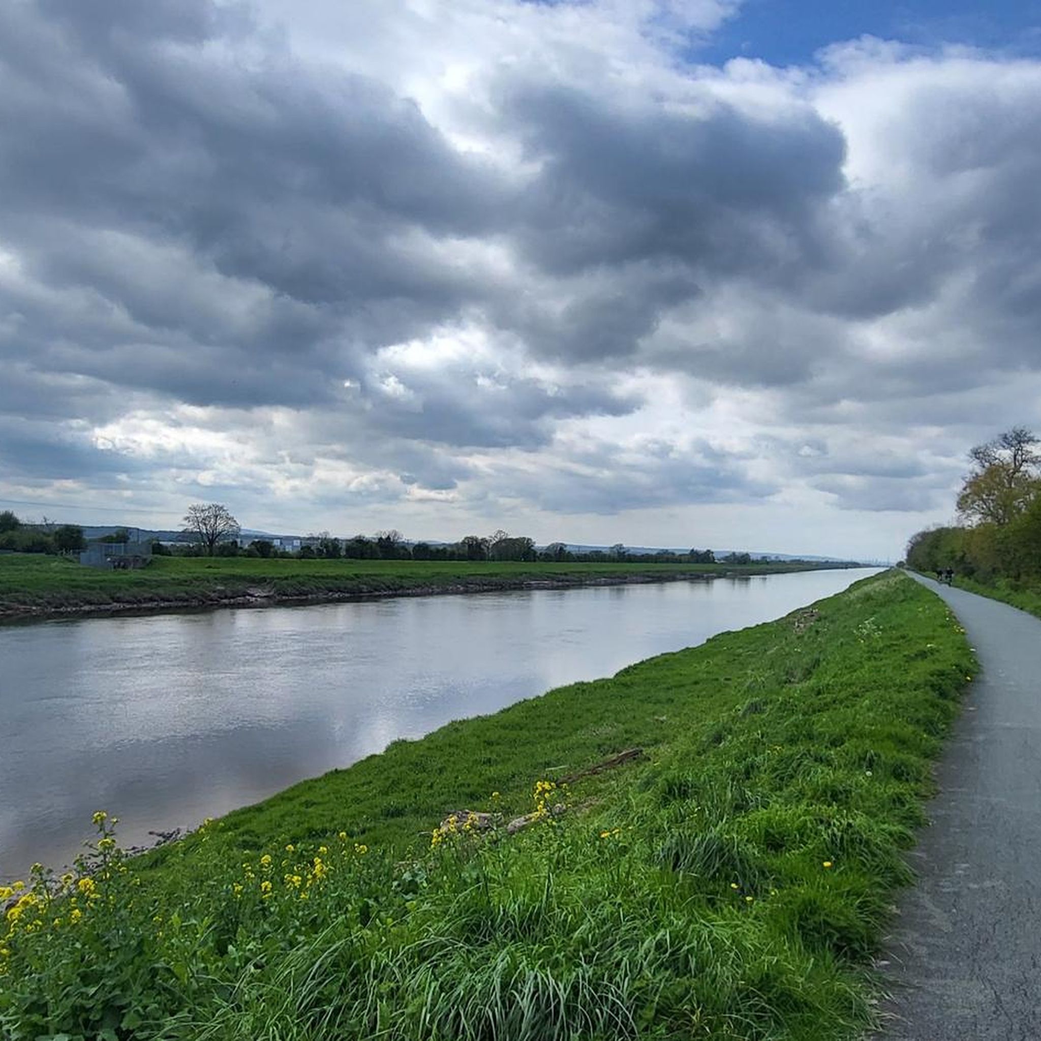
The River Dee round is a safe, completely traffic-free loop of 24 kms (15 miles). It follows the National Cycle Network Route 5 to the west of the city as far as Hawarden Bridge, returning via the riverside cycle path along the River Dee. Chester Cycling Campaign’s seven Family Cycle Rides have been planned with all members of the family in mind. The routes use quiet lanes, established cycle routes and canal tow paths wherever possible, except for some occasional short sections on busier roads. All rides are between 15 and 20 miles in length, and are suitable for families with children, either riding their own bikes or riding on a trailer bike. Some rides include short off-road sections. The directions for these rides also include a description of a minor road alternative. Route Grading: (A) Quiet Route – This is a route with long stretches of off-road cycleway.
7
2
Frequently Asked Questions
How many running routes are available in the Woodbank area?
Woodbank offers a wide selection of running routes, with over 550 different trails to explore. This includes a variety of options suitable for different fitness levels.
Are there easy running routes suitable for beginners in Woodbank?
Yes, Woodbank has approximately 70 easy running routes perfect for beginners or those looking for a gentle jog. An excellent option is the Running loop from Shotton, which is about 3.5 km long and features minimal elevation changes.
What is the typical length of running routes in the Woodbank area?
The running routes in Woodbank vary in length, catering to different preferences. Many popular routes range from 3.5 km to nearly 10 km. For example, the Alpaca Farm – Capenhurst Pinfold loop from Capenhurst is 5.8 km, while the Poweylane Plantations loop from Capenhurst extends to about 9.6 km.
Are the running trails in Woodbank dog-friendly?
Many of the trails in Woodbank, especially those traversing open farmland and riverside paths, are suitable for running with dogs. However, it's always recommended to keep dogs under control, especially when passing through agricultural areas or near livestock. Check specific route details for any restrictions.
Are there any circular running routes in Woodbank?
Yes, many of the running routes in Woodbank are designed as loops, offering a convenient circular experience. Examples include the Running loop from Capenhurst and the View Towards North Wales – River Dee Riverside Trail loop from Sealand, allowing you to start and finish at the same point.
What kind of scenery can I expect on the running trails around Woodbank?
Jogging around Woodbank offers diverse scenery, including open farmland, riverside paths along the River Dee, and areas passing by plantations. The routes provide a mix of natural and agricultural landscapes, often with views towards North Wales.
What do other runners enjoy the most about jogging in Woodbank?
The running routes in Woodbank are highly rated by the komoot community, with an average score of 4.3 stars from over 50 reviews. Runners frequently praise the accessible nature of the trails, the gentle gradients, and the varied landscapes that make for an enjoyable and consistent running experience.
Are there any interesting landmarks or viewpoints along the running routes?
While running in Woodbank, you can encounter several points of interest. The River Dee Riverside Trail offers scenic views, and the Burton Marsh Boardwalk is a notable viewpoint. Some routes also offer distant views towards North Wales.
Is there public transport access to the running trails in Woodbank?
Woodbank is accessible, and some starting points for routes, such as those near Capenhurst or Shotton, may have public transport links. It's advisable to check local bus or train schedules for the specific starting point of your chosen route.
What is the best time of year for running in Woodbank?
Woodbank's trails, characterized by generally flat terrain and gentle gradients, are suitable for running year-round. Spring and autumn offer pleasant temperatures and vibrant scenery, while summer provides longer daylight hours. Winter running is also possible, though conditions may vary.
Are there any cafes or refreshment stops near the running routes?
While the routes often traverse rural areas, some starting points or nearby villages like Capenhurst may offer local amenities, including cafes or shops for refreshments. It's a good idea to plan your route and check for facilities in advance, especially for longer runs.
What kind of terrain can I expect on the running trails?
The terrain in Woodbank is generally flat with minimal elevation changes, making it suitable for a range of running abilities. You'll encounter paths through open farmland, riverside trails, and sometimes sections near plantations, providing a mix of surfaces.
Most popular attractions around Woodbank

Get inspired with the komoot mobile app


Explore more
Browse the best Running Trails & Routes in other regions.
