The best walks and hikes around Rocklands
4.3
(135)
593
hikers
37
hikes
Hiking around Rocklands reveals a distinctive landscape characterized by massive, scattered boulders and striking orange sandstone formations. This region, nestled within the Cederberg Wilderness Area, offers a rugged and visually unique environment for exploration. Hikers can traverse rocky plateaus, follow the curves of the Brandewyn river, and experience the raw beauty of this "almost alien landscape." The terrain provides a variety of experiences, from moderate paths to more challenging routes within the mountainous conservation area.
Best hiking trails around Rocklands
…Last updated: September 30, 2026
4.7
(46)
234
hikers
11.6km
02:57
30m
30m
Moderate hike. Good fitness required. Easily-accessible paths. Suitable for all skill levels.
4.9
(15)
48
hikers
Moderate hike. Good fitness required. Easily-accessible paths. Suitable for all skill levels.

5.0
(1)
6
hikers
Moderate hike. Good fitness required. Easily-accessible paths. Suitable for all skill levels.
3.7
(3)
9
hikers
9.77km
02:29
20m
20m
Moderate hike. Good fitness required. Easily-accessible paths. Suitable for all skill levels.
4.4
(7)
6
hikers
7.51km
01:55
20m
20m
Easy hike. Great for any fitness level. Easily-accessible paths. Suitable for all skill levels.
Get access to more routes and recommendations from other explorers.
Already have an account?
Our route recommendations are based on thousands of hikes, rides, and runs completed by other people on komoot.
Start today with a free account
Your next adventure awaits.


Tips from the Community

A really nice single track path, that seems to abruptly end with a drop into a steep valley, which has been nicknamed the bomb hole, I went down this, on foot with the bike, my friends found a way around it, took us both about the same time, I was significantly more winded by the experience!.
0
0

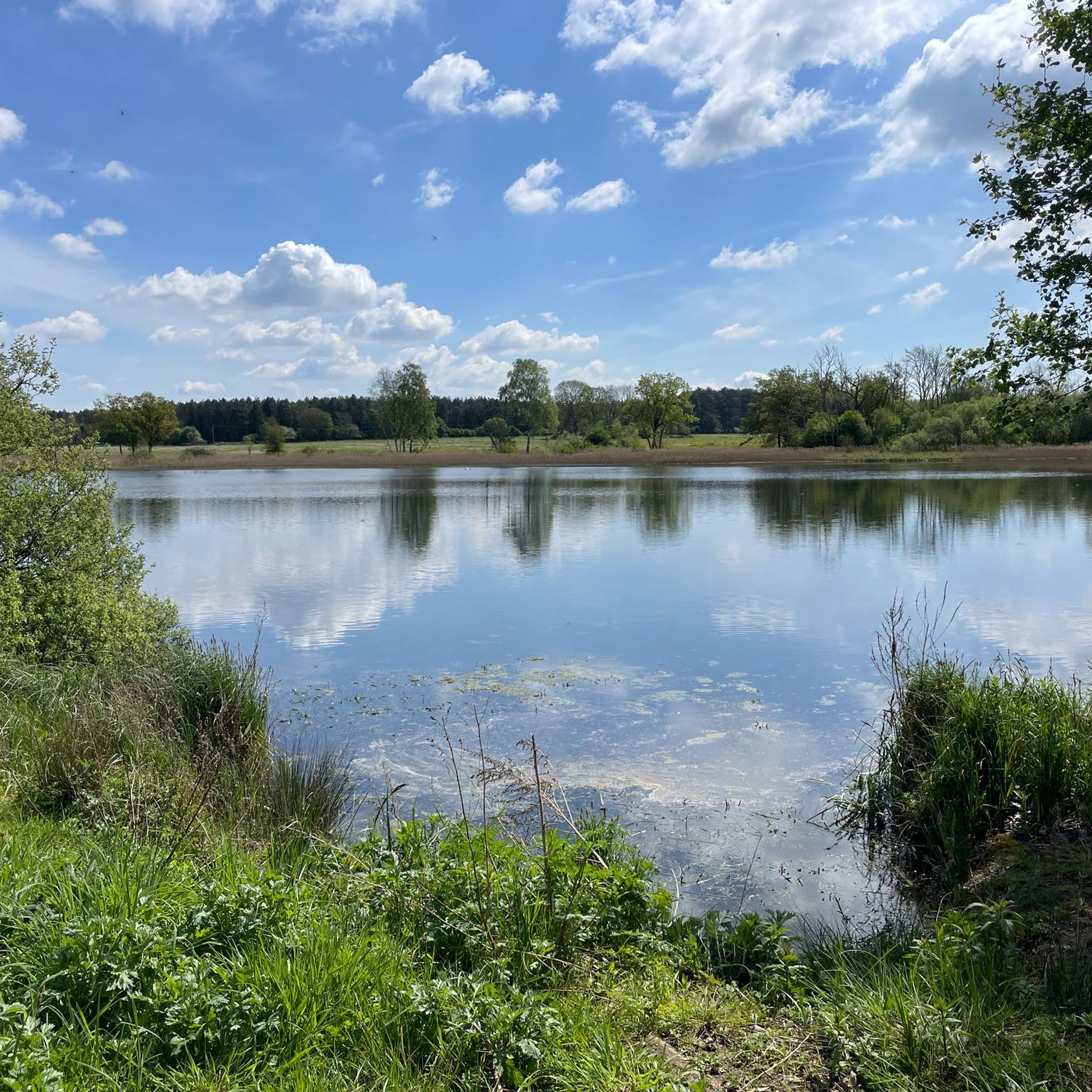
Take time to go off the trail to the bird hides and vantage points around the water. The route is best in spring before the nettles take over the path in summer!
0
0

The inscription is a bit faded now, but reads: The footprint of our ancestors Familiar as our own faces Remote as fossils Written on clay And washed away Over & over Over and over For more info about the Songline see: https://www.luphen.org.uk/walks/peddars_way/norfolk_songline.htm
0
0

The pub in Thomson (The Chequers) on Griston Road is worth a visit...old with lots of character.
0
0

Not so good spot for lunch, move on and find a better place
0
2
Really nice easy walk good on a warm day with shelter from the forests
1
0

Thompson Water and the common form an SSSI managed by the Norfolk Wildlife Trust. It's a particularly important area for dragonflies and damselflies.
0
0
Frequently Asked Questions
How many hiking trails are there in Rocklands?
Rocklands offers a diverse range of hiking experiences with over 35 trails available. These include 13 easy routes, 22 moderate paths, and 2 more challenging options, ensuring there's something for every skill level.
What is the best time of year to go hiking in Rocklands?
The ideal time for hiking in Rocklands is during spring, when the weather is pleasant and the valleys burst into vibrant bloom with veld flowers. Summer months can be extremely hot, with temperatures reaching 40°C, making spring a more comfortable choice for exploration.
What kind of landscape can I expect to see on a hike in Rocklands?
Hikers in Rocklands will encounter an 'almost alien landscape' dominated by massive, scattered boulders and striking orange sandstone formations. The trails traverse rocky plateaus, follow the Brandewyn river, and offer expansive views within the wild, mountainous Cederberg Wilderness Area.
Are there any circular hiking routes in Rocklands?
Yes, Rocklands features several circular routes. For example, the Thompson Water – Pingo Pond on the Pingo Trail loop from Stow Bedon is a moderate 9 km path, and the Pingo Pond on the Pingo Trail – Thompson Water loop from Stonebridge offers a 14.6 km journey through diverse landscapes.
Do I need a permit to hike in Rocklands?
Yes, permits are required for certain trails in Rocklands. If you plan to hike within the Cederberg Wilderness Area, which is managed by CapeNature, you will need a permit from them. For trails on private farmlands, permits can typically be obtained from the host offices.
What do other hikers enjoy most about the trails in Rocklands?
The trails in Rocklands are highly rated by the komoot community, with an average score of 4.3 stars from over 100 reviews. Hikers often praise the unique orange sandstone formations, the dramatic boulder-strewn landscapes, and the wild, mountainous character of the Cederberg Wilderness Area.
Are there any easy hikes suitable for beginners in Rocklands?
Yes, Rocklands offers 13 easy hiking routes. An example is the Highland Cattle in the Field loop from Stonebridge, which is a pleasant 7.5 km trail.
Can I find waterfalls or rivers along the hiking trails?
Yes, many trails in Rocklands follow the curves of the Brandewyn river. You can find refreshing dips and opportunities to refill water bottles at various waterfalls along the way, offering both scenic beauty and practical stops.
What are some interesting natural features or landmarks to look out for?
Beyond the iconic sandstone formations, you can explore natural features like Thompson Water and Pingo Pond on the Pingo Trail. The region is also known for its unique 'pingos' and ponds, such as those found at Thompson Common Pingos and Ponds.
Are there any longer, more challenging hikes available?
While most routes are moderate, Rocklands does offer 2 difficult trails for those seeking a greater challenge within the mountainous Cederberg Wilderness Area. These routes often feature steeper sections and require a good level of fitness.
Are there any trails that offer expansive views?
Yes, trekking across the rocky plateaus in Rocklands provides expansive views of the surrounding landscape and a true sense of wilderness. The The Great Eastern Pingo Trail, for instance, offers a scenic journey through varied terrain with great vistas.
What other activities can I do in Rocklands besides hiking?
Rocklands is a comprehensive outdoor adventure destination. Besides hiking, you can enjoy bouldering, sport climbing, highlining, swimming, trail running, mountain biking, and birding, making it a great place for a multi-activity trip.
Most popular attractions around Rocklands

Get inspired with the komoot mobile app


Explore more
Browse the best Hikes in other regions.
