The best running trails around Capo Di Ponte
4.4
(10)
1,150
runners
15
runs
Jogging around Capo Di Ponte offers diverse landscapes, from challenging mountain trails to accessible paths within the Valcamonica region. The area features panoramic views of the Scalve and Camonica valleys, with impressive peaks and the Oglio River flowing nearby. Runners can explore routes through thick chestnut woods, providing shaded environments and fresh air. The varied terrain includes both inclined paths for challenging workouts and flatter options for relaxed runs.
Best jogging routes around Capo Di Ponte
- The most popular jogging…
Last updated: July 5, 2026
17
runners
17.0km
01:50
220m
220m
Hard run. Very good fitness required. Mostly paved surfaces. Suitable for all skill levels.
8
runners
29.5km
04:39
1,740m
1,740m
Hard run. Very good fitness required. Sure-footedness, sturdy shoes and alpine experience required.

Sign up for free
7
runners
9.51km
01:03
120m
120m
Moderate run. Good fitness required. Mostly paved surfaces. Suitable for all skill levels.
7
runners
24.5km
04:24
1,700m
1,700m
Hard run. Very good fitness required. Sure-footedness, sturdy shoes and alpine experience required.
3
runners
7.74km
00:56
170m
170m
Moderate run. Good fitness required. Mostly paved surfaces. Suitable for all skill levels.
Get access to more routes and recommendations from other explorers.
Sign up for free
Already have an account?
Our route recommendations are based on thousands of hikes, rides, and runs completed by other people on komoot.
Start today with a free account
Your next adventure awaits.
Login or Signup


Tips from the Community

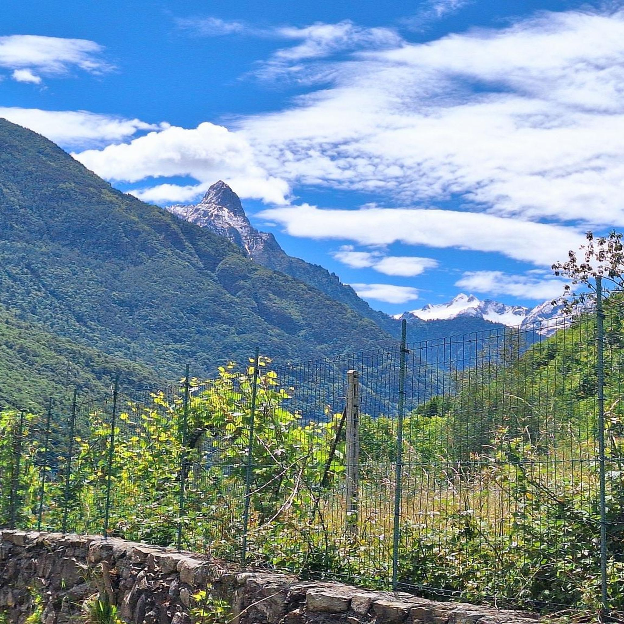
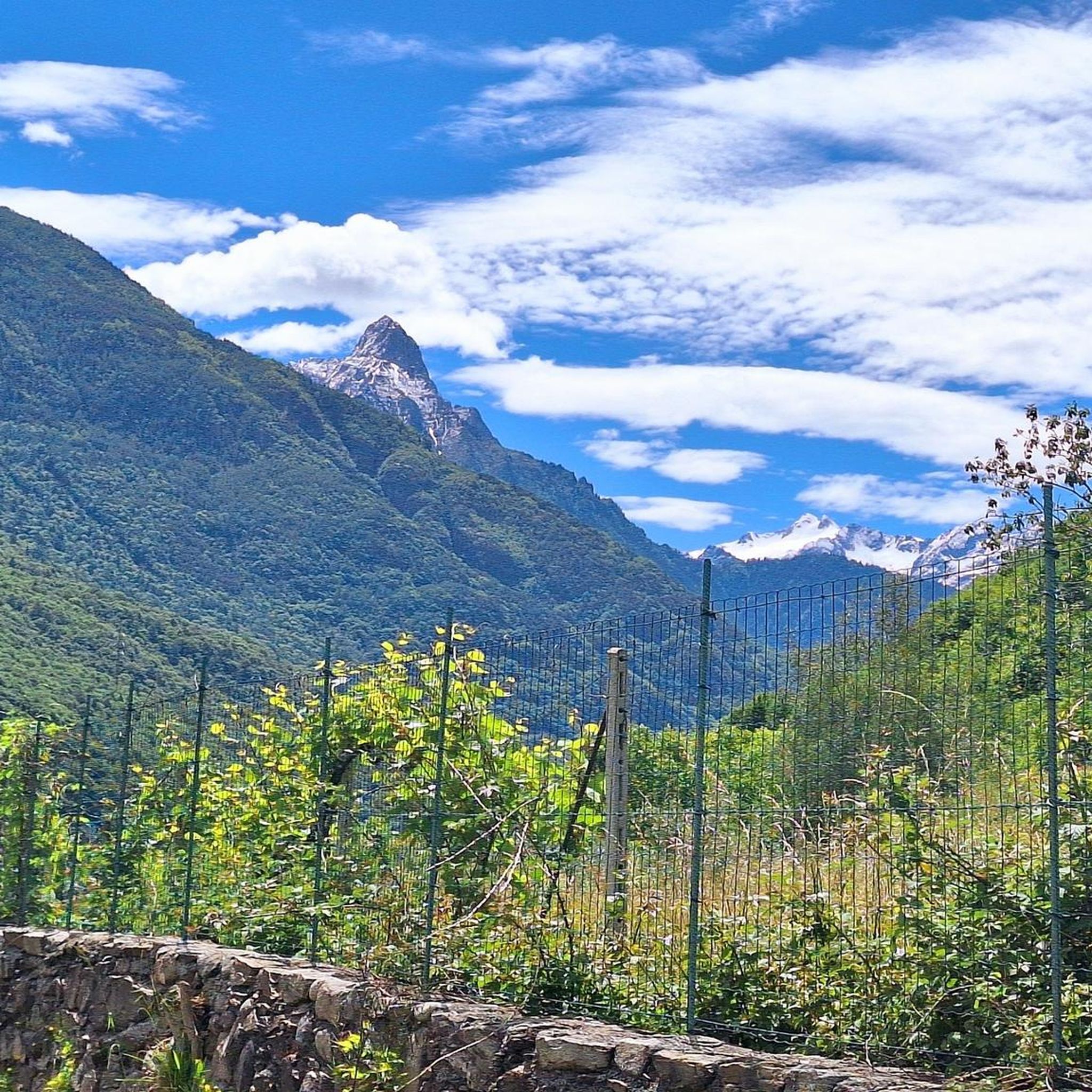
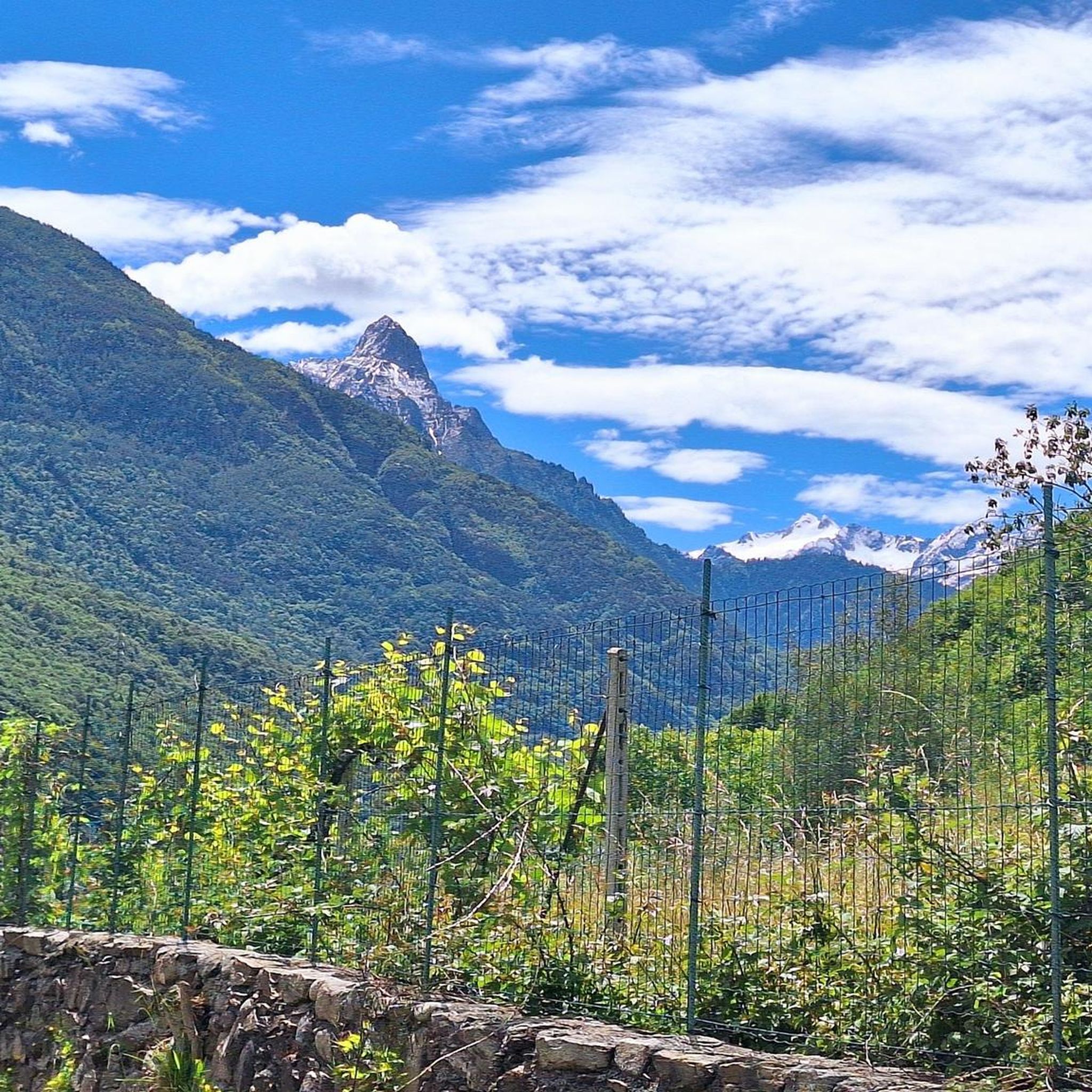
Mount Campioncino (2,102 m) is a panoramic peak in the Bergamo Prealps, located between the Scalve Valley (Bergamo) and the Camonica Valley (Brescia). It is a popular hiking destination for its spectacular views and relative ease of access. 🏔️ Key information Altitude: 2,102 m Starting point: Fondi di Schilpario (BG) or Passo dei Campelli Elevation gain: approximately 850–890 m Difficulty: hiking (E), with easy sections (F) on an unmarked trail Type of route: circular or round trip Duration: 4.5–6 hours total, depending on the route 🌄 View from the summit From the summit, you can enjoy a breathtaking view of: Presolana Cimon della Bagozza Monte Campione Concarena The valleys below: Val di Scalve and Val Camonica 🥾 Recommended itinerary Starting point: Fondi di Schilpario (1,249 m) Route: climb to Passo dei Campelli Monte Campioncino is considered a true balcony overlooking Val Camonica, with a view that it extends as far as Mount Adamello on clear days
0
0
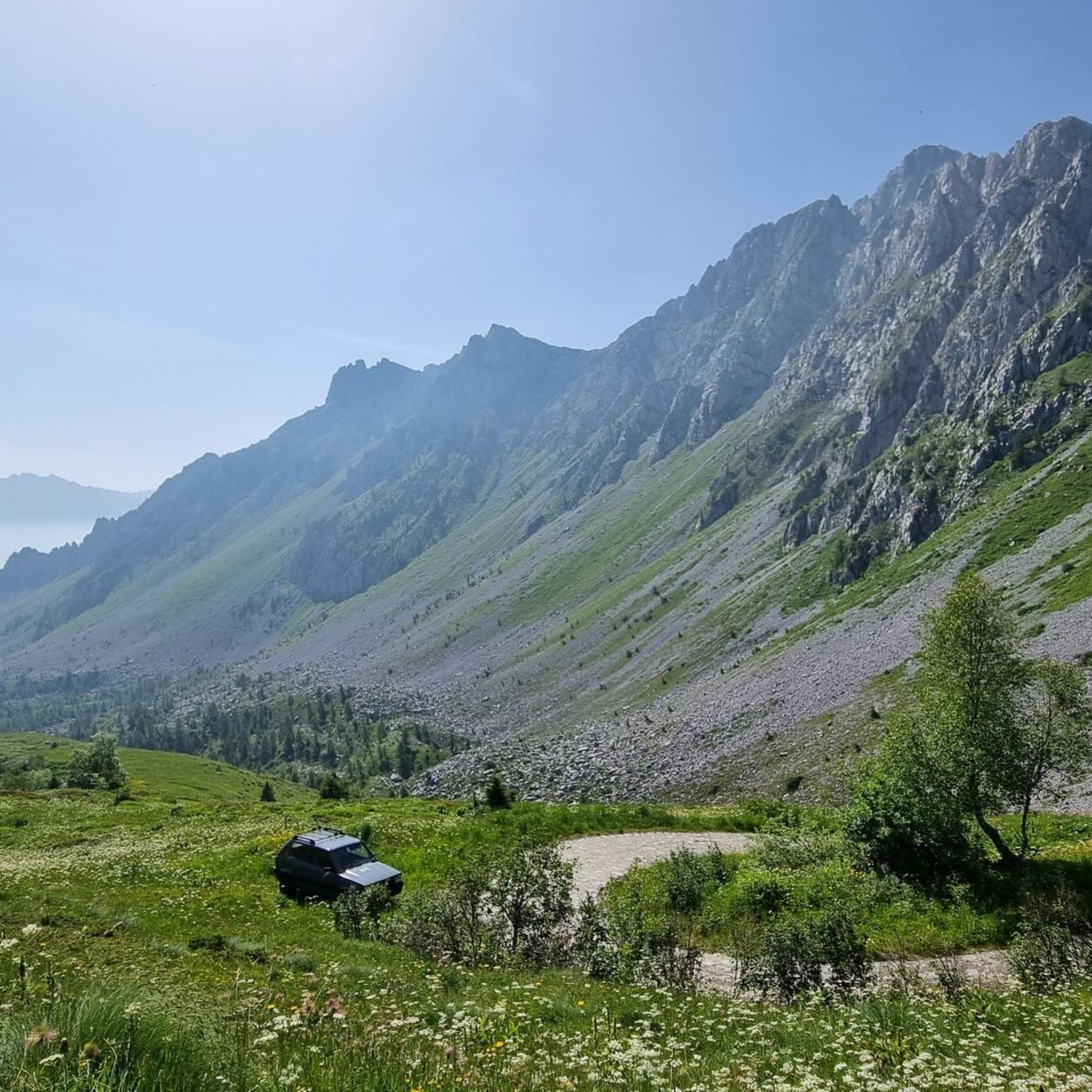
The Campelli Pass is an Alpine pass at approximately 1,892 meters above sea level that connects the Scalve Valley (province of Bergamo) with the Camonica Valley (province of Brescia). It is a popular hiking destination for its scenic beauty and the variety of available itineraries. 🏔️ Main Features Location: Between Schilpario (BG) and Cerveno (BS) Elevation: approximately 1,892 m View: Spectacular view of Cimon della Bagozza and the Piccole Dolomiti Scalvine Access: From Schilpario – Fondi: winter route for snowshoeing or ski mountaineering From Schilpario – Baracca Rossa: shorter and more scenic summer route From Ono San Pietro (BS): longer and more challenging route 🚶♂️ Recommended Activities Summer Hiking: Well-marked trails, also suitable for families Winter Snowshoeing: Safe and picturesque itineraries in the snow Mountain Biking: Technical and scenic routes, with stops at the Campione Refuge and Campelli Lake 📍 Nearby Points of Interest Campione Refuge: Not far from the pass, offers refreshments and overnight accommodations Campelli Lake Campelli: a small Alpine lake, ideal for a break Madonnina dei Campelli: a panoramic and spiritual point along the route
0
0

Splendid view of Cimon Bagozza, Scalve Valley and Valcamonica
0
2

Simple peak, but spectacular in every season
0
0

The refuge is located at 1940m, on the border between Val Camonica and Val di Scalve. Amazing cuisine with typical dishes and homemade desserts.
0
0

The Capre bridge allows you to cross the Clegna, a stream that originates at the foot of Mount Garzeto, in the Orobie Alps, runs through the Clegna valley and flows from the right into the Oglio at Capo di Ponte. In the locality of Poma, not far away, there is a group of characteristic huts. The Alta Via delle Orobie Orientali passes through here.
1
0
Cerveno and Ono San Pietro have historic centers with magnificent views that open up between the cobbled streets. The road connecting the two villages is magnificent.
1
0

The climb from Ono San Pietro is really steep, it is ideal to tackle it with an EMTB. Going up instead from Val di Scalve, the climb is more manageable. Place that deserves to be visited.
0
0
Frequently Asked Questions
How many running routes are available in Capo di Ponte, and what are their difficulty levels?
Capo di Ponte offers a wide selection of running routes, with over 70 trails to explore. These routes cater to various fitness levels, including 3 easy paths, 27 moderate trails, and 43 more challenging routes for experienced runners. This variety ensures there's a suitable option whether you're looking for a relaxed jog or a demanding mountain run.
What kind of terrain can I expect on the jogging trails around Capo di Ponte?
The jogging trails in Capo di Ponte feature diverse terrain. You'll find paths winding through thick chestnut woods, offering shaded and serene environments. Many routes traverse mountainous landscapes, providing panoramic views of the Scalve and Camonica valleys. The area is characterized by a mix of challenging inclines and more accessible, flatter sections, often along the Oglio River or through ancient villages.
Are there any family-friendly running routes in Capo di Ponte?
Yes, Capo di Ponte offers several family-friendly running options, particularly among its 3 easy routes. These paths are generally less technical and have gentler inclines, making them suitable for families with children or those looking for a leisurely jog. The region's charming medieval villages and archaeological parks also provide interesting backdrops for a family outing.
Can I bring my dog on the running trails in Capo di Ponte?
Many of the running trails in Capo di Ponte are dog-friendly, allowing you to enjoy the beautiful scenery with your canine companion. It's always recommended to keep your dog on a leash, especially in areas with wildlife or near livestock, and to carry water for both yourself and your pet. Please be mindful of local regulations and other trail users.
What are some notable landmarks or natural features I might see while running in Capo di Ponte?
While running in Capo di Ponte, you can encounter a rich blend of natural beauty and historical sites. Highlights include stunning mountain passes like Campelli Pass and Vivione Pass, offering breathtaking views. You might also pass by serene spots like Lake Valbona or historical structures such as the Statue of the Madonna of Campelli. The region is also famous for its UNESCO World Heritage rock engravings, which you can explore in areas like the Naquane National Park.
Are there any circular running routes in Capo di Ponte?
Yes, many of the running routes in Capo di Ponte are designed as loops, allowing you to start and finish in the same location without retracing your steps. For example, the difficult De Marie al Volano Hut – Colombé Hut loop from Paspardo and the De Marie al Volano Hut loop from Cimbergo are popular circular options, offering varied scenery and rewarding experiences.
What do other runners say about the trails in Capo di Ponte?
The running trails in Capo di Ponte are highly regarded by the komoot community, boasting an average rating of 4.5 stars from over 10 reviews. Runners frequently praise the diverse landscapes, from challenging mountain ascents to peaceful forest paths, and the opportunity to combine physical activity with cultural exploration amidst ancient sites and charming villages.
When is the best time of year to go jogging in Capo di Ponte?
The best time to go jogging in Capo di Ponte is generally during spring, summer, and early autumn. These seasons offer pleasant temperatures and vibrant natural scenery. Spring brings blooming wildflowers, while summer provides lush green forests. Early autumn is particularly beautiful with changing foliage. Winter can be challenging due to snow and colder conditions, especially on higher mountain trails.
Are there any long-distance running options for experienced athletes?
Absolutely. Capo di Ponte offers several challenging long-distance routes for experienced runners. For instance, the difficult De Marie al Volano Hut – Volano Chapel loop from Paspardo spans 17.0 miles (27.4 km) with significant elevation gain, taking approximately 4 hours 42 minutes to complete. Another demanding option is the Passo Campelli loop from Capo di Ponte, covering 29.5 km with substantial elevation changes.
Are there any running routes that pass by mountain huts?
Yes, some of the more challenging running routes in Capo di Ponte will take you past mountain huts, which can be great spots for a break or to refuel. The De Marie al Volano Hut – Colombé Hut loop from Paspardo is a prime example, offering extensive mountain views and passing by alpine huts like Colombé Hut. You might also encounter Campione Hut or Cimon della Bagozza Hut on other trails.
What is the elevation gain like on the running trails in Capo di Ponte?
The elevation gain on running trails in Capo di Ponte varies significantly, catering to different levels of challenge. Easy routes will have minimal elevation, while difficult trails can feature substantial ascents. For example, the De Marie al Volano Hut – Volano Chapel loop from Paspardo includes an impressive 1905 meters of elevation gain, providing a rigorous workout amidst high mountain terrain.
Most popular routes around Capo Di Ponte
Most popular attractions around Capo Di Ponte

Get inspired with the komoot mobile app


Explore more
Browse the best Running Trails & Routes in other regions.
