The best walks and hikes around Crocefieschi
4.3
(654)
2,107
hikers
144
hikes
Hiking around Crocefieschi offers access to the natural and wooded environment of the Ligurian Apennines, serving as a starting point for numerous excursions. The region is characterized by hilly terrain and dense woodlands, situated on the northern slopes of Mount Schigonzo at the high basin of the Scrivia torrent. It is part of the Antola Regional Natural Park, featuring prominent peaks like Mount Antola and unique geological formations such as the Rocche del Reopasso. Nearby Brugneto Lake also contributes to…
Last updated: August 17, 2026
4.5
(52)
174
hikers
8.93km
03:12
240m
230m
Moderate hike. Good fitness required. Mostly accessible paths. Sure-footedness required.
4.5
(38)
100
hikers
7.56km
02:37
210m
210m
Moderate hike. Good fitness required. Mostly accessible paths. Sure-footedness required.

Sign up for free
4.3
(6)
24
hikers
17.8km
06:07
690m
690m
Hard hike. Very good fitness required. Mostly accessible paths. Sure-footedness required.
4.2
(6)
8
hikers
6.96km
02:24
260m
260m
Moderate hike. Good fitness required. Mostly accessible paths. Sure-footedness required.
4.5
(4)
13
hikers
9.98km
03:35
320m
320m
Moderate hike. Good fitness required. Mostly accessible paths. Sure-footedness required.
Get access to more routes and recommendations from other explorers.
Sign up for free
Already have an account?
Our route recommendations are based on thousands of hikes, rides, and runs completed by other people on komoot.
Start today with a free account
Your next adventure awaits.
Login or Signup
Tips from the Community

The metal gates are located just before reaching the castle and allow you to pass over a compact block of conglomerate stone, which would otherwise be challenging to negotiate. The remaining path from the parking lot has numerous wooden steps; it is steep and tiring, but safe. There are several rest stops along the way, equipped with tables.
0
0
I arrived in a camper and found a spot easily in the large lot next to the bridge. In town, I also stocked up on groceries at the small butcher's shop just as you enter the village... the owner was very friendly and the shop was well-stocked!
0
0
Whether you choose to climb from the parking lot below the castle (moderate difficulty, about 40 minutes on a well-marked path, steps, and a walkway) or follow the "Castellani's Path" from Vobbia (about two hours, including stops), the arrival near the castle is breathtaking! Spectacular, simply! This view is worth the effort (by car) to reach the tiny village of Vobbia, which, however, is located in an area rich in natural beauty! For information, visit this wonderful website: https://www.parcoantola.it/pagina.php?id=47
0
0

A longer section leads over metal gratings that are not suitable for all dogs. There is no alternative but to avoid them!
1
0

Nice observation point over the castle and one of the towers where you could once climb. Great for a souvenir photo. you must not suffer from vertigo, exposed sides and a small climb to the top must be done with care and suitable shoes.
0
0
Absolutely worth visiting, perhaps taking the longer, but simpler, Via dei Castellani from Vobbia. The castle, unique in its kind, is very well renovated and the guides explain the history beautifully.
0
0

On the top of Monte Reale there is a sanctuary dating back to 1868 "dedicated to Our Lady of Loreto", a refuge open to all (the ground floor) and several outdoor benches.
0
0

A very nice little town.
25
0
Frequently Asked Questions
What kind of hiking trails can I expect around Crocefieschi?
Crocefieschi, nestled in the Ligurian Apennines, offers a diverse range of hiking trails. You'll find paths winding through dense woodlands, leading to prominent peaks like Mount Antola, and exploring unique geological formations such as the Rocche del Reopasso. The area is part of the Antola Regional Natural Park, providing varied landscapes from hilly terrain to scenic viewpoints.
Are there easy hiking options suitable for beginners or families in Crocefieschi?
Yes, Crocefieschi offers trails suitable for various fitness levels. While some routes are challenging, you can find moderate options like the Monte Proventino da Crocefieschi – Parco Regionale Naturale dell'Antola, which is about 7 km long and takes around 2 hours and 23 minutes. This loop trail is accessible and offers a good introduction to the area's natural beauty.
What are some notable natural landmarks or viewpoints to see on a hike?
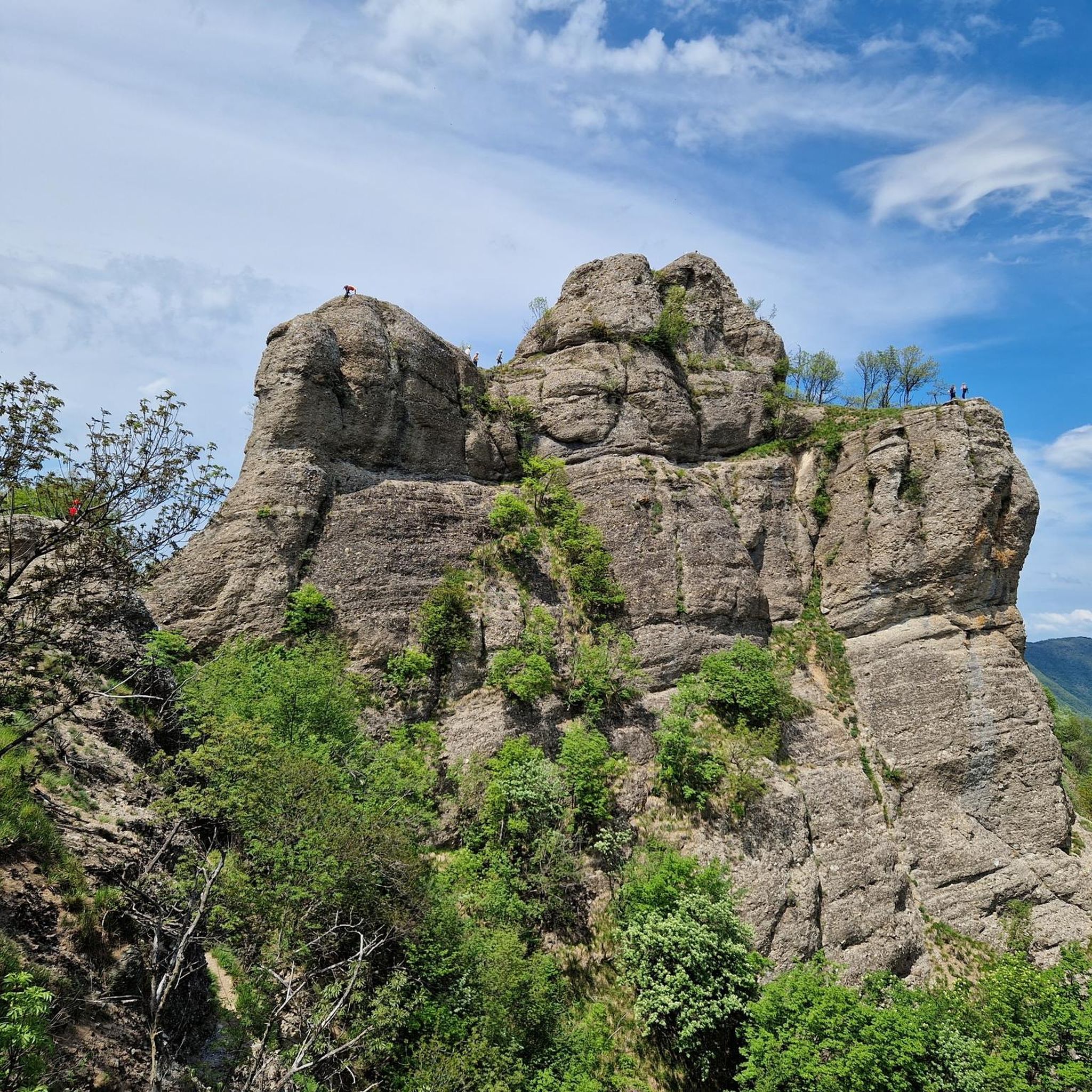
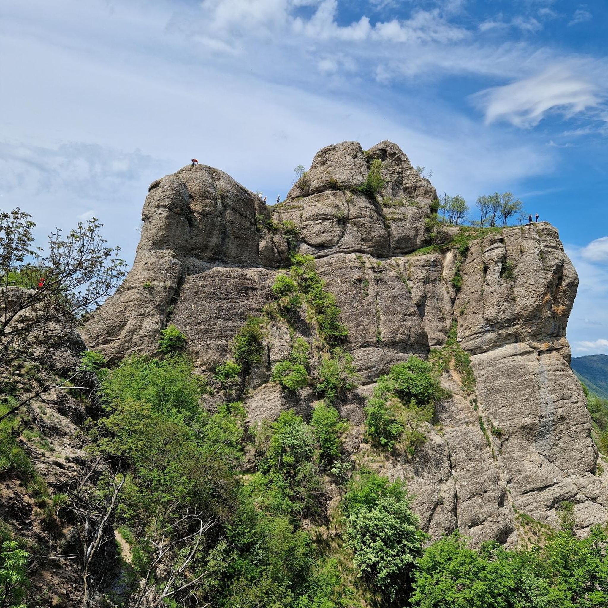
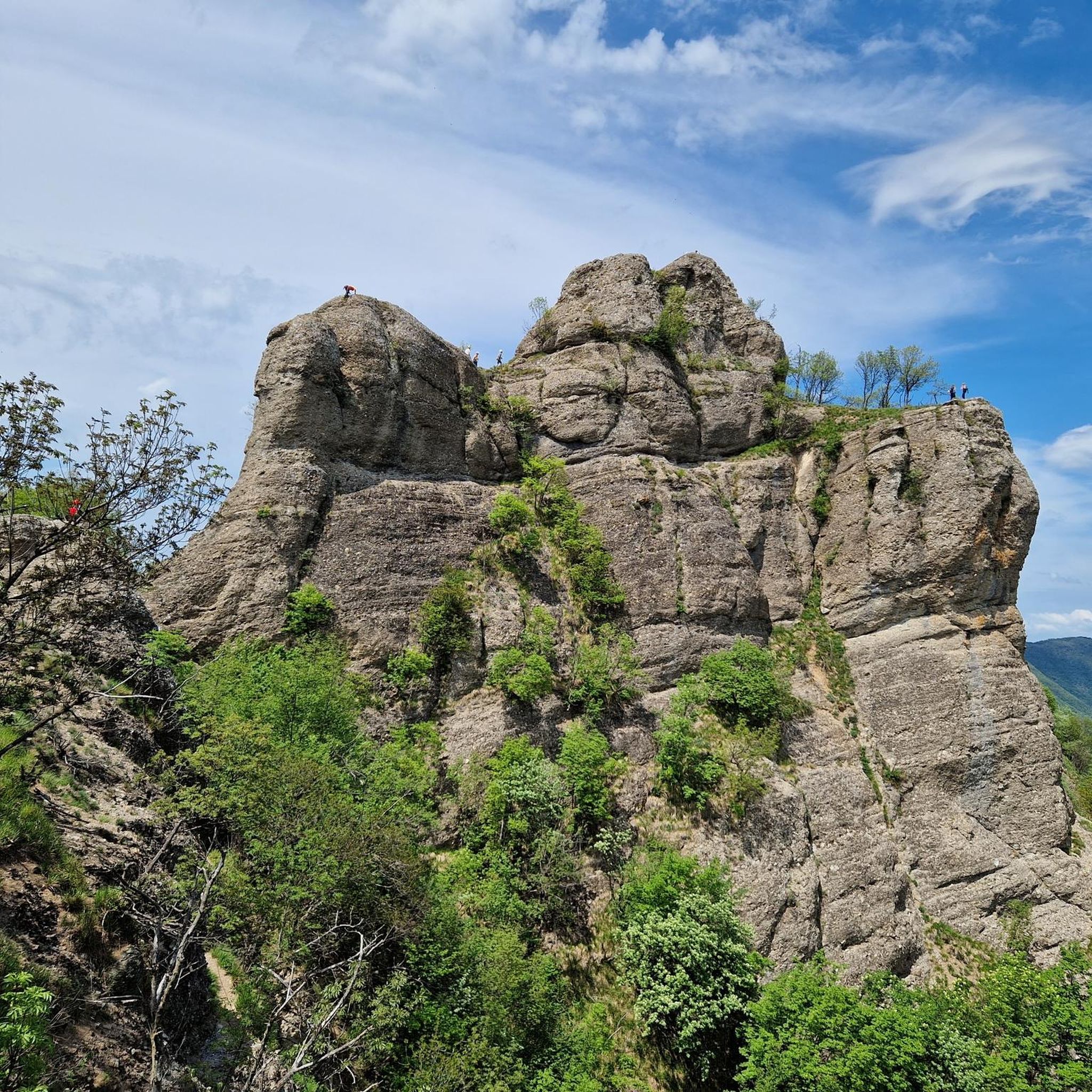
The region is rich in natural beauty. You can hike to the summit of Mount Antola, which offers extraordinary panoramic views. Another unique feature is the Rocche del Reopasso, two conglomeratic pinnacles providing wide views of the surrounding woods. Nearby, you'll also find Brugneto Lake, adding to the scenic attractions.
Are there any circular hiking routes available in Crocefieschi?
Yes, there are several circular routes. For example, the Cesare Fera Trail – Monte Proventino Summit Cross loop from Crocefieschi is a moderate 8.8 km loop that takes approximately 3 hours and 15 minutes. Another option is the Castello della Pietra – Church of San Pietro, Vobbia loop from Castello della Pietra, a 10.2 km moderate route.
What historical or cultural sites can I explore while hiking in the area?
Beyond its natural beauty, Crocefieschi has historical elements. The town itself features medieval streets and noble palaces, hinting at its Roman origins. You can also visit the parish church of S. Croce, built in 1578, and the 16th and 17th-century Palazzi Gemelli. A notable nearby landmark is the Castello della Pietra, a fascinating castle to explore.
How challenging are the hikes around Crocefieschi?
The trails around Crocefieschi range from moderate to difficult. There are 7 moderate routes and 3 difficult routes. Challenging ascents include the Ronco - Minceto - Reopasso Trail, an 17.8 km route with a demanding climb, and the ascent to the Rocche del Reopasso, which can be quite exposed and may require mountaineering skills.
What do other hikers say about the trails in Crocefieschi?
The hiking trails in Crocefieschi are highly regarded by the komoot community, holding an average rating of 4.3 stars from over 40 reviews. Hikers often praise the varied landscapes, the quiet woodlands, and the panoramic views from peaks like Monte Maggio.
Are there any trails that offer views of Lake Brugneto?
While specific routes directly along Lake Brugneto are not detailed, the lake is a significant natural attraction nearby. Many trails in the Antola Regional Natural Park, which encompasses Crocefieschi, offer expansive views that may include glimpses of the lake or its surrounding valleys, especially from higher elevations.
What is the best time of year to go hiking in Crocefieschi?
The Ligurian Apennines offer pleasant hiking conditions for much of the year. Spring and autumn generally provide the most comfortable temperatures and vibrant scenery, with lush greenery in spring and colorful foliage in autumn. Summer can be warm but is still suitable, especially for higher-altitude trails. Winter hiking is possible, but some higher or more exposed routes may require appropriate gear and experience due to snow or ice.
How many hiking trails are available in the Crocefieschi area?
There are over 10 hiking trails available around Crocefieschi, catering to different skill levels. This includes a mix of easy, moderate, and difficult routes, ensuring options for most hikers.
Are there any trails that lead to Mount Antola?
Yes, Crocefieschi is an excellent starting point for excursions into the Antola Regional Natural Park, which includes Mount Antola. While not explicitly listed as a direct route from Crocefieschi in the provided data, the park offers clear paths to its summit. The Monte Proventino da Crocefieschi – Parco Regionale Naturale dell'Antola trail, for instance, leads through the park, bringing you closer to the region's prominent peaks.
Most popular routes around Crocefieschi
Most popular attractions around Crocefieschi

Get inspired with the komoot mobile app


Explore more
Browse the best Hikes in other regions.
