The best walks and hikes in the T'aeback-Sanmaek
4.6
(2059)
14,977
hikers
423
hikes
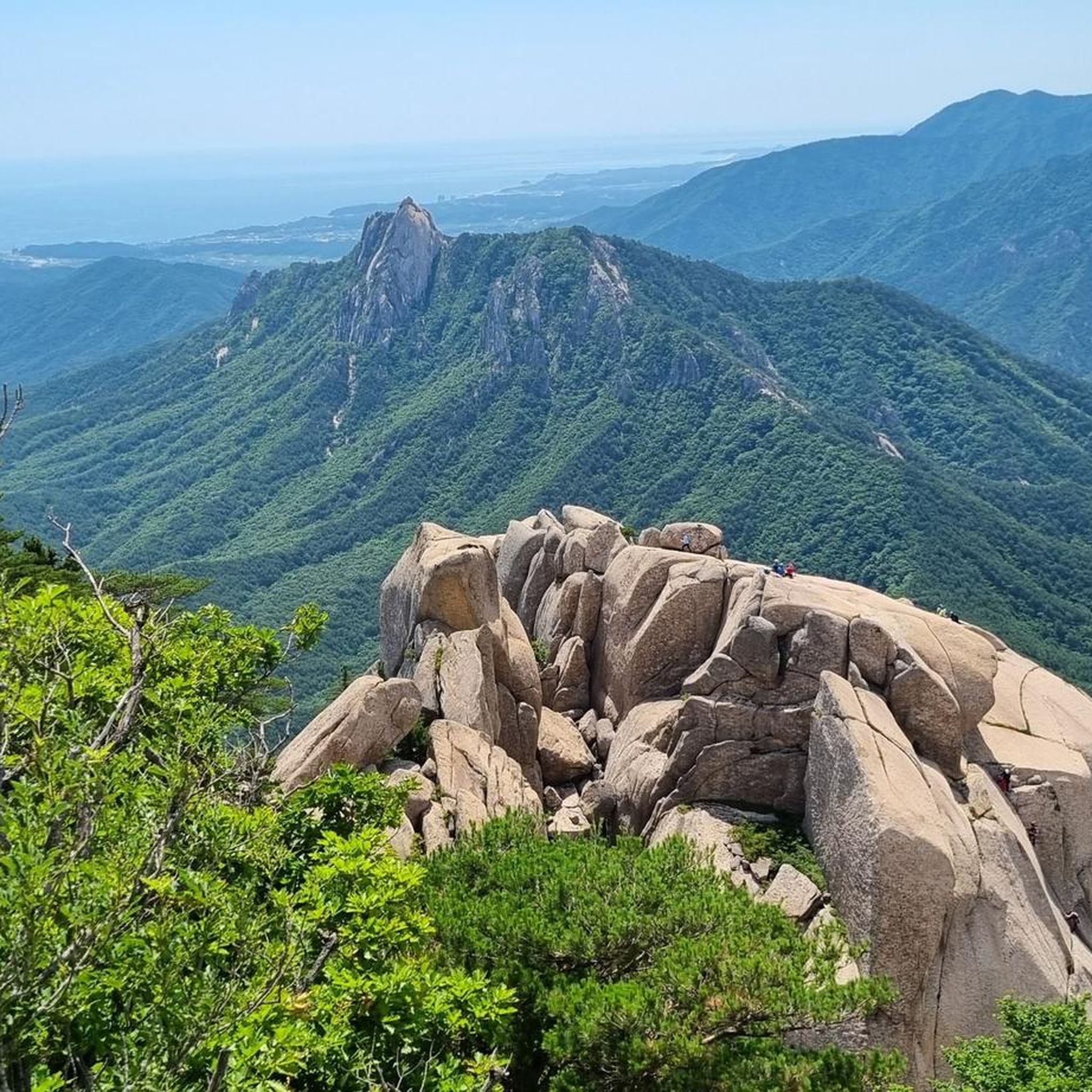
Hiking in the T'aebaek-sanmaek offers diverse landscapes across a mountain range stretching 500 to 600 kilometers, forming the main ridge of the Korean peninsula. The region features steep eastern slopes descending to the East Sea and more gradual western slopes that feed major rivers like the Han and Nakdong. Prominent peaks such as Seoraksan (1,708 m) and Taebaeksan (1,566.7 m) define the terrain, providing varied elevation and challenging ascents. This topography includes rich ecosystems, ancient altars, and significant water sources, making it a notable destination for outdoor activities.
Best hiking trails in the T'aeback-Sanmaek
- The most popular hiking route is Great Buddha of Sinheungsa – Seoraksan National Park loop from Seoraksan National Park, a 7.5 miles (12.1 km) trail that takes 4 hours 3 minutes to complete. This moderate route explores a significant national park area.
- Another top favourite among local hikers is Seoraksan National Park – Biryong Falls loop from Seoraksan National Park, an easy 3.7 miles (6.0 km) path. This trail leads to the scenic Biryong Falls within Seoraksan National Park.
- Local hikers also love the Seoraksan National Park – Biseondae loop from Biryong Waterfall, a 4.8 miles (7.8 km) trail leading through varied terrain, often completed in about 2 hours 35 minutes.
- Hiking in the T'aeback-Sanmaek is defined by prominent peaks, diverse topography, and rich ecosystems including ancient altars and river sources. The network offers options for different ability levels, from gentle paths to challenging ascents.
- The routes in T'aeback-Sanmaek are highly rated by the komoot community with an average score of 4.6 stars from over 1200 reviews. More than 9800 hikers have used komoot to explore T'aeback-Sanmaek's varied terrain.
Last updated: May 15, 2026
4.8
(57)
391
hikers
Moderate hike. Good fitness required. Easily-accessible paths. Suitable for all skill levels.
4.8
(56)
333
hikers
5.95km
01:57
240m
240m
Easy hike. Great for any fitness level. Easily-accessible paths. Suitable for all skill levels.

Sign up for free
4.7
(22)
238
hikers
7.80km
02:35
280m
280m
Moderate hike. Good fitness required. Mostly accessible paths. Sure-footedness required.
4.9
(11)
121
hikers
13.7km
04:16
510m
510m
Moderate hike. Good fitness required. Easily-accessible paths. Suitable for all skill levels.
4.8
(11)
119
hikers
19.8km
08:27
1,240m
1,240m
Hard hike. Very good fitness required. Sure-footedness, sturdy shoes and alpine experience required.
3.8
(34)
181
hikers
7.48km
03:06
600m
600m
Moderate hike. Good fitness required. Easily-accessible paths. Suitable for all skill levels.
4.5
(12)
181
hikers
16.4km
04:51
440m
440m
Moderate hike. Good fitness required. Mostly accessible paths. Sure-footedness required.
4.3
(19)
150
hikers
10.6km
03:36
480m
480m
Moderate hike. Good fitness required. Easily-accessible paths. Suitable for all skill levels.
4.9
(27)
155
hikers
17.0km
05:12
580m
580m
Hard hike. Very good fitness required. Easily-accessible paths. Suitable for all skill levels.
4.4
(12)
114
hikers
6.91km
02:36
480m
480m
Moderate hike. Good fitness required. Easily-accessible paths. Suitable for all skill levels.
Get access to more routes and recommendations from other explorers.
Sign up for free
Already have an account?
Our route recommendations are based on thousands of hikes, rides, and runs completed by other people on komoot.
Start today with a free account
Your next adventure awaits.
Login or Signup

Tips from the Community

The turtle steles at Beomeosa Temple symbolize wisdom and longevity and serve as memorial stones for deceased monks.
0
0


The road from Daegwallyeong to Seonjaryeong is famous for its snow-covered winter scenery, but the summer meadows and East Sea views are also fantastic.
0
0

The North Gate of Geumjeongsanseong Fortress is located 1.6 km west of Beomeosa Temple, at the spot where the main ridge, descending southward from Godangbong Peak, rises again toward Wonhyobong Peak. The North Gate exhibits the crudest appearance of the four gates of Geumjeongsanseong Fortress, has no arch-shaped decoration and is smaller than the other gates. The upper part of the foundational facility, measuring one kan (a unit of measurement referring to the distance between two columns) at the front and one kan at the sides, is a one-story watch tower with a half-hipped roof with a double-wing bracketing system. The gate measures 2.5 meters at the front, and 3.5 meters at the sides. The area around Sesimjeong Pavilion, situated in front of the gate, used to be known as 'Hwaeombeol' because the venerable Korean Buddhist priest Wonhyo (617-686) preached the Hwaeomgyeong, or Avatamsaka Sutra, there. It was also a training camp for monk-soldiers, including Buddhist monks from Beomeosa Temple, Gukcheongsa Temple, and Haewolsa Temple. The North Gate is known to be the passageway used by independence activists when they carried the Korean Declaration of Independence and the documents related to the independence movement and the March 1st Movement in 1919 at Beomeosa Temple, got off at Mulgeum Station on the Gyeongbu Line, by crossing Godangbong Peak of Geumjeongsan Mountain, and went to the Cheongnyeonam Hermitage.
1
0
A visitor walking from the Beomeosa Gregarious Wisteria Habitat along Beomeocheon Stream will find a spectacular heap of rocks extending from Geumgangam Hermitage to the North Gate of Geumjeongsanseong Fortress. This area, called Dolbada (" Sea of Rocks" ), is 70m wide and 2.5km long. It was formed by the natural process of water freezing and melting repeatedly in nearby chasms. The murmuring sound of water flowing to down Daeseongam Hermitage was thought to inspire religious faith, and it is regarded as one of the Eight Scenic Views of Geumjeong, and has the special name of Daeseong Eunsu (" Silver Water of Daeseong").
0
0
A visitor walking from the Beomeosa Gregarious Wisteria Habitat along Beomeocheon Stream will find a spectacular heap of rocks extending from Geumgangam Hermitage to the North Gate of Geumjeongsanseong Fortress. This area, called Dolbada (" Sea of Rocks" ), is 70m wide and 2.5km long. It was formed by the natural process of water freezing and melting repeatedly in nearby chasms. The murmuring sound of water flowing to down Daeseongam Hermitage was thought to inspire religious faith, and it is regarded as one of the Eight Scenic Views of Geumjeong, and has the special name of Daeseong Eunsu (" Silver Water of Daeseong").
0
0
In earlier times, at the entrance to the temple there was a flag to mark the boundary of the temple compound. The flag hung on a banner pole made of wood or iron. A pair of stone supports were used to firmly clamp the banner pole. These supports are thought to have been built in the late Goryeo Dynasty or the early Joseon Dynasty.
1
0
The symbolic entrance gate of Beomeosa, consisting of four wooden pillars on stone foundations, marks the beginning of the path to enlightenment and reminds visitors to enter with humility.
0
0
Frequently Asked Questions
How many hiking trails are available in the T'aebaek-sanmaek region?
The T'aebaek-sanmaek region offers a vast network of trails, with over 430 hiking routes recorded on komoot. These range from easy strolls to challenging ascents, catering to all experience levels.
What are some notable natural features or landmarks to see while hiking in T'aebaek-sanmaek?
The T'aebaek-sanmaek is rich in natural beauty and significant landmarks. You can explore the dramatic granite formations of Ulsanbawi Peak, discover the source of the Han River at Geomryongso, or visit ancient altars on peaks like Janggunbong and Munsubong within Taebaeksan National Park. The region also boasts the largest wildflower habitat in South Korea, stretching from Geumdaebong Peak to Daedeoksan Mountain.
Are there any waterfalls accessible on the hiking trails?
Yes, the T'aebaek-sanmaek features several beautiful waterfalls. A popular choice is Biryong Falls, which can be reached via the Seoraksan National Park – Biryong Falls loop from Seoraksan National Park. Other notable waterfalls include Oryeon Falls and various cascades found throughout the region.
What is the best time of year to go hiking in the T'aebaek-sanmaek?
The T'aebaek-sanmaek is a fantastic hiking destination year-round. Spring brings vibrant rhododendron blooms, summer offers lush green forests, autumn is famous for its spectacular foliage, and winter transforms the landscape into a snowy wonderland, making it popular for winter hiking. Your best time to visit depends on the experience you're seeking.
Are there any family-friendly hiking options in the T'aebaek-sanmaek?
Absolutely. While some trails are challenging, Taebaeksan National Park, for instance, offers trails with gentle grades and wide paths, making them suitable for families and beginners. The Seoraksan National Park – Biryong Falls loop from Seoraksan National Park is an easy 3.7-mile (6.0 km) path that leads to a scenic waterfall, perfect for a family outing.
Are there any circular hiking routes available?
Yes, many routes in the T'aebaek-sanmaek are designed as loops, allowing you to start and end at the same point. An example is the Great Buddha of Sinheungsa – Seoraksan National Park loop from Seoraksan National Park, a moderate 7.5-mile (12.1 km) trail that explores a significant national park area.
What do other hikers say about the trails in T'aebaek-sanmaek?
The trails in T'aebaek-sanmaek are highly regarded by the komoot community, with an average rating of 4.6 out of 5 stars from over 1,200 reviews. Hikers often praise the diverse topography, the stunning views from prominent peaks, and the well-maintained paths that cater to various skill levels.
Are there options for challenging hikes in the T'aebaek-sanmaek?
Yes, for experienced hikers seeking a challenge, the T'aebaek-sanmaek offers several difficult routes. The Seoraksan National Park – Great Buddha of Sinheungsa loop from Seoraksan National Park is a difficult 10.5-mile (16.9 km) trail with significant elevation gain, providing a rewarding experience for those looking for a strenuous adventure.
Can I reach the hiking areas using public transport?
Yes, Taebaek city, which is situated beneath Taebaeksan, is well-connected to Seoul by rail, making it a convenient base for accessing parts of the mountain range. From Taebaek city, local transport options may be available to reach specific trailheads.
Are there any cultural or spiritual sites along the hiking trails?
The T'aebaek-sanmaek holds deep cultural and spiritual significance. You can visit Manggyeongsa Temple, located at an altitude of 1,460 meters on Mount Taebaeksan, which houses the highest spring in Korea. The region also features Cheonjedan, a site where harvest ceremonies have been held for thousands of years, reflecting the mountain's historical importance.
What kind of wildlife can I expect to see while hiking?
The T'aebaek-sanmaek boasts rich ecosystems. While specific sightings can vary, the region is known for its diverse flora and fauna. Baekcheon Valley, for example, is recognized as the world's southernmost lenok habitat, indicating the presence of unique aquatic life. Hikers might also encounter various bird species and other forest animals.
Are there any easy hiking trails for beginners?
Certainly. The T'aebaek-sanmaek has 73 easy routes, perfect for beginners or those looking for a relaxed walk. The Seoraksan National Park – Biryong Falls loop from Seoraksan National Park is an excellent easy option, covering 3.7 miles (6.0 km) and leading to a beautiful waterfall.
Most popular routes in the T'aeback-Sanmaek
Most popular attractions in the T'aeback-Sanmaek

Get inspired with the komoot mobile app


Explore more
Browse the best Hikes in other regions.
