The best walks and hikes around Bagnoregio
4.5
(781)
4,994
hikers
19
hikes
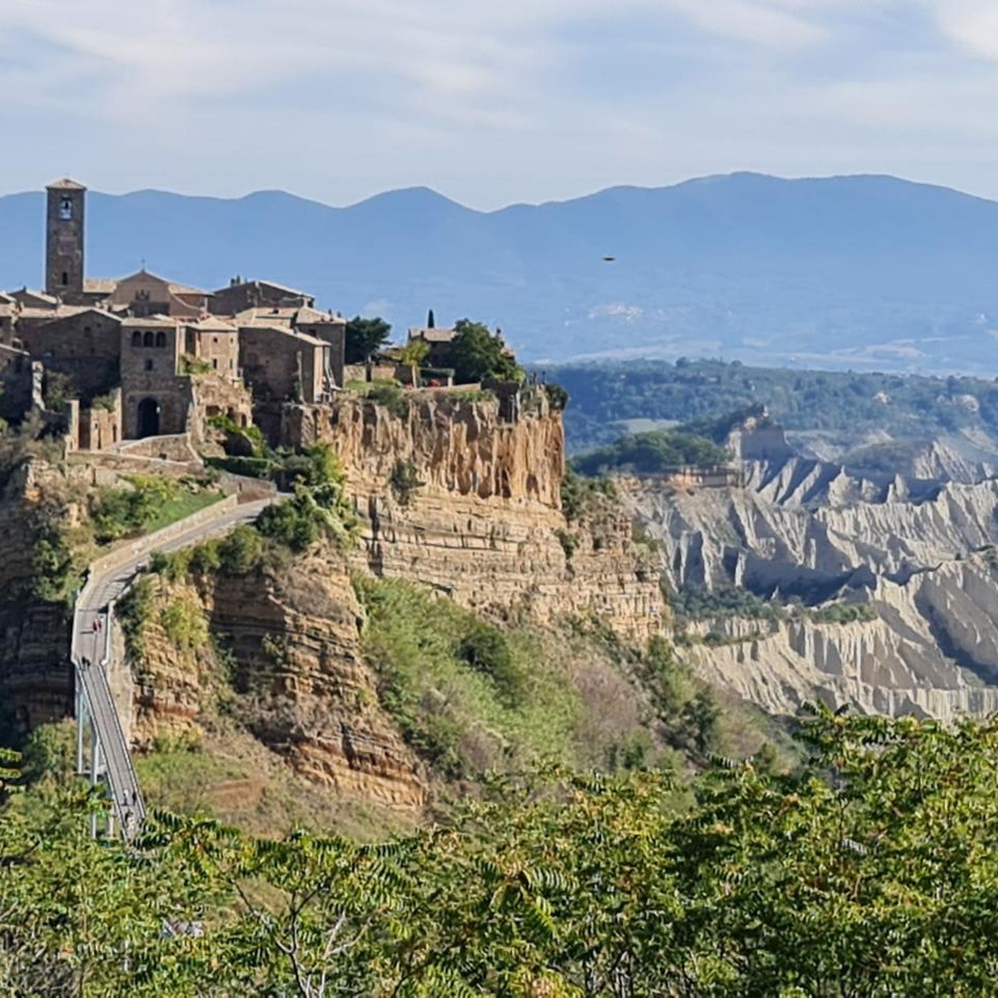
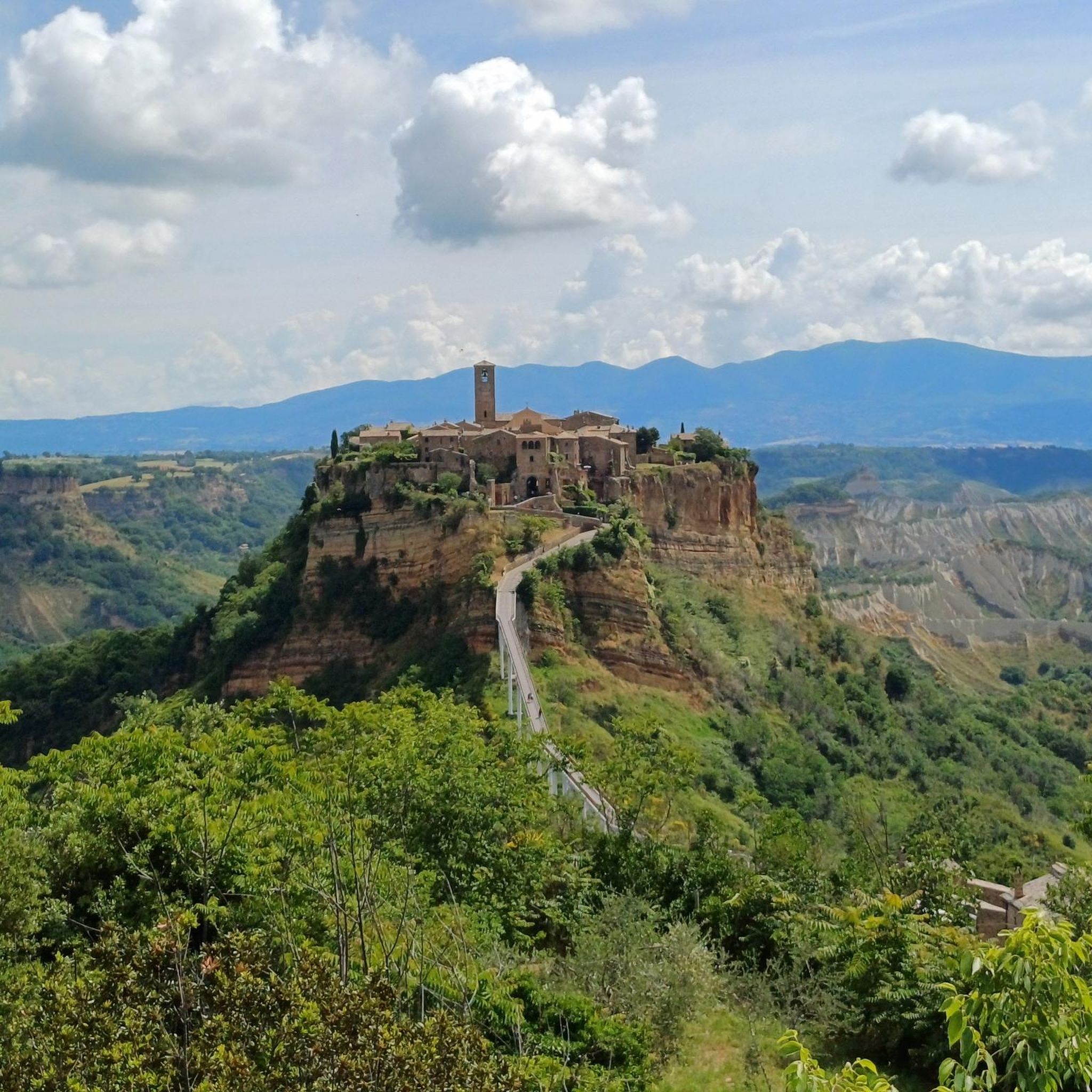
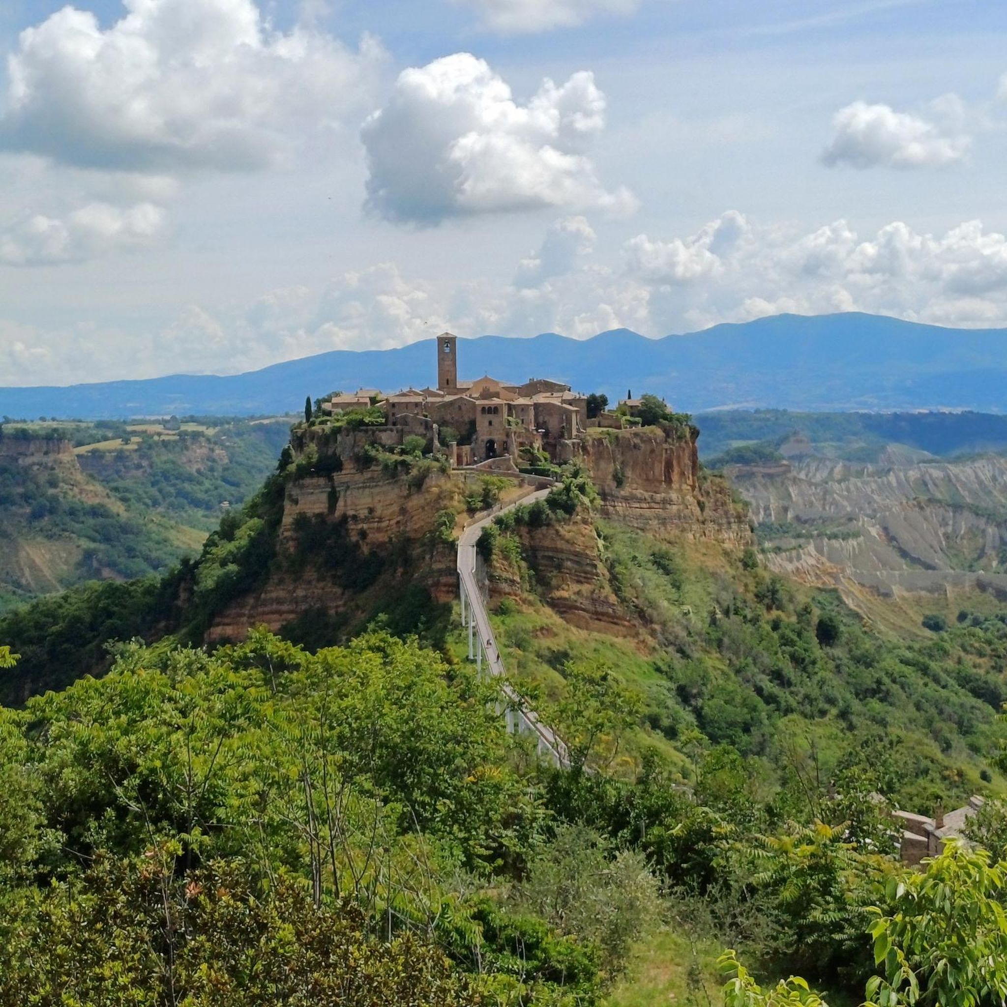
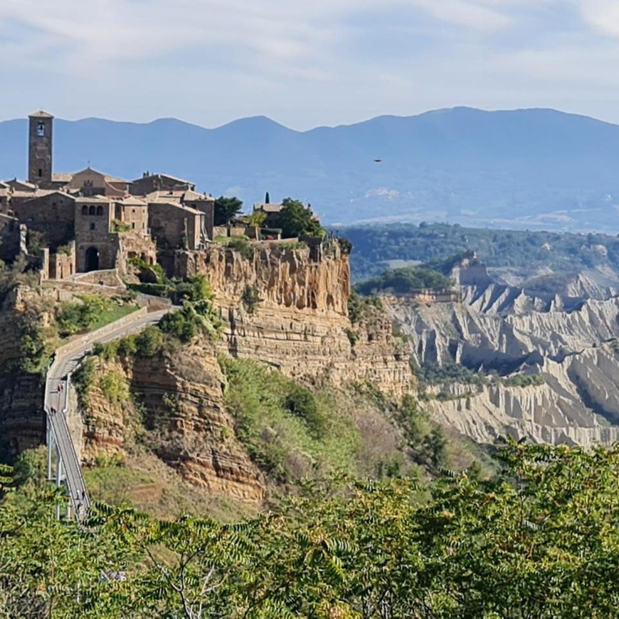
Hiking around Bagnoregio offers exploration of a unique geological landscape, dominated by the Valle dei Calanchi. This region is characterized by dramatic eroded formations, including deep ravines, pinnacles, and tuff hills, sculpted from marine clay and volcanic tuff. The iconic Civita di Bagnoregio, perched atop a fragile tuff hill, provides a focal point for many routes, offering panoramic views of the surrounding badlands. The terrain features a mix of open valleys and dense woods, shaped by ongoing natural processes.
Best…
Last updated: August 17, 2026
4.0
(1)
2
hikers
4.77km
01:29
180m
180m
Embark on an easy hike that takes you through the unique landscape surrounding Civita di Bagnoregio. This ring tour covers 3.0 miles (4.8 km) with a manageable elevation gain of…
4.6
(41)
731
hikers
Easy hike. Great for any fitness level. Easily-accessible paths. Suitable for all skill levels.

Sign up for free
4.6
(23)
244
hikers
Moderate hike. Good fitness required. Easily-accessible paths. Suitable for all skill levels.
5.0
(1)
100
hikers
Easy hike. Great for any fitness level. Easily-accessible paths. Suitable for all skill levels.
4.5
(10)
67
hikers
Hard hike. Very good fitness required. Easily-accessible paths. Suitable for all skill levels.
Get access to more routes and recommendations from other explorers.
Sign up for free
Already have an account?
Our route recommendations are based on thousands of hikes, rides, and runs completed by other people on komoot.
Start today with a free account
Your next adventure awaits.
Login or Signup

Tips from the Community

After visiting Civita di Bagnoregio, we came here to eat something and were very positively surprised. The food was great.
0
0
Old town square, just as you imagine a square in Italy. Café, church etc.
0
0
From the village, you have a wonderful view over the rugged ridges of the valle dei calanchi.
0
0
From here you climb into another time...
0
0
Very early in the morning it is still quiet and most beautiful. Wonderful mood of colors and light.
0
0
Sweet, but also makes you think about tourism. How much can you sell yourself, when does privacy begin? But, a beautiful village!
0
0
The dying city sees up to 14,000 people a day, who each pay 5.00 Euros entrance fee for this. It borders on prostitution to have to put up with this. In itself a beautiful village, which for this high price looks the way it does. We were there early in the morning, when the Chinese tour groups arrived around 11:00 AM, we were already on our way back.
0
0
On foot and as early as possible in the morning, then it's still beautiful.
0
0
Frequently Asked Questions
How many hiking trails are available around Bagnoregio?
There are over 20 hiking routes in the Bagnoregio area, offering a diverse range of experiences. You'll find a good mix of easy, moderate, and more challenging trails to explore the unique landscape.
Are there easy hikes suitable for families or beginners in Bagnoregio?
Yes, Bagnoregio offers 11 easy routes perfect for families or those new to hiking. A great option is the From Bagnoregio towards Civita and the Lubriano stage - Ring tour, which is an easy 3.0-mile (4.8 km) trail providing lovely views towards Civita di Bagnoregio.
Can I find circular walks around Bagnoregio?
Absolutely. Many of the routes around Bagnoregio are designed as circular walks, allowing you to start and end in the same location. For example, the View of Civita di Bagnoregio – View of the Calanchi Valley loop from Bagnoregio is an easy 2.3-mile (3.8 km) loop offering scenic vistas of Civita and the distinctive Calanchi Valley.
What kind of geological features can I expect to see while hiking in Bagnoregio?
The hiking trails in Bagnoregio are defined by the dramatic Valle dei Calanchi (Valley of the Badlands). You'll encounter unique eroded formations, including deep ravines, pinnacles, and sharp ridges sculpted from marine clay and volcanic tuff. This ongoing geological process creates a constantly changing environment with a distinctive, almost lunar appearance.
Are there any specific landmarks or attractions to see along the hiking trails?
The most prominent landmark is Civita di Bagnoregio, often called the 'dying city,' perched atop a fragile tuff hill. Many trails offer breathtaking panoramic views of Civita and the surrounding Calanchi Valley. You can also explore nearby historical sites like Bolsena Old Town and the Rocca Monaldeschi or the impressive Orvieto Cathedral, which are within easy reach.
What do other hikers enjoy most about hiking in Bagnoregio?
The hiking routes in Bagnoregio are highly rated by the komoot community, with an average score of 4.5 stars from over 600 reviews. Hikers frequently praise the stunning panoramic views of Civita di Bagnoregio and the unique, dramatic landscapes of the Valle dei Calanchi.
What is the best time of year to hike in Bagnoregio?
Spring and autumn are generally the best times for hiking in Bagnoregio. The weather is milder, and the landscape offers beautiful colors. Summer can be very hot, making early morning or late afternoon hikes preferable. Winter offers a different, often stark beauty, but trails can be muddy after rain.
Are there any longer or more challenging routes for experienced hikers?
Yes, for more experienced hikers, there are several moderate and difficult routes. For instance, the View of Civita di Bagnoregio – View of Civita di Bagnoregio loop from Bagnoregio is a challenging 14.9-mile (23.9 km) trail that offers extensive exploration of the area's dramatic terrain and views.
Is it possible to hike into the Valle dei Calanchi itself?
Yes, dedicated hiking trails delve directly into the Valle dei Calanchi, allowing you to experience the unique eroded formations up close. These paths wind through valleys and woods, leading to the towering clay formations and offering a profound appreciation of nature's power.
Are there any historical or cultural insights related to the Bagnoregio hiking area?
The region is steeped in history, with Civita di Bagnoregio itself being a medieval village with Etruscan origins. The Valle dei Calanchi represents a fragile relationship between humanity and the territory, with Civita serving as a powerful symbol of resilience against ongoing erosion. The area is also part of a tentative UNESCO World Heritage site due to its unique geological and cultural significance. You can learn more about this at UNESCO's website.
Are there options for parking near the hiking trailheads in Bagnoregio?
Yes, Bagnoregio typically offers parking facilities, especially near the main access points for Civita di Bagnoregio, which serve as starting points for many popular hiking routes. It's advisable to check local signage for specific parking areas and any associated fees.
Can I reach hiking trails in Bagnoregio using public transport?
While Bagnoregio itself is accessible by public transport (bus connections from larger towns like Viterbo or Orvieto), direct public transport to specific trailheads within the Valle dei Calanchi might be limited. Most hikers start their journeys from Bagnoregio town, which is well-connected and serves as a hub for many routes.
Most popular attractions around Bagnoregio

Get inspired with the komoot mobile app


Explore more
Browse the best Hikes in other regions.
