The best walks and hikes around Gàiru/Gairo
4.5
(1045)
4,125
hikers
58
hikes
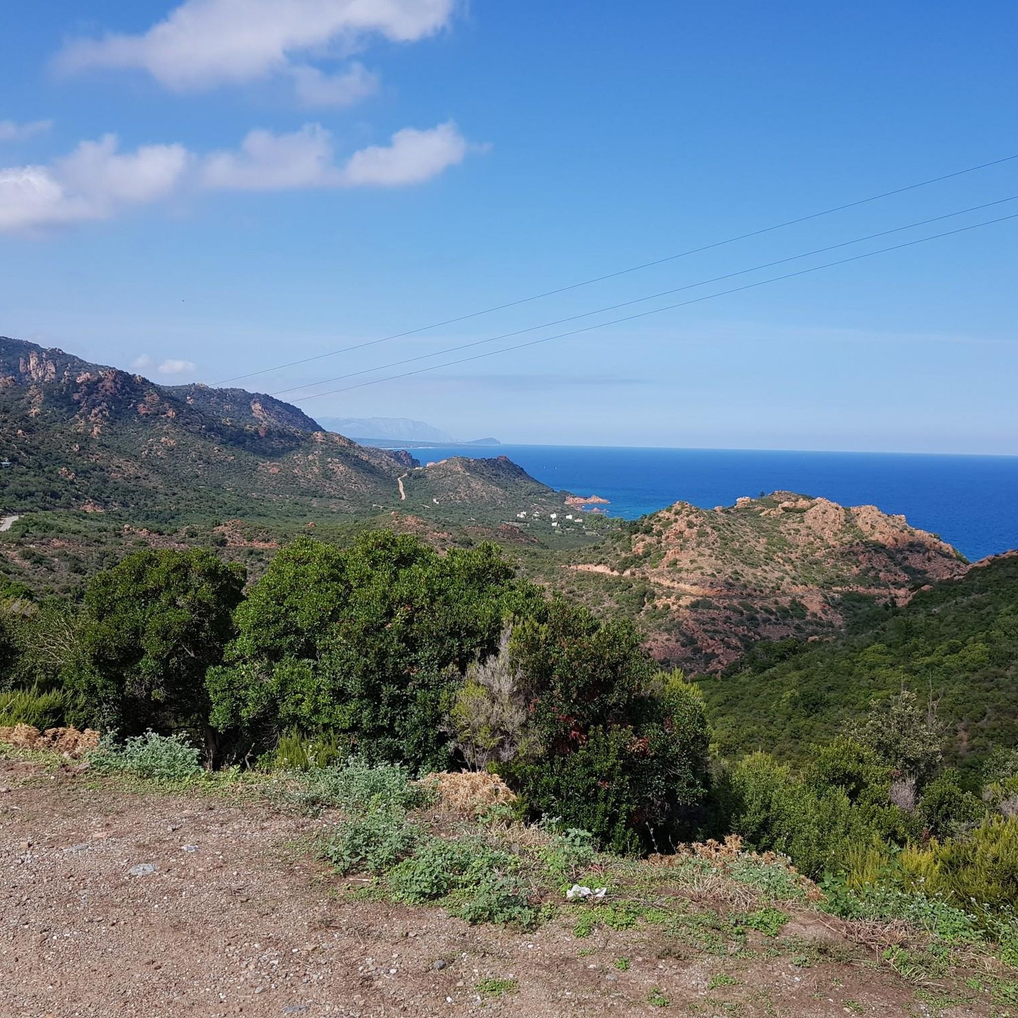
Hiking around Gàiru/Gairo offers diverse landscapes, blending mountainous terrain with coastal scenery. The region is characterized by dramatic limestone formations, including the towering Monte Perda Liana, and extends into the rugged Gennargentu Mountains. Hikers can explore varied environments, from challenging mountain paths to coastal trails featuring beaches and porphyry rocks. Natural features like the Monte Ferru natural pools and the historic Gairo Vecchio ghost town add to the area's unique appeal for outdoor activities.
Best hiking trails around Gàiru/Gairo
- The most popular hiking route is Pirincanes Gorge Loop, a 9.1 miles (14.7 km) trail that takes 4 hours 34 minutes to complete. This difficult route explores the notable Pirincanes Gorge.
- Another top favourite among local hikers is Montarbu - Perda Liana Loop Trail, a difficult 12.8 miles (20.6 km) path. This trail offers views of Monte Perda Liana, a prominent geological landmark.
- Local hikers also love the Lose and liana and Pizzu Margiani Pubusa, a 9.9 miles (15.9 km) trail leading through mountainous terrain, often completed in about 5 hours 26 minutes.
- Hiking around Gàiru/Gairo is defined by mountainous landscapes, unique rock formations, and coastal paths. The network offers options for different ability levels, from easy walks to challenging ascents.
- The routes in Gàiru/Gairo are highly rated by the komoot community with an average score of 4.6 stars from over 700 reviews. More than 2,900 hikers have used komoot to explore Gàiru/Gairo's varied terrain.
Last updated: August 30, 2026
3.8
(4)
35
hikers
14.7km
04:35
530m
530m
Hard hike. Good fitness required. Sure-footedness, sturdy shoes and alpine experience required.
5.0
(6)
12
hikers
20.6km
06:40
870m
870m
Hard hike. Very good fitness required. Mostly accessible paths. Sure-footedness required.

Sign up for free
4.0
(2)
5
hikers
15.9km
05:26
820m
820m
Hard hike. Very good fitness required. Mostly accessible paths. Sure-footedness required.
4.7
(119)
497
hikers
5.55km
01:32
100m
100m
Easy hike. Great for any fitness level. Easily-accessible paths. Suitable for all skill levels.
4.7
(79)
264
hikers
Moderate hike. Good fitness required. Mostly accessible paths. Sure-footedness required.
Get access to more routes and recommendations from other explorers.
Sign up for free
Already have an account?
Our route recommendations are based on thousands of hikes, rides, and runs completed by other people on komoot.
Start today with a free account
Your next adventure awaits.
Login or Signup

Other adventures around Gàiru/Gairo

Tips from the Community

Biel Take water with you
1
0
The path branches off to the left of the road. Continue past the small metal gate on the left.
0
0

Great view. Beautiful area.
0
0

From here (there's a parking lot nearby, at the end of the paved road), there are many hiking destinations. The pebble beach is also worth a visit.
0
0
This narrow but easily accessible trail leads along the (mostly dry) stream through the valley and is very varied over its short distance.
0
0
Very nice coastal tour with spectacular views.
1
0

A uniquely shaped, towering tower, a natural monument, symbol of Ogliastra, and a key morphological feature of central-eastern Sardinia. Perhaps once a gathering place for the Nuragic peoples, it later became, in popular legend, the entrance to the underworld. It protrudes from the earth like a giant finger reaching toward the sky and, especially in this wild area, is a landmark visible from afar for hikers. Perda 'e Liana is an extraordinary rock formation declared a natural monument in 1993. The peculiar "mountain," known in Sardinian as Taccu or Tonneri, rises in the Gairo Sant'Elena area: it is the greatest witness to the erosive effects of weathering that have been affecting the vast limestone cover of Ogliastra on the border with Barbagia di Seulo for several million years. Erosion gradually isolated the "tower," forming its base. It is the highest (1293 m) of the numerous Ogliastra limestone mountains, the northern foothills of the Tonneri plateau, about two kilometers away, to which it is connected by the s'Arcu 'e su Pirastu Trottu pass. Perhaps in ancient times, they formed a single mountain ridge. Source and further information: https://www.sardegnaturismo.it/de/entdecken/perda-e-liana
0
0
Frequently Asked Questions
How many hiking trails are available around Gàiru/Gairo?
Gàiru/Gairo offers a diverse network of over 50 hiking trails. These routes cater to various skill levels, from easy walks to challenging mountain ascents, allowing you to explore the region's unique landscapes.
Are there easy hiking options in Gàiru/Gairo?
Yes, Gàiru/Gairo provides 14 easy hiking routes. A good option for a less strenuous walk is the View of the Valley and the Sea – Coccorrocci Trail Signpost loop from Coccorrocci, which offers scenic coastal views.
What are some challenging hikes in the Gàiru/Gairo area?
For experienced hikers, there are 10 difficult routes. The Pirincanes Gorge Loop is a demanding 9.1-mile trail that explores the notable Pirincanes Gorge. Another challenging option is the Montarbu - Perda Liana Loop Trail, offering views of the iconic Monte Perda Liana.
Are there any circular walks or loop hikes available?
Yes, many trails in Gàiru/Gairo are designed as loops. For example, the Pirincanes Gorge Loop and the Montarbu - Perda Liana Loop Trail are popular circular routes that allow you to start and end at the same point.
What natural landmarks or features can I see while hiking in Gàiru/Gairo?
The region is rich in natural beauty. You can encounter the towering limestone formation of Monte Perda Liana, explore the rugged Gennargentu Mountains, or discover the dramatic coastal scenery with porphyry rocks and beaches like Su Sirboni and Cala 'e Luas. The Pirincanes Waterfall is another notable natural feature.
Are there any historical or cultural sites to explore on hikes?
Yes, Gàiru/Gairo offers unique historical insights. You can visit Gairo Vecchio, an abandoned 'ghost town' deserted after a flood in 1951, which provides an atmospheric experience. The area also features ancient Nuragic remains, such as traditional shepherds' houses known as 'cuiles' and the Perdu Isu Nuraghe complex.
Can I find natural swimming pools or waterfalls along the trails?
Absolutely. The area around Monte Ferru boasts wonderful natural swimming pools and waterfalls, fed by the 'su 'accu 'e s'axina' spring. These natural basins are nestled among red porphyry rocks and lush vegetation, offering refreshing stops during your hike. The Pirincanes Waterfall is also a highlight.
What do other hikers say about the trails in Gàiru/Gairo?
The trails in Gàiru/Gairo are highly rated by the komoot community, with an average score of 4.6 stars from over 700 reviews. Hikers often praise the diverse landscapes, from challenging mountain paths to stunning coastal views, and the unique natural and historical attractions along the routes.
Is there public transport available to reach hiking trailheads in Gàiru/Gairo?
While specific public transport options directly to all trailheads might be limited, the hamlet of Gairo Taquisara provides access to the historic Trenino Verde (Green Train). This scenic railway line can be integrated into trekking itineraries, offering a different way to access parts of the Sardinian landscape.
Are there any caves to explore near Gàiru/Gairo?
Yes, the region has several caves. The Taquisara Cave is a natural cave offering opportunities for exploration. Additionally, nearby attractions include the Su Marmuri Cave and the Serbissi Cave, which are significant geological features in the broader area.
What is the best time of year to go hiking in Gàiru/Gairo?
Gàiru/Gairo offers good hiking conditions for much of the year. Spring and autumn generally provide the most pleasant temperatures for exploring both the mountainous and coastal trails. Summer can be hot, especially for mountain hikes, but coastal walks might be enjoyable with opportunities for swimming. Winter offers cooler temperatures, suitable for hiking, though some higher mountain areas might experience more challenging conditions.
Most popular routes around Gàiru/Gairo
Most popular attractions around Gàiru/Gairo

Get inspired with the komoot mobile app


Explore more
Browse the best Hikes in other regions.
