The 16 Most Amazing Peaks around Santa Margherita Di Staffora
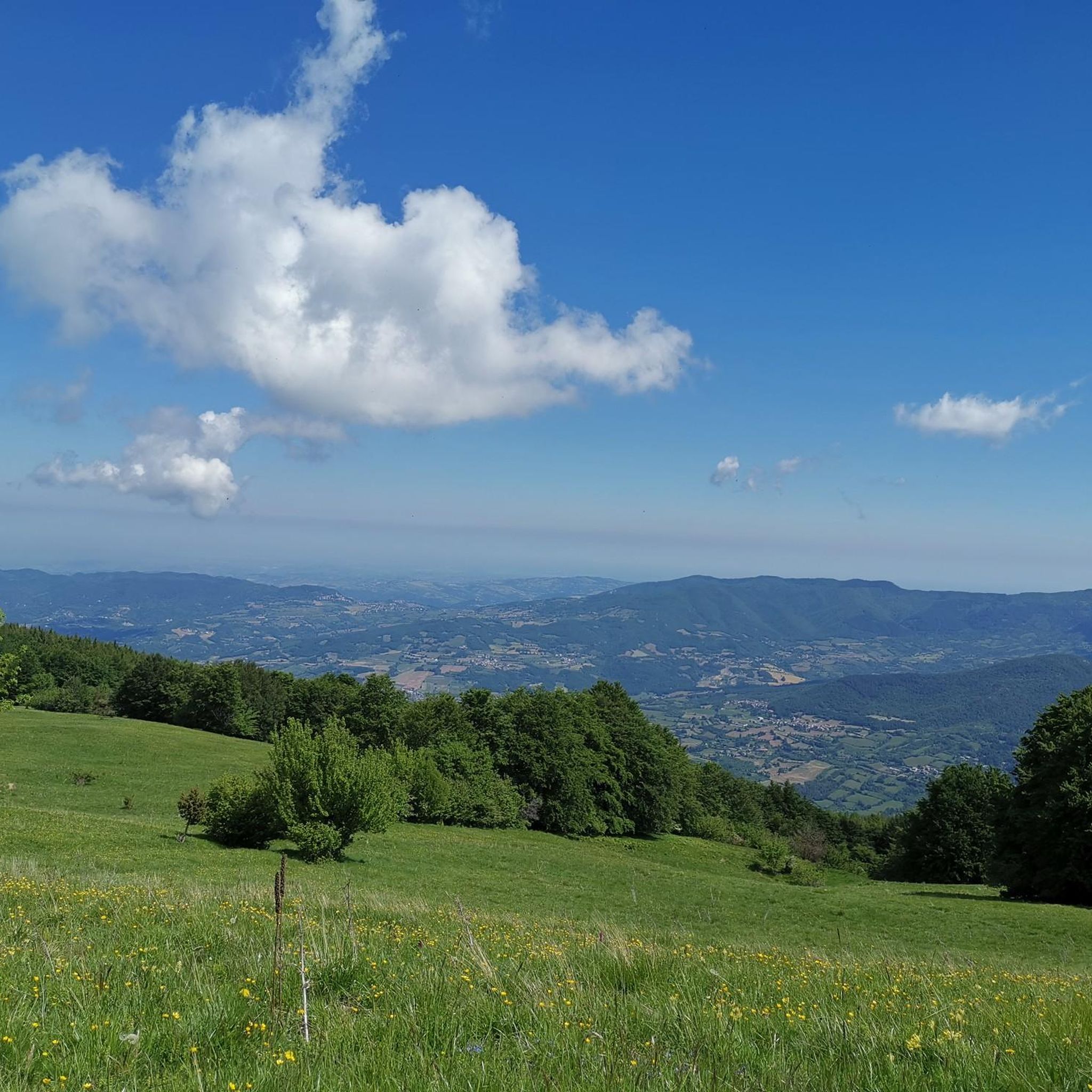
Best mountain peaks around Santa Margherita Di Staffora are found in the Upper Staffora Valley, part of the Ligurian Apennines in Lombardy, Italy. This mountainous terrain offers numerous opportunities for outdoor enthusiasts. The region features significant high-altitude areas and scenic trails, providing expansive views across the Staffora Valley. It is known for its naturalistic and landscape value, ideal for those seeking genuine Apennine beauty.
Best mountain peaks around Santa Margherita Di Staffora
- The most popular mountain peaks is Monte Ebro…
Last updated: July 1, 2026
Monte Lesima and the ENAV radar
Highlight • Summit
Translated by Google •
Tip by

Monte Ebro
Highlight • Summit
Translated by Google •
Tip by
Sign up now to discover places like this
Get recommendations on the best single tracks, peaks, & plenty of other exciting outdoor places.
Sign up for free
Statue of Christ the Redeemer on Monte Giarolo
Highlight • Monument
Translated by Google •
Tip by

Monte Carmo Summit Cross
Highlight • Summit
between the municipalities of Gorreto (Liguria), Carrega Ligure (Piedmont) and Ottone (Emilia Romagna). It is …
Translated by Google •
Tip by

Monte Chiappo Summit and Rifugio Monte Chiappo
Highlight • Summit
Translated by Google •
Tip by
Sign up for free to discover even more peaks around Santa Margherita Di Staffora.
Sign up for free
Already have an account?
Start today with a free account
Your next adventure awaits.
Login or Signup
Popular around Santa Margherita Di Staffora

Other adventures around Santa Margherita Di Staffora

Tips from the Community

Each of these crosses, which travelers often encounter in the fields or, as here, on mountain peaks, is a reminder of the crucifixion and resurrection of Jesus Christ. “Here on earth, His memory exists, but in the Kingdom of Heaven is His presence: this presence is the joy of those who have already attained salvation. Remembrance is our comfort, we who are still wanderers, traveling toward our homeland.” (Saint Bernard of Clairvaux, c. 1090–1153)
0
0
The small sacred monument we encounter on Monte Carmo is perhaps the perfect place for a brief moment of reflection. A few years ago, Christiane Völkel commented on the wonderfully fitting sentence by the Italian poet Francesco Petrarch (who lived in the 14th century), "Everywhere one has heaven above oneself," as follows: "What is the use of prayer? This question moves me (...) I have found for myself the answer and the certainty that when I pray I am with the Lord, or rather, that when I pray he is often noticeably closer to me than usual. Thus, I retain the possibility of pouring out my heart to him (...) This intimacy with him makes me believe in him."
0
0
Up here, on Monte Giarolo, the hiker won't find the classic summit cross that crowns many mountains. Instead, on a pedestal divided into two sections, stands the figure of the Risen Christ, adorned with a cross. Christ raises one arm in greeting—or rather, in blessing—and with the other, he embraces the cross, that gruesome symbol of suffering and death, which, through his resurrection, he transformed into a glorious symbol of victory over death.
0
0

At 1,473 meters above sea level, the peak of Mount Giarolo is on the so-called Ligurian Apennines but in the province of Alessandria, Piedmont. It is the northernmost point of the Antola chain and divides the Borbera and Curone valleys. On the summit there is a statue of Christ the Redeemer.
1
0
The most famous crucifix in Italy is not found on the tops of the mountains, although of course there are many summit crosses all over the country, such as here on Monte CARMO, but in literature: The author Giovanni Guareschi, spiritual father of the protagonists 'Don Camillo' and 'Peppone', has included another main character in his stories - which are well-known and popular far beyond the country's borders: the crucified Christ, who speaks to Don Camillo from the high altar. The author himself makes the following comment on this: "So you have to explain: if the priests feel insulted by Don Camillo, they can smash a candlestick on my skull for all I care; if the communists are insulted by Peppone, they can break a club in two on my back; but if someone feels insulted by Christ's speeches, there's nothing you can do. Whoever speaks in my stories... is my Christ, that is, the voice of my conscience. My personal business, my affair. And therefore: each for himself and God for all.” (G. Guareschi)
2
0

Mount Ebro (1700 m above sea level) is the most beautiful and panoramic mountain of the entire Ántola chain, and one of the most beautiful and panoramic of the entire Ligurian Apennines. It is a gigantic pyramid, mostly grassy, that rises on the watershed between Borbera and Curone, a short distance from the important node of Mount Chiappo. The slopes of the mountain are generally wide and slightly sloping, covered by thick woods at lower altitudes, and meadows above 1400-1500 meters. The imposing southern slope is an exception, which towers, very high and steep, over the village of Aie di Cósola.
4
0
Monte Chiappo (1700 m above sea level) is a large grassy mountain, vaguely shaped like a large pyramid, which rises on the main axis of the Ántola Chain. The Stàffora and Curone streams originate on its northern side; for this reason, near the summit the mountain range divides into three buttresses: the easternmost one divides the Stàffora Valley from the Trebbia Valley, rising further into Monte Lésima; the central one heads north, forming the watershed between Stàffora and Curone, while the western one, on which Monte Ebro stands, separates the Borbera Valley from the Curone Valley. The summit of the mountain is the meeting point between the regional borders of Piedmont, Emilia-Romagna and Lombardy.
4
0
The Feast of the Redeemer has been celebrated on Mount Giarolo since the beginning of the last century, when the first statue of the Redeemer was erected on August 11, 1901 (replaced with the new one exactly one hundred years later) in order to celebrate the 19th centenary of the birth of Christ. It was inaugurated by the Bishop of Tortona who, for the occasion, promoted a diocesan pilgrimage in which approximately 12,000 faithful participated. Since then, every year on the first Sunday of August tourists and faithful go to the top of the mountain to renew the tradition.
3
0
Frequently Asked Questions
What kind of mountain peaks and high-altitude areas can I explore around Santa Margherita di Staffora?
The region around Santa Margherita di Staffora, nestled in the Ligurian Apennines, offers a variety of mountainous terrain. You'll find high-altitude areas like Pian del Poggio and Pian dell'Armà, which are recognized as ski and tourist resorts. These spots provide panoramic trails for hiking, mountain biking, and trekking, along with snow sports in winter. The area is known for its naturalistic and landscape value, featuring panoramic summits, historic peaks, and cultural landmarks.
Which mountain peaks offer the best panoramic views in the Santa Margherita di Staffora area?
For breathtaking panoramic views, consider visiting Monte Ebro, which is considered the most panoramic mountain of the entire Ántola chain. Another excellent choice is Monte Lesima, offering magnificent landscape views between the Oltrepò Pavese and Liguria. From higher elevations like Pian del Poggio, you can also enjoy expansive vistas of the Staffora Valley and the surrounding Apennine landscape.
Are there any mountain peaks with historical or cultural significance near Santa Margherita di Staffora?
Yes, the region blends natural beauty with historical depth. Monte Giarolo is home to a prominent Statue of Christ the Redeemer, a site of annual pilgrimage and celebration. Additionally, the Monte Carmo Summit Cross is a popular destination for hikers, located at a watershed between Liguria, Piedmont, and Emilia Romagna. The historical 'Sentiero dei Briganti' (Brigands' Trail) also leads through forests and valleys to the Brigands' Cave, offering a blend of nature and history.
What outdoor activities can I do near the mountain peaks around Santa Margherita di Staffora?
The varied terrain is perfect for a range of outdoor activities. You can enjoy hiking, mountain biking, and trekking on numerous trails. In winter, high-altitude areas like Pian del Poggio transform into destinations for skiing and other snow activities. For specific routes, you can explore options like gravel biking, running, and mountain biking. For example, there are challenging gravel biking routes like the 'Passo del Giova – Radar Station of Monte Lesima loop' and running trails such as the 'Via del Sale to Monte Lesima Trail'. You can find more details on these activities in the Gravel biking around Santa Margherita Di Staffora, Running Trails around Santa Margherita Di Staffora, and MTB Trails around Santa Margherita Di Staffora guides.
Are there any family-friendly or easy hiking options among the mountain peaks?
While many trails in the Ligurian Apennines can be challenging, the region around Santa Margherita di Staffora offers varied terrain suitable for different fitness levels. The 'Sentiero dei Briganti' is a moderate hiking route, and the 'Cima della Colletta Loop Trail' provides a good experience of the mountainous landscape. For easier options, look for trails around Pian del Poggio and Pian dell'Armà, which are tourist resorts and may have more accessible paths. Always check specific trail details for difficulty and duration before heading out with family.
What is the best time of year to visit the mountain peaks near Santa Margherita di Staffora?
The region offers beauty throughout the year. Spring brings blooming flowers, summer provides cool relief at higher altitudes, autumn paints the woods in golden hues, and winter covers the peaks in snow, making it suitable for snow sports. For hiking and trekking, the warmer months from late spring to early autumn are generally ideal, offering pleasant temperatures and clear trails. If you're interested in snow activities, winter is the best time to visit.
What unique natural features can I observe in the mountainous areas?
The area boasts a rich natural environment with diverse landscapes. You'll find extensive forests, open meadows, and clear streams. From peaks like Monte Ebro, you can observe its characteristic grassy pyramid shape. The region's natural beauty changes dramatically with the seasons, offering different flora and fauna to appreciate throughout the year.
Is there a mountain refuge or hut available for hikers in the area?
Yes, on Monte Chiappo, you'll find the Rifugio Monte Chiappo, which also offers restaurant services. This makes it a convenient stop for hikers exploring the area, especially as Monte Chiappo is a significant watershed point between the borders of Piedmont, Lombardy, and Emilia Romagna.
Are there any specific landmarks or structures on the mountain peaks?
Several peaks feature notable landmarks. Monte Lesima is distinctive for its large metal lattice cross and a geoid-shaped ENAV radar, which has become an unmistakable symbol. On Monte Giarolo, a Statue of Christ the Redeemer stands prominently. Monte Carmo also features a summit cross, making these peaks not just natural viewpoints but also sites of interest.
What makes the mountain peaks around Santa Margherita di Staffora a worthwhile destination?
The region is ideal for those seeking 'slow tourism' amidst genuine Apennine beauty, away from crowds. Visitors are drawn to the extensive panoramic views from higher elevations, the diverse outdoor activities available (hiking, biking, snow sports), and the rich natural environment with its seasonal changes. The area also offers historical and cultural depth, with trails passing ancient churches and historical sites, providing an authentic experience of the Ligurian Apennines.
Most popular routes around Santa Margherita Di Staffora
Most popular attractions around Santa Margherita Di Staffora

Get inspired with the komoot mobile app


Explore more
See even more amazing summits around Santa Margherita Di Staffora with these guides:
