The best walks and hikes around Altavilla Silentina
4.8
(28)
92
hikers
12
hikes
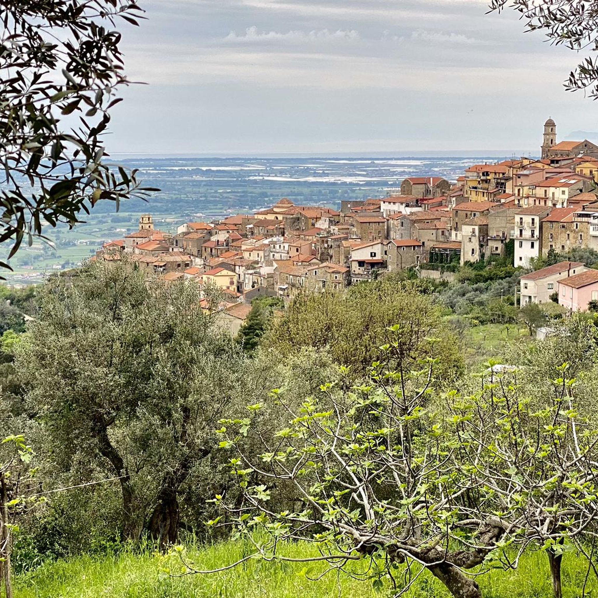
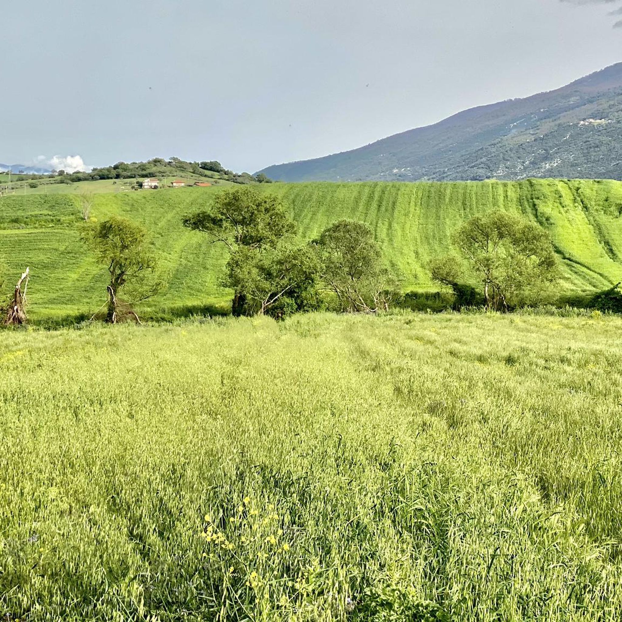
Hiking around Altavilla Silentina offers trails through a landscape characterized by hills, valleys, and forested areas. The region features several prominent summits, such as Monte della Nuda and Mount Calpazio, providing varied elevation changes. Hikers can expect routes that traverse natural terrain, often including ascents to panoramic viewpoints.
Best hiking trails around Altavilla Silentina
- The most popular hiking route is Sant'Elia Cave – Summit of Monte della Nuda loop from Postiglione, a 6.2 miles (10.0 km) difficult trail that…
Last updated: August 18, 2026
4.7
(11)
29
hikers
9.50km
05:19
940m
940m
Hard hike. Very good fitness required. Sure-footedness, sturdy shoes and alpine experience required.
4.7
(6)
15
hikers
Moderate hike. Good fitness required. Easily-accessible paths. Suitable for all skill levels.

Sign up for free
1
hikers
14.7km
05:46
710m
710m
Hard hike. Very good fitness required. Sure-footedness, sturdy shoes and alpine experience required.
5.0
(4)
10
hikers
8.25km
02:07
30m
30m
Moderate hike. Good fitness required. Easily-accessible paths. Suitable for all skill levels.
6
hikers
8.34km
02:07
20m
20m
Moderate hike. Good fitness required. Easily-accessible paths. Suitable for all skill levels.
Get access to more routes and recommendations from other explorers.
Sign up for free
Already have an account?
Our route recommendations are based on thousands of hikes, rides, and runs completed by other people on komoot.
Start today with a free account
Your next adventure awaits.
Login or Signup
Tips from the Community

Colle Medoro is an important mountain pass located in the Alburni Mountains in Campania, known for being a transit and access point for challenging hikes, especially towards Monte della Nuda. It offers spectacular views and trails through beech forests and limestone slopes, requiring appropriate equipment and good physical condition. Main features: Location: It is located in the Alburni Mountains, overlooking the area from Postiglione. Landmark: It is a key pass to reach the summit of Monte della Nuda (1,704 m). Difficulty: The trails that cross it are classified as challenging (EE - Expert Hikers), with significant elevation gain and sections that may require mountaineering experience and mountaineering equipment. Trails: It connects several locations, such as Postiglione, passing through the Grotta di Sant'Elia and climbing towards the summit of Monte della Nuda. Ambience: It offers evocative scenery with woods, rocky ridges, and expansive 360° views from the summit. In short, Colle Medoro is a destination for experienced hikers who seek the wild beauty of the Alburni and are ready for a demanding challenge.
1
0

Very well preserved ruins. Gigantic and extremely interesting.
1
0

The diver in the Tomba del Tuffatore in the archaeological museum of Paestum
0
0

(Museo archeologico nazionale di Paestum) Alongside the National Archaeological Museum of Taranto, the National Archaeological Museum of Paestum is now considered the most important museum for Lower Italian and Western Greek art. With more than 440,000 visitors in 2017 and 2019, the museum, including the archaeological park, is one of the most visited archaeological museums in Italy. As part of the Cilento and Vallo di Diano National Park, the museum has been a UNESCO World Heritage Site since 1998.
0
0


In the comitium popular assemblies were held and local magistrates were elected. The building of the 3rd century BC lost its role in the 2nd century BC in favor of the nearby forum and was partly absorbed by the temple of mens bona, a deity who embodied the debt of gratitude of the former slaves towards their former masters and in this case of the inhabitants of Pestum towards Rome.
2
0
Better known as Basilica, from the name given to it by eighteenth-century scholars due to the almost total disappearance of the walls of the cella, the pediment and the trabeation. It is actually dedicated to Hera, wife of Zeus and the main divinity of Poseidonia. It is a Peripteral with nine columns on the fronts and eighteen on the sides (24.35 x 54 m), the cella has a well-preserved pronaos, corresponding to the odd number of columns on the front and is separated by a central colonnade, partly preserved and intended to support the peak of the roof. At the back of the cella is the adyton, a space inaccessible to the faithful and home to the temple's treasury.
2
0
Founded in the Caesarian era (around 50 BC), it is among the oldest examples of this type of building. Initially built without an external ring, it still retains a few steps of the caeva (stairs for the public). The balteo, a parapet separating the arena from the cavea, was built to a considerable height to avoid aggression from the animals performing in the arena. At the end of the 1st century AD, an external ring was added consisting of a series of arches resting on brick pillars, above which the crowning of the cavea (maenianum summum) was positioned, perhaps made of wood. Currently, the amphitheatre is only partially visible since approximately a third is buried under the modern road.
1
0
Frequently Asked Questions
How many hiking trails are available around Altavilla Silentina?
There are 6 hiking routes documented around Altavilla Silentina on komoot. These trails range in difficulty from moderate to difficult, offering varied experiences for hikers.
Are there any easy hiking trails suitable for beginners in Altavilla Silentina?
The hiking trails around Altavilla Silentina are primarily categorized as moderate to difficult. There are no routes specifically marked as easy. However, the Sanctuary of Our Lady of the Pomegranate – On Mount Calpazio loop from Vuccolo Maiorano is a moderate 6.5-mile (10.4 km) path that might be suitable for those with some hiking experience looking for a less strenuous option compared to the difficult routes.
Are there circular hiking routes in Altavilla Silentina?
Yes, many of the trails around Altavilla Silentina are circular routes. For example, the popular Sant'Elia Cave – Summit of Monte della Nuda loop from Postiglione is a challenging 6.2-mile (10.0 km) loop. Another option is the Summit of Monte della Nuda – Monte della Nuda loop from Serra Monaco, an 8.9-mile (14.4 km) difficult trail.
What is the best time of year to go hiking in Altavilla Silentina?
The best time to hike in Altavilla Silentina is typically during the spring (April-June) and autumn (September-October) months. During these periods, the weather is generally mild and pleasant, making for comfortable hiking conditions. Summers can be very hot, especially at lower elevations, while winters might bring cooler temperatures and occasional rain, though hiking is generally possible.
Are dogs allowed on the hiking trails in Altavilla Silentina?
Generally, dogs are welcome on hiking trails in natural areas around Altavilla Silentina, provided they are kept under control, especially around wildlife or livestock. Always ensure your dog is on a leash where required and that you clean up after them to maintain the natural environment for everyone.
What kind of scenery can I expect on the hikes around Altavilla Silentina?
Hikers can expect a landscape characterized by hills, valleys, and forested areas. Many routes include ascents to prominent summits like Monte della Nuda and Mount Calpazio, offering panoramic viewpoints over the surrounding region. The trails often traverse natural terrain, providing a mix of woodland paths and open vistas.
Are there any interesting landmarks or attractions to see along the hiking routes?
Yes, the region offers several points of interest. You can explore the Ridge of Monte Calpazio for views, or visit the Roccadaspide castle. Some routes, like the Sanctuary of Our Lady of the Pomegranate – On Mount Calpazio loop from Vuccolo Maiorano, incorporate significant cultural sites directly into the hike.
What do other hikers enjoy most about hiking in Altavilla Silentina?
The hiking experiences in Altavilla Silentina are highly rated by the komoot community, with an average score of 4.8 stars from over 20 reviews. Hikers often praise the challenging ascents to summits, the beauty of the forested paths, and the scenic loop trails that define the area's varied terrain.
Are there any long-distance hiking options available?
While there aren't specific multi-day long-distance trails listed, some of the routes are quite substantial. For instance, the On Mount Calpazio – Ridge of Monte Calpazio loop from Prime Querce covers 7.7 miles (12.4 km) with significant elevation gain, offering a full day's challenge for experienced hikers.
Is parking generally available at the trailheads for these hikes?
Starting points for many routes, such as 'from Postiglione' or 'from Vuccolo Maiorano', are typically accessible by car. While specific parking details for each trailhead are not provided, it is common for villages and popular hiking access points in the region to have designated or informal parking areas. It's advisable to check local signage upon arrival.
Are the hiking trails in Altavilla Silentina well-marked?
The komoot community highly rates the trails around Altavilla Silentina, suggesting that navigation is generally clear. While specific details on trail marking standards are not provided, the high user satisfaction indicates that hikers find their way effectively, often utilizing digital maps and GPS for guidance.
Can I find viewpoints or summits with panoramic views?
Yes, the region is known for its prominent summits like Monte della Nuda and Mount Calpazio. Many routes are designed to lead to these peaks, offering extensive panoramic views. The Ascent to Monte della Nuda from Colle Medoro is a highlight specifically for reaching a summit with views.
Most popular routes around Altavilla Silentina
Most popular attractions around Altavilla Silentina

Get inspired with the komoot mobile app


Explore more
Browse the best Hikes in other regions.
