The best walks and hikes in the Santa Rosa Mountains
4.7
(33)
459
hikers
41
hikes
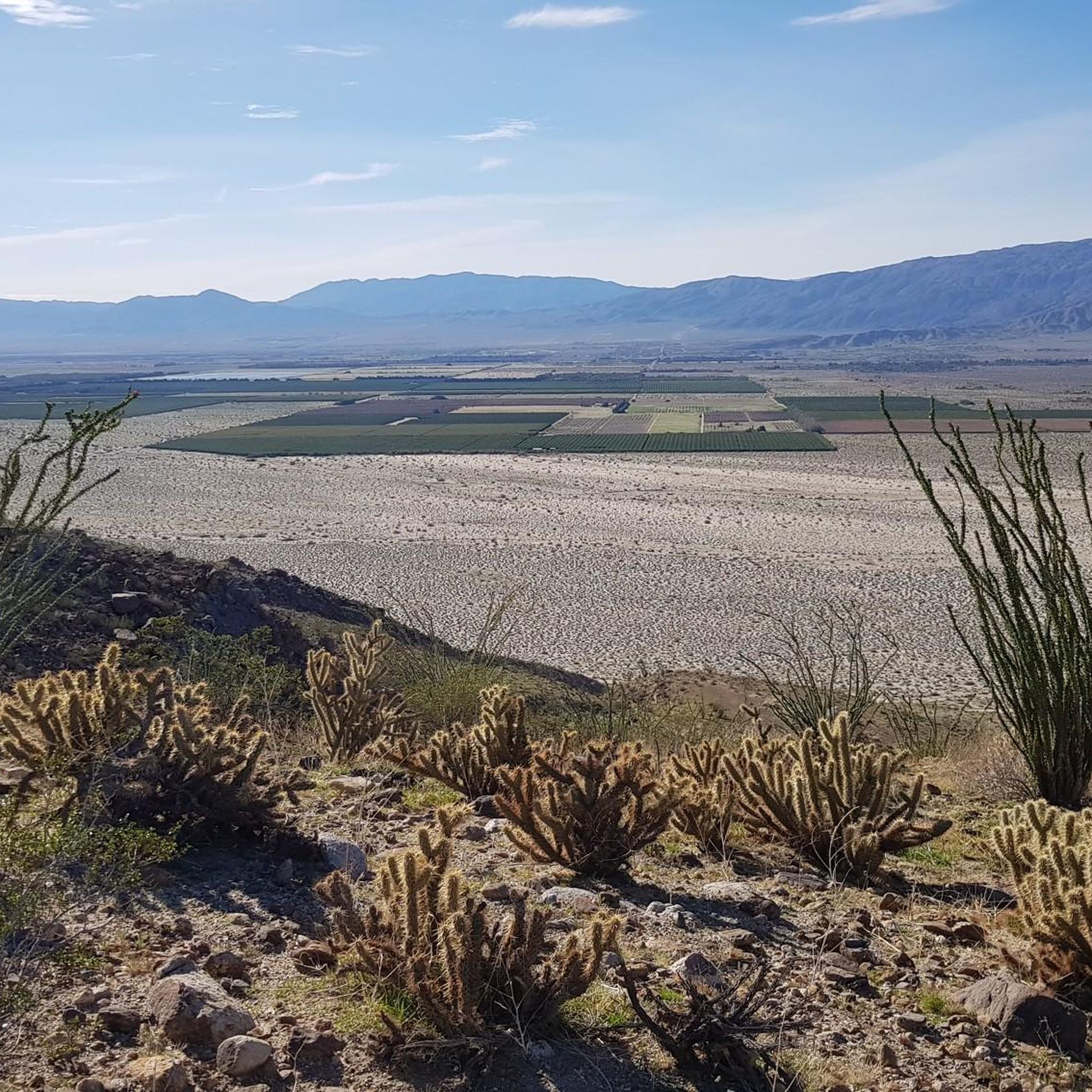
Hiking in the Santa Rosa Mountains offers diverse landscapes, transitioning from arid desert floors to alpine forests and high peaks. The region is characterized by significant elevation changes, unique palm oases, and expansive views of the Coachella Valley. These mountains form a crucial part of the Santa Rosa and San Jacinto Mountains National Monument, providing varied terrain for outdoor activities.
Best hiking trails in the Santa Rosa Mountains
- The most popular hiking route is South Fork Palm Wash Canyon to…
Last updated: June 25, 2026
4.08km
02:07
780m
0m
Prepare for a rewarding hike up Coyote Peak from Rockhouse Truck Trail, a moderate route covering 2.5 miles (4.1 km). You will gain a significant 2574 feet (784 metres) in…
17.7km
04:48
310m
90m
Embark on a moderate hike along the Lower Coyote Canyon Trail, a 11.0-mile (17.7 km) journey that typically takes about 4 hours and 47 minutes to complete. You will gain…

Sign up for free
10.6km
02:52
120m
150m
Embark on a moderate hike along the Inspiration Wash Trail, a 6.6-mile (10.6 km) route that takes approximately 2 hours and 51 minutes to complete. You will gain 388 feet…
11.4km
03:29
230m
220m
The Calcite Mine and Palm Wash Loop offers a challenging desert hike, rated as difficult, that takes you through unique geological formations. You will cover 7.1 miles (11.4 km) and…
5.0
(1)
4
hikers
8.04km
02:17
190m
190m
Hike the moderate Calcite Mine Trail in Anza-Borrego Desert State Park, exploring unique geology, slot canyons, and historical mine sites.
6
hikers
21.9km
08:08
1,440m
1,440m
Hike the difficult Villager Peak Trail in Anza-Borrego Desert State Park, a 13.6-mile route with 4724 feet of elevation gain.
4
hikers
8.17km
03:34
750m
750m
Hike the Rockhouse Truck Trail to Coyote Mountain for panoramic desert views, significant elevation gain, and a challenging desert experienc
2
hikers
3.75km
01:22
230m
230m
Hike the easy 2.3-mile Alcoholic Pass Trail in Anza-Borrego Desert State Park for desert views and historical significance.
1
hikers
33.9km
12:17
2,090m
2,090m
The Villager and Rabbit Peak Trail is an exceptionally challenging 21.1-mile hike in Anza-Borrego Desert State Park, offering spectacular de
10
hikers
10.7km
03:03
250m
250m
Moderate hike. Good fitness required. Easily-accessible paths. Suitable for all skill levels.
Get access to more routes and recommendations from other explorers.
Sign up for free
Already have an account?
Our route recommendations are based on thousands of hikes, rides, and runs completed by other people on komoot.
Start today with a free account
Your next adventure awaits.
Login or Signup
Popular around Santa Rosa Mountains
Tips from the Community

This is the closest spot to pitch your tent if you want to get to the Paradise Valley Café early in the morning. There is room for about three tents and the view of the cliffs is stunning.
1
0

The view of Clark Dry Lake is impressive throughout the hike.
0
0
The Paradise Valley Café is practically a must if you hike the PCT. Besides lots of hospitality, you can expect delicious burgers, salad, all kinds of omelets and even breakfast beer. The café is located 0.9 miles off trail. The Cafe accepts packages but ensure you write your ETA on the package: Your Name – Hold for PCT hiker – ETA (your expected date of arrival) c/o Paradise Valley Cafe 61721 State Highway 74 Mountain Center CA 92561 Opening hours: https://www.theparadisevalleycafe.com/pages/contact.html
5
2
Frequently Asked Questions
How many hiking trails are available in the Santa Rosa Mountains?
The Santa Rosa Mountains offer a diverse network of over 25 hiking trails, catering to various skill levels. You'll find everything from easy walks to challenging multi-day treks across the region's unique desert and mountain landscapes.
What is the best time of year to hike in the Santa Rosa Mountains?
The ideal time for hiking in the Santa Rosa Mountains, especially for more strenuous or multi-day routes, is typically between November and April. During these months, temperatures are more moderate, making for a more comfortable experience. Summer months can be extremely hot, so it's best to avoid strenuous activity during the hottest parts of the day.
Are there any easy, family-friendly hikes in the Santa Rosa Mountains?
Yes, the Santa Rosa Mountains offer several easy trails suitable for families. For example, the Alcoholic Pass Trail in Anza-Borrego Desert State Park is an easy option. The region research also mentions the Randall Henderson Trail and Palm Canyon Trail as good choices for minimal elevation change and wildlife spotting.
Where can I find trails with significant elevation gain for a challenging hike?
For a more challenging experience with substantial elevation gain, consider routes like the Villager Peak Summit. This difficult trail covers over 13 miles and ascends nearly 1,440 meters, offering a strenuous workout and rewarding views. Another demanding option is the Villager Trail and Rabbit Peak Trail, which features over 2,000 meters of ascent.
Are there any loop hikes in the Santa Rosa Mountains?
Yes, you can find loop hikes in the Santa Rosa Mountains. For instance, the Hiking loop from Calcite Mine Trailhead is an easy 5.2 km loop. Another moderate option is the Fonts Point loop from Borrego Springs, which is about 12.7 km long.
What kind of wildlife might I encounter while hiking?
The Santa Rosa Mountains are home to diverse wildlife. You might spot the largest herd of Peninsular Bighorn Sheep in the United States, along with various birds, frogs, toads, and the desert slender salamander. Hikers should also be aware that rattlesnakes are present in the area.
What are some notable natural features or attractions to see along the trails?
The region is famous for its magnificent palm oases, such as Bear Creek Oasis and the extensive system of native fan palm oases in Indian Canyons. You'll also encounter dramatic elevation changes, offering breathtaking panoramic views of the Coachella Valley, the Salton Sea, and peaks like Toro Peak. The Indian Canyon Trail to Cougar Canyon is a moderate route that takes you through some of these unique landscapes.
Do I need permits for hiking in certain areas of the Santa Rosa Mountains?
Yes, permits may be required for accessing certain wilderness areas within the Santa Rosa Mountains and the broader Santa Rosa and San Jacinto Mountains National Monument. It's advisable to check with local ranger stations or visitor centers, such as the Santa Rosa and San Jacinto Mountains National Monument Visitor Center, before heading out.
What do other hikers say about the trails in the Santa Rosa Mountains?
The trails in the Santa Rosa Mountains are highly regarded by the komoot community, with an average rating of 4.9 stars from over 30 reviews. Hikers frequently praise the dramatic elevation changes, the unique palm oases, and the expansive desert vistas that define the region's varied terrain.
Are there any trails that offer views of the Coachella Valley?
Many trails in the Santa Rosa Mountains provide stunning views of the Coachella Valley due to the dramatic elevation changes. The Randall Henderson Trail, mentioned in regional research, is known for excellent valley views. Additionally, the Palms to Pines Scenic Byway offers numerous vista points, providing easy access to panoramic overlooks of the valley.
What should I consider regarding water and heat when planning a hike?
Given the desert environment, it is critical to carry plenty of water, especially during warmer months. Avoid strenuous activity during the hottest parts of the day, particularly from late spring through early fall. Proper hydration and sun protection are essential for a safe hiking experience in the Santa Rosa Mountains.
Can I access the Santa Rosa Mountains trails via public transport?
While specific public transport routes directly to all trailheads might be limited, trails can be accessed from both the Coachella Valley and the alpine village of Idyllwild. For detailed information on reaching specific trailheads, it's best to consult local transport services or visitor centers in the area.

Get inspired with the komoot mobile app


Explore more
Browse the best Hikes in other regions.
