The best MTB trails in the Santa Ana Mountains
4.0
(95)
1,284
riders
63
rides
Mountain biking in the Santa Ana Mountains offers diverse terrain and extensive trail networks across a rugged range in Southern California. The region is characterized by steep mountains, sandstone canyons, and river valleys, providing varied landscapes for riders. It encompasses diverse ecosystems including woodlands, chaparral, and coastal sage scrub, with significant elevation changes. This area provides a range of mountain bike trails suitable for different skill levels.
Best mountain bike trails in the Santa Ana Mountains
- The most popular mountain bike trail is Robber's Peak and Barham Ridge Loop, a 10.0 miles (16.0 km) trail that takes 1 hour 38 minutes to complete. This moderate route offers scenic ridge trails and views.
- Another top favourite among local mountain bikers is San Juan Lollipop – Cleveland National Forest, a Difficult 21.5 miles (34.6 km) path. This challenging route explores the varied terrain within the Cleveland National Forest.
- Local mountain bikers also love the Beginner Loop, a 5.9 miles (9.4 km) trail leading through rolling hills and open spaces, often completed in about 56 minutes.
- Mountain biking in the Santa Ana Mountains is defined by rugged mountains, sandstone canyons, and diverse woodlands and chaparral. The network offers options for easy, moderate, and difficult ability levels.
- The routes in Santa Ana Mountains are highly rated by the komoot community with an average score of 4.2 stars from over 80 reviews. More than 1,300 mountain bikers have used komoot to explore Santa Ana Mountains's varied terrain.
Last updated: August 17, 2026
3.0
(1)
98
riders
16.0km
01:38
350m
350m
Get ready for a moderate mountain biking adventure on the Robber's Peak and Barham Ridge Loop, a route spanning 9.9 miles (16.0 km) with 1142 feet (348 metres) of elevation gain. You can expect to complete this ride in about 1 hour and 37 minutes, navigating a mix of singletrack and wider, often exposed paths. As you climb, the terrain becomes varied, featuring some short, steep, and rocky sections, particularly along Barham Ridge. The highlight of your ride will be the panoramic views from Robber's Peak, offering expansive vistas of the Anaheim Hills cityscape, vibrant orange groves, and even Mt. San Antonio on clear days. From Barham Ridge, you'll also discover a beautiful lookout point with sweeping views to the south and west, making every pedal stroke worthwhile.
This mountain biking loop is located within Santiago Oaks Regional Park, which requires a small entrance fee per vehicle to access. The park is open year-round, making it a flexible option for your next ride. Since it is a popular destination, you might encounter other riders and hikers on the trails, even during weekdays. For your convenience, amenities such as picnic areas and restrooms are available right at the trailhead.
Santiago Oaks Regional Park is known for its diverse landscape, providing a dynamic backdrop for your ride. The area's natural environment blends urban views with natural beauty, showcasing the unique intersection of city and wilderness. This trail stands out in the region for its combination of challenging terrain and rewarding panoramic vistas, offering a comprehensive mountain biking experience. It's a great way to explore the local topography and enjoy an active day outdoors.
4.5
(4)
16
riders
9.41km
00:56
220m
220m
Start your mountain biking adventure on the Beginner Loop, an easy route spanning 5.8 miles (9.4 km) within Whiting Ranch Wilderness Park. You will gain 721 feet (220 metres) in elevation over approximately 56 minutes, making it a great choice for a quick ride. As you pedal, the trail takes you through varied Southern California landscapes, from oak-wooded canyons to rolling grassland hills. Look out for the striking Red Rock Canyon formations and enjoy expansive views from the Whiting Ranch viewpoint. The path also features sections of coastal sage scrub and chaparral, offering a diverse and engaging experience.
Before you head out, be aware that parking at the trailhead usually costs $3.00, so plan accordingly. The park is a popular spot for various activities, so you will likely encounter hikers and horseback riders on the trail. Always be mindful of other users to ensure a safe and enjoyable experience for everyone. Consider an early start to avoid peak times and make the most of your ride.
This route is set within the unique environment of Whiting Ranch Wilderness Park, known for its blend of natural habitats. The park's diverse ecosystem supports a variety of plant life, from the sturdy oaks in the canyons to the resilient chaparral on the slopes. It is a prime example of Southern California's natural beauty, offering a refreshing escape into the outdoors. The Beginner Loop provides an accessible way to explore this distinctive regional landscape.

Sign up for free

25
riders
26.7km
03:01
870m
870m
Moderate mountain bike ride. Good fitness required. Advanced riding skills necessary.
20
riders
34.6km
03:51
1,040m
1,040m
Hard mountain bike ride. Very good fitness required. Suitable for all skill levels.
1.0
(1)
22
riders
57.5km
06:52
2,210m
2,210m
Embark on a challenging mountain biking adventure along the Santiago and Modjeska Peaks via Harding-Santiago Truck Trail Loop. This difficult route spans 35.8 miles (57.5 km) and demands a significant effort, with an elevation gain of 7259 feet (2213 metres) over an estimated 6 hours and 52 minutes. As you climb, you will experience expansive views of Orange County unfolding below, set against the rugged backdrop of the Santa Ana Mountains. The trail offers a varied terrain, even on its fire roads, ensuring an engaging ride that tests your fitness and skills.
Before you head out, be aware that this route is located within Cleveland National Forest and requires very good fitness and advanced riding skills. After heavy rains, the initial sections can become sloppy, and you might encounter loose rocks on the trail. During winter months, especially closer to the peaks, there is a possibility of snow and ice, so always check the weather conditions before your visit. Planning your ride carefully will help you navigate these conditions safely.
This loop takes you to Santiago Peak, which stands as the highest point in Orange County, offering truly spectacular vistas where you can spot other prominent Southern California peaks. The journey provides a unique perspective on the region's diverse landscape and its natural environment. It is a notable ride for those seeking a demanding experience with rewarding panoramic views, making it a standout option for experienced mountain bikers in the area.
4.0
(1)
19
riders
25.1km
02:24
480m
480m
Embark on a moderate mountain biking adventure through Santiago Oaks Regional Park with the Santiago Creek and Weir Canyon Loop. This route spans 15.6 miles (25.1 km) and involves a total elevation gain of 1563 feet (476 metres), typically taking around 2 hours and 23 minutes to complete. As you ride, you will encounter the classic dry Southern California landscape, offering expansive views into Weir Canyon and panoramic vistas of the Anaheim Hills from spots like Robber's Peak. In spring, the canyon comes alive with vibrant wildflowers, including California poppies, adding a splash of color to your journey. The trail provides a diverse and engaging experience for riders seeking a good workout with scenic rewards.
When planning your visit, be aware that the route has a predominant lack of shade, making hydration and sun protection essential, especially during warmer months. You can access the trail system easily, as Santiago Oaks Regional Park offers various parking options and entry points. Consider starting your ride early in the morning to avoid the midday sun and enjoy cooler temperatures. Always check local park regulations before heading out to ensure a smooth and enjoyable experience.
This loop is a quintessential Orange County mountain biking experience, showcasing the region's unique natural environment. It winds through a beautiful, dry landscape that defines Southern California, making it a popular choice for locals and visitors alike. The trail's well-connected system allows for different ride variations, providing flexibility if you want to extend or shorten your outing. It stands out as a solid option for those looking to immerse themselves in the local terrain and enjoy a rewarding ride.
15
riders
41.7km
04:27
1,320m
1,320m
The Black Star Motorway Loop offers a challenging mountain biking experience, spanning 25.9 miles (41.7 km) with a significant elevation gain of 4337 feet (1322 metres). This difficult route, estimated to take 4 hours and 27 minutes, takes you through diverse terrain, from paved roads to hard-packed dirt and exciting singletrack. As you climb, you'll be treated to continuous panoramic views of rolling hills and mountains, with extensive vistas from notable viewpoints like Beek's Place. The descent on the Silverado Motorway provides a thrilling ride, but be ready for loose dirt and rocky sections that demand advanced skills.
Before you head out, know that this is a hard mountain bike ride, requiring very good fitness and advanced riding skills, especially for the downhill portions. While you'll encounter minimal motor traffic, be prepared for challenging climbs and potentially loose conditions on the descent. It's wise to plan your visit carefully, ensuring you are well-prepared for the substantial elevation gain and varied terrain. Always check local conditions before starting your ride.
This loop is a classic for mountain bikers in the Cleveland National Forest, known for its significant climbs and rewarding descents. The route transitions quickly between different surfaces, offering a dynamic ride that keeps you engaged. The extensive vistas from high points make the effort worthwhile, providing a sense of accomplishment as you overlook the landscape. It's a standout trail for those seeking a demanding and scenic adventure.
5.0
(5)
16
riders
11.5km
01:00
140m
140m
Embark on an easy mountain biking adventure along the Peters Canyon North Loop and East Ridge Trail, a 7.1-mile (11.5 km) route that offers a quick escape into nature. You will gain 465 feet (142 metres) of elevation over approximately one hour, making it a perfect option for a refreshing ride. Enjoy the changing scenery as you cycle from open grasslands to areas with expansive views of the Upper Peters Canyon Reservoir, especially along the North Loop Trail.
When planning your visit, be aware that Peters Canyon Regional Park is a popular destination, so you might share the trails with hikers and equestrians, particularly on weekends. The trails are generally well-marked, and maps are available at the park entrance for your convenience. Parking is typically available in the park's designated areas, ensuring easy access to the trailhead.
The East Ridge View Trail section provides panoramic vistas of Peters Canyon and the wider Orange County area, offering a dynamic backdrop for your ride. The park itself boasts diverse habitats, including coastal sage scrub and riparian zones, which contribute to the unique natural environment you will experience on this route.
8
riders
11.7km
00:55
110m
110m
This easy 7.3-mile mountain biking trail along Serrano Creek in Lake Forest offers a quick ride with 369 feet of elevation gain.
21.6km
02:32
850m
840m
Challenge yourself on the Sierra Peak via Coal Canyon Trail Loop, a 13.5-mile mountain bike ride with panoramic views from Sierra Peak.
Get access to more routes and recommendations from other explorers.
Sign up for free
Already have an account?
Our route recommendations are based on thousands of hikes, rides, and runs completed by other people on komoot.
Start today with a free account
Your next adventure awaits.
Login or Signup

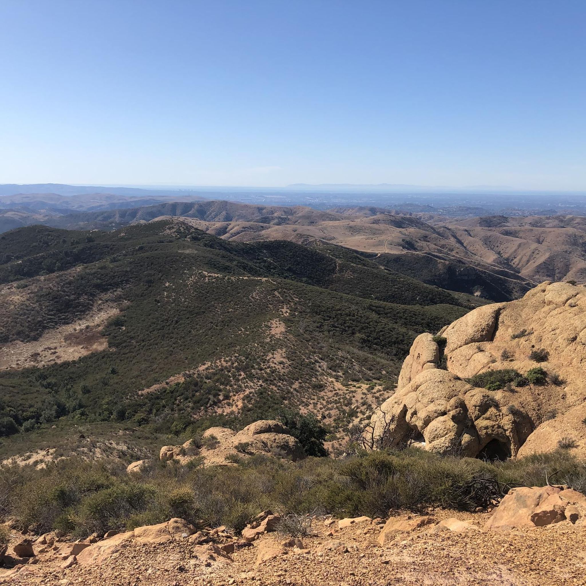
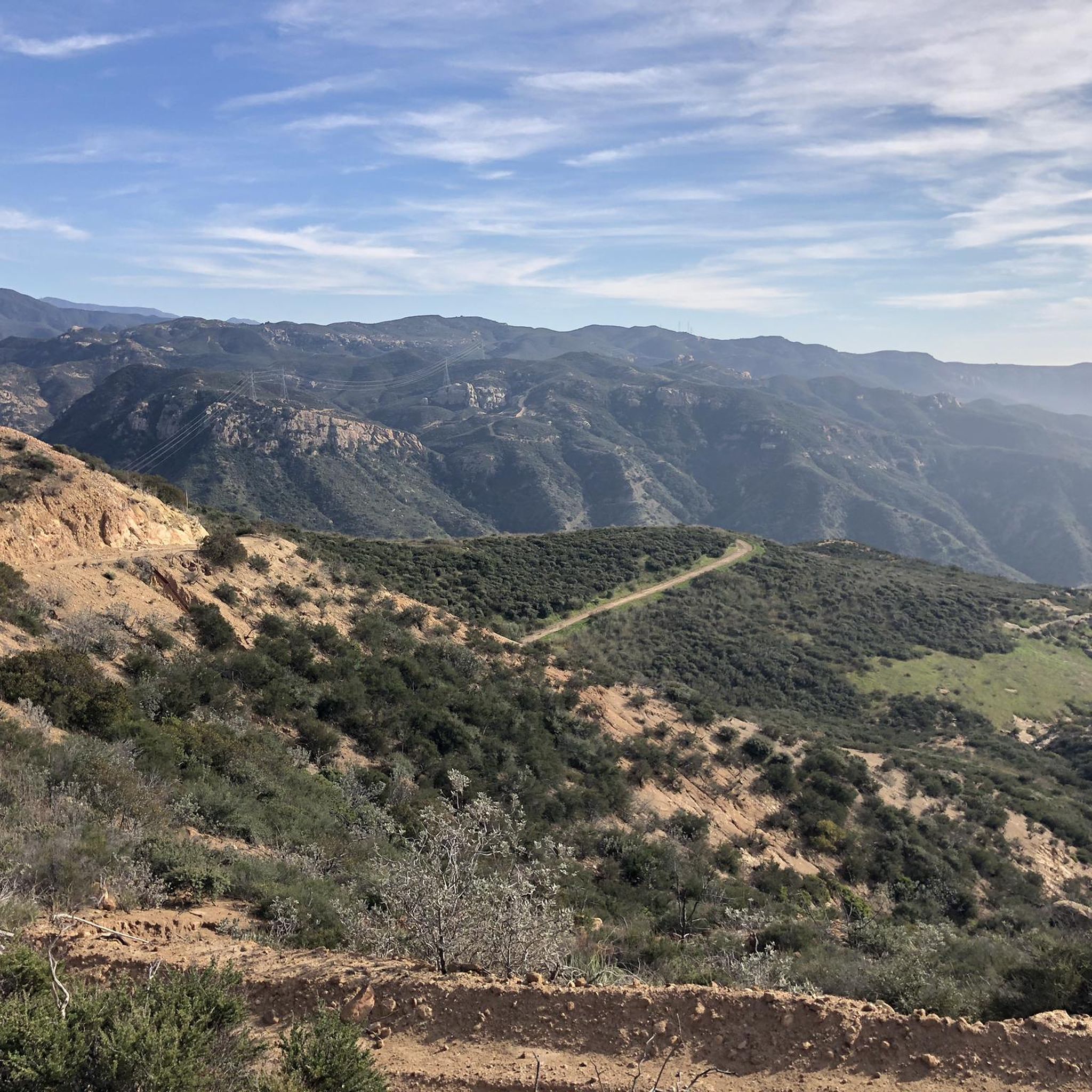
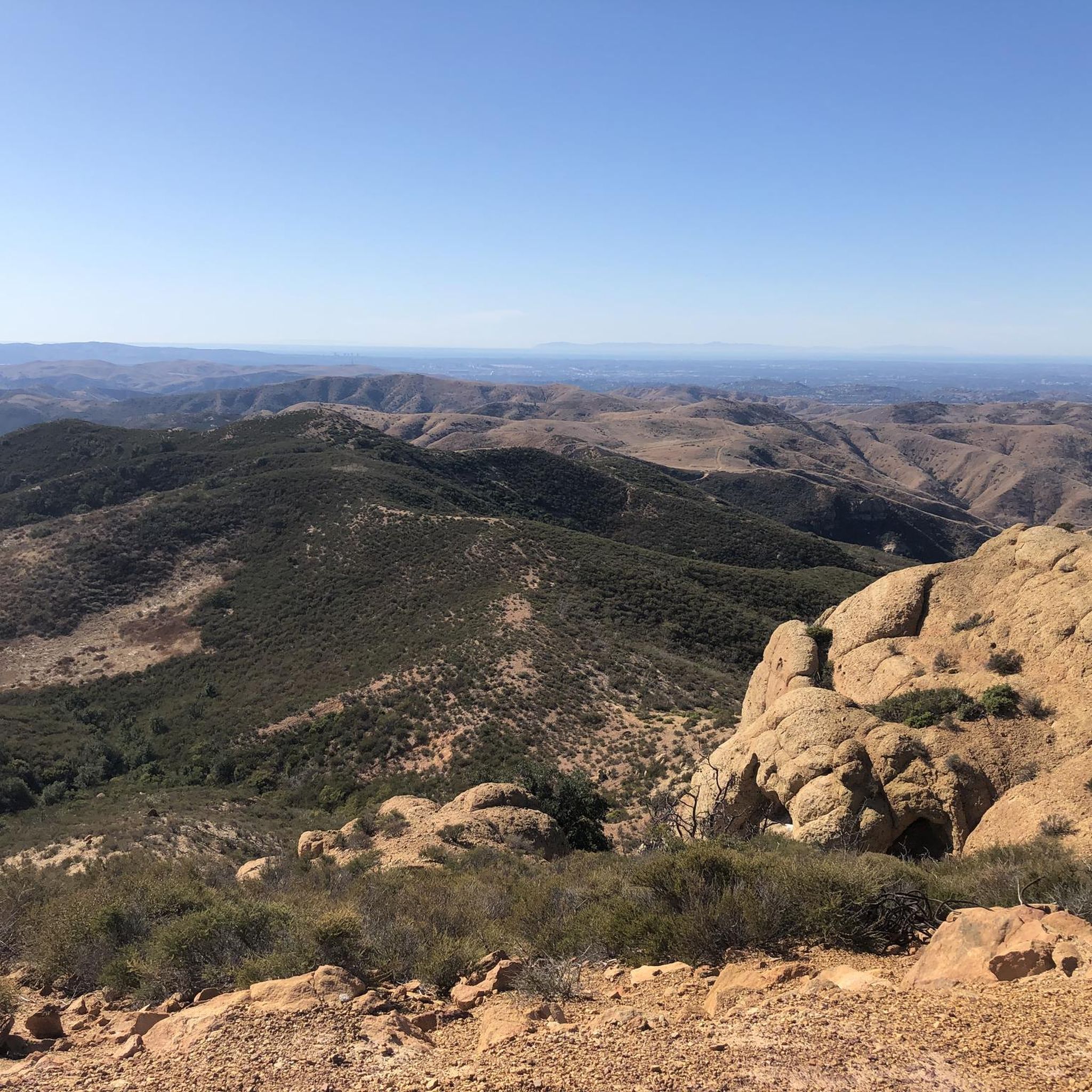
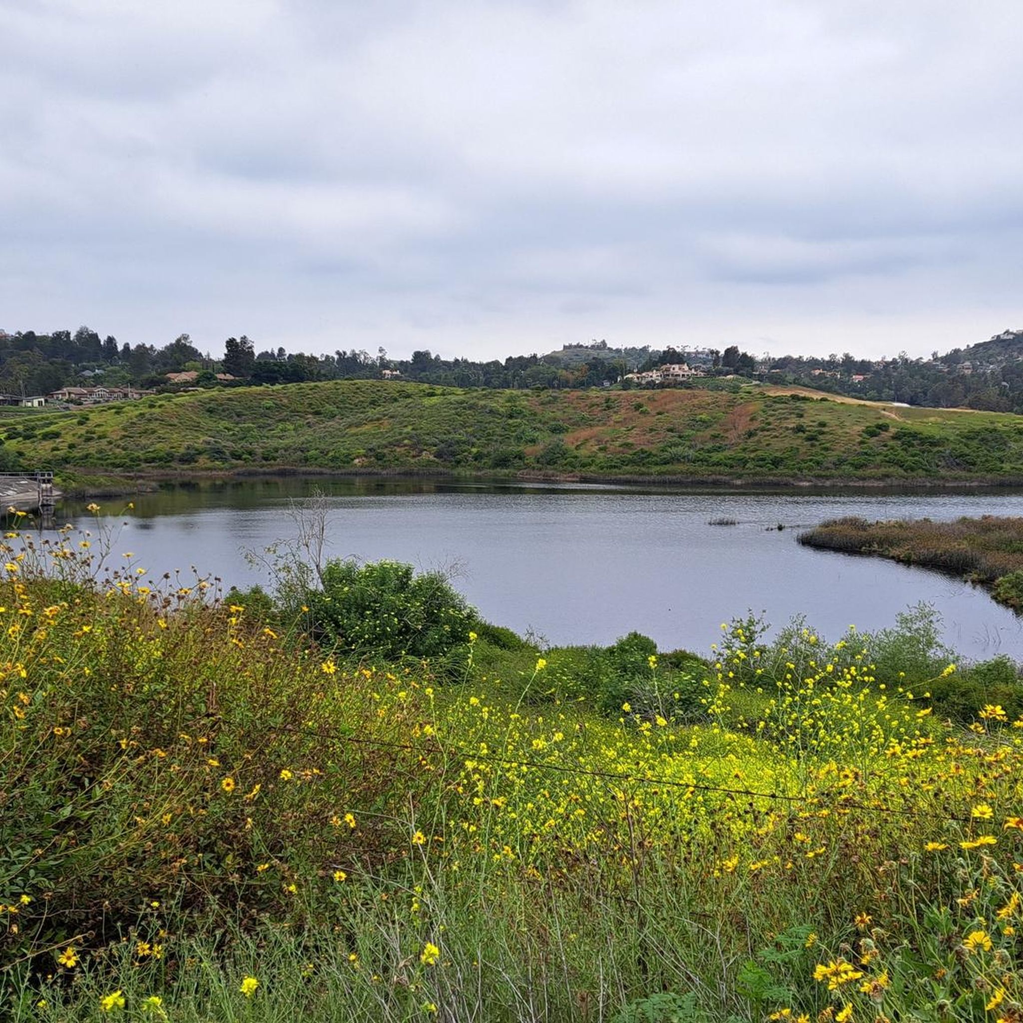
Other adventures in the Santa Ana Mountains

Tips from the Community

Situated up with the cell towers at 3,045 feet, Sierra Peak offers awesome views of Orange County and the surrounding mountains. Because it's such a long trek from car to summit, you'll likely have most of the route and the peak to yourself.
0
0

The trail is a wide dirt road through what feels like remote terrain, despite being quite close to Orange County. There is some loose rock that could make the descent mildly technical, but otherwise, this is a fairly steady route to Mini Moab and Sierra.
0
0
The Silverado Motorway (also referred to as The Motorway and Silverado Trail) is a multi-directional trail, but it's an absolute must-do in the downhill direction. You get continuous views as you rip in and out of small canyons and ravines on a smooth dirt and gravel path.
0
0
The trail here is easy, flat, packed dirt along the neighborhood creek with ample shade. This is a great local trail and is relatively lightly trafficked. There is no parking at the western trailhead.
0
0

Lake View Trail leads all around the Upper Peters Canyon Reservoir. The trail is easy but still includes some up and down. Along the trail, you will get nice views over the lake and the dam. Right above the dam, you can find a nice viewpoint with a bench.
0
0
This part of the trail switchbacks through the canyon foothills and grants fantastic views into Weir Canyon proper. The trail is a wide packed dirt road with other doubletrack connector trails.
0
0

Hikers, bikers, joggers, and nature enthusiasts can all enjoy the trail's natural features. The Santiago Creek Trail links Orange County's parks; Grijalva, Yorba, and Hart Parks.
0
0
The trail is wide packed dirt with splendid views of the nearby hills and the upper reservoir. There is a bench and an informative signpost at the end of the Cactus Point which describes the role of the reservoir in drought prevention.
0
0
Frequently Asked Questions
How many mountain bike trails are available in the Santa Ana Mountains?
The Santa Ana Mountains offer a wide selection of mountain bike trails, with over 60 routes available on komoot. These trails cater to various skill levels, including 16 easy, 33 moderate, and 17 difficult options.
What kind of terrain can I expect when mountain biking in the Santa Ana Mountains?
The Santa Ana Mountains feature diverse and rugged terrain, ranging from challenging climbs and exhilarating descents to scenic routes. You'll encounter steep mountains, sandstone canyons, and river valleys, with significant elevation changes. The landscape includes rare woodlands, extensive chaparral, and coastal sage scrub.
Are there any easy mountain bike trails suitable for beginners or families?
Yes, the Santa Ana Mountains have several easy trails perfect for beginners or families. A good option is the Beginner Loop, which is 5.9 miles long and leads through rolling hills and open spaces. Another accessible choice is the Peters Canyon North Loop and East Ridge Trail, offering scenic views within Peters Canyon Regional Park.
Where can I find challenging mountain bike trails for advanced riders?
For advanced riders seeking a challenge, the Santa Ana Mountains offer several demanding routes. Consider the San Juan Lollipop – Cleveland National Forest, a difficult 21.5-mile path with varied terrain. Another strenuous option is the Santiago and Modjeska Peaks via Harding-Santiago Truck Trail Loop, which covers nearly 36 miles with significant elevation gain.
Are there any mountain bike trails that feature waterfalls or unique natural formations?
Absolutely! The Santa Ana Mountains are home to several natural attractions. You can find Black Star Falls within Black Star Canyon, a popular natural waterfall. Additionally, the Red Rock Trail in Whiting Ranch Wilderness Park is known for its incredible red sandstone formations.
What are some notable viewpoints or landmarks accessible by mountain bike?
Many trails lead to stunning viewpoints and landmarks. Robber's Peak offers scenic ridge views, often included in routes like the Robber's Peak and Barham Ridge Loop. Other prominent peaks accessible include Los Pinos Peak and Bedford Peak, providing expansive vistas of the region.
Are there any good loop trails for mountain biking in the Santa Ana Mountains?
Yes, the Santa Ana Mountains offer several excellent loop trails. Besides the Robber's Peak and Barham Ridge Loop, you might enjoy the Santiago Creek and Weir Canyon Loop, a moderate 15.6-mile ride. For a more challenging option, the Black Star Motorway Loop is a difficult 25.9-mile route.
What do other mountain bikers say about the trails in the Santa Ana Mountains?
The mountain bike trails in the Santa Ana Mountains are highly regarded by the komoot community, holding an average rating of 4.2 stars from over 80 reviews. More than 1,300 mountain bikers have used komoot to explore the varied terrain, often praising the diverse landscapes and the range of options for different skill levels.
What is the best time of year to go mountain biking in the Santa Ana Mountains?
The Santa Ana Mountains are a year-round destination, but the best time for mountain biking is typically during the cooler, drier months from fall through spring. Summers can be very hot, so early morning rides are recommended if you visit during that season. Always check local weather conditions before heading out.
Are there any cafes or places to stop for a break near the mountain bike trails?
Yes, a well-known classic stop and popular hangout for cyclists in Santiago Canyon is Cook's Corner. It offers a casual spot for a break and is a favorite among local riders.
Are permits required for mountain biking on trails in the Santa Ana Mountains?
While many trails are publicly accessible, some areas within the Santa Ana Mountains, particularly those managed by specific parks or reserves like the Cleveland National Forest, may require permits or have specific access rules. It's always best to check with the relevant park or forest service for the most current regulations before your ride.
Can I bring my dog on the mountain bike trails?
Policies regarding dogs on trails vary by specific park or wilderness area within the Santa Ana Mountains. While some trails may allow dogs on leash, others, especially in protected wilderness areas or certain regional parks, may restrict or prohibit them. Always check the specific regulations for the trail or park you plan to visit beforehand.
Most popular routes in the Santa Ana Mountains
Most popular attractions in the Santa Ana Mountains

Get inspired with the komoot mobile app


Explore more
Browse the best MTB trails in other regions.
