Top 15 Mountain Passes around Pian Camuno
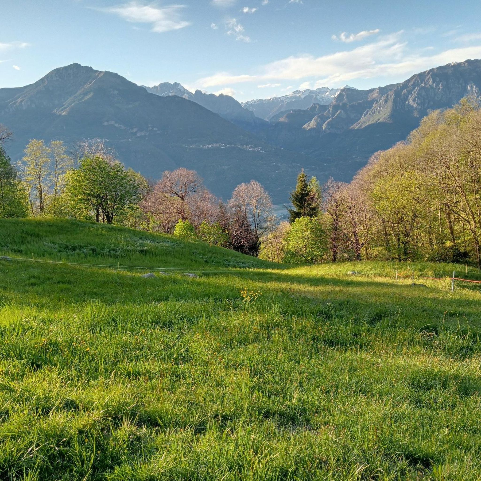
Best mountain passes around Pian Camuno are situated in the lower Valle Camonica, within the province of Brescia, Lombardy, Italy. This municipality is surrounded by a mountainous landscape, providing access to various mountain passes. Its location near Lake Iseo and the Oglio River offers a scenic backdrop for exploring the Alpine and Pre-Alpine terrain. The region features diverse routes suitable for cycling, hiking, and scenic drives.
Best mountain passes around Pian Camuno
- The most popular mountain pass is Presolana Pass…
Last updated: June 26, 2026
Presolana Pass
Highlight • Mountain Pass
Translated by Google •
Tip by

Pass of the Seven Crosses
Highlight • Mountain Pass
Translated by Google •
Tip by

Sign up now to discover places like this
Get recommendations on the best single tracks, peaks, & plenty of other exciting outdoor places.
Sign up for free
Mount Altissimo
Highlight • Summit
Showing Translation
Tip by

Colle di San Zeno Pass
Highlight • Mountain Pass
Translated by Google •
Tip by

Passo Spino
Highlight • Mountain Pass
It is a small wooded pass, not marked by structures or refuges.
It is located on the road/mule track that connects the two main passes in the area:
Croce di Marone
Showing Translation
Tip by
Sign up for free to discover even more mountain passes around Pian Camuno.
Sign up for free
Already have an account?
Start today with a free account
Your next adventure awaits.
Login or Signup
Tips from the Community

Rather unknown pass, although it has already hosted the Giro. The small road has hardly any significant car traffic and is fantastic for cycling.
0
0

📌 Characteristics of Passo Spino (Sebino version) It is a small wooded pass, not marked by structures or refuges. It is located on the road/mule track that connects the two main passes in the area: Croce di Marone Forcella di Sale It is a transit point for MTB riders and hikers who follow the “Malghe in rete” loop. The section between Forcella di Sale and Passo Spino is predominantly downhill, with some short uphill sections. 🥾 Why it is important Passo Spino is useful as a reference point if: you are doing the Croce di Marone → Forcella di Sale → Noase → Sale Marasino loop you are riding the panoramic mountain road that connects the two main passes of Sebino you are climbing or descending by MTB along the “Malghe in rete” route It is not a panoramic viewpoint like Croce di Pezzolo or the Almana ridge: it is more of a technical passage along the ridge. 🗺️ Quick summary Forcella di Sale = pass at 1150 m, start of the Sentiero Benedetti Passo Spino = immediately after, on the road that continues towards Noase Croce di Marone = connected to both via the same mountain road
0
0
Mount Altissimo is a mountain in the Bergamo Prealps, 1703 m high, located between the lower Val Camonica and the lower Val di Scalve. It is the highest peak of the mountain group that separates these two valleys and overlooks the Borno plateau. Two very different slopes Southern slope: steep, rocky, almost devoid of vegetation, with a difference in altitude of about 1500 m from the Oglio valley floor. Northern slope: gentle slope towards Borno, covered with fir trees and dotted with mountain huts, chalets and ski slopes of the Borno Ski Area. 🚶♂️ Hiking — The main itineraries Mount Altissimo is very popular with hikers thanks to the good network of trails (difficulty E). Here are the best-known and documented routes. 1) From Erbanno – Trail 197 or 155 A steep and challenging itinerary, with a significant difference in altitude. Trail 197: Start: Erbanno (Darfo Boario Terme) Passes through: small church of San Valentino (690 m), Malga Mine, junction with trail 194 From the cross: spectacular view of the lower Val Camonica and Lake Iseo Summit reachable in 15 minutes from the final junction Trail 155 (more direct and strenuous): Difference in altitude: about 1460 m Steep sections, some chains on a slightly exposed traverse Remarkable panorama of the meadows of "Segable" Arrival at the Monte Altissimo refuge and the ski lifts 2) From Gorzone – Trail 154 A wilder route on the south side, with a long and tough climb. 3) From Borno – North slope (ski slope areas) A gentler and more panoramic itinerary, often chosen for loop tours that include refuges, mountain huts and small churches (as in your story). 🏞️ What makes Mount Altissimo special Sharp contrast between the two slopes: one severe and rocky, the other gentle and wooded. Wide panoramas of the lower Val Camonica, Lake Iseo and Presolana. Network of mountain huts and chalets still active in summer. Presence of the Monte Altissimo refuge at the summit, also reached by ski lifts. Possibility of varied loop tours, combining woods, slopes, ridges and small isolated churches.
0
0

wonderful view of the valley below
0
0

I've done it twice in the same lap, first from Desso, then after climbing Monte Pora. They're completely different. From Desso, it's long and always in double digits, with significant peaks, so take it with a pinch of salt; the other is rideable. Seeing is believing. 🚴♀️
0
0

Nice climb with fantastic views.
15
0

Piardi refuge with beautiful views of Mount Guglielmo and the valleys below. Crocesia very popular with all types of cyclists
0
0

This is the Passo delle Sette Crocette! An ancient road between the upper Val Trompia and Val Grigna, with a dry stone wall and seven iron crosses. A 1688 cippus adds to the historic charm. Legends tell of witchcraft and mountain piety linked to tragic events. A fascinating place steeped in history and mystery.
3
1
Frequently Asked Questions
What are some of the most scenic mountain passes around Pian Camuno?
The region offers several passes with breathtaking views. Presolana Pass provides extensive and spectacular views, especially after its challenging climb. Passo Crocedomini, though not listed as a highlight, is known for its breathtaking views of the surrounding Lombardy mountains, including distant views of the Orobie Alps and Adamello glaciers. Passo del Maniva also boasts impressive views of the Lombardy mountain region.
Are there any mountain passes with historical significance near Pian Camuno?
Yes, the Pass of the Seven Crosses is an ancient road featuring a dry stone wall and seven iron crosses, with a 1688 cippus adding to its historic charm. Legends of witchcraft and mountain piety are also associated with this fascinating place. Passo Crocedomini also has a rich history, having served as a strategic and military route, and still features a cross marking historical boundaries.
What kind of outdoor activities can I do near these mountain passes?
The mountain passes around Pian Camuno are excellent for various outdoor activities. You can find numerous routes for cycling, hiking, and running. For cycling, explore options like the 'Old Road along Lake Iseo – Vello–Toline Cycle Path loop' or the 'Montecchio Roman Bridge – Vivione Pass loop'. Hikers can enjoy trails such as 'Cima di Marucolo to Malga Rodeneto' or the 'Fraine Mule Trail'. You can find more details on these activities in the Cycling around Pian Camuno, Hiking around Pian Camuno, and Running Trails around Pian Camuno guides.
Are there challenging climbs for cyclists in the area?
Absolutely. The Presolana Pass offers a challenging climb, especially from Dezzo di Scalve, with an average gradient of 7% over 7 km and sections reaching up to 14%. It's a classic climb for local cyclists and has been featured in many Giro stages. Passo Crocedomini also presents a challenging route for cyclists with a maximum gradient of 12 percent.
Which mountain passes are good for hiking and offer access to trails?
Many passes provide excellent hiking opportunities. Passo Croce is an important junction point and serves as a starting point for several trails, including those maintained for mountain biking. Passo del Maniva is also an excellent destination for hiking, with numerous trails suitable for various skill levels, and Passo della Presolana is a hub for hiking and mountaineering, including the renowned Presolana Periplo.
What are the road conditions like for driving or cycling on these passes?
Conditions vary by pass. The Colle di San Zeno has a beautifully paved west driveway from Pisogne, while its east approach, though fully paved, has historically been less maintained. Passo Crocedomini's road (SP345) can have a maximum gradient of 12 percent, and some sections, particularly on the south side, may be unpaved or gravel. Passo del Maniva features narrow, winding, and sometimes poorly paved sections, especially from Bagolino, but also offers wider curves and good conditions in other parts.
When is the best time to visit the mountain passes around Pian Camuno?
The best time to visit depends on your planned activities. For hiking and cycling, late spring to early autumn (May to October) generally offers the most favorable conditions. However, some passes like Passo Crocedomini are typically closed from November to May due to snow. For winter sports, Passo del Maniva and Passo della Presolana are popular destinations during the colder months.
Are there any places to refill water or find amenities on the passes?
Yes, at Passo Croce, you can find a drinking water source locally known as "il fontanone," perfect for refilling your water supplies. At Passo Crocedomini, a refuge provides a stopping point for visitors, and the area is also known for local cheeses and dairy products. Passo del Maniva has alpine huts offering traditional dishes, and the town of Castione della Presolana near Passo della Presolana provides amenities.
What kind of natural features can I expect to see on these mountain passes?
You can expect diverse natural beauty. The Pass of the Seven Crosses offers a mountainous environment with green meadows, huts, red rocks, and colorful rhododendrons. Passo Crocedomini provides views of the Adamello glaciers, while Passo del Maniva features the Maniva waterfall. Passo della Presolana is known for its dramatic landscapes, rocky peaks, and the panoramic viewpoint of "Salto degli Sposi".
Are there any winter sports opportunities on the mountain passes?
Yes, Passo del Maniva is a significant winter sports hub, offering a ski resort, Maniva Ski, with 20 km of slopes and 7 lifts for skiing, snowboarding, and ski mountaineering. Passo della Presolana is also a popular tourist resort in winter, with ski lifts for skiing and snowboarding.
What do visitors enjoy most about the mountain passes around Pian Camuno?
Visitors particularly appreciate the challenging climbs and fantastic views offered by passes like Presolana Pass. The historical charm and beautiful mountainous environment of places like the Pass of the Seven Crosses are also highly valued. Many enjoy the diverse routes for cycling and hiking, and the serene mountain experience provided by the region's passes.
Most popular routes around Pian Camuno
Most popular attractions around Pian Camuno

Get inspired with the komoot mobile app


Explore more
See even more epic mountain passes by checking out these guides around Pian Camuno:
