The best road cycling routes around Camino Al Tagliamento
4.4
(130)
2,800
riders
258
rides
Road cycling routes around Camino Al Tagliamento are characterized by the flat to gently rolling terrain of the Friulian plain, shaped by the Tagliamento River. This region in Udine province, Italy, offers extensive road cycling opportunities with minimal elevation gain. The landscape features the Tagliamento River's wide channels and numerous resurgences forming streams, providing a unique riparian environment. Cyclists will find routes traversing open fields, riverbanks, and past historical sites, making for accessible and scenic rides.
Best road cycling routes…
Last updated: May 30, 2026
3.8
(4)
78
riders
Moderate road ride. Good fitness required. Some segments of this route may be unpaved and difficult to ride.
4.7
(3)
50
riders
57.9km
02:24
290m
290m
Moderate road ride. Good fitness required. Some segments of this route may be unpaved and difficult to ride.

Sign up for free
5.0
(1)
46
riders
70.3km
02:51
340m
340m
Moderate road ride. Good fitness required. Mostly well-paved surfaces and easy to ride.
4.0
(1)
47
riders
54.9km
02:24
250m
250m
Moderate road ride. Good fitness required. Mostly well-paved surfaces and easy to ride.
3.8
(11)
34
riders
37.0km
01:27
60m
60m
Moderate road ride. Great for any fitness level. Some segments of this route may be unpaved and difficult to ride.
Get access to more routes and recommendations from other explorers.
Sign up for free
Already have an account?
Our route recommendations are based on thousands of hikes, rides, and runs completed by other people on komoot.
Start today with a free account
Your next adventure awaits.
Login or Signup

Tips from the Community

Codroipo is an Italian municipality located in Friuli-Venezia Giulia, known for being the lively capital of Medio Friuli. Its name derives from the Latin quadrivium (road intersection), due to its historic strategic position at the intersection of important Roman roads such as the Via Postumia and the Via Julia Augusta.
1
0

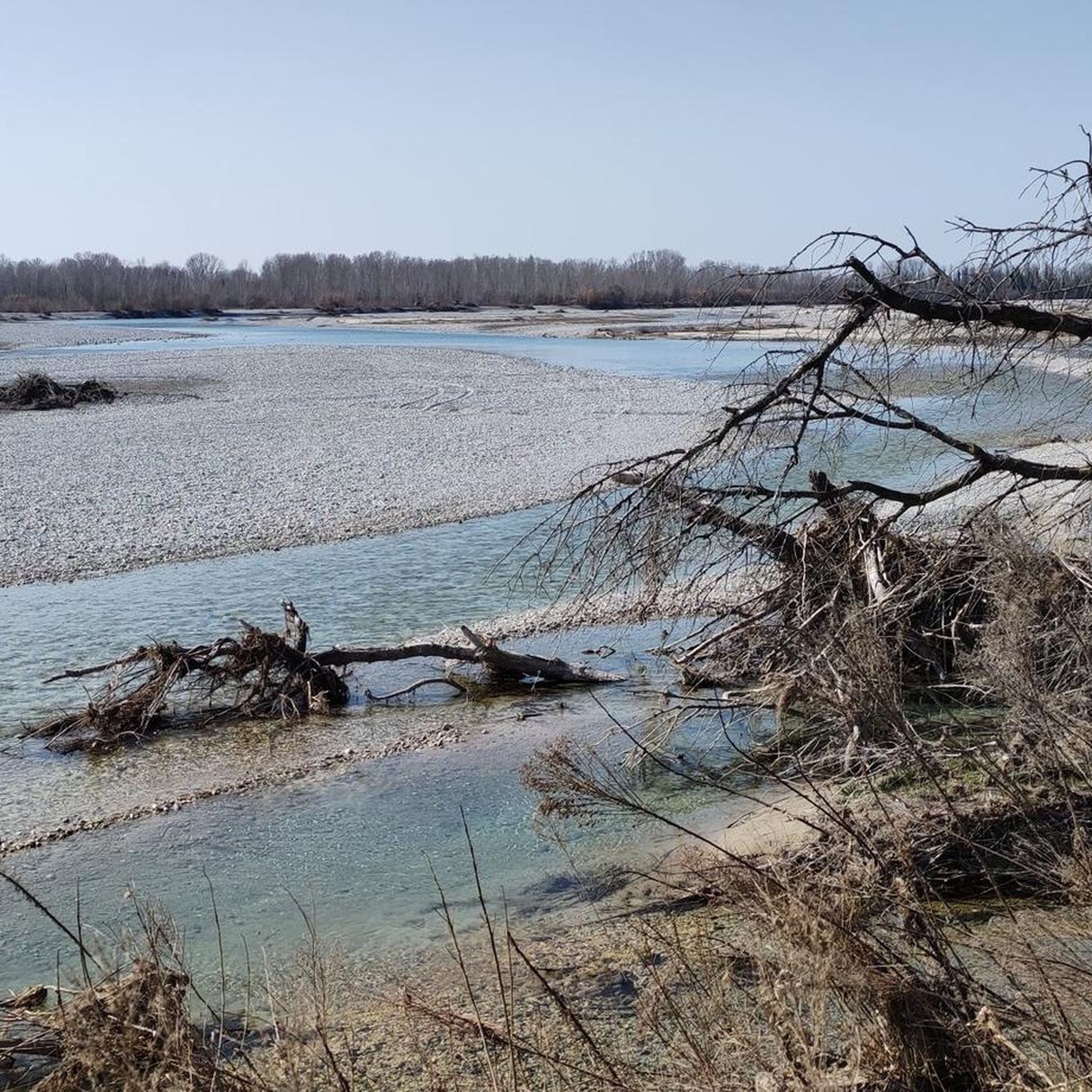
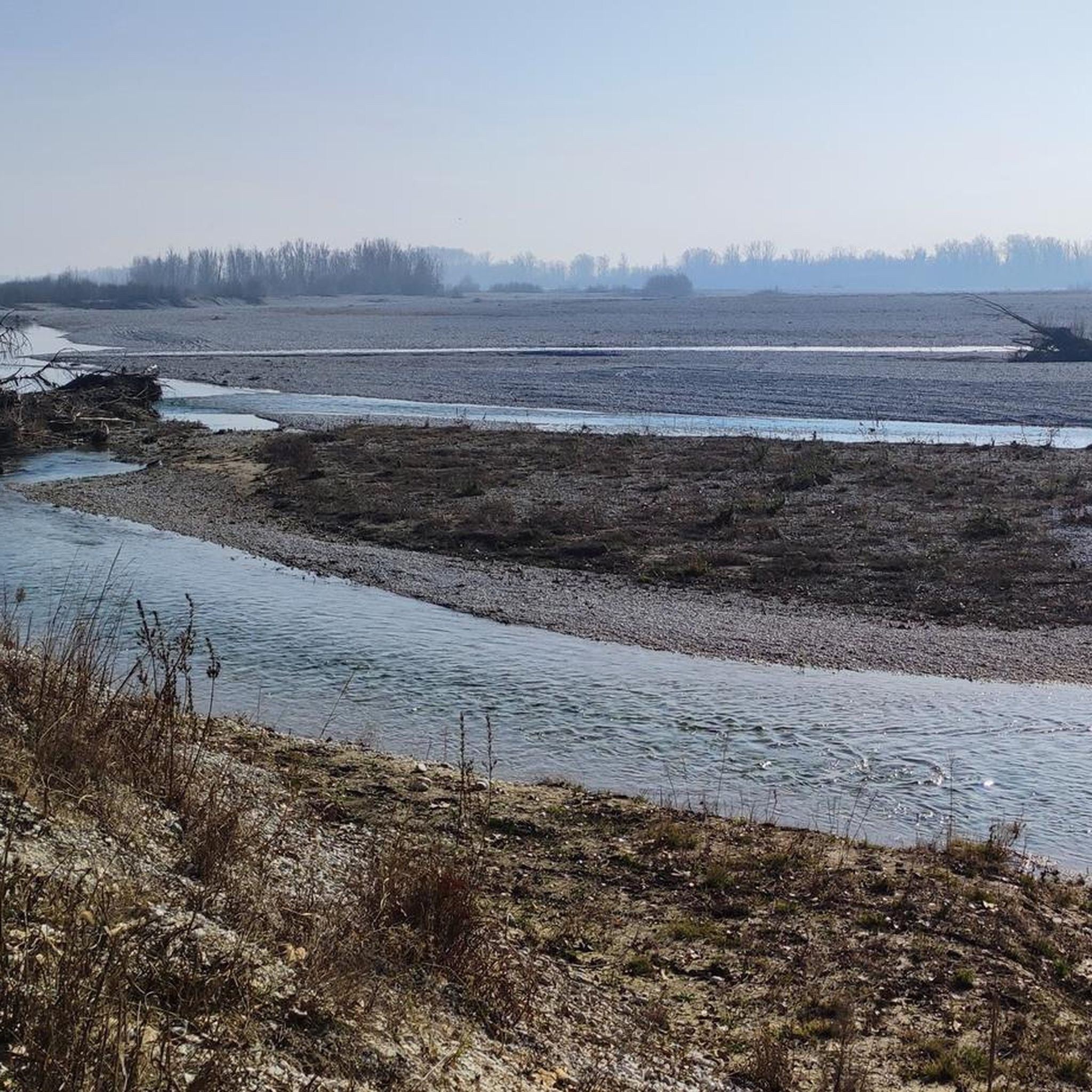
surprising panorama on the course of the tagliamento river.
0
0

In the city center, the cathedral is an eye-catcher. Around the cathedral, there is sufficient gastronomic supply, including ice cream parlors.
0
0
The novel bridge combines historical elements. It is worth stopping at both bridge entrances to enjoy the views of the Tagliamento and the hills.
1
0

Spectacular view of the width of the Tagliamento River and Pinzano Bridge. See Koomot Route ConLoZaino By Romano Paludgnach crest of Monte di Ragogna from the Alpine Church Park Car with ascent from Muris
0
0

Directions near the Parish of Santa Maria Maggiore.
18
0
The course of the Tagliamento River between the municipalities of Dignano and Spilimbergo. https://it.wikipedia.org/wiki/Tagliamento
18
0
Directions to Via Varano in the small hamlet of Cisterna in the municipality of Coseano in the province of Udine.
16
0
Frequently Asked Questions
How many road cycling routes are available in Camino Al Tagliamento?
There are over 260 road cycling routes around Camino Al Tagliamento, offering a wide variety of options for different skill levels. Approximately 100 of these are considered easy, 137 moderate, and 24 difficult.
What is the best time of year for road cycling in Camino Al Tagliamento?
Spring, from April to early June, is an excellent time to visit, with green fields, wide river channels from snowmelt, and comfortable temperatures. Autumn also offers clear skies and vibrant colors from changing poplars along irrigation channels, making it another ideal season for cycling.
Are there easy road cycling routes suitable for beginners in the area?
Yes, Camino Al Tagliamento is well-suited for beginners, with over 100 easy routes. The region's flat or gently rolling terrain, particularly along the Tagliamento River, provides minimal elevation gain. The Tagliamento cycle path (FVG6) is an example of an easy route, offering an 80 km ride with continuous scenic views.
What kind of landscapes can I expect to see while road cycling in Camino Al Tagliamento?
You'll experience the unique riparian environment of the Tagliamento River, often referred to as Europe's last major unregulated Alpine river, with its braided channels and wide gravel bed. Routes also traverse open fields, past numerous resurgences forming streams like the Varmo and Stella rivers, and through abundant forests, all set against the backdrop of the flat Friulian plain.
Are there any long-distance road cycling routes in Camino Al Tagliamento?
Yes, the region offers several longer routes. For example, the Tagliamento Bridge – Tagliamento River loop from Codroipo is a moderate 79.7 km (49.5 miles) route that takes around 3 hours 24 minutes to complete, following the river's course.
What historical or cultural attractions can I visit along the cycling routes?
The area is rich in history. You can cycle past the grandiose Villa Manin, an 18th-century complex, or explore Valvasone, recognized as one of Italy's most beautiful medieval villages. The ancient Braida Mill and Flambro Springs also offer a picturesque stop.
Are there circular road cycling routes available?
Yes, many routes in the region are designed as loops. A popular option is the View of the Tagliamento River loop from Codroipo, a 66.7 km (41.4 miles) moderate trail that offers continuous scenic views along the river.
What do other road cyclists enjoy most about cycling in Camino Al Tagliamento?
The area is highly rated by the komoot community, with an average score of 4.4 stars from over 120 reviews. Cyclists often praise the tranquil riding experience along the Tagliamento River, the flat and well-maintained paths, and the picturesque backdrops of historical sites and natural wonders.
Are there any challenging road cycling routes in Camino Al Tagliamento?
While the region is largely flat, there are 24 routes classified as difficult for those seeking more of a challenge. These routes might involve longer distances or slightly more varied terrain, though significant climbs are rare due to the nature of the Friulian plain.
Can I combine road cycling with public transport in the region?
Yes, the Friuli Venezia Giulia region, which includes Camino al Tagliamento, is recognized as bike-friendly. Public transport services are often equipped to carry bicycles, making it convenient to reach starting points or return from longer point-to-point rides.
Are there any specific routes that connect towns or villages?
Certainly. The Codroipo – San Daniele loop from Codroipo is a moderate 52.1 km (32.4 miles) path that navigates through the region's lowlands, connecting various towns with gentle gradients, allowing you to explore local communities.
Where can I find scenic viewpoints along the road cycling routes?
Many routes offer scenic views, especially those that follow the Tagliamento River. The river's braided channels and wide gravel bed provide unique natural vistas. Additionally, routes passing through rural hamlets and near historical sites like San Vito al Tagliamento offer picturesque village scenes.
Most popular routes around Camino Al Tagliamento
Most popular attractions around Camino Al Tagliamento

Get inspired with the komoot mobile app


Explore more
Browse the best Road cycling routes in other regions.
