The best walks and hikes around Camino Al Tagliamento
4.2
(298)
1,255
hikers
186
hikes
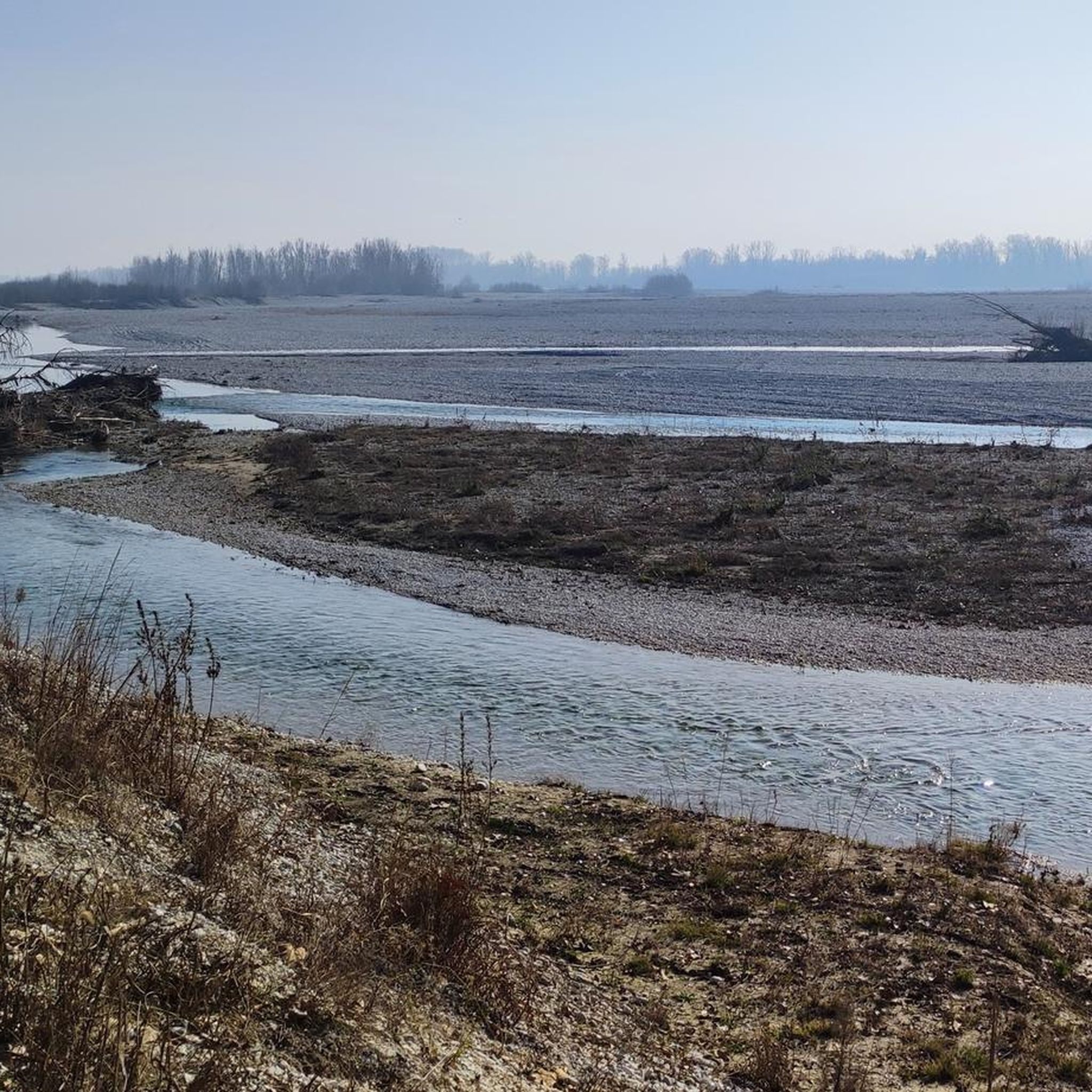
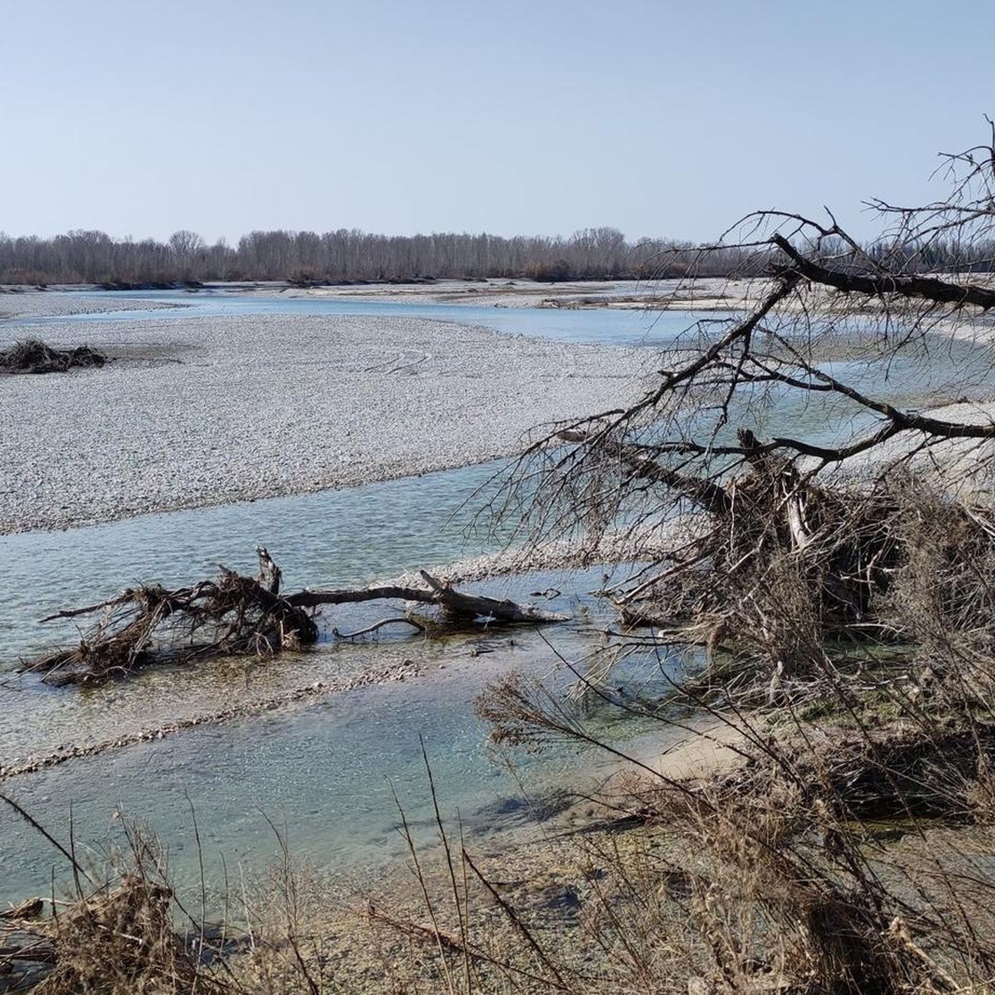
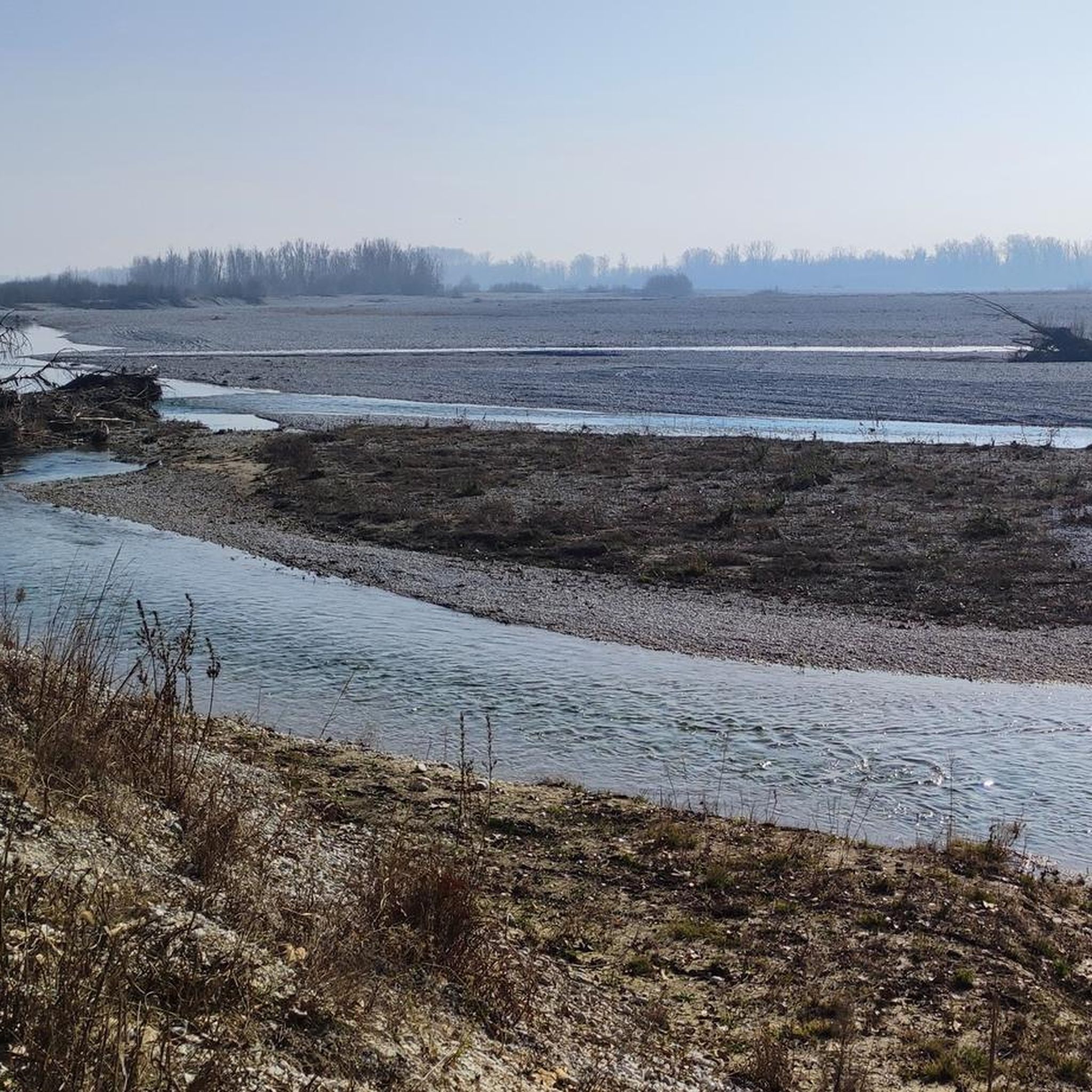
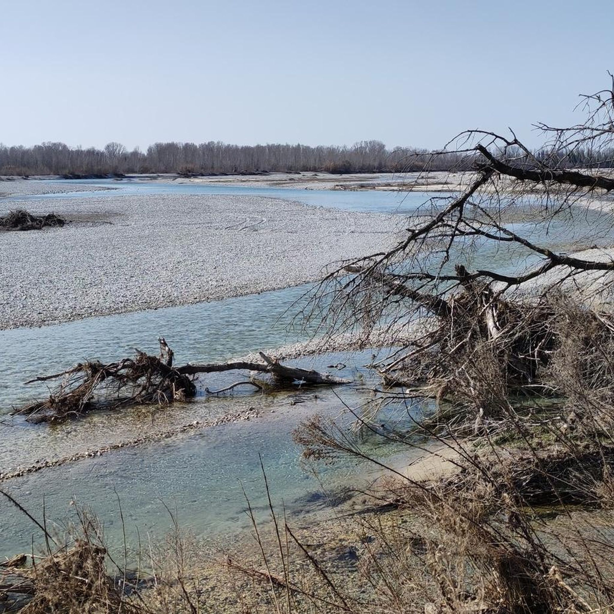
Hiking around Camino Al Tagliamento offers diverse landscapes centered around the Tagliamento River, known for its pristine waters and wide riverbed. The region features varied terrain, including woodlands, prairies, and dirt roads, with occasional small fords. Hikers can explore areas with historical significance, such as Great War relics near Monte di Ragogna, and natural features like the Flambro springs. The elevation changes are generally gentle, making many paths accessible for various fitness levels.
Best hiking trails around Camino Al Tagliamento
…Last updated: July 4, 2026
4.4
(45)
204
hikers
Easy hike. Great for any fitness level. Easily-accessible paths. Suitable for all skill levels.
4.8
(16)
44
hikers
9.96km
02:31
20m
20m
Moderate hike. Good fitness required. Easily-accessible paths. Suitable for all skill levels.

Sign up for free
4.4
(10)
69
hikers
5.95km
01:31
10m
10m
Easy hike. Great for any fitness level. Easily-accessible paths. Suitable for all skill levels.
4.4
(7)
21
hikers
13.8km
03:30
30m
30m
Moderate hike. Good fitness required. Easily-accessible paths. Suitable for all skill levels.
3.7
(3)
17
hikers
Moderate hike. Good fitness required. Easily-accessible paths. Suitable for all skill levels.
Get access to more routes and recommendations from other explorers.
Sign up for free
Already have an account?
Our route recommendations are based on thousands of hikes, rides, and runs completed by other people on komoot.
Start today with a free account
Your next adventure awaits.
Login or Signup

Tips from the Community

Villa Manin, a place of great charm and history near the locality of Passariano.
0
0

A true gem of a local recreation area with plenty of shady forest and watercourses from the karst springs, with a touch of adventure.
0
0
A true gem of a local recreation area with plenty of shady forest and watercourses from the karst springs, with a touch of adventure.
0
0
A magnificent historical monument from the Middle Ages, perfectly restored and in excellent condition.
1
0

https://www.komoot.com/it-it/tour/2111995497 A beautiful, peaceful, and very easy walk that allows us to observe one of Friuli's characteristic natural phenomena: the Risorgive (spring springs). The trail is equipped with numerous benches, a picnic area, and a play area for children.
0
0

beautiful view of codroipo
0
0
beautiful view of the mountains
0
0
Frequently Asked Questions
How many hiking trails are available in Camino Al Tagliamento?
There are nearly 100 hiking trails around Camino Al Tagliamento, catering to various skill levels. You'll find a good mix of easy and moderate routes, with a few more challenging options for experienced hikers.
What kind of landscapes can I expect to see while hiking in Camino Al Tagliamento?
Hiking in Camino Al Tagliamento offers diverse landscapes, primarily centered around the Tagliamento River, known as the 'last Alpine river in Europe that maintains its natural dynamics'. You'll encounter a mix of dirt roads, wooded areas, and prairies, with unique habitats along the river's course. The region also features natural biotopes, such as the area around the Braida Mill and Flambro Springs, offering picturesque scenery.
Are there any easy, family-friendly hikes in the area?
Yes, Camino Al Tagliamento has many easy routes suitable for families. A popular choice is the Panorama over Codroipo – Little Free Library loop from Codroipo / Codroip, which is just under 5 km and offers pleasant views. Another accessible option is the Villa Manin loop from Codroipo / Codroip, a 7.7 km trail that explores the surroundings of the historic Villa Manin.
Can I find circular hiking routes in Camino Al Tagliamento?
Absolutely. Many of the trails in Camino Al Tagliamento are designed as circular routes, allowing you to start and end at the same point. Examples include the Little Free Library – Villa Manin loop from Codroipo / Codroip and the Codroipo – Villa Manin loop from Codroipo, which are both moderate-difficulty circular paths.
What historical sites or attractions can I visit while hiking?
The region is rich in history. You can explore the grand Villa Manin, an 18th-century complex that serves as a focal point for several hiking loops. The historic town of Valvasone, with its imposing castle and ancient mill, is also worth visiting. Hikers can also discover the ruins of medieval castles and protohistoric sites towards the plain.
Are there any longer hiking trails for more experienced hikers?
While many routes are easy to moderate, you can combine trails or choose longer loops for a more extended experience. The Villa Manin – Little Free Library loop from Codroipo / Codroip is a moderate 12.7 km route, offering a good distance for those looking for a longer day out. The historic Via del Tagliamento also offers possibilities for multi-day exploration.
What do other hikers enjoy most about hiking in Camino Al Tagliamento?
The area is highly rated by the komoot community, with an average score of 4.2 stars from over 230 reviews. Hikers often praise the diverse terrain, the unique ecosystem of the Tagliamento River, and the blend of natural beauty with historical sites like Villa Manin and Ragogna Castle. The accessibility of paths for various fitness levels is also frequently highlighted.
Is Camino Al Tagliamento suitable for dog-friendly hikes?
Yes, many trails in Camino Al Tagliamento are suitable for hiking with dogs. The region's natural landscapes, including wooded areas and dirt roads, provide ample space for your canine companions. Always ensure your dog is on a leash where required and respect local regulations, especially around protected natural areas or agricultural lands.
What is the best time of year to go hiking in Camino Al Tagliamento?
The spring and autumn months generally offer the most pleasant hiking conditions in Camino Al Tagliamento, with mild temperatures and vibrant natural colors. Summer can be warm, but the riparian forests along the Tagliamento River provide some shade. Winter hiking is possible, but be prepared for cooler temperatures and potentially muddy conditions.
Are there options for parking at trailheads?
While specific parking details vary by trailhead, many popular starting points for hikes, especially those near towns like Codroipo or attractions like Villa Manin, offer designated parking areas. It's advisable to check the route details on komoot for specific parking information for your chosen trail.
Can I reach hiking trails using public transport?
Public transport options to reach specific trailheads might be limited in some of the more rural parts of Camino Al Tagliamento. However, larger towns in the region, such as Codroipo, are generally accessible by public transport, and some popular routes may start from or pass through these areas. Planning your route in advance and checking local bus schedules is recommended.
Most popular routes around Camino Al Tagliamento
Most popular attractions around Camino Al Tagliamento

Get inspired with the komoot mobile app


Explore more
Browse the best Hikes in other regions.
