The best walks and hikes in Ringkøbing-Skjern
4.6
(5187)
27,232
hikers
988
hikes
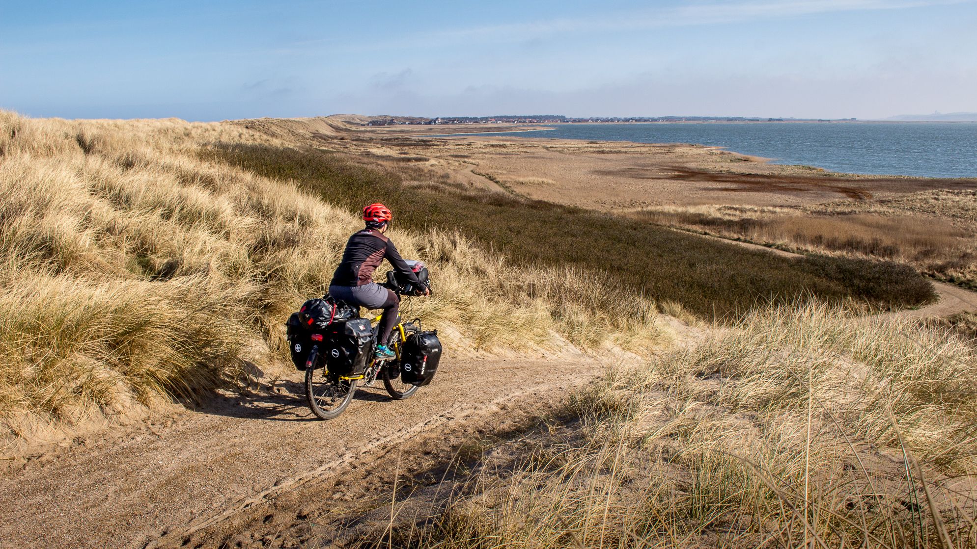
Hiking in Ringkøbing-Skjern offers diverse landscapes, from the extensive Ringkøbing Fjord to the North Sea coast with its dunes and beaches. The region also features the Skjern River Valley, characterized by wetlands and forests, providing varied terrain for exploration. Hikers can experience a blend of coastal paths, fjord-side routes, and inland trails through woodlands and heathlands. The area's low elevation ensures accessible routes across its natural features.
Best hiking trails in Ringkøbing-Skjern
- The most popular hiking route is Bagges Dam hiking route, a 5.8 miles (9.3 km) trail that takes 2 hours 20 minutes to complete. This moderate route explores the area around Bagges Dam, offering varied natural scenery.
- Another top favourite among local hikers is Hindø Island Tour, an easy 3.6 miles (5.7 km) path. This route circles Hindø Island, providing views of the fjord and its surroundings.
- Local hikers also love the Cable Ferry at Filsø – Skjern River loop from Pumpestation Nord, an 8.4 miles (13.5 km) trail leading through the Skjern River Valley and past Filsø, often completed in about 3 hours 23 minutes.
- Hiking in Ringkøbing-Skjern is defined by coastal dunes, the Ringkøbing Fjord, and the Skjern River Valley. The network offers options for easy, moderate, and difficult routes, catering to various ability levels.
- The routes in Ringkøbing-Skjern are highly rated by the komoot community with an average score of 4.6 stars from over 4000 reviews. More than 24000 hikers have used komoot to explore Ringkøbing-Skjern's varied terrain.
Last updated: August 19, 2026
4.6
(426)
1,369
hikers
9.29km
02:20
10m
10m
Moderate hike. Good fitness required. Easily-accessible paths. Suitable for all skill levels.
4.7
(251)
784
hikers
5.75km
01:26
0m
0m
Easy hike. Great for any fitness level. Easily-accessible paths. Suitable for all skill levels.

Sign up for free
4.6
(434)
1,229
hikers
13.5km
03:24
10m
10m
Moderate hike. Good fitness required. Easily-accessible paths. Suitable for all skill levels.
4.0
(31)
94
hikers
11.2km
02:48
10m
10m
Moderate hike. Good fitness required. Easily-accessible paths. Suitable for all skill levels.
4.8
(5)
28
hikers
16.5km
04:09
10m
10m
Moderate hike. Good fitness required. Easily-accessible paths. Suitable for all skill levels.
Get access to more routes and recommendations from other explorers.
Sign up for free
Already have an account?
Our route recommendations are based on thousands of hikes, rides, and runs completed by other people on komoot.
Start today with a free account
Your next adventure awaits.
Login or Signup


Other adventures in Ringkøbing-Skjern

Tips from the Community

For the Highland cattle an absolutely dreamlike beautiful nature reserve 🐂...
0
0
A very special nature reserve with all its beauty of lakes, streams, reed belts and meadows, the animals and birds living here freely 💚.
0
0

A quick note for dog owners: Dogs are not allowed on the last section of the path to this observation tower. They are allowed on the dike path along the Skjern Å.
1
0

Dogs are prohibited on Hindø, even on a leash.
1
0


Beautiful nature with a view of the fjord. It's naturally packed when the weather is nice, so please be considerate of one another.
2
0

We’re planning to take this walk, unfortunately no dogs allowed.
0
0
Frequently Asked Questions
How many hiking trails are available in Ringkøbing-Skjern?
Ringkøbing-Skjern offers a wide array of hiking opportunities, with over 1000 routes available. These trails cater to various preferences, ranging from easy strolls to more challenging hikes.
What kind of landscapes can I expect to see while hiking in Ringkøbing-Skjern?
The region boasts diverse landscapes, including the extensive Ringkøbing Fjord, impressive coastal dunes, and wide North Sea beaches. You can also explore the unique wetland environment of the Skjern River Valley, as well as lush forests and open heathlands. This variety ensures a rich and changing scenery for hikers.
Are there hiking options for all skill levels in Ringkøbing-Skjern?
Yes, Ringkøbing-Skjern provides hiking routes suitable for all abilities. The majority of trails, over 800, are considered easy, while there are also nearly 200 moderate routes and a selection of more difficult trails for experienced hikers.
What do other hikers say about the trails in Ringkøbing-Skjern?
The hiking trails in Ringkøbing-Skjern are highly regarded by the komoot community, holding an impressive average rating of 4.6 stars from over 4500 reviews. Hikers often praise the varied terrain, from coastal paths to fjord-side routes and inland woodlands, and the accessibility of the routes.
Are there any circular hiking routes in Ringkøbing-Skjern?
Yes, the region offers several excellent circular routes. For example, the Hindø Island Tour is an easy 3.6-mile (5.7 km) path circling Hindø Island. Another option is the Cable Ferry at Filsø – Skjern River loop from Pumpestation Nord, which is a moderate 8.4-mile (13.5 km) trail through the Skjern River Valley. The West-Stadil-Fjord circle also offers a scenic loop.
Can I bring my dog on the hiking trails in Ringkøbing-Skjern?
While many natural areas in Denmark are dog-friendly, it's always best to keep your dog on a leash, especially in nature reserves, near livestock, or during bird breeding seasons. Always check local signage for specific rules regarding dogs on individual trails or in protected areas to ensure a pleasant experience for everyone.
Are there family-friendly hiking options in Ringkøbing-Skjern?
Absolutely. With a large number of easy trails, Ringkøbing-Skjern is well-suited for families. The low elevation throughout the region means most paths are gentle. Consider routes around the Ringkøbing Fjord or the Skjern River Valley, which often feature accessible paths and opportunities for nature observation. The Hindø Island Tour is an easy option that families might enjoy.
What interesting landmarks or attractions can I see along the hiking trails?
Many trails offer access to notable landmarks. You can visit the charming town of Nymindegab, known for its views of dunes and the fjord. The iconic Lyngvig Lighthouse provides panoramic views after a climb. You might also encounter the Bagge's Causeway or explore the vibrant Hvide Sande Harbour.
Are there any trails that offer good viewpoints?
Yes, the diverse landscapes of Ringkøbing-Skjern provide several opportunities for scenic viewpoints. The coastal dunes and the areas around Ringkøbing Fjord offer sweeping vistas of both the North Sea and the calmer inland waters. Climbing the Lyngvig Lighthouse offers an exceptional panoramic view of the narrow land strip. Additionally, the view from Lønborg Banke by Lønborg Church in the Skjern River Valley is highly recommended.
Is there public transport available to reach hiking trailheads?
While specific public transport options to every trailhead can vary, the region is generally accessible. For detailed information on bus routes and schedules that might connect to various towns and areas near hiking trails, it's advisable to check local transport provider websites or apps. Planning your route in advance will help determine the best way to reach your desired starting point.
Where can I find parking for hiking trails in Ringkøbing-Skjern?
Many popular trailheads and natural attractions in Ringkøbing-Skjern offer designated parking areas. For instance, the 10 Spir Trailhead and Parking Area is one such example. When planning your hike, it's often helpful to check the specific tour details on komoot, as parking information is frequently included for individual routes.
Are there any long-distance hiking opportunities in the region?
While Ringkøbing-Skjern is known for its varied day hikes, you can create longer experiences by combining sections of trails, particularly along the Ringkøbing Fjord or within the expansive Skjern River Valley. The Skjern Enge Trail, at over 10 miles (16 km), offers a significant distance for a single hike.
Most popular routes in Ringkøbing-Skjern
Most popular attractions in Ringkøbing-Skjern

Get inspired with the komoot mobile app


Explore more
Browse the best Hikes in other regions.
