The best cycling routes around Frasso Sabino
4.8
(19)
634
riders
58
rides
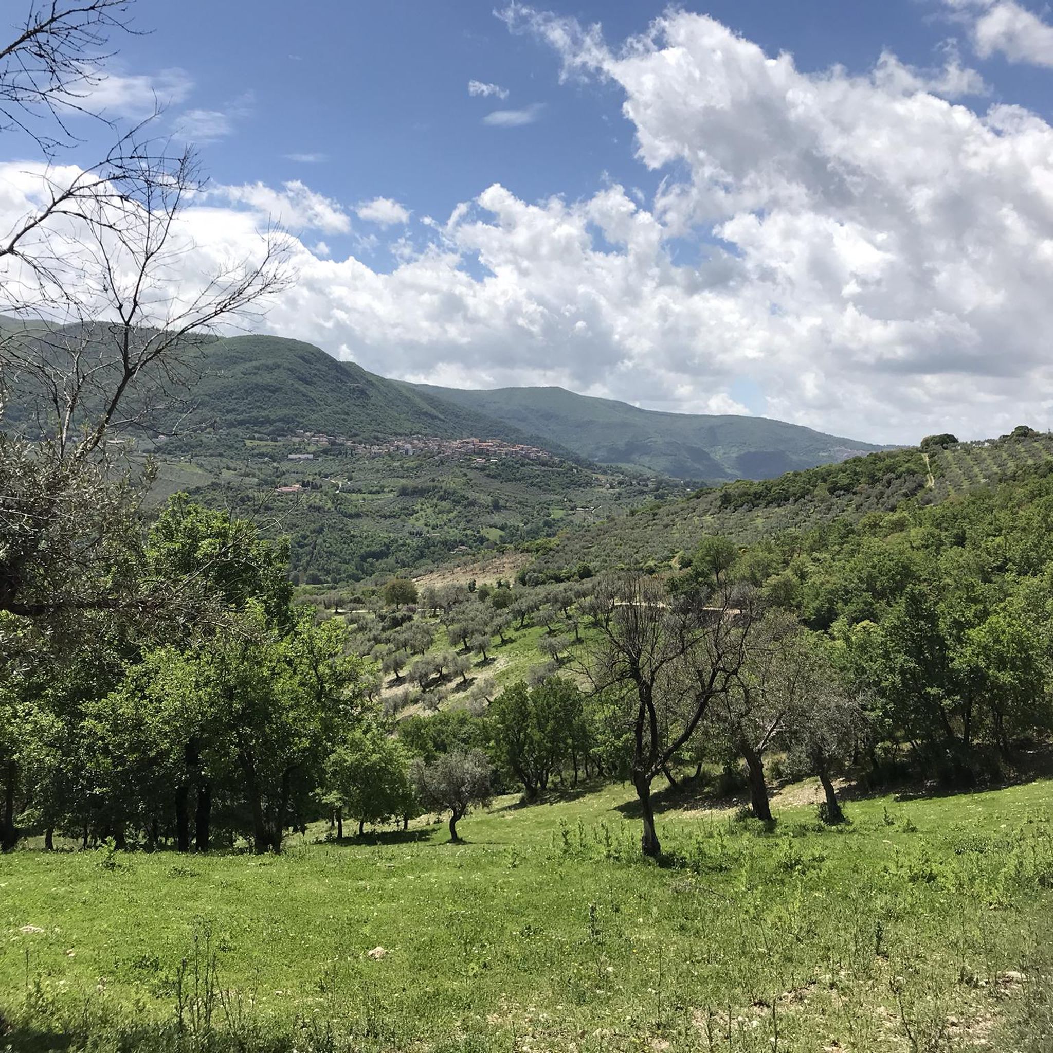
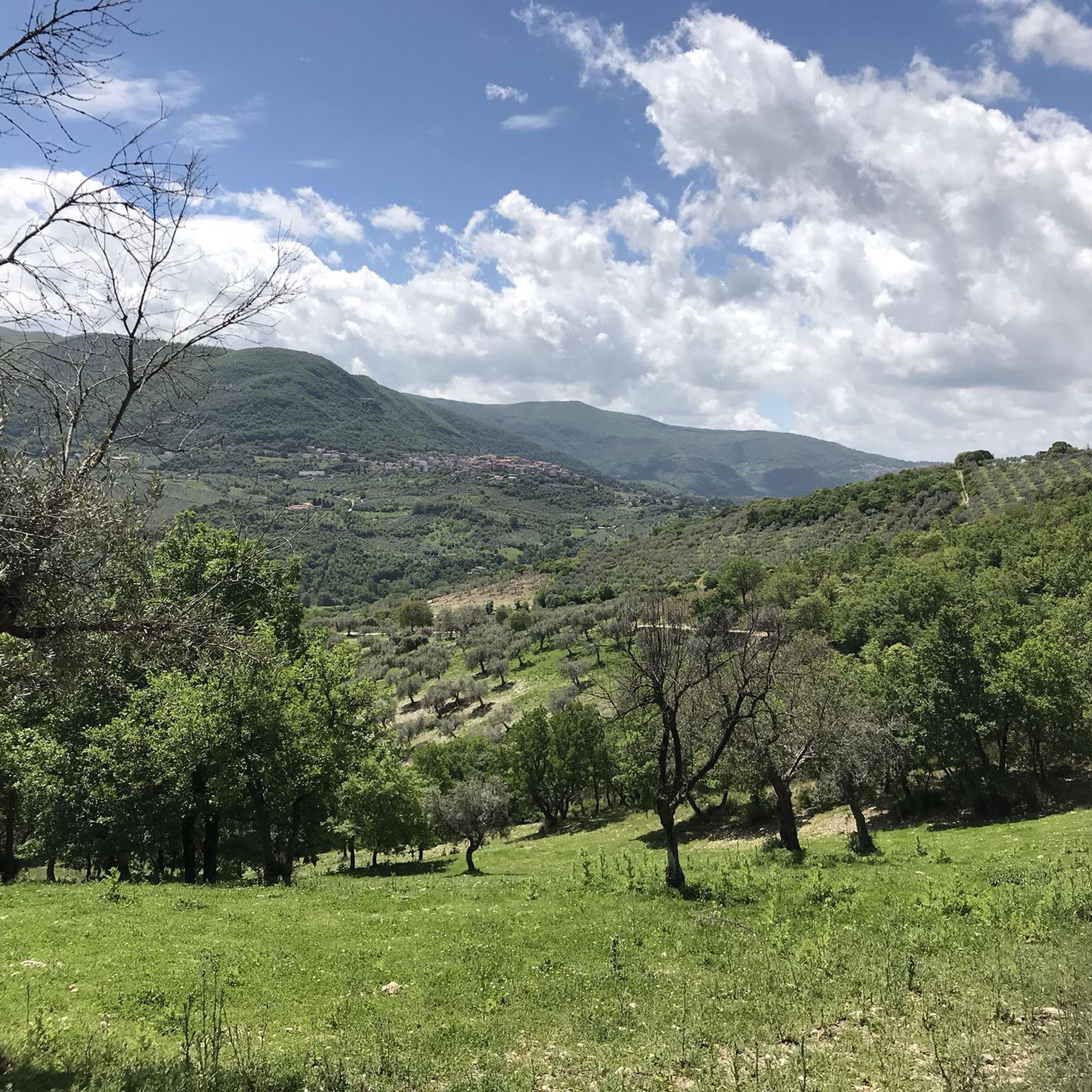
Touring cycling routes around Frasso Sabino are situated in the Sabina region of Lazio, Italy, characterized by rolling hills, ancient olive groves, and diverse natural landscapes. The terrain includes undulating routes through the Sabine Mountains, offering ascents and descents. The area features a mix of paved roads and paths suitable for off-road cycling, with elevations reaching up to 489 meters at Monte Acuziano. This region provides varied cycling experiences across its natural features.
Best touring cycling routes around Frasso Sabino
…Last updated: June 22, 2026
32
riders
72.7km
04:53
1,200m
1,200m
Hard bike ride. Very good fitness required. Mostly paved surfaces. Suitable for all skill levels.
28
riders
111km
08:03
2,220m
2,220m
Hard bike ride. Very good fitness required. Mostly paved surfaces. Suitable for all skill levels.

Sign up for free
5.0
(2)
7
riders
Hard bike ride. Very good fitness required. Mostly paved surfaces. Suitable for all skill levels.
4.0
(1)
11
riders
42.4km
02:46
600m
600m
Hard bike ride. Very good fitness required. Mostly paved surfaces. Suitable for all skill levels.
15
riders
72.3km
05:05
1,400m
1,400m
Hard bike ride. Very good fitness required. Mostly paved surfaces. Suitable for all skill levels.
Get access to more routes and recommendations from other explorers.
Sign up for free
Already have an account?
Our route recommendations are based on thousands of hikes, rides, and runs completed by other people on komoot.
Start today with a free account
Your next adventure awaits.
Login or Signup

Tips from the Community

The sanctuary of Santa Maria delle Grazie is linked to Nerola both dynastically and devotionally. It was indeed Raimondo Orsini, Duke of Gravina and Count of Nerola, who had the church and convent built for the Franciscan Amadeiti, as a sign of gratitude towards the blessed Amedeo Menezes da Silva. The venerated image of the Madonna delle Grazie came from the castle of Nerola, from where it was brought to the church in a solemn procession on Pentecost Day in 1480. Local sources report that the Madonna venerated in the sanctuary was found in the castle of Nerola, or at least kept there, and then transferred to the new conventual church of Santa Maria delle Grazie. According to the sanctuary's tradition, the blessed Amedeo found the image of the Madonna in the castle of Nerola by revelation and left the castle of Nerola in procession for its new home precisely upon the completion of the sanctuary's construction in 1480. In a later age, the image was first placed in the first side chapel and then, in 1826, on the high altar. The sources of the Via Mariana recall that the venerated image was crowned in 1779 and, after a theft, was crowned again in 2008 by Cardinal Angelo Comastri. Another record describes the image as placed above the altar, stripped after the theft and recently restored, also with the contribution of gold offered by the population. Alongside this Marian devotion, a wooden triptych commissioned by the Orsini from Antoniazzo Romano is also documented in the sanctuary, with the Madonna and Child between Saint Francis and Saint Anthony of Padua, but distinct from the miraculous image that is the object of popular worship.
0
0

Umbilicus Italiæ - Centro d'Italia, Rieti / Geographical Center of Italy In Piazza San Rufo, Varronian tradition places the so-called Umbilicus Italiae, the geographical center of Italy, commemorated by a plaque. Piazza San Rufo is located amidst the imposing buildings of the historic center, which line the main streets Via Roma and Via Garibaldi. In the center of the square, a section of wall, a remnant of the Roman city's first city walls, can be seen beneath the pavement. The value of this area is commemorated by a plaque and a monument with a unique shape, located exactly in the center of the square and aptly called "la caciotta" (the caciotta) for its rounded and circular design. The work, created between the 1980s and 1990s following the city's twinning with the Georgian capital Tbilisi, appears to resemble the base of a column and features the design of the Italian peninsula on its surface, accompanied by the inscription "Umbilicus Italiae" (Umbilicus Italiae), which runs along half the circumference of the monument itself. Text / Source: Official Tourist Portal of the City of Rieti https://www.visitrieti.com/2020/01/25/rieti-umbilicus-italiae/
14
0

Going down via Roma you reach the Velino bridge, known however by the same name as the one demolished in the thirties and placed, a little below, on the river bed: Roman bridge.
1
0


The first temple located in Monteleone Sabino dates back to at least the 3rd century
0
0

Poggio Moiano is a beautiful village of medieval origin, built on a hill overlooking the surrounding woods of the Monti Lucretili regional park. In the surrounding area there are various testimonies from the Roman era even if the first news of the town is later and dates back to the year 1000 AD. Here every year, during the last week of June for the feast of the Sacred Heart, the flower display takes place with the streets of the village transformed into enormous canvases for works made with flower petals.
0
0
The first temple located in Monteleone Sabino dates back to at least the 3rd century; it was rebuilt in Romanesque style in the 11th century, recovering part of the structures and much of the material from the pre-existing building.[1][2] Before the construction of the primitive chapel, built to house the remains of Saint Victoria, it seems that no place of Christian worship existed on the site. The site is archaeologically important due to the presence in the space around the church of remains from the Roman era: buildings, architectural details and tombs. The oldest part, adjacent to the catacombs, which preserves tombs from the imperial age of the Decian period. A short distance away are the ruins of a Roman villa, with a cistern connected to underground springs. For a long time there was the habit of the faithful to drink this water, because it was close to the tomb of Saint Victoria. Starting from 593 Pope Gregory I reunited various dioceses in the Trebula Mutuesca area. In 817 Pope Stephen IV re-entrusted the sanctuary to the Benedictine monks, which by now must have reached considerable dimensions, with three internal naves and a bell tower... follows "https://it.wikipedia.org/wiki/Santuario_di_Santa_Vittoria#Storia" The powerful Orsini family had important restoration and conservation works carried out in the 15th century. In 1574, following the Council of Trent, Bishop Pietro Camaiani assigned an income to the church, so that it was kept in good condition.[4] The building was restored starting in 2018, to repair the damage caused by the earthquake that hit the area in 2016 and to counteract the slow collapse of the embankment on which the structure is located. The interventions concerned the internal roofing, protection against water infiltration and deformations of the bell tower.[1]
0
0
Frequently Asked Questions
What kind of terrain can I expect on touring cycling routes around Frasso Sabino?
The touring cycling routes in the Frasso Sabino area, nestled in the Sabina region, are characterized by rolling hills and ancient olive groves. You'll encounter undulating routes through the Sabine Mountains, offering a mix of ascents and descents. The terrain includes both paved roads and paths suitable for off-road cycling, with elevations reaching up to 489 meters at Monte Acuziano.
Are there any challenging touring cycling routes for experienced riders?
Yes, Frasso Sabino offers numerous challenging routes. For instance, the View of Castel di Tora – Orvinio loop from Frasso Sabino is a difficult 45.2-mile (72.7 km) trail with significant elevation gain through the Sabine Hills. Another demanding option is the Orvinio – View of Castel di Tora loop from Frasso Sabino, a 56.6-mile (91.2 km) path that traverses varied terrain with extensive climbs and descents.
What natural features or landmarks can I see along the touring cycling routes?
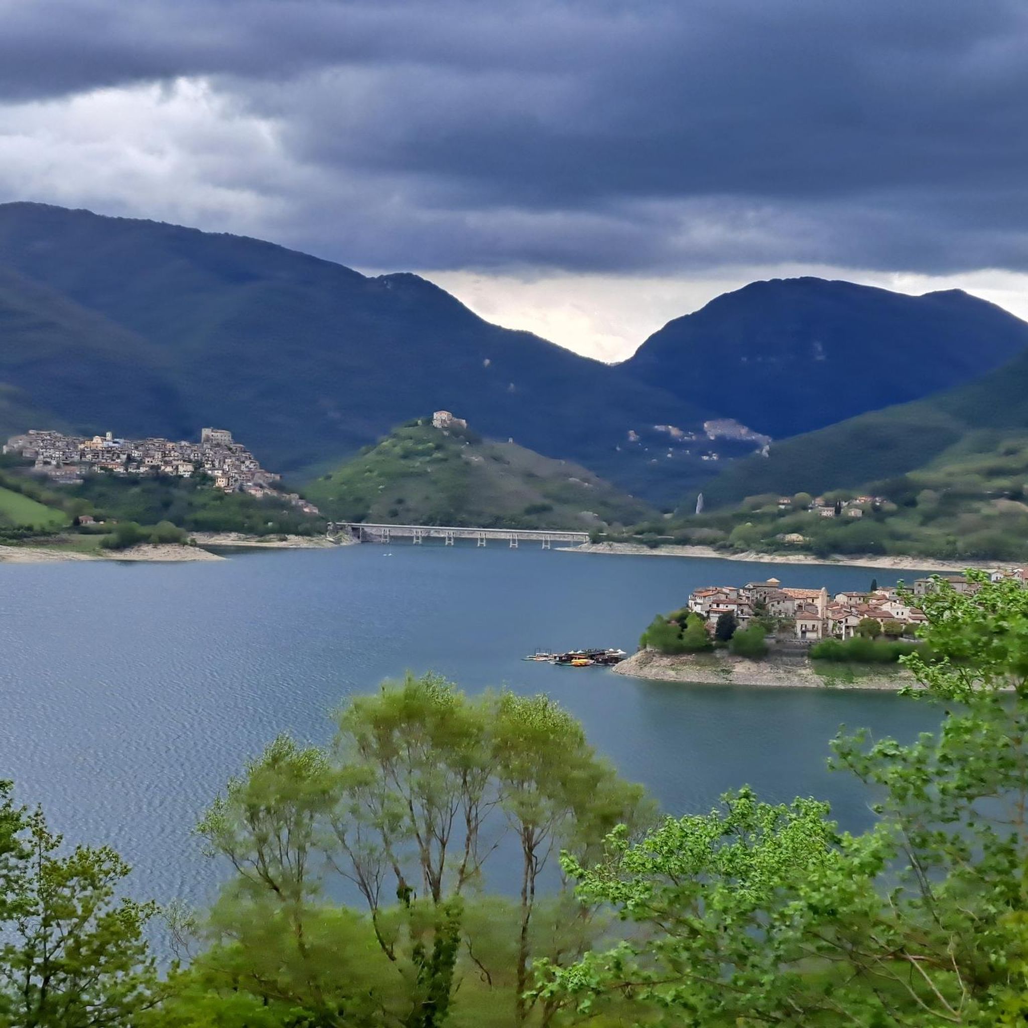
Cycling around Frasso Sabino offers a journey through diverse natural beauty and historical sites. You can encounter picturesque lakes like Lake Turano, and even spot waterfalls such as the Pozze del Diavolo Waterfall or the Acquaviva Waterfall. The region is also rich in medieval villages and historical sites, including the imposing Castello Sforza Cesarini in Frasso Sabino itself, and the ancient Abbey of Farfa.
Are there any circular touring cycling routes available?
Yes, many of the touring cycling routes around Frasso Sabino are designed as loops, allowing you to start and end in the same location. Examples include the View of Palombara Sabina – Murals of the Former Gentili Quarry loop from il Torraccio a Poggio Moiano, which is a 61.0-mile (98.2 km) trail through the Sabine Mountains, and the Rieti, Navel of Italy – Roman Bridge over the Velino River loop from Frasso Sabino.
What is the best time of year to go touring cycling in Frasso Sabino?
The Sabina region, where Frasso Sabino is located, generally offers pleasant cycling conditions for much of the year. Spring and autumn are particularly ideal, with milder temperatures and beautiful landscapes. Summers can be warm, especially in July and August, so early morning or late afternoon rides are recommended during those months. Winters are generally mild but can have cooler, wetter days.
What do other touring cyclists say about the routes in Frasso Sabino?
The touring cycling routes around Frasso Sabino are highly regarded by the komoot community, holding an average rating of 4.8 stars from over 20 reviews. Cyclists often praise the diverse terrain, the scenic views of the Sabine Hills, and the opportunity to explore charming medieval villages and historical sites along the way.
Are there options for family-friendly touring cycling in the area?
While many routes in Frasso Sabino are rated as difficult due to significant elevation changes, the broader Sabina region offers varied terrain. For families, it's advisable to look for routes with less elevation gain and on quieter, paved roads or dedicated paths. You might find more suitable options by exploring routes closer to the valleys or around the edges of the olive groves, which tend to be less strenuous.
Can I bring my dog on touring cycling routes in Frasso Sabino?
Generally, dogs are welcome on public paths and roads in Italy, but specific rules can vary. When cycling, ensure your dog is well-behaved, on a leash if required, and that you carry water and waste bags. For routes that pass through nature reserves or private land, always check local regulations. It's best to choose routes that avoid heavy traffic and provide ample space for your dog's safety and comfort.
Where can I find parking for my car when starting a cycling tour?
In Frasso Sabino and surrounding villages, you can typically find public parking areas. Look for designated parking zones within the village centers or near popular starting points for routes. It's always a good idea to arrive early, especially on weekends, to secure a spot. For longer tours, consider parking in a secure location or at your accommodation if they offer such facilities.
Is public transport available to reach Frasso Sabino with a bicycle?
Public transport options to Frasso Sabino and within the Sabina region primarily consist of regional buses and trains. While some regional trains allow bicycles, it's crucial to check the specific train line's policy and any associated fees or restrictions, especially during peak hours. Bus services often have limited space for bicycles, so it's advisable to confirm with the bus operator in advance.
Are there cafes or places to stop for refreshments along the routes?
Yes, as you cycle through the Sabina region, you'll pass through various medieval villages and small towns. These often have local cafes, trattorias, and small shops where you can stop for refreshments, a coffee, or a meal. Places like Frasso Sabino itself, or nearby villages such as Fara in Sabina and Toffia, are good spots to plan a break. The historic Osteria del Tancia, located in the Sabine Mountains, is also a notable stop for cyclists.
How many touring cycling routes are available around Frasso Sabino?
There are over 50 touring cycling routes available around Frasso Sabino on komoot, offering a wide range of options for different skill levels and preferences. This extensive network allows cyclists to explore the diverse landscapes and historical sites of the Sabina region.
Are there any routes that offer views of lakes or dams?
Yes, some routes in the broader Sabina region can incorporate views of picturesque lakes and dams. For example, the Junction for Rocca Sinibalda – Sanctuary of Santa Vittoria loop from il Torraccio a Poggio Moiano passes near areas that offer glimpses of the region's water features. You can also find specific highlights like the Posticciola Dam and a Viewpoint over Lake Turano, which can be integrated into longer rides.
Most popular attractions around Frasso Sabino

Get inspired with the komoot mobile app


Explore more
Browse the best Cycling routes in other regions.
