The best road cycling routes around Montebello Sul Sangro
4.7
(7)
217
riders
23
rides
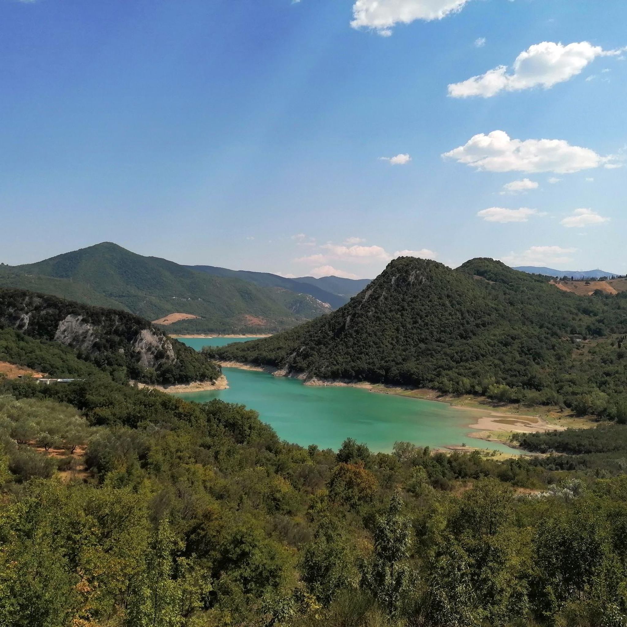
Road cycling routes around Montebello Sul Sangro are characterized by varied terrain within the Abruzzo region of Italy. The town is situated on an elevated ridge at 810 meters above sea level, providing panoramic views of the Sangro Valley and Lake Bomba. Road cyclists can expect a mix of challenging climbs and scenic descents, with the Maiella mountain range visible in the distance. The area features quiet tarmac roads that navigate through this landscape.
Best road cycling routes around Montebello…
Last updated: July 5, 2026
5.0
(1)
22
riders
82.7km
04:33
1,730m
1,730m
Hard road ride. Very good fitness required. Mostly well-paved surfaces and easy to ride.
11
riders
109km
06:01
2,310m
2,310m
Hard road ride. Very good fitness required. Mostly well-paved surfaces and easy to ride.

Sign up for free
5.0
(1)
19
riders
90.1km
04:48
1,050m
1,050m
Hard road ride. Very good fitness required. Some segments of this route may be unpaved and difficult to ride.
13
riders
124km
06:40
2,480m
2,480m
Hard road ride. Very good fitness required. Mostly well-paved surfaces and easy to ride.
8
riders
48.8km
03:38
1,020m
1,020m
Hard road ride. Very good fitness required. Some segments of this route may be unpaved and difficult to ride.
Get access to more routes and recommendations from other explorers.
Sign up for free
Already have an account?
Our route recommendations are based on thousands of hikes, rides, and runs completed by other people on komoot.
Start today with a free account
Your next adventure awaits.
Login or Signup



Tips from the Community

The sanctuary of the Madonna in Saletta is a religious building located in the middle of a pine and fir forest, three kilometers away from the center of the municipality of Castel del Giudice, in the province of Isernia
1
0
Built in the Middle Ages, this gateway is one of the main entrances to the ancient village. On one of its sides, you can read a verse by Gabriele D'Annunzio, which reads: "The city of stone, shone in the clear of May."
0
0

spectacular places, lots of wind.
0
0

The Sangro river originates from Mount Turchio at 1,400 meters and flows into the Adriatic Sea. It is 122 kilometers long and has become quite famous in the world of sport fishing.
2
0

Passo Forchetta, connecting Roccaraso to Campo di Giove, offers a journey through a fresh and lush forest. The road, although the asphalt is not in perfect condition and subject to small landslides, offers a picturesque and fascinating driving experience.
1
0

Originally known as Porta della Fiera, it was rebuilt in 1841 in its current form; it faces via Occidentale, former state road 363, next to the Torre Adriana. The structure, articulated around a round arch, has a regular stone facing only on the external facade. On the top there is a pediment with a coat of arms and an inscription commemorating the date of inauguration of the road.
0
0

You can get here by train with your bike and go for a ride.
8
0
Frequently Asked Questions
What kind of terrain can I expect when road cycling around Montebello Sul Sangro?
Road cycling around Montebello Sul Sangro offers a diverse and engaging experience. Situated on an elevated ridge at 810 meters above sea level, the area features varied terrain with both challenging climbs and scenic descents. You'll find quiet tarmac roads winding through the landscape, providing panoramic views of the Sangro Valley, Lake Bomba, and the majestic Maiella mountain range in the distance.
How many road cycling routes are available in the Montebello Sul Sangro area?
There are over 15 road cycling routes available around Montebello Sul Sangro. These routes primarily cater to cyclists looking for challenging rides, with a few moderate options also present.
Are there any easy or family-friendly road cycling routes near Montebello Sul Sangro?
The road cycling routes around Montebello Sul Sangro are predominantly rated as difficult, with only one moderate route identified. The terrain, characterized by significant elevation changes due to the region's elevated ridges and valleys, means that truly easy or flat family-friendly road cycling paths are limited. Cyclists seeking less strenuous options might consider exploring the broader Sangro Valley floor, though specific easy routes are not highlighted in this area.
What are some notable landmarks or viewpoints I can encounter on road cycling routes?
The region around Montebello Sul Sangro is rich in historical and natural sights. While cycling, you might pass by the impressive Castello di Roccascalegna, a medieval castle perched dramatically on a rock spur. Other points of interest include the Church of Saint Peter and the Waterfall in Gola di Pennadomo. Many routes also offer stunning panoramic views, such as the View from Roccascalegna Castle, showcasing the surrounding valleys and mountains.
Are there any circular road cycling routes available?
Yes, many of the road cycling routes in the Montebello Sul Sangro area are designed as loops. For example, you can explore the Quarto Grande Plateau – Bar Stazione di Palena loop from Civitaluparella, which offers expansive views, or the Sanctuary of Madonna in Saletta loop from Civitaluparella, winding through the landscape to a notable sanctuary. Another option is the Pietraferrazzana Rock Spur – Capracotta loop from San Carlo, known for its varied terrain and significant elevation changes.
What is the best time of year to go road cycling in Montebello Sul Sangro?
The Abruzzo region, including Montebello Sul Sangro, generally offers pleasant conditions for road cycling from spring through autumn. Spring brings blooming landscapes, while autumn provides cooler temperatures and vibrant foliage. Summers can be warm, especially in the valleys, but the elevated position of Montebello Sul Sangro (810m) can offer some relief. Always check local weather forecasts before heading out.
What do other cyclists say about road cycling in Montebello Sul Sangro?
The road cycling routes around Montebello Sul Sangro are highly regarded by the komoot community, holding an average rating of 5.0 stars from 2 reviews. Over 114 road cyclists have used komoot to explore the varied terrain, often praising the challenging climbs, scenic descents, and the panoramic views of the Sangro Valley and Lake Bomba.
Are there any routes that pass by the historic old town of Montebello Sul Sangro?
While specific routes directly through the ancient part of Montebello Sul Sangro (Buonanotte Vecchia) are not detailed as road cycling paths, the town itself is a significant landmark. Its old village, with stone houses and ruins like the Caracciolo Castle and Santa Giusta church bell tower, offers a unique historical backdrop. Cyclists in the area will experience the town's elevated position and its peculiar, age-old beauty, making it a worthy point of interest for a stop or a detour.
What are the typical elevation changes on road cycling routes in this area?
Given Montebello Sul Sangro's location on an elevated ridge and its views of the Maiella mountain range, road cycling routes in this area feature significant elevation changes. For instance, routes can involve climbs of over 1,700 meters, such as the Quarto Grande Plateau – Bar Stazione di Palena loop from Civitaluparella or the Pietraferrazzana Rock Spur – Capracotta loop from San Carlo. These profiles contribute to the routes being predominantly rated as difficult.
Can I find accommodation or places to eat that are cyclist-friendly in Montebello Sul Sangro?
Montebello Sul Sangro, nestled in nature, offers a peaceful environment. While specific cyclist-friendly establishments are not detailed, the town and surrounding villages in the Abruzzo region are generally welcoming to visitors. You can expect to find local cafes, pubs, and accommodation options that cater to tourists and outdoor enthusiasts. It's advisable to check in advance for specific amenities like secure bike storage.
Are there any routes that offer views of Lake Bomba?
Yes, Montebello Sul Sangro's elevated position provides panoramic views of the surrounding area, including the clear waters of Lake Bomba, which lies just below the town. Many road cycling routes in the region will offer glimpses or direct views of the lake as you navigate the varied terrain and scenic descents.
What is the longest road cycling route available in the area?
One of the longer road cycling routes in the area is the Pietraferrazzana Rock Spur – Capracotta loop from San Carlo, which spans approximately 92.4 kilometers (57.4 miles) and involves significant elevation changes.
Most popular routes around Montebello Sul Sangro
Most popular attractions around Montebello Sul Sangro

Get inspired with the komoot mobile app


Explore more
Browse the best Road cycling routes in other regions.
