The best road cycling routes around Río Guadiana Menor - Tramo Superíor
5.0
(2)
189
riders
20
rides
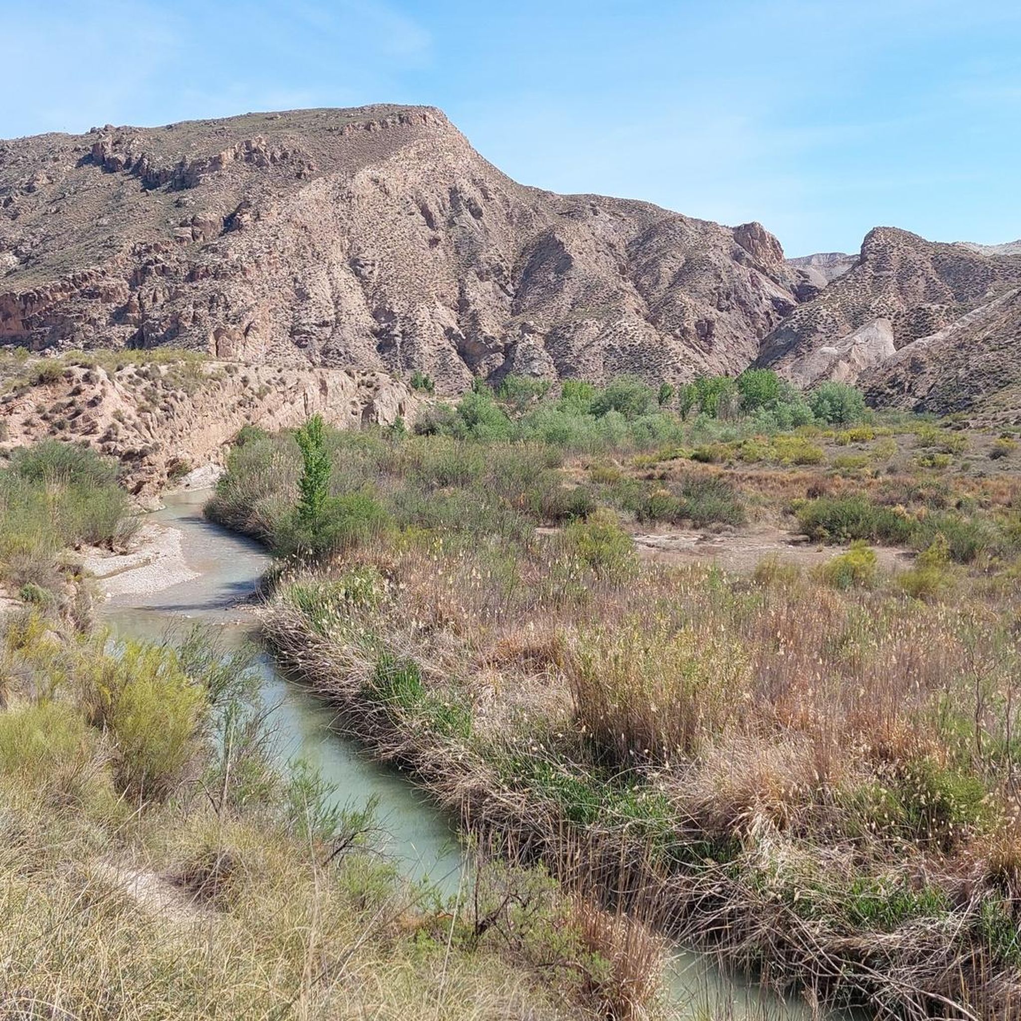
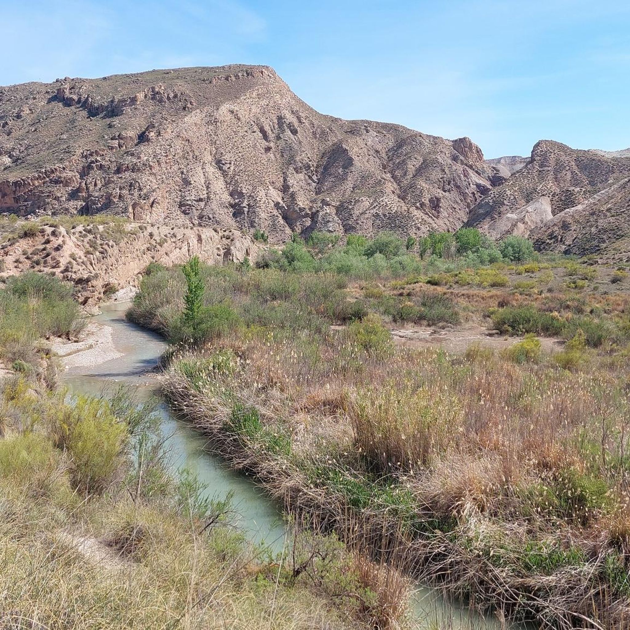
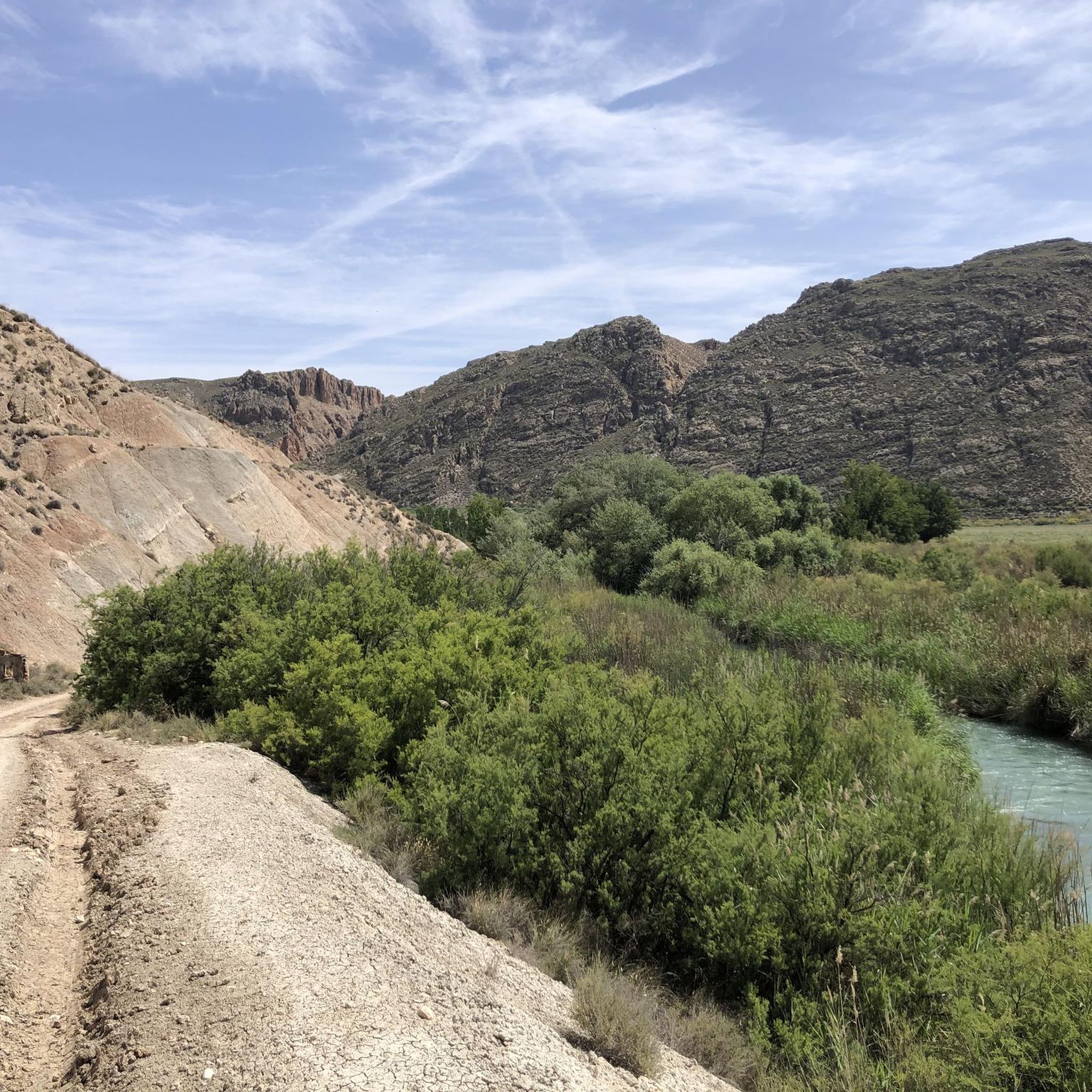
Road cycling routes around Río Guadiana Menor - Tramo Superíor traverse a region characterized by diverse natural landscapes, including unique badlands and barrancos. The area features varied terrain, from riparian ecosystems along the riverbanks to vast stepparian plateaus and Mediterranean forests. Cyclists can expect mostly paved surfaces, offering engaging rides through striking geological formations and changing scenery. This upper section of the Río Guadiana Menor provides a compelling destination for exploring its natural beauty by road bike.
Best road cycling…
Last updated: July 13, 2026
11
riders
62.9km
03:17
720m
720m
Moderate road ride. Good fitness required. Mostly well-paved surfaces and easy to ride.
3
riders
36.8km
02:12
940m
930m
Hard road ride. Very good fitness required. Some segments of this route may be unpaved and difficult to ride.

Sign up for free
1
riders
29.5km
01:26
180m
180m
Easy road ride. Great for any fitness level. Mostly well-paved surfaces and easy to ride.
23
riders
30.6km
01:39
490m
490m
Moderate road ride. Good fitness required. Some segments of this route may be unpaved and difficult to ride.
20
riders
69.6km
03:55
1,490m
1,490m
Hard road ride. Very good fitness required. Some segments of this route may be unpaved and difficult to ride.
12
riders
132km
07:42
3,090m
3,090m
Hard road ride. Very good fitness required. Some segments of this route may be unpaved and difficult to ride.
12
riders
46.3km
02:22
700m
700m
Moderate road ride. Good fitness required. Mostly well-paved surfaces and easy to ride.
8
riders
88.0km
04:19
1,190m
1,190m
Hard road ride. Very good fitness required. Mostly well-paved surfaces and easy to ride.
7
riders
67.4km
03:43
1,150m
1,160m
Hard road ride. Very good fitness required. Some segments of this route may be unpaved and difficult to ride.
7
riders
37.8km
02:06
800m
800m
Moderate road ride. Good fitness required. Mostly well-paved surfaces and easy to ride.
Get access to more routes and recommendations from other explorers.
Sign up for free
Already have an account?
Our route recommendations are based on thousands of hikes, rides, and runs completed by other people on komoot.
Start today with a free account
Your next adventure awaits.
Login or Signup

Tips from the Community


A town located in the southeast of the province, at the foot of the Sierra de Cazorla and facing the olive-growing countryside. Birthplace of the painter Rafael Zabaleta, to whom he has dedicated a museum with a large part of his work. It is a colorful collection of narrow streets with white houses in which the church of San Pedro and San Pablo, the church of the hospital, the Arco de la Manquita de Utrera and the Arco de Los Santos or del Señor stand out.
11
0
Here you can once again safely survey the landscape and its olive trees.
3
0
Here you can safely survey the landscape from a parallel parking lot/road.
0
0

Castril is a wonderful destination in the province of Granada! Castril Castle: Located on La Peña, this castle offers stunning views of the town and its surroundings. Although it is in ruins, it can be visited on guided tours Historic Center: Stroll through the cobbled streets and white houses adorned with flowers. Don't miss the Church of Nuestra Señora de los Ángeles Sendero de la Cerrada del Río Castril: A spectacular walk through walkways and wooden bridges over the Castril River Sierra de Castril Natural Park: Enjoy nature with trails, waterfalls and stunning landscapes
0
0
Castril is a wonderful destination in the province of Granada! Castril Castle: Located on La Peña, this castle offers stunning views of the town and its surroundings. Although it is in ruins, it can be visited on guided tours Historic Center: Stroll through the cobbled streets and white houses adorned with flowers. Don't miss the Church of Nuestra Señora de los Ángeles Sendero de la Cerrada del Río Castril: A spectacular walk through walkways and wooden bridges over the Castril River Sierra de Castril Natural Park: Enjoy nature with trails, waterfalls and stunning landscapes
8
0
The El Portillo reservoir or El Portillo Dam is located on the Castril River, in the municipality of Castril, in the province of Granada. This reservoir belongs to the Guadalquivir Hydrographic Confederation, in the Granada area.
2
0
The El Portillo reservoir or El Portillo Dam is located on the Castril River, in the municipality of Castril, in the province of Granada. This reservoir belongs to the Guadalquivir Hydrographic Confederation, in the Granada area.
1
0
Frequently Asked Questions
What kind of terrain and landscapes can I expect on road cycling routes in Río Guadiana Menor - Tramo Superior?
The region offers a diverse range of landscapes, from unique badlands and dramatic barrancos to riparian ecosystems along the riverbanks. You'll also encounter vast stepparian plateaus and Mediterranean forests. The routes feature mostly paved surfaces, providing engaging rides through striking geological formations and constantly changing scenery.
Are there road cycling routes suitable for beginners or those looking for an easy ride?
Yes, there are routes suitable for various skill levels. For an easier option, consider the Fontanar y Cuevas del Campo — circular desde Pozo Alcón. This 18.3-mile (29.5 km) trail is rated as easy and typically takes about 1 hour 25 minutes to complete, with minimal elevation gain.
What are some challenging road cycling routes in the Río Guadiana Menor - Tramo Superior region?
For experienced cyclists seeking a challenge, the region offers several difficult routes. The Granada Geopark: Pozo Alcón and Castril Loop is a demanding 54.9-mile (88.3 km) trail with significant elevation gain. Another difficult option is the Negratín Reservoir Loop, covering over 100 km with substantial climbing.
What natural features or landmarks can I see while road cycling in this area?
The region is renowned for its unique geological formations, including dramatic 'badlands' and 'barrancos' (ravines), particularly around the Negratín badlands and the 'Los Coloraos Desert'. You'll also ride alongside the Río Guadiana Menor with its riparian vegetation, and through pine-holm oak forests. The Negratín Reservoir is another prominent natural landmark visible on several routes.
Are there any circular road cycling routes available?
Yes, many of the routes in the Río Guadiana Menor - Tramo Superior are designed as loops. Examples include the Negratín Reservoir Loop via Pozo Alcón and Hinojares, the Dehesas de Guadix - Villanueva - Pedro Martínez Loop, and the Puerto de Tíscar Loop from Hinojares.
What is the best time of year for road cycling in Río Guadiana Menor - Tramo Superior?
While specific seasonal data isn't provided, regions in Andalusia typically offer pleasant cycling conditions during spring (March to May) and autumn (September to November) when temperatures are milder. Summers can be very hot, and winters can be cooler, especially at higher elevations. It's always advisable to check local weather forecasts before your ride.
Can I find accommodation or places to eat near the cycling routes?
The region encompasses municipalities such as Freila, Gorafe, Guadix, and Pozo Alcón. These towns are good starting points for routes and likely offer various services including cafes, restaurants, and accommodation options for cyclists. It's recommended to check specific towns along your chosen route for available amenities.
What is the typical duration for road cycling routes in this area?
Route durations vary significantly based on distance, elevation, and your cycling pace. Easy routes like Fontanar y Cuevas del Campo — circular desde Pozo Alcón can take around 1.5 hours, while moderate routes such as Negratín Reservoir Loop via Pozo Alcón and Hinojares might take 3-4 hours. More difficult and longer routes, like the Puerto de Tíscar – La Yedra Castle loop from Pozo Alcón, can extend to 8 hours or more.
Is public transport available to access the road cycling routes?
While specific public transport details for accessing trailheads are not provided, the region includes several municipalities like Freila, Zújar, and Pozo Alcón. These towns may have bus connections from larger cities in Andalusia. Cyclists often drive to a starting point and park, or arrange private transport. It's best to research transport options to your specific starting location.
Are there opportunities for wildlife spotting along the road cycling routes?
Yes, the diverse ecosystems of the Río Guadiana Menor - Tramo Superior region offer opportunities for wildlife observation. The riparian areas are home to notable bird species like the purple heron and black-winged stilt, as well as otters. The surrounding dry landscapes and forests also support various flora and fauna, making for an interesting ride for nature enthusiasts.
How many road cycling routes are available in the Río Guadiana Menor - Tramo Superior region?
There are over 15 road cycling routes available in the Río Guadiana Menor - Tramo Superior region, catering to various difficulty levels from easy to difficult. This provides ample choice for exploring the area by bike.
What do other road cyclists say about the routes in Río Guadiana Menor - Tramo Superior?
The road cycling routes in Río Guadiana Menor - Tramo Superior are highly rated by the komoot community, with an average score of 5.0 stars. Over 150 road cyclists have used komoot to explore the varied terrain, often praising the unique badlands, riparian ecosystems, and stepparian plateaus that define the region's scenic beauty.
Most popular routes around Río Guadiana Menor - Tramo Superíor

Get inspired with the komoot mobile app


Explore more
Browse the best Road cycling routes in other regions.
