The best MTB trails around Río Guadiana Menor - Tramo Superíor
4.6
(93)
369
riders
21
rides
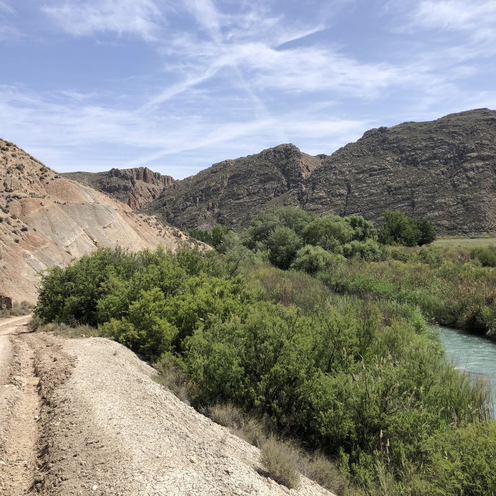
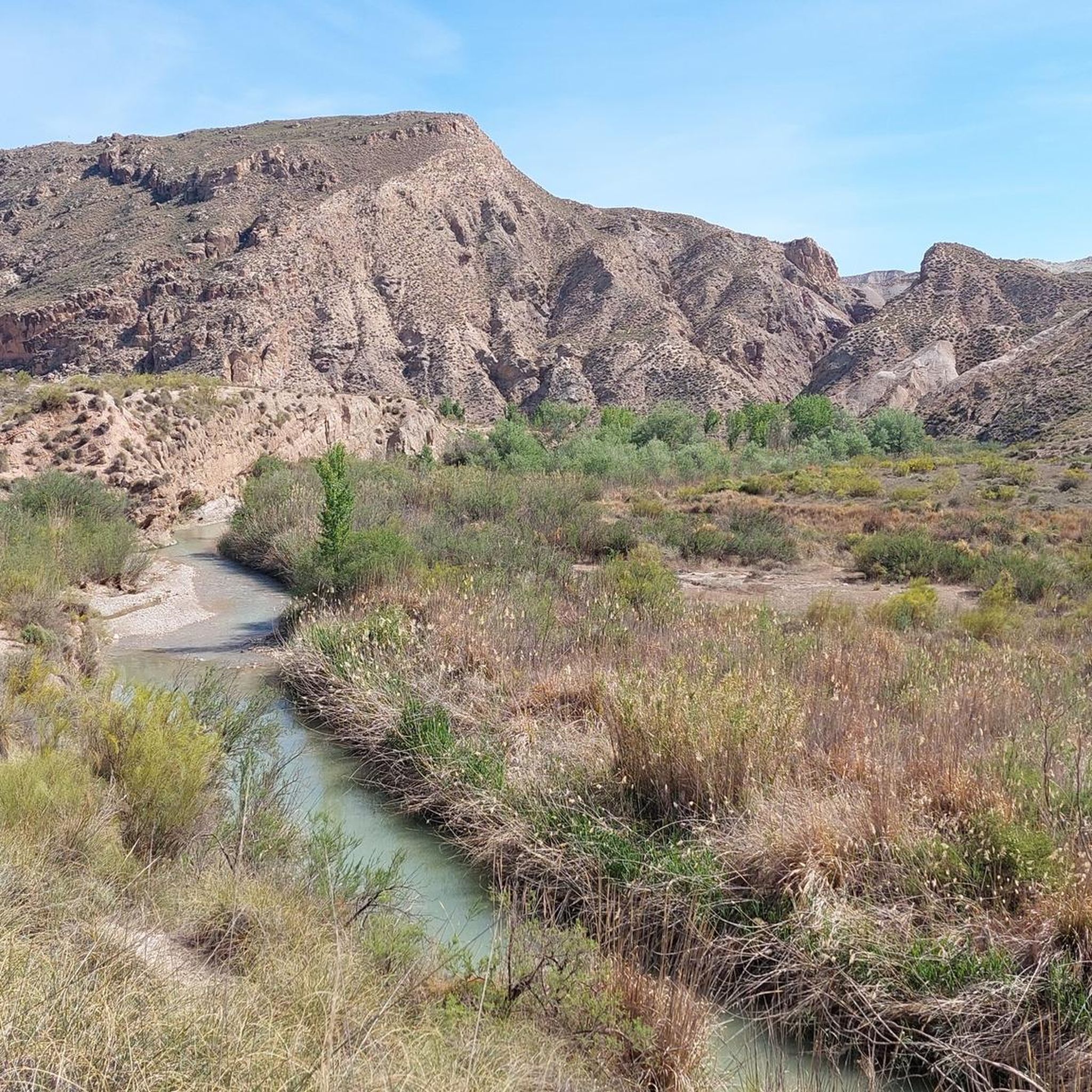
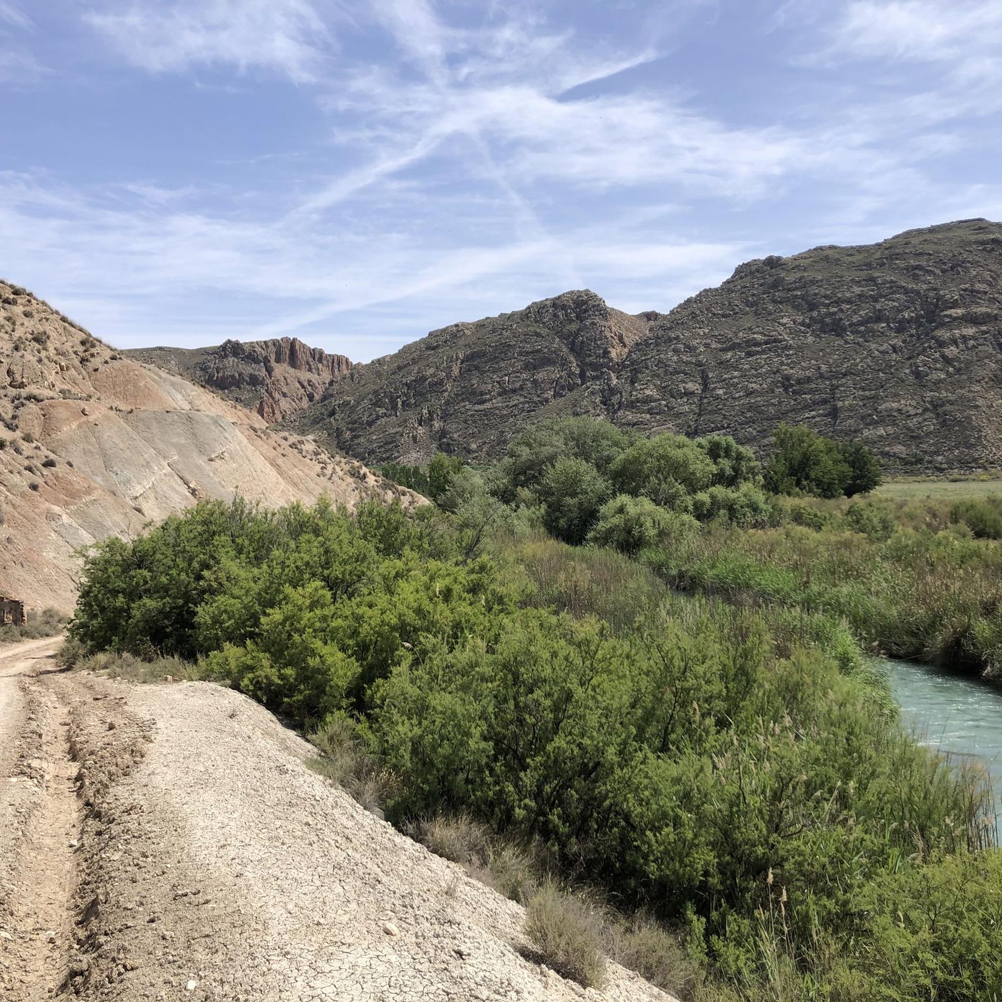
Mountain biking around Río Guadiana Menor - Tramo Superíor offers diverse landscapes across the Comarca de Guadix, characterized by its unique riverine environment and dramatic "badlands" formations. The region features steppe plateaus, semi-arid pine and kermes oak forests, and Mediterranean scrub, providing varied terrain for mountain bikers. The hydrological network of the Guadiana Menor flows through alluvial plains and floodplains, with gentle slopes in the lowlands and hills with moderate structural influence. This area, recognized as a Special Area of…
Last updated: July 10, 2026
5.0
(1)
3
riders
29.2km
02:43
640m
640m
Moderate mountain bike ride. Good fitness required. Suitable for all skill levels.
37.3km
03:10
600m
600m
Moderate mountain bike ride. Good fitness required. Suitable for all skill levels.

Sign up for free
4.1
(9)
20
riders
Moderate mountain bike ride. Good fitness required. Suitable for all skill levels.
4.0
(2)
15
riders
55.3km
05:19
1,130m
1,130m
Hard mountain bike ride. Very good fitness required. Advanced riding skills necessary.
6
riders
65.2km
05:41
1,010m
1,010m
Hard mountain bike ride. Very good fitness required. Suitable for all skill levels.
13
riders
69.4km
06:33
1,960m
1,960m
Hard mountain bike ride. Very good fitness required. Suitable for all skill levels.
5.0
(1)
7
riders
60.0km
04:53
1,090m
1,090m
Hard mountain bike ride. Very good fitness required. Suitable for all skill levels.
4.5
(2)
7
riders
38.4km
03:10
540m
540m
Moderate mountain bike ride. Good fitness required. Suitable for all skill levels.
5.0
(1)
6
riders
32.2km
03:25
960m
960m
Hard mountain bike ride. Very good fitness required. Advanced riding skills necessary.
5.0
(2)
5
riders
28.2km
02:50
870m
870m
Moderate mountain bike ride. Good fitness required. Suitable for all skill levels.
Get access to more routes and recommendations from other explorers.
Sign up for free
Already have an account?
Our route recommendations are based on thousands of hikes, rides, and runs completed by other people on komoot.
Start today with a free account
Your next adventure awaits.
Login or Signup

Tips from the Community

In April 2026, after the rains, the spring was flowing strongly. It was appreciated to find this spring right next to the forest track.
1
0

Added to the collection: https://www.komoot.com/de-de/collection/3600632/-naturdenkmaeler-besondere-baeume-und-weitere-schaetze-der-natur
0
0
Added to the collection: https://www.komoot.com/de-de/collection/3600632/-naturdenkmaeler-besondere-baeume-und-weitere-schaetze-der-natur
2
0

Very nice little place with the best view.
0
0

The 47 km loop is breathtaking for about half of the tour: mind-blowing views as far as the eye can see over 360°. Then in the second part, lots of roads that climb constantly... you have to be in good shape for this loop. The little extra: the tapas bar in the city center after that.
1
0

The Negratín reservoir was inaugurated in 1984 and its construction meant the disappearance of the town of Las Juntas and the old spa of Zujar, as well as various farmhouses that remained under the waters of the reservoir. The Negratín reservoir is the second largest reservoir in the Autonomous Community of Andalusia, with more than 567 Hm3.
7
0

Tough climb but the gravel surface was good to do. Beautiful view over the surprisingly green valley.
1
1

At this intersection is where the Hornico nature classroom is located, dependent on the Department of the Environment of the Government of Andalusia, and it is from where courses are taught mainly to schoolchildren who come from various points of our geography.
13
0
Frequently Asked Questions
What types of mountain bike trails can I find in Río Guadiana Menor - Tramo Superior?
The region offers a diverse range of mountain bike trails, from moderate rides to challenging routes requiring good fitness. You'll encounter varied terrain including riverine environments, dramatic "badlands" formations, steppe plateaus, and semi-arid pine and kermes oak forests. There are 14 moderate and 9 difficult routes available, ensuring options for different skill levels.
Are there any family-friendly mountain bike trails in the area?
While the region features many moderate and difficult trails, some routes offer gentler slopes suitable for families. For a moderate option, consider Puntal Blanco — circular desde el Embalse del Negratín, which is 18.1 miles (29.2 km) long and offers scenic views. Always check the route details on komoot for specific difficulty and terrain to ensure it matches your family's experience level.
Can I bring my dog on the mountain bike trails?
Many trails in the Río Guadiana Menor - Tramo Superior region are suitable for dogs, especially those that follow wider tracks or less technical terrain. However, it's always advisable to check local regulations and ensure your dog is well-behaved and on a leash where required. Be mindful of the semi-arid climate, especially during warmer months, and ensure you carry enough water for both yourself and your dog.
What natural features and viewpoints can I expect to see along the trails?
The region is rich in natural beauty. You'll ride through the unique riverine environment of the Guadiana Menor, characterized by lush vegetation like tamarisk groves and poplars. The dramatic "badlands" of the Guadix Depression offer striking eroded geological formations, and routes like Puntal de Don Diego Viewpoint – Los Coloraos Badlands loop from Bácor lead to panoramic viewpoints. The Negratín Reservoir is another significant scenic highlight.
Are there any circular mountain bike routes available?
Yes, many of the mountain bike routes in Río Guadiana Menor - Tramo Superior are circular, allowing you to start and end at the same point. Examples include Puntal Blanco — circular desde el Embalse del Negratín and Los Coloraos Badlands – Gorafe Desert Canyons loop from Cuevas del Campo. These loops are convenient for planning your ride.
What is the best time of year to go mountain biking in Río Guadiana Menor - Tramo Superior?
The best times for mountain biking are typically spring (March to May) and autumn (September to November) when temperatures are milder. Summers can be very hot in this semi-arid region, making early morning or late afternoon rides preferable. Winters are generally mild, but some trails might be affected by rain, so checking trail conditions beforehand is recommended.
Where can I find parking for mountain bike trails?
Parking availability varies by trailhead. Many routes, especially those starting from towns like Cuevas del Campo, Bácor, Freila, or Pozo Alcón, will have designated parking areas or suitable roadside spots. For example, routes around the Negratín Reservoir often have parking near access points. Always check the route description on komoot for specific parking recommendations.
Are there any cafes or restaurants near the mountain bike trails?
Yes, you'll find cafes and restaurants in the nearby towns and villages such as Gorafe, Freila, Zújar, and Pozo Alcón. These places offer opportunities to refuel and relax before or after your ride. It's a good idea to plan your route to pass through or near these settlements if you intend to stop for refreshments.
Do I need any special permits for mountain biking in this region?
Generally, no special permits are required for mountain biking on established trails in the Río Guadiana Menor - Tramo Superior region, which is recognized as a Special Area of Conservation (ZEC). However, always respect local signage and regulations, especially when riding through protected areas or private land. Stay on marked trails to minimize environmental impact.
What do other mountain bikers enjoy most about the trails here?
The mountain bike trails in Río Guadiana Menor - Tramo Superior are highly rated by the komoot community, with an average score of 4.8 stars from over 70 reviews. Riders frequently praise the diverse landscapes, from the unique "badlands" formations to the tranquil riverine environments, and the variety of routes suitable for different skill levels. The sense of adventure and the stunning views are often highlighted.
Are there any particularly challenging mountain bike routes for experienced riders?
Yes, experienced riders looking for a challenge will find several difficult routes. For instance, the Pine of the Crosses – Desert Landscape of Pozo Alcón loop from Pozo Alcón is a demanding 42.5 miles (68.3 km) trail with over 2000 meters of elevation gain. Another difficult option is the Gorafe Desert – Gorafe Desert Canyons loop from Central Hidroeléctrica de Negratín, which spans 52.3 miles (84.1 km).
Most popular routes around Río Guadiana Menor - Tramo Superíor

Get inspired with the komoot mobile app


Explore more
Browse the best MTB trails in other regions.
