The best cycling routes in Pena Veidosa
5.0
(1)
52
riders
3
rides
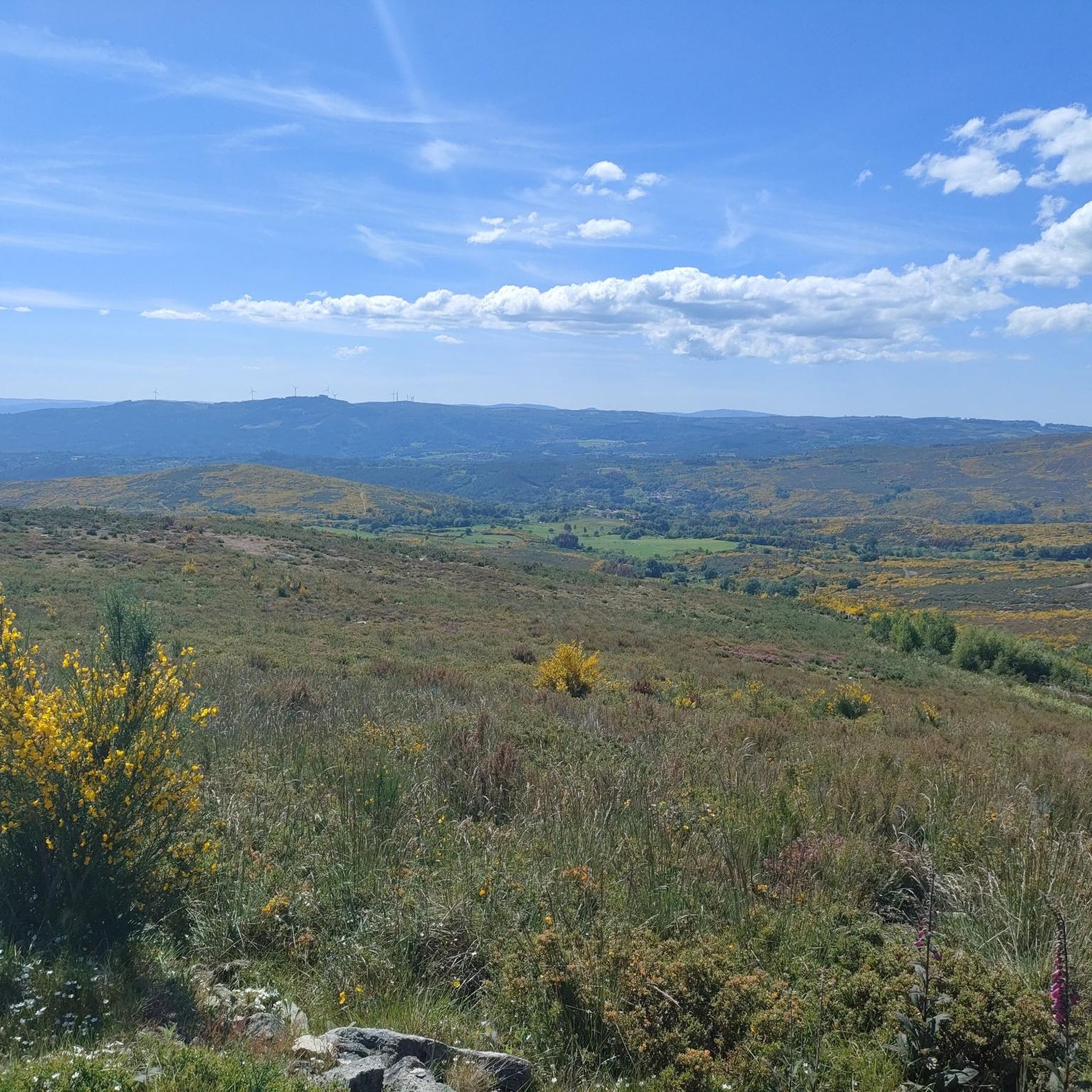
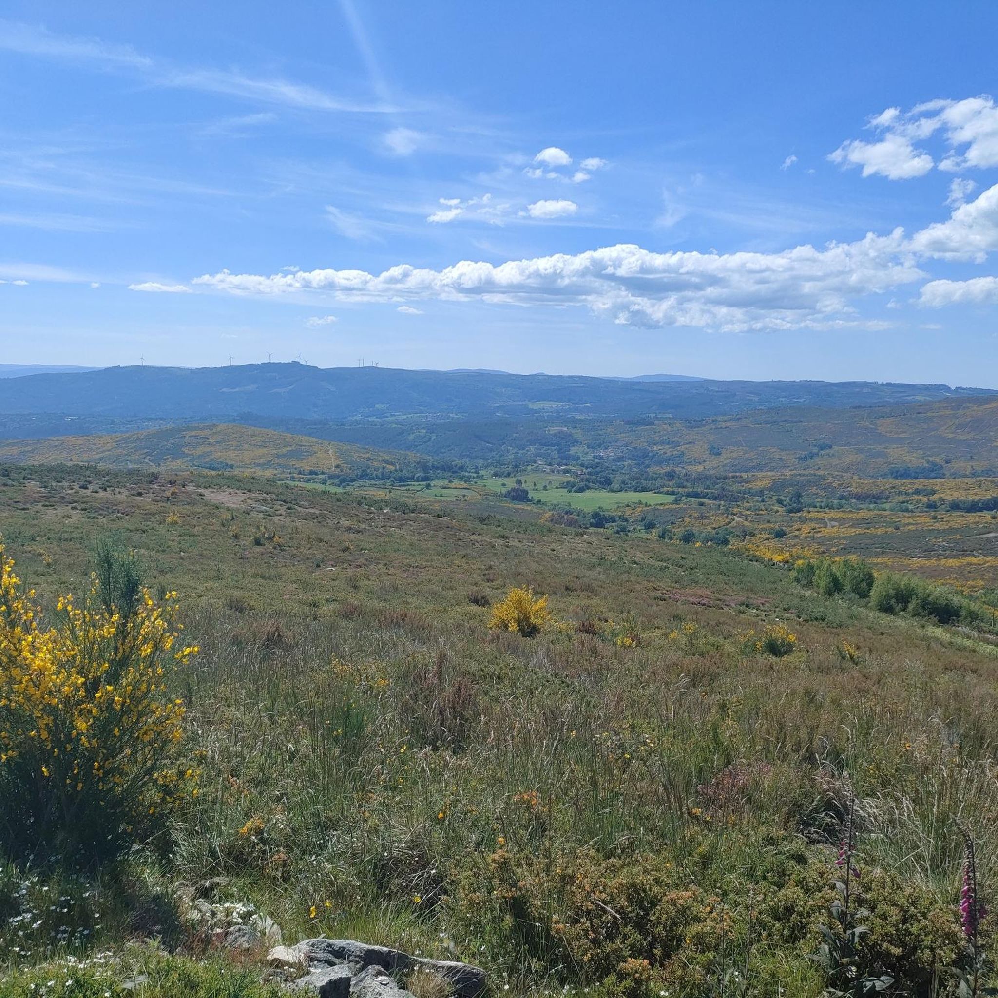
Touring cycling routes in Pena Veidosa traverse a Special Area of Conservation within Galicia, Spain, characterized by diverse landscapes. The region features low mountain terrain, extensive heathlands, and oak forests, with high-altitude areas sculpted by wind erosion revealing granite boulders. Located in the Dorsal Gallega mountain range, it includes the prominent Serra de Martiñá, which rises to over 1000 meters above sea level. The Arenteiro and Oseira rivers also flow through this natural space, offering varied terrain for touring cyclists.
…Last updated: October 2, 2026
24
riders
33.3km
02:58
750m
760m
Hard bike ride. Very good fitness required. Mostly paved surfaces. Suitable for all skill levels.
5.0
(2)
18
riders
53.5km
04:01
1,040m
1,040m
Hard bike ride. Very good fitness required. Mostly paved surfaces. Suitable for all skill levels.

62.7km
04:29
1,320m
1,320m
Hard bike ride. Very good fitness required. Mostly paved surfaces. Suitable for all skill levels.
4
riders
35.9km
02:51
570m
570m
Hard bike ride. Very good fitness required. Mostly paved surfaces. Suitable for all skill levels.
6
riders
81.4km
06:34
1,580m
1,580m
Hard bike ride. Very good fitness required. Mostly paved surfaces. Suitable for all skill levels.
Our route recommendations are based on thousands of hikes, rides, and runs completed by other people on komoot.
Start today with a free account
Your next adventure awaits.
Popular around Pena Veidosa

Tips from the Community

General tourist information, free maps and brochures, cultural events calendar, details on accommodation and restaurants, guided tours, and train and bus timetables. Assistance with provincial plans, ecotourism, and sustainable tourism recommendations. Provides maps, brochures, and guidance for discovering Ourense and its surroundings.
1
0
The Monastery of Santa María la Real de Oseira is located in the parish of Oseira (municipality of San Cristovo de Cea, Ourense), about 34 km from the city of Ourense and near the borders with Pontevedra and Lugo. Founded in 1137 by a group of hermits, it joined the Cistercian Order of Clairvaux in 1141. During the 12th and early 13th centuries, its main church was built, becoming one of the largest Cistercian monasteries in Spain. In 1552, a fire devastated the complex, but the church survived and retains an elegant, understated architectural style.
1
0
It spans the Miño River, linking the historic center of Ourense with the A Ponte neighborhood. It was built in the 1st century AD as a branch of the Via Nova (Via XVIII), connecting Bracara Augusta (Braga) with Asturica Augusta (Astorga). Only traces of the original Roman phase remain, such as rusticated stonework at the ends near the banks. It suffered damage during the Middle Ages; in 1228, under Bishop Lorenzo and with the support of Ferdinand III, it was rebuilt with pointed arches and renovated approaches. Until the 17th century, the bridge repeatedly collapsed. The final work was directed by Melchor de Velasco Agüero around 1660, establishing its current appearance.
1
0
The Roman bridge in Ourense, known as Ponte Vella or Puente Mayor, over the Miño River, was built in the 1st century AD as part of a branch of the Via Nova (Eighteenth Century). According to tradition, it dates back to the time of Trajan, although its construction characteristics place it close to the time of Augustus. Of that first bridge, only a few cushioned ashlars from the bases remain, as silent witnesses of the past.
1
0


The tourism office is on the south end of the famous stone bridge (Puente Romano) over the Miño River
0
1

Great mural. The Lego figures give it a very special look.
1
0

Excellent town to take a break
0
0
Frequently Asked Questions
What is the general difficulty level of touring cycling routes in Pena Veidosa?
Touring cycling routes in Pena Veidosa are generally considered challenging. All available routes are rated as difficult, featuring significant elevation gains and varied terrain suitable for experienced cyclists.
What kind of terrain will I encounter on touring cycling routes in Pena Veidosa?
You can expect diverse terrain, including low mountain landscapes, extensive heathlands, and oak forests. The region is part of the Dorsal Gallega mountain range, with high-altitude areas featuring impressive granite boulders sculpted by wind erosion. Routes often include ascents and descents through these natural features.
Are there any less crowded touring cycling routes in Pena Veidosa?
For a potentially less crowded experience, consider the Mel do Saldoiro – Rodeiro Town Hall loop from Rodeiro. This route offers a challenging ride through the Galician countryside, allowing you to explore the area's natural beauty away from more frequently mentioned paths.
What are the typical distances and durations for touring cycling routes in Pena Veidosa?
The touring cycling routes in Pena Veidosa vary in length and duration. For example, the Chantada Town Center – Rodeiro Town Hall loop from Rodeiro is one of the longer options, covering approximately 50.7 miles (81.6 km) and typically taking around 6 hours 38 minutes to complete. Other routes range from about 20.5 miles (33.0 km) to 39.0 miles (62.7 km).
What are some scenic viewpoints or natural features to look out for on the touring routes?
Pena Veidosa is rich in natural beauty. You'll find extensive heathlands, ancient oak forests, and impressive granite boulders, especially in higher altitude areas. The region also features the Arenteiro and Oseira rivers, and the prominent Serra de Martiñá, which rises over 1000 meters above sea level, offering panoramic views.
What is the best season for touring cycling in Pena Veidosa?
Given the mountainous terrain and potential for varied weather, spring and autumn are generally ideal for touring cycling in Pena Veidosa. These seasons offer milder temperatures and beautiful natural scenery. Summers can be warm, while winters may bring colder conditions and potentially more challenging riding.
Are there any circular touring cycling routes available in Pena Veidosa?
Yes, several touring cycling routes in Pena Veidosa are designed as loops. An example is the Oseira Monastery – Oseira Fountain loop from Velorio Municipal, which allows you to start and finish at the same point after exploring the area.
What kind of wildlife might I encounter while cycling in Pena Veidosa?
Pena Veidosa is a Special Area of Conservation, home to diverse wildlife. You might spot various bird species like the common goshawk, Dartford warbler, or Montagu's harrier. The area also hosts the long-tailed salamander, stag beetle, and several bat species, including forest bats and horseshoe bats.
What do other touring cyclists say about their experience in Pena Veidosa?
The touring cycling routes in Pena Veidosa are highly rated by the komoot community, with an average score of 5.0 stars. Cyclists often praise the challenging ascents, the scenic rides through protected natural landscapes, and the opportunity to explore the diverse terrain of Galicia.
Are there any touring cycling routes that pass by historical landmarks?
Yes, some routes incorporate historical points of interest. For instance, the Monte Faro and Mosteiro de Oseira route passes by the historic Oseira Monastery, offering a chance to combine your ride with cultural exploration.
How many touring cycling routes are available for Pena Veidosa?
There are currently 5 touring cycling routes available in Pena Veidosa, all of which are rated as difficult, providing challenging options for cyclists.

Get inspired with the komoot mobile app


Explore more
Browse the best Cycling routes in other regions.
