Attractions and Places To See around Thruscross Reservoir - Top 4
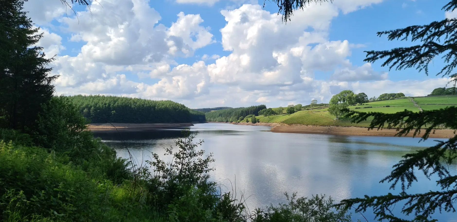
Best attractions and places to see around Thruscross Reservoir include the reservoir itself, a significant natural feature in the Washburn Valley. It is the northernmost and highest of the four reservoirs, offering a remote and scenic landscape. The area is known for its surrounding moorland, woodlands, and the historical site of the submerged West End village. Visitors can explore diverse landscapes and historical remnants.
Best attractions and places to see around Thruscross Reservoir
- The most popular attractions is Thruscross Reservoir…
Last updated: August 18, 2026
Thruscross Reservoir
Highlight • Viewpoint
Tip by

Ruins of West End Village at Thruscross Reservoir
Highlight • Settlement
Tip by

Sign up now to discover places like this
Get recommendations on the best single tracks, peaks, & plenty of other exciting outdoor places.
Sign up for free
Scot Lane Lakeside Path
Highlight • Trail
Tip by
Thruscross Reservoir Car Park
Highlight • Parking
Tip by

Holme Field Head Ruins
Highlight • Viewpoint
Tip by
Start today with a free account
Your next adventure awaits.
Login or Signup
Other adventures around Thruscross Reservoir

Tips from the Community

Imposing and deserted building overlooking the northern end of Thruscross Reservoir. Recorded by the Yorkshire Vernacular Buildings Group in 1976: "The 1841 census return shows it to have been occupied by a young unmarried woman called Ann Young farming over 200 acres; a family with the same surname contemporaneously occupied Whit Moor Farm with a similar acreage."
1
0
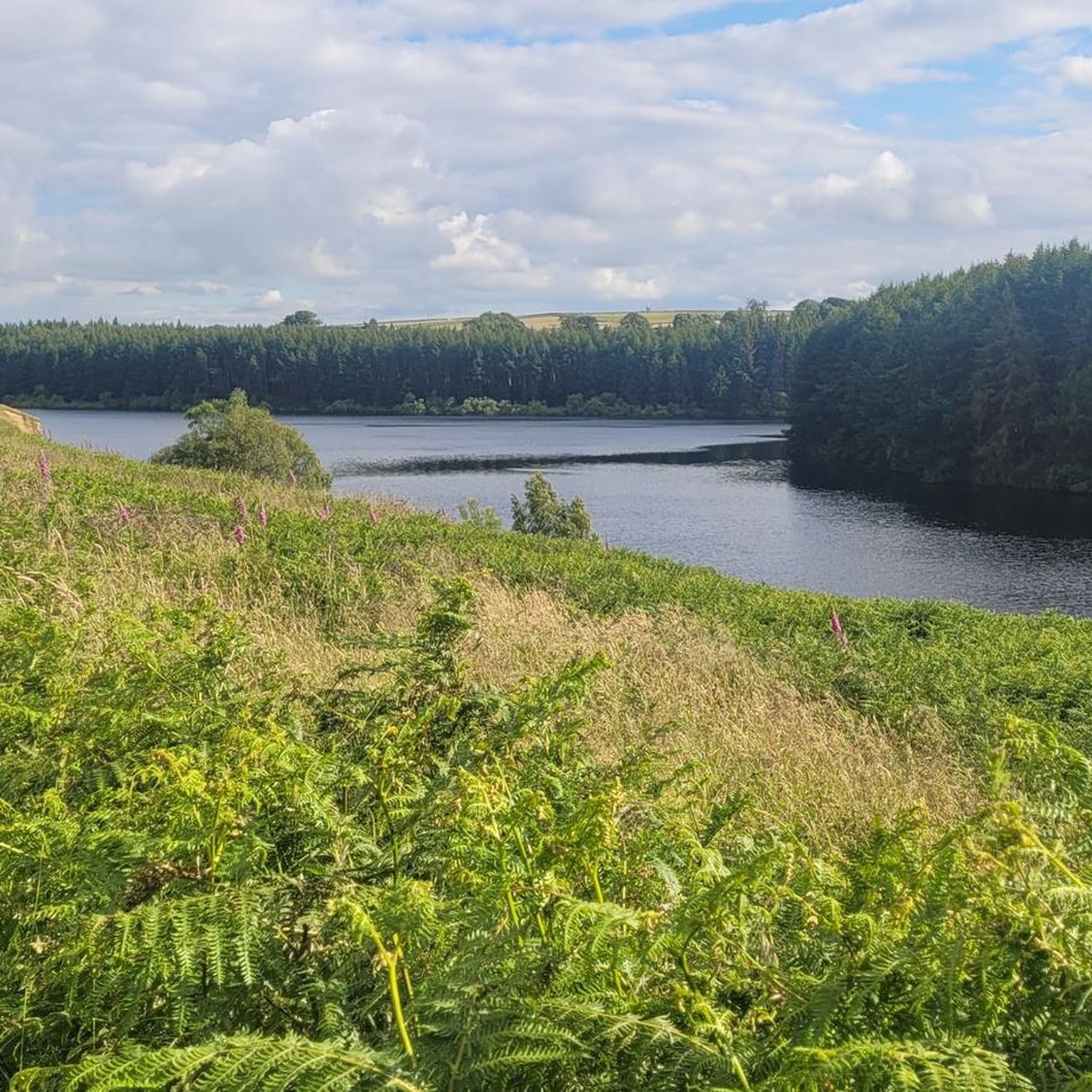
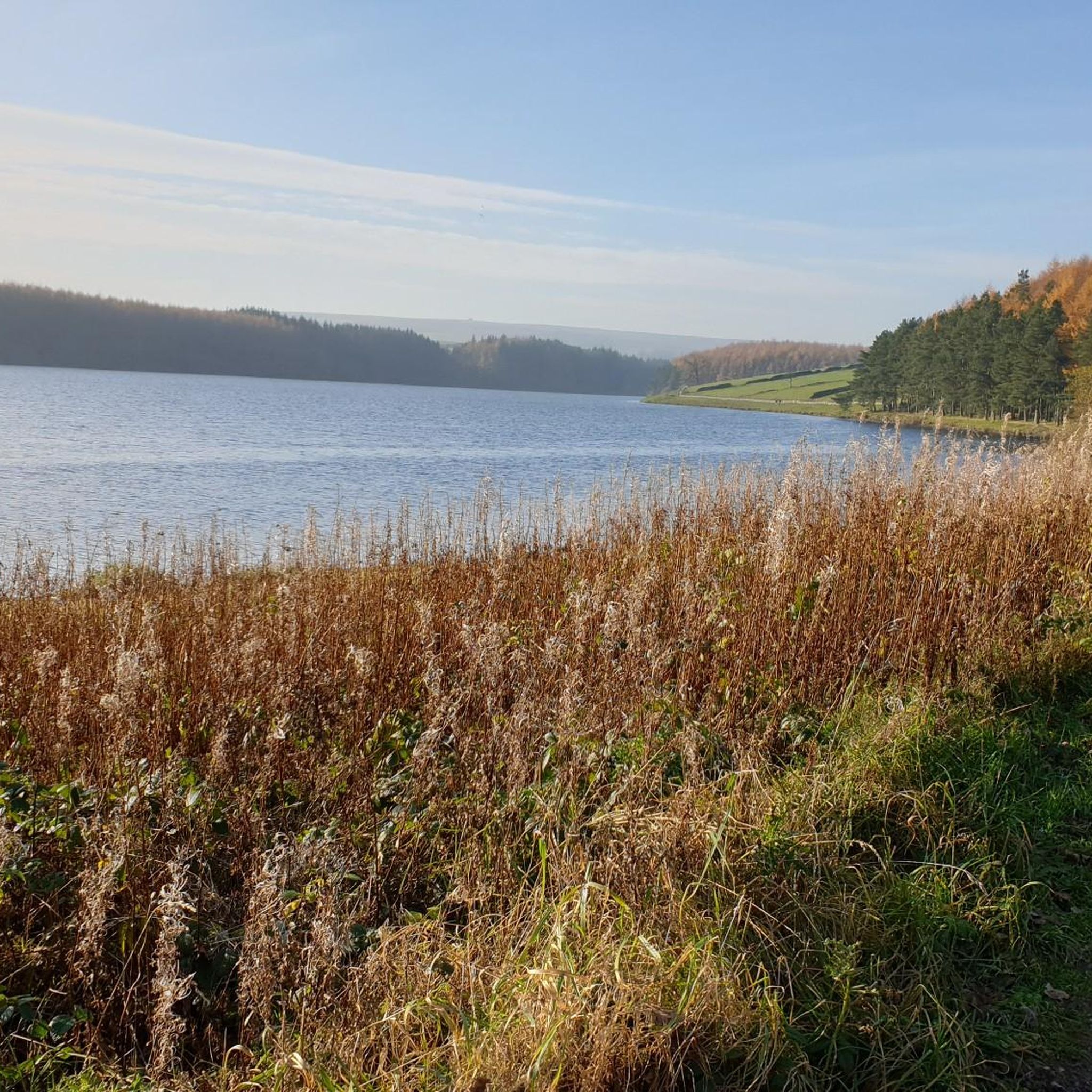
Undoubtedly the most scenic of the Washburn reservoirs with the moorland backdrop to the north. The circular route around the reservoir from the car park is about 5 miles, the track on the southwestern side runs along the edge of plantations and offers some shade from the sun and shelter from the elements. The track on the northeastern side is more exposed, and if you do the whole circuit you will cross over Far Comb Hill and the plantation along the edge of the reservoir at Whit Moor - a great route.
0
0
Fair sized and well-maintained car park with space for at least 30-40+ vehicles. Few picnic tables at the south-eastern end of the car park. There is also space for a few cars if you park off-road next to Thruscross Reservoir Lodge, on Reservoir Road on the eastern side of the dam, but these spots tend to fill up quickly.
1
0
Different experience on each side of the reservoir. The track on the west / southwestern side is shaded and slightly elevated, running along the edge of plantations, and Scot Lane on the eastern side is a bit more exposed. A full circular route of the reservoir is around 5 miles or so.
1
0
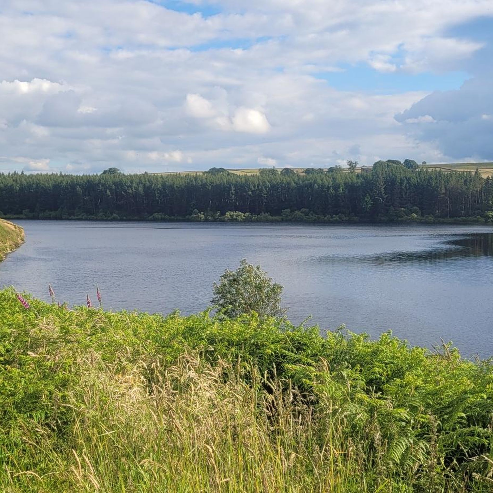
The walk from the large car park at Thruscross Reservoir dam up the west side of the reservoir to Cloggers Lane is magical and gives far better views than the tracks along Scot Lane on the eastern side. The track meanders along the edge of coniferous plantations, giving dappled shade on a sunny day and unobstructed views across the reservoir.
1
0

Scot Lane runs on the northern bank of the reservoir. A pleasant, relatively newly planted hedge runs along this bank, and the views of the reservoir are lovely; you will be able to make out the dam from here on the opposite side of it.
0
0
It is very odd to think that an entire village once existed here, but that's what you're looking at here. The entire village of West End. Cloggers Lane dropped here towards Patrick's Mill, the Butcher's Arm and a church, all of which vanished under the Thruscross Reservoir in the mid 1960s. A curious, eerie sight.
0
0
There are four reservoirs in the Washburn Valley, and this one is the northernmost. What distinguishes this one from the other three is also the fact that this one was built in 1966 while the other ones in the 19th century. The reservoir belongs to Yorkshire Water, the water company. From Reservoir Road in particular, the views of the reservoir are stunning - particularly given that you are high above. Sunsets here are just something else!
0
0
Frequently Asked Questions
What historical sites can I explore around Thruscross Reservoir?
The most significant historical site is the Ruins of West End Village at Thruscross Reservoir. This village was submerged when the reservoir was built in 1966, and its remnants, including old foundations and a former flax mill, become visible during periods of low water. You can also find the Holme Field Head Ruins, an imposing deserted building overlooking the northern end of the reservoir, and evidence of prehistoric settlements in the wider Washburn Valley.
Are there walking trails around Thruscross Reservoir?
Yes, Thruscross Reservoir is very popular for walking. A rugged 4.5-mile (7.2 km) circular route around the reservoir offers varied terrain through woodland, moorland, and pastures. For a gentler option, there's a 1.5-mile (2.4 km) accessible circular path through woodlands leading to the water's edge. The Scot Lane Lakeside Path on the northern bank provides lovely views.
Where can I find the best views of Thruscross Reservoir and its surroundings?
The Thruscross Reservoir itself offers stunning views, especially from Reservoir Road, which is elevated. The Scot Lane Lakeside Path provides excellent perspectives across the water towards the dam. For panoramic vistas of the wider area, consider the more challenging Simon's Seat and Rocking Hall loop.
What makes Thruscross Reservoir unique compared to other reservoirs in the area?
Thruscross is the northernmost and highest of the four reservoirs in the Washburn Valley, giving it a more remote and serene feel. Its most unique feature is the submerged village of West End, whose ruins emerge when water levels are low, offering a haunting glimpse into the past. The area is also designated as a Dark Sky Discovery Site, making it excellent for stargazing.
Are there any accessible paths or facilities at Thruscross Reservoir?
Yes, there is a 1.5-mile (2.4 km) accessible circular path through woodlands that leads to the water's edge, suitable for those seeking a gentler stroll. The main Thruscross Reservoir Car Park is fair-sized, well-maintained, and noted as wheelchair accessible, with picnic tables available.
What kind of outdoor activities and routes are available near Thruscross Reservoir?
Beyond the reservoir's circular walk, the area offers a variety of outdoor activities. You can find numerous hiking trails, including the easy "Thruscross Reservoir and Cloggers Lane loop" and the more challenging "Simon's Seat and Rocking Hall loop." For mountain biking enthusiasts, there are several routes like the "Denton Moor – Red Gate Trail loop." Explore more options on the Hiking around Thruscross Reservoir and MTB Trails around Thruscross Reservoir guide pages.
When is the best time of year to visit Thruscross Reservoir?
Thruscross Reservoir offers beauty year-round. Spring and summer are ideal for enjoying the lush woodlands and moorlands. Autumn brings vibrant colours to the landscape. For a chance to see the remnants of the drowned village of West End, periods of drought and low water levels are best, which can occur at various times of the year. The area is also excellent for stargazing on clear nights due to minimal light pollution.
Is Thruscross Reservoir suitable for families or dog walkers?
Yes, the area is generally suitable for families and dog walkers. The 1.5-mile accessible circular path is great for a gentler family stroll. The Scot Lane Lakeside Path is also a pleasant option. Many of the trails are dog-friendly, but always ensure dogs are kept under control, especially around livestock and wildlife.
Can I go stargazing near Thruscross Reservoir?
Absolutely. The area around Thruscross Reservoir, particularly the car park, is designated as a Dark Sky Discovery Site. This means there is minimal light pollution, making it an excellent location for stargazing and observing celestial bodies on clear nights.
What kind of wildlife can I expect to see around Thruscross Reservoir?
Thruscross Reservoir is a haven for wildlife, particularly birds. It's a good spot for birdwatching, with species such as curlews, oystercatchers, and occasional red kites. The surrounding woodlands and moorlands also support various other local fauna.
Are there more challenging hikes available for experienced walkers?
Yes, for experienced walkers seeking a challenge, the "Simon's Seat and Rocking Hall loop" is a 13.3-mile (21.4 km) hike with significant elevation gain, offering panoramic views from Simon's Seat. This route provides a more strenuous exploration of the wider moorland landscape.
Most popular routes around Thruscross Reservoir

Get inspired with the komoot mobile app


Explore more
Still not found the Highlight you’re looking for? See guides of the top attractions in other regions:
