Thruscross Reservoir
Thruscross Reservoir
Easy hikes and walks around Thruscross Reservoir
4.6
(2040)
19,148
hikers
242
hikes
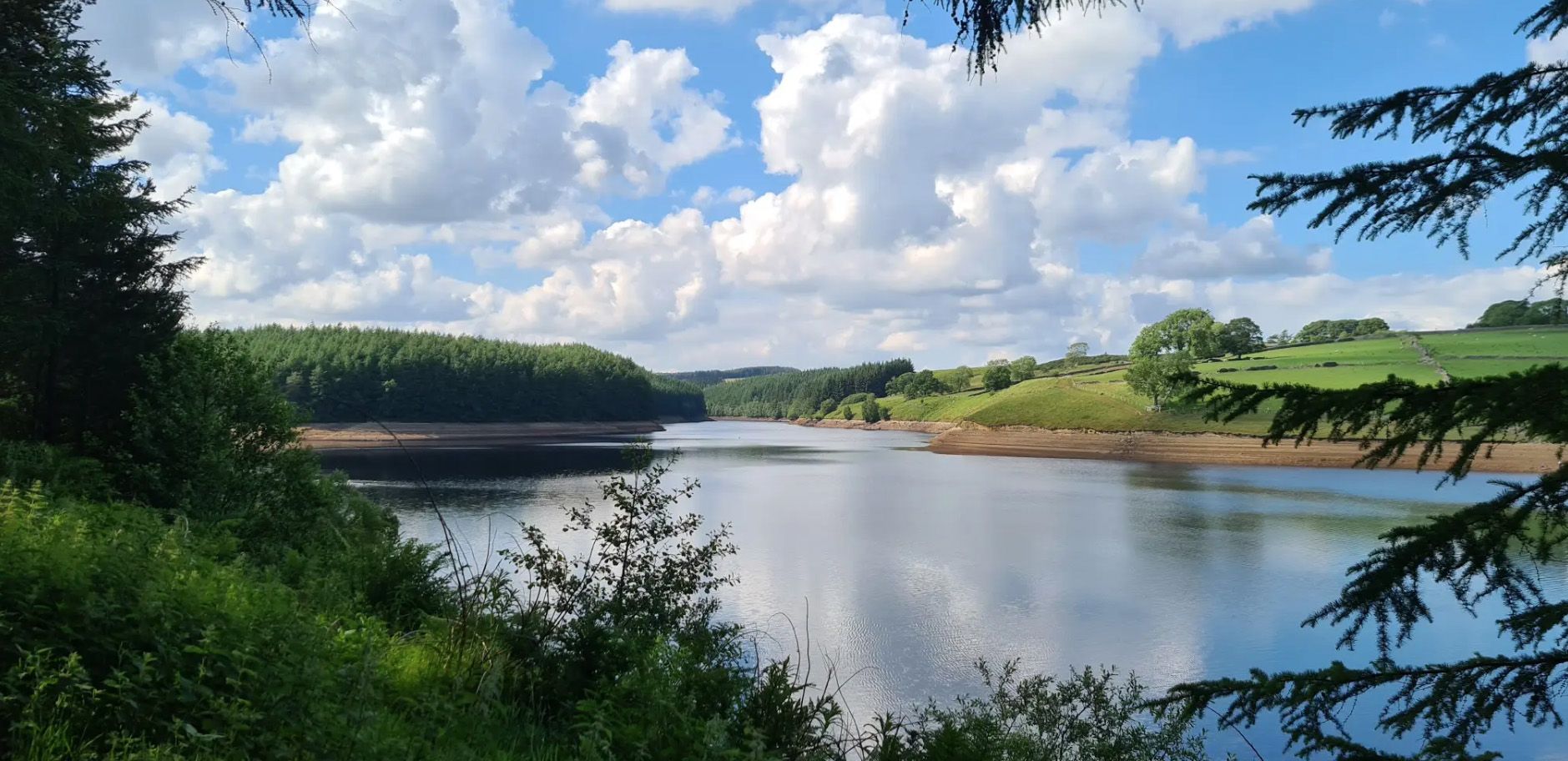
Easy hiking trails around Thruscross Reservoir traverse a landscape characterized by its rugged shoreline paths, expansive open moorland, and serene woodlands. Nestled in the scenic Washburn Valley, the area features the imposing Thruscross Dam and sections following the River Washburn. This varied terrain offers diverse visual experiences for hikers.
Best easy hiking trails around Thruscross Reservoir
- The most popular easy hiking route is Thruscross Reservoir and Cloggers Lane loop from Thruscross Reservoir Car Park, a 4.7 miles (7.5 km)…
Last updated: June 24, 2026
4.6
(24)
205
hikers
Embark on the Thruscross Reservoir and Cloggers Lane loop, an easy hike that takes you around the tranquil waters of Thruscross Reservoir. This circular route spans 4.7 miles (7.5 km)…
4.3
(4)
28
hikers
5.59km
01:32
90m
90m
Easy hike. Great for any fitness level. Easily-accessible paths. Suitable for all skill levels.

Sign up for free
2.0
(1)
13
hikers
Easy hike. Great for any fitness level. Easily-accessible paths. Suitable for all skill levels.
8
hikers
3.25km
00:52
30m
30m
Easy hike. Great for any fitness level. Easily-accessible paths. Suitable for all skill levels.
4.5
(6)
34
hikers
5.85km
01:33
50m
50m
Easy hike. Great for any fitness level. Easily-accessible paths. Suitable for all skill levels.
Get access to more routes and recommendations from other explorers.
Sign up for free
Already have an account?
Our route recommendations are based on thousands of hikes, rides, and runs completed by other people on komoot.
Start today with a free account
Your next adventure awaits.
Login or Signup
Popular around Thruscross Reservoir
Other adventures around Thruscross Reservoir

Tips from the Community

Undoubtedly the most scenic of the Washburn reservoirs with the moorland backdrop to the north. The circular route around the reservoir from the car park is about 5 miles, the track on the southwestern side runs along the edge of plantations and offers some shade from the sun and shelter from the elements. The track on the northeastern side is more exposed, and if you do the whole circuit you will cross over Far Comb Hill and the plantation along the edge of the reservoir at Whit Moor - a great route.
0
0
Cracking location from which to explore. Reasonably well-sized car park (about 25 spaces) immediately accessible from the A59. Head south to walk around Fewston and Swinsty Reservoirs along very easy and well-maintained tracks, or even better, head north up the River Washburn for a serene woodland walk along the babbling river's edge, to eventually pop out at the very imposing face of Thruscross Reservoir dam. If this car park is full, then try Swinsty Moor Plantation or Fewston village if heading south, or try the bigger car park at Thruscross Reservoir if heading north.
1
0
Cracking location from which to explore. Reasonably well-sized car park at Blubberhouses. Head south to walk around Fewston and Swinsty Reservoirs along very easy and well-maintained tracks, or even better, head north up the River Washburn for a serene woodland walk along the babbling river's edge, to eventually pop out at the very imposing face of Thruscross Reservoir dam.
0
0
Delightful walk along the River Washburn between Thruscross Reservoir and Blubberhouses. Easy track to follow along the river's edge, in parts it is a wide gravel track with very easy going, although it does eventually become more of a rabbit-path, narrow in places and riddled with tree routes.
1
0
Fair sized and well-maintained car park with space for at least 30-40+ vehicles. Few picnic tables at the south-eastern end of the car park. There is also space for a few cars if you park off-road next to Thruscross Reservoir Lodge, on Reservoir Road on the eastern side of the dam, but these spots tend to fill up quickly.
1
0
If you are enthusiastic enough to walk around all three reservoirs (Thruscross, Fewston, and Swinsty), clocking in at 15 miles, then you will see that Thruscross has the most spectacular dam of the three. If you follow the track from the car park at the western end of the dam, to the south towards the River Washburn, a track that descends quite steeply, then you will be rewarded with imposing views of the face of the dam.
1
0
Different experience on each side of the reservoir. The track on the west / southwestern side is shaded and slightly elevated, running along the edge of plantations, and Scot Lane on the eastern side is a bit more exposed. A full circular route of the reservoir is around 5 miles or so.
1
0
The walk from the large car park at Thruscross Reservoir dam up the west side of the reservoir to Cloggers Lane is magical and gives far better views than the tracks along Scot Lane on the eastern side. The track meanders along the edge of coniferous plantations, giving dappled shade on a sunny day and unobstructed views across the reservoir.
1
0
Frequently Asked Questions
How many easy hiking trails are available around Thruscross Reservoir?
There are over 90 easy hiking trails around Thruscross Reservoir. These routes offer diverse experiences, from rugged shoreline paths to serene woodlands, all within the scenic Washburn Valley.
Are there any circular easy walks around Thruscross Reservoir?
Yes, several easy circular routes are available. A popular option is the Thruscross Reservoir and Cloggers Lane loop from Thruscross Reservoir Car Park, which is 4.7 miles (7.5 km) long. Another is the Thruscross Reservoir Car Park – Thruscross Reservoir loop from Thruscross, a shorter 2.5 miles (4.1 km) trail.
What unique natural features can I expect to see on an easy hike here?
Easy hikes around Thruscross Reservoir offer a variety of natural features. You'll encounter rugged shoreline paths, open moorland, and tranquil woodlands. The imposing Thruscross Dam is a dramatic structure, and sections of trails follow the babbling River Washburn. Keep an eye out for wildflowers and local wildlife.
Are the easy trails around Thruscross Reservoir suitable for families with children?
Yes, many easy trails are suitable for families. Routes like the Thruscross Reservoir Car Park – Thruscross Reservoir loop from Thruscross, at 2.5 miles (4.1 km), offer varied terrain that can be engaging for children without being overly strenuous. The mix of woodlands and reservoir views provides an interesting backdrop for a family outing.
Can I bring my dog on the easy hiking trails?
Yes, dogs are generally welcome on the easy hiking trails around Thruscross Reservoir. However, it's always recommended to keep dogs on a lead, especially around livestock and to protect local wildlife. Please ensure you clean up after your pet.
What is the terrain like on the easy walks?
Even on easy walks, the terrain around Thruscross Reservoir can be varied and more rugged in places compared to other reservoir walks. You can expect a mix of paths, including some with stiles, steps, and potentially muddy banks, especially after rain. This variety keeps the walks engaging.
Are there any historical points of interest visible during a hike?
Yes, one of the most intriguing historical points is the submerged village of West End. During periods of drought and low water levels, remnants of the village, such as the old flax mill and parts of the church, can become visible, adding a unique historical dimension to your walk.
Where can I park for easy access to the trails?
There is a car park available at Thruscross Reservoir, which provides convenient access to many of the easy trails, including the popular Thruscross Reservoir and Cloggers Lane loop.
What do other hikers enjoy most about the easy trails at Thruscross Reservoir?
The area is highly rated by the komoot community, with an average score of 4.6 stars from over 1,700 reviews. Reviewers often praise the diverse landscapes, the tranquility of the River Washburn sections, and the stunning views of the reservoir and surrounding moorland.
What is the best time of year for easy walks around Thruscross Reservoir?
Thruscross Reservoir offers engaging walks throughout the year. Spring and summer bring wildflowers and lush greenery, while autumn provides beautiful foliage. Even in winter, the rugged landscape has a unique charm, though paths may be muddier. The area is also a designated Dark Sky Discovery Site, making it excellent for stargazing on clear nights.
Are there any cafes or pubs nearby for refreshments after a hike?
While the immediate vicinity of Thruscross Reservoir is more remote, you can find cafes and pubs in nearby villages within the Washburn Valley or slightly further afield, offering options for refreshments after your easy hike.
How long do the easy hikes typically take?
The duration of easy hikes varies depending on the route and your pace. For example, the Thruscross Reservoir and Cloggers Lane loop (4.7 miles / 7.5 km) typically takes around 2 hours, while the shorter Thruscross Reservoir Car Park – Thruscross Reservoir loop (2.5 miles / 4.1 km) can be completed in just over an hour.
Most popular routes around Thruscross Reservoir

Get inspired with the komoot mobile app


Explore more
Browse the best Hikes in other regions.
