Routes

Planner

Features

Updates

App

Login or Signup

Get the App

Login or Signup

Routes
Hikes

Ozark-St. Francis National Forest

Routes
Hikes

Ozark-St. Francis National Forest

The best family-friendly hikes and walks in Ozark-St. Francis National Forest

4.6

(30)

655

hikers

18

hikes

If you have ever tried to plan hiking in Ozark-St. Francis National Forest, you know how overwhelming the options can be. With over a million acres and hundreds of miles of trails, it is tough to tell which routes are genuinely worth your time and effort, and which are just filler. We get it — nobody wants to spend precious outdoor time on a disappointing trail.

That is exactly why we created this guide. Our komoot community has mapped, hiked, and reviewed countless routes across this incredible landscape. We have sifted through the data to bring you a curated shortlist of the trails that truly deliver, saving you the guesswork and ensuring your legs are well-spent.

Hiking here means immersing yourself in a diverse landscape of rugged mountains, rolling hills, and dense oak-hickory woodlands, often punctuated by dramatic bluffs and clear, flowing creeks. The forest offers everything from gentle strolls to more demanding climbs, with the Ozark Mountains dominating the western side and the distinct topography of Crowley's Ridge in the St. Francis portion. For the most vibrant experience, we find the waterfalls are particularly impressive during spring when water levels are high, and the fall foliage in autumn is simply spectacular.

If you only do one hike, make it the Yellow Rock Trail, a 2.8 miles (4.5 km) route that offers fantastic scenic views for relatively little effort, making it a top pick for a first visit or families. For a slightly different feel, the Ozark Highlands Trail: Matney Knob, at 1.9 miles (3.1 km), provides a rewarding ascent to a scenic overlook. With an average rating of 4.6 stars from our community, you can trust these routes are well-loved. Start exploring with komoot and discover your next favorite trail.

Last updated: May 11, 2026

5.0

(4)

69

hikers

#1.

Yellow Rock Trail

4.51km

01:21

150m

130m

The Yellow Rock Trail offers a delightful journey through the unique geology of the Ozarks, transitioning from rugged sections with massive boulders to serene cedar glades and dense forests. You'll find yourself immersed in nature, with the path leading you to the dramatic Yellowrock Overlook, which provides expansive panoramic views of the Lee Creek Valley. This 2.8-mile (4.5 km) hiking route is rated easy, with 480 feet (146 metres) of elevation gain, and typically takes around 1 hour and 20 minutes to complete.

When planning your visit, you have the flexibility of two distinct starting points. The route from the CCC Scenic Overlook is largely flat and very accessible, making it a great option for families or those seeking an easier hike. Alternatively, starting from the Lee Creek Trailhead involves a more adventurous and slightly steeper initial climb through a narrow gorge. Fall is a particularly popular time to visit for the stunning autumn colors, but spring and summer also offer beautiful scenery.

This National Recreation Trail is considered the iconic hike in Devil's Den State Park, renowned for its stunning Yellowrock Overlook, often compared to the famous Whitaker Point. The trail also showcases extensive rock work built by the Civilian Conservation Corps (CCC) in the 1930s, including a small pavilion at the top. It's a fantastic way to experience the diverse ecosystem and geological formations of the region.

Navigate with device

Send to Phone

Save

Easy

This section of the Ozark Highlands Trail offers a rewarding journey through rugged forestland to Hare Mountain, the highest point on the entire OHT. You'll hike through diverse hardwood and pine forests, encountering scenic bluffs and rock formations along the way. The trail provides expansive panoramas of the surrounding Ozark wilderness, especially from higher elevations.

Starting from the Morgan Fields trailhead, this 1.9-mile (3.1 km) hike involves a steady ascent of 753 feet (229 metres), taking approximately 1 hour and 1 minute. While rated easy, the terrain is rocky and rugged, so wear appropriate footwear. Fall is an especially vibrant time to visit, as the changing leaves create a kaleidoscope of colors across the landscape.

Beyond its natural beauty, this segment of the Ozark Highlands Trail is steeped in history, passing old rock walls that were once part of a historic roadbed. The Hare Mountain area is also the site of an annual "Hare Mountain Hike-In," reflecting the trail's enduring appeal and community spirit. It's a great way to experience a significant part of the OHT's wilderness character.

Easy
guide_signup
Let us show you the way with the komoot mobile app
With a free komoot account, you can easily find, customize, and navigate endless outdoor adventures.

Sign up for free

1

hikers

The Ozark Highlands Trail: Matney Knob offers a compact yet engaging hiking experience, leading you through varied forest landscapes and down to the White River. You'll encounter rocky sections and switchbacks, with bluffs providing stunning overlooks of the river, making it a rewarding journey for its length. This 1.9-mile (3.1 km) route, despite its easy rating, includes 516 feet (157 metres) of elevation gain, which you can cover in about 55 minutes, giving you a good workout with high scenic payoff.

To plan your visit, head to the trailhead located conveniently off Highway 341, also known as Push Mountain Road, just south of the White River bridge. This section of the Ozark Highlands Trail is especially popular from fall through spring, and it's a fantastic option for winter hiking when many other trails are less accessible. Always check for current trail conditions, as some sections might have high weeds alongside the single track, though the tread itself is generally clear.

This segment is part of the larger Ozark Highlands Trail, celebrated as one of the premier long-distance hiking trails in the United States. The Matney Knob trail's varied terrain, from high ground with valley views to its descent to the White River, showcases the rugged beauty of the Ozarks. It's also a component of the proposed 700-mile Trans-Ozark Trail, highlighting its significance in the region's hiking network.

Easy

This easy 2.8-mile (4.5 km) section of the Ozark Highlands Trail, from its Western Terminus to Frog Bayou, offers a delightful immersion into the forested beauty of the Arkansas Ozarks. You'll wander through lush woodlands, encountering scenic bluffs and interesting rock formations, with the chance to spot small streams and seasonal waterfalls, especially after a good rain. It's a perfect, relatively flat introduction to the OHT's natural features, taking about 1 hour and 10 minutes with a gentle 89 feet (27 metres) of elevation gain.

To plan your visit, head to Lake Fort Smith State Park, where the Western Terminus is conveniently located behind the visitor center, offering ample parking. The trail is clearly marked with reflective white blazes, making navigation simple. While accessible year-round, the fall through spring seasons are particularly popular, with winter providing a unique, quiet hiking experience. Always check for current trail conditions, as sections can be muddy after wet weather.

This segment is part of the much longer Ozark Highlands Trail, a designated National Recreation Trail renowned for its rugged beauty and solitude. It provides a glimpse into the OHT's character, showcasing diverse plant life and historical elements like old home sites. It's an excellent choice for those seeking a short, accessible hike or a gentle entry point into one of the United States' premier long-distance trails.

Easy

1.14km

00:18

10m

0m

For a delightful and accessible outdoor experience in Devil's Den State Park, the Lake Trail is an ideal pick. This easy hiking route is a short 0.7 miles (1.1 km) with a gentle 24 feet (7 metres) of elevation gain, making it perfect for a quick 17-minute walk. You'll enjoy a pleasant journey that includes crossing the charming Suspension Bridge over Lee Creek and discovering a serene waterfall, offering picturesque views without demanding much effort.

Planning your visit to the Lake Trail is straightforward; it's a family-friendly option that doesn't require permits or special gear. Parking is readily available within Devil's Den State Park, and the trail is suitable for all seasons, though spring and autumn provide particularly pleasant weather. It's a great choice for a spontaneous outing or for those looking for beginner Lake Trail options.

This trail stands out as a tranquil escape, showcasing the natural beauty of the Arkansas landscape. Its minimal difficulty and short duration make it a popular choice for visitors of all ages, providing a taste of the park's scenery without committing to a longer trek. It's a true hidden gem for a peaceful stroll.

Easy
Sign up for free to see 14 more hikes in Ozark-St. Francis National Forest.

Get access to more routes and recommendations from other explorers.

Sign up for free

Already have an account?

Our route recommendations are based on thousands of hikes, rides, and runs completed by other people on komoot.

Start today with a free account

Your next adventure awaits.

Login or Signup

Popular around Ozark-St. Francis National Forest
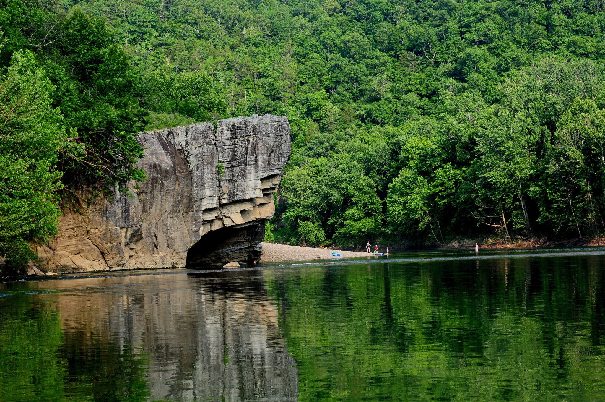
Ozark Highlands Trail: Falling Water Creek Trailhead to Dillard's Ferry — Hiking the Buffalo River corridor

Ozark Highlands Trail — 200 miles of backcountry beauty

Other adventures in Ozark-St. Francis National Forest

Ozark Highlands Trail: Falling Water Creek Trailhead to Dillard's Ferry — Hiking the Buffalo River corridor

Hiking Collection by

Sue

Tips from the Community

Sue
August 12, 2025, Hare Mountain campsite

Hare Mountain, part of a designated Special Interest Area, is the highest point along the OHT, rising to about 2,400 feet. There are several campsites here, with bear poles, fire rings, a picnic table and plenty of trees for hanging a hammock. There is a nearby well, and all sites have beautiful panoramic views of the Boston Mountains, especially during sunrise and sunset. It's worth the detour, even if you don't plan on staying overnight.

0

0

beginner trail, a few elevation changes, river view

0

0

Lake Fort Smith State Park has many amenities including camp sites and a visitor center. It is a great starting point for the moutnain biking trails located in the park.

0

0

This 30 foot long pedestrian suspension bridge was built in the 1930's by the Civlian Conservation Corps. It is just south of the Welcome Center for Devil's Den State Park.

1

0

The Lake Trail and Dam were built in the 1930's by the Civilian Conservation Corps. It is very scenic and offers many photographic opportunities.

1

0

Historic shelter built by the Civilian Conservation Corps (CCC) in the 1930s. The shelter overlooks the scenic Lee Creek Valley.

0

0

Beautiful State Park with access to Lee Creek and various trails in the State Park and Ozark National Forest

0

0

Trailhead to the Butterfield Hiking Trail

0

0

Frequently Asked Questions

How many family-friendly hiking trails are available in Ozark-St. Francis National Forest?

There are over 18 family-friendly hiking trails in the Ozark-St. Francis National Forest, with 8 of them specifically rated as easy, making them ideal for families with children or those seeking a relaxed outing.

What natural landmarks or attractions can families explore along the trails?

The Ozark-St. Francis National Forest is rich with natural wonders and historical sites. Families can discover the impressive Alum Cove Natural Bridge and Rock Formations, a massive stone arch formed by nature. You might also visit the historic CCC Overlook Shelter for scenic views, or explore the White Rock Mountain Recreation Area & Campground, which offers stunning vistas and rustic charm.

Are there any trails with waterfalls that are suitable for families?

Yes, the forest is home to several beautiful waterfalls. While some require more challenging hikes, families can enjoy the scenic beauty around Haw Creek Falls Recreation Area or the unique Lake Trail - Devil's Den State Park, which features a waterfall. The region is known for its picturesque waterways and cascades.

What is a good easy, short hike for families with young children or toddlers?

For a very easy and short option, the Lake Trail is an excellent choice. It's just over 1 kilometer long with minimal elevation gain, making it perfect for little legs and strollers. It offers a pleasant stroll around a lake.

Are there any family-friendly loop trails in the Ozark-St. Francis National Forest?

While many trails are out-and-back, the region offers opportunities for loop experiences. For instance, the Pedestal Rocks and Kings Bluff area, though not explicitly listed in this guide, is known for a 4-mile loop featuring unique rock formations and panoramic views, which can be a rewarding family adventure.

What do other hikers enjoy most about family-friendly hiking in Ozark-St. Francis National Forest?

The Ozark-St. Francis National Forest is highly rated by the komoot community, with an average score of 4.6 stars. Reviewers often praise the diverse terrain, the beauty of the clear creeks and bluffs, and the sense of natural tranquility. Many appreciate the well-maintained trails and the opportunity to experience Arkansas's 'Natural State' with their loved ones.

Are dogs allowed on family-friendly hiking trails in the Ozark-St. Francis National Forest?

Generally, dogs are welcome on trails in the Ozark-St. Francis National Forest, but they must be kept on a leash. It's always a good idea to check specific trail regulations before you go, as some areas or facilities might have restrictions. Remember to bring water for your pet and clean up after them.

What is the best time of year to go hiking with family in this region?

Spring and fall are generally the best seasons for family hiking in the Ozark-St. Francis National Forest. In spring, wildflowers bloom, and waterfalls are often at their fullest. Fall offers spectacular foliage, with vibrant colors across the oak and hickory forests. Summers can be hot and humid, while winters can bring cold temperatures and occasional ice, though clear winter days can be beautiful.

Are there any trails that offer scenic views or overlooks suitable for families?

Absolutely! The Ozark-St. Francis National Forest is renowned for its scenic vistas. The Yellow Rock Trail is a great option, offering rewarding views for a moderate effort. The region's diverse topography, from low streamside elevations to high ridges, ensures many opportunities for breathtaking panoramas.

Where can we find parking for family-friendly trails?

Most designated trailheads within the Ozark-St. Francis National Forest, especially for popular family-friendly routes, offer dedicated parking areas. It's advisable to check specific trail information or maps before your visit to confirm parking availability and any potential fees, particularly for state park areas within or adjacent to the forest.

Are there any less crowded family-friendly trails if we want a more peaceful experience?

While popular trails can see more visitors, many of the forest's extensive trail systems offer opportunities for solitude. Consider exploring sections of the Ozark Highlands Trail that are less frequented, such as the Ozark Highlands Trail: Matney Knob section, which provides a peaceful experience amidst the natural beauty. Early mornings or weekdays can also help avoid crowds.

What kind of wildlife might we see on a family hike?

The Ozark-St. Francis National Forest is home to a rich variety of wildlife. Families might spot white-tailed deer, various bird species like bobwhite quail and wild turkey, and smaller mammals such as rabbits. If you're lucky and observant, you might even catch a glimpse of a black bear, though they are generally shy. Remember to observe from a distance and never feed wild animals.

Most popular routes in Ozark-St. Francis National Forest

Hiking in Ozark-St. Francis National Forest

Most popular attractions in Ozark-St. Francis National Forest

Places to see

Store rating

Get inspired with the komoot mobile app

With a free komoot account, you can easily find, customize, and navigate endless outdoor adventures.

or

Join komoot Now

Store rating

Explore more

Browse the best Hikes in other regions.

Benton CountyOuachita National ForestWashington CountyGarland CountyPulaski CountyFranklin CountyCrawford CountyMadison CountyCrittenden CountyMontgomery CountyFaulkner CountySaline CountyHot Spring CountyPolk CountyPerry CountyScott CountySearcy CountyCarroll County

Nearby adventure guides

Things to Do in Johnson County

background

Get ready to conquer new peaks

Sign up for Free

Explore
RoutesRoute plannerFeaturesHikesMTB TrailsRoad cycling routesBikepackingSitemap
Download the app
Follow Us on Socials

© komoot GmbH

Privacy Policy