The best traffic-free bike rides in Monterey County
4.9
(85)
3,964
riders
15
rides
No traffic road cycling routes in Monterey County traverse a diverse landscape, characterized by its dramatic Pacific coastline, fertile valleys, and rolling hills. The region features expansive forests, including towering redwoods, alongside agricultural lands and vineyards. Cyclists encounter varied elevations, from coastal paths to significant climbs, providing a range of experiences. This geographical mix offers distinct scenery and terrain for road cycling.
Best no traffic road cycling routes in Monterey County
- The most popular no traffic road cycling route is…
Last updated: July 7, 2026
21
riders
Moderate road ride. Good fitness required. Some segments of this route may be unpaved and difficult to ride.
14
riders
18.1km
00:51
170m
170m
Moderate road ride. Great for any fitness level. Some segments of this route may be unpaved and difficult to ride.

Sign up for free
12
riders
45.8km
02:45
1,030m
1,030m
Hard road ride. Very good fitness required. Mostly well-paved surfaces and easy to ride.
9
riders
81.5km
05:23
1,630m
1,630m
Hard road ride. Very good fitness required. Mostly well-paved surfaces and easy to ride.
1
riders
Moderate road ride. Good fitness required. Mostly well-paved surfaces and easy to ride.
Get access to more routes and recommendations from other explorers.
Sign up for free
Already have an account?
Our route recommendations are based on thousands of hikes, rides, and runs completed by other people on komoot.
Start today with a free account
Your next adventure awaits.
Login or Signup
Popular around Monterey County
Traffic-free bike rides in the Trish Hills
Traffic-free bike rides in Fort Ord Dunes State Park
Traffic-free bike rides in Fort Ord National Monument
Traffic-free bike rides in Palo Corona Regional Park
Traffic-free bike rides in Garland Ranch Regional Park
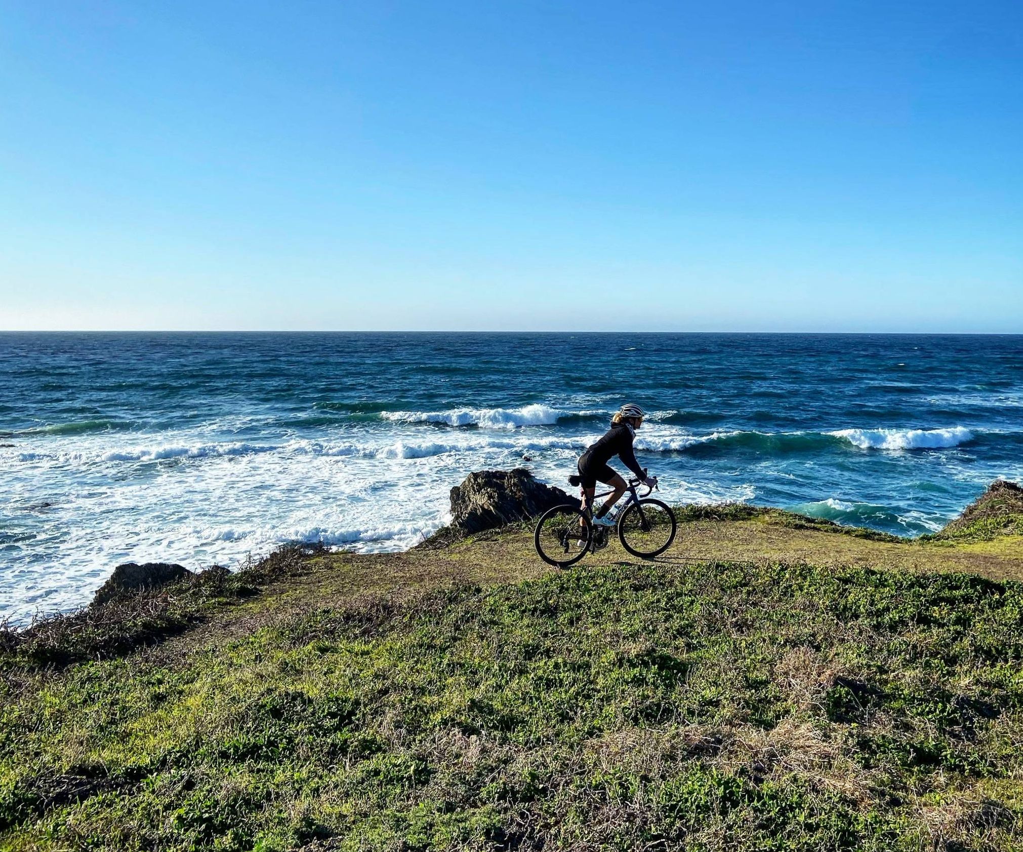
Mountain roads and dirt of California — Central Coast Love

California Coastal Trail — Following the coastline from Mexico to Oregon

The tour of your life – music trails on the Pacific coast

On the most beautiful route of California - The Pacific Coast Route
Traffic-free bike rides in Monterey County
Other adventures in Monterey County


Tips from the Community

I rode it in 2021 and it was all washed out with patches of debris washed over the road. Someone told me they had fixed it as of 2025.
0
0

This is what camping along the coast is all about! Great views and easy access to the shoreline. The camp hosts are very helpful and can usually get you in to one of the first-come, first-served sites if you don't have a reservation. However, if you'd like the peace of mind that comes with a sure thing you can make reservations here: www.recreation.gov/camping/campgrounds/233116
0
0

Pescadero Point is a fantastic spot to view the ghost trees and offers spectacular ocean views, along with fascinating rock formations. This area is known for its legendary big waves, which can reach heights of up to 50 feet (15 meters) in the winter, but it's a stunning sight to see any time of year. There is a manned gate at the entrance of the Pebble Beach Golf Course to access this location for vehicles, however, if you're on a bike you can pass for free.
0
0

Very beautiful, spacious beach with a great view. The sea is a bit rough (September) and cold for swimming (15°C). But for walking, jogging, ... a dream
1
0

There is a simple gate that allows cyclists to pass with ease but bars the road from vehicular traffic. From here you can access the sprawling Fort Ord trail system.
0
0


Watkins Gate Road is a paved road with a soft singletrack on each side. This 3-mile road offers views of dense trees on each side.
0
0

Public city park overlooking picturesque Carmel Beach. Surrounded by cypress and pine trees, the park is also a great place to let your dog run around free if you have a running companion.
0
0
Frequently Asked Questions
How many no-traffic road cycling routes are available in Monterey County?
There are 13 dedicated no-traffic road cycling routes in Monterey County featured in this guide. These routes offer a variety of experiences, from easy coastal rides to challenging inland loops, ensuring a suitable option for most cyclists.
Are there any easy, car-free road cycling routes suitable for beginners or families?
Yes, Monterey County offers a few easy, car-free options. The Watkins Gate Road – Gigling Road gate loop from WeatherTech Raceway Laguna Seca is a moderate route that can be adapted for a less strenuous ride. For a truly beginner-friendly experience, the Monterey Bay Coastal Recreation Trail is an excellent choice, though not specifically listed in this guide, it's a well-known paved path perfect for families.
What kind of scenery can I expect on these no-traffic road cycling routes?
The no-traffic routes in Monterey County offer diverse and stunning scenery. You can expect breathtaking ocean views, especially on routes near the coast, as well as picturesque landscapes through forests, valleys, and agricultural lands. Some routes, like the Cannery Row, Monterey – Fort Ord loop, combine urban coastal charm with more natural, open spaces.
Are there any loop routes for no-traffic road cycling in Monterey County?
Yes, many of the no-traffic road cycling routes in Monterey County are designed as loops. For example, the San Juan Batista – Fremont Peak Summit loop offers a challenging circular ride, while the Wolf Hill loop from Del Rey Oaks provides a moderate option. These loops allow you to start and end at the same point, making logistics easier.
What is the best time of year to go no-traffic road cycling in Monterey County?
Monterey County generally enjoys mild weather year-round, making it suitable for cycling in most seasons. Spring and fall often offer the most pleasant conditions with moderate temperatures and less fog. Summers can be warm inland but cooler along the coast. Winters are mild but can bring rain, so checking the forecast is always recommended.
Are there any challenging no-traffic road cycling routes for advanced riders?
Absolutely. For experienced cyclists seeking a challenge, routes like the San Juan Batista – Fremont Peak Summit loop, covering over 86 km with significant elevation gain, or the Roadbike loop from Highway 68 / Hidden Hills, which includes over 1000m of climbing, provide demanding rides with rewarding views.
What do other cyclists say about the no-traffic road cycling routes in Monterey County?
The no-traffic road cycling routes in Monterey County are highly rated by the komoot community, with an average score of 4.9 stars from over 100 ratings. Reviewers often praise the stunning coastal views, the well-maintained paved surfaces, and the peaceful, car-free environment that allows for an immersive cycling experience.
Are there any points of interest or natural attractions along these routes?
Yes, many routes pass by or are near notable attractions. While cycling, you might encounter highlights such as El Estero Lake Park or the Del Monte Lake Trail. The region is also known for its dramatic coastline and diverse natural features, including canyons like Mill Creek Canyon, offering plenty to explore beyond the ride itself.
Where can I find parking for these no-traffic road cycling routes?
Parking availability varies by route. Many routes start near established trailheads or public parks which often have designated parking areas. For example, routes around Fort Ord National Monument or near WeatherTech Raceway Laguna Seca typically have parking options. It's advisable to check the specific route details on komoot for the most accurate parking information for your chosen ride.
Are there any cafes or restaurants near the no-traffic road cycling routes in Monterey County?
Yes, especially for routes that pass through or near towns and coastal areas. The Monterey Bay Coastal Recreation Trail, for instance, is well-known for its proximity to numerous cafes and restaurants in areas like Cannery Row and Fisherman's Wharf. For inland routes, options might be more spread out, so planning ahead for refreshments is recommended.
Can I bring my dog on these no-traffic road cycling routes?
Dog policies vary depending on the specific trail or park. While some paved paths, like sections of the Monterey Bay Coastal Recreation Trail, may allow leashed dogs, areas within Fort Ord National Monument or other protected natural reserves might have stricter rules or prohibit dogs on certain trails. Always check local regulations for the specific route you plan to ride to ensure compliance.
What is the typical length of a no-traffic road cycling route in Monterey County?
The no-traffic road cycling routes in Monterey County vary significantly in length. You can find shorter routes, such as the Watkins Gate Road – Gigling Road gate loop at around 22 km, up to much longer and more challenging rides like the San Juan Batista – Fremont Peak Summit loop, which is over 86 km. This variety ensures options for different fitness levels and time commitments.
Most popular routes in Monterey County
Most popular attractions in Monterey County

Get inspired with the komoot mobile app


Didn’t find what you were looking for?
Check out more Road cycling routes throughout Monterey County below and find the perfect route in your destination.
Explore more
Browse the best Road cycling routes in other regions.
