The best traffic-free bike rides around Gavet de la Conca
4.6
(9)
1,245
riders
5
rides
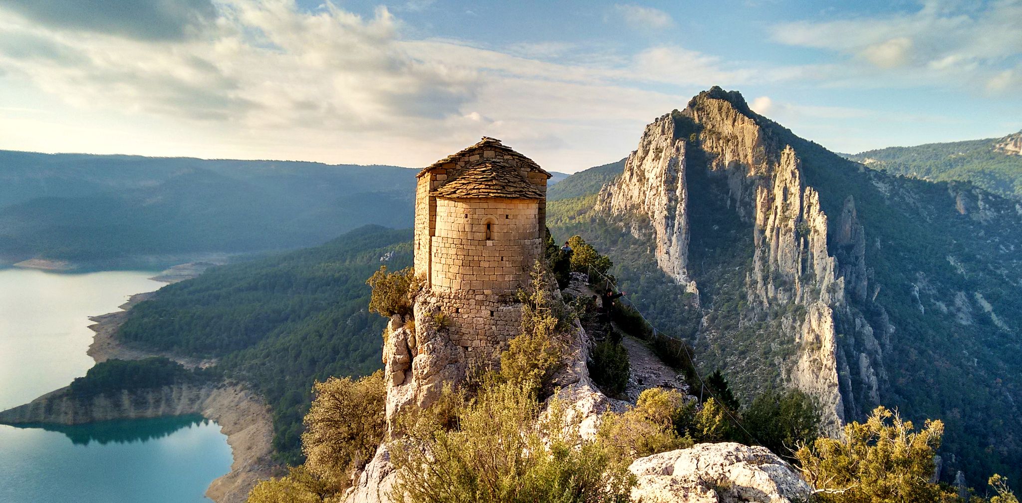
No traffic road cycling routes around Gavet de la Conca traverse a diverse landscape characterized by a wide fluvial basin and flanked by the Montsec mountain range to the south, including Montsec de Rúbies and Serra de Carreu-Sant Corneli. The municipality features valleys carved by rivers like the Conques and various ravines such as Barcedana and Xércoles, providing varied topography. This tranquil rural setting, with its low population density, offers quiet roads ideal for road cycling.
Best no traffic road cycling routes around Gavet de la Conca
- The most popular no traffic road cycling route is Plaza Mayor Artesa de Segre – Alòs de Balaguer Spring loop from Vilanova de Meià, a 37.8 miles (60.8 km) trail that takes 3 hours 7 minutes to complete. This route offers varied terrain through the region's fluvial basin and surrounding hills.
- Another top favourite among local road cyclists is Sant Salvador de Toló – Coll de Comiols loop from Església de Sant Pere d'Aransís, a difficult 31.9 miles (51.3 km) path. This route features significant elevation gain, climbing towards the Coll de Comiols mountain pass with expansive views.
- Local road cyclists also love the Coll de Faidella (1250 m) loop from Isona i Conca Dellà, a 24.6 miles (39.7 km) trail leading through mountainous terrain and rural villages, often completed in about 2 hours 14 minutes.
- Road cycling around Gavet de la Conca is defined by its mountainous backdrop, deep valleys, and tranquil rural roads, offering a diverse range of challenges. The network provides options for different ability levels, from moderate loops to more difficult climbs with substantial elevation gain.
- The routes in Gavet de la Conca are highly rated by the komoot community with an average score of 4.6 stars from 7 reviews. More than 1000 road cyclists have used komoot to explore Gavet de la Conca's varied terrain.
Last updated: July 7, 2026
5.0
(1)
11
riders
Moderate road ride. Good fitness required. Some segments of this route may be unpaved and difficult to ride.
8
riders
51.3km
02:54
1,020m
1,020m
Hard road ride. Very good fitness required. Mostly well-paved surfaces and easy to ride.

Sign up for free
7
riders
39.7km
02:14
850m
850m
Moderate road ride. Good fitness required. Mostly well-paved surfaces and easy to ride.
3
riders
11.8km
00:40
180m
180m
Moderate road ride. Great for any fitness level. Some segments of this route may be unpaved and difficult to ride.
4
riders
47.9km
02:52
1,160m
1,160m
Hard road ride. Very good fitness required. Mostly well-paved surfaces and easy to ride.
Our route recommendations are based on thousands of hikes, rides, and runs completed by other people on komoot.
Start today with a free account
Your next adventure awaits.
Login or Signup


Other adventures around Gavet de la Conca

Tips from the Community

Fresh drinking water - perfect location to fill your bottles
0
0

From the main road you cannot appreciate the rustic beauty of this town on the plain of Lleida. It is worth entering the town and walking through the streets of the historic center.
0
0
Next to the Coll d'Ares, it is the most iconic port in the Montsec mountain range and the Lleida Pre-Pyrenees. The views from above, either towards the Pyrenees and the Isona and Tremp valley, as well as the Plana de Lleida, are magnificent. It is a port with 4 aspects, each one different: - The southern slope, which begins in Artesa de Segre, is almost 24 km long and runs along a road with a lot of traffic, very wide and with long straights. After passing the town of Folquer, you face the hardest section of the climb, now with continuous curves and horseshoes, although with a road that is still very wide. The best are the views of the Lleida plain. It is not a side that I like since it is very stinky. - The southeast slope, the one that begins in Pons, is longer than the previous one, with 29 km. It has 2 rest sections, with some descent, and the road is narrow and twisty. There are good views along the climb. This slope joins the southern slope that comes from Artesa de Segre at the height of Folquer, where the hardest 7 km remain until reaching the top of the pass. - The main northern slope begins in Tremp and is 28.2 km. It is similar to the Artesa de Segre slope, with a similar gradient and a wide, busy road with a progressive slope, although it is true that there are no kilometers that reach 7%. I don't like. - The northwest slope, which also begins in Tremp, takes the old road that goes up through the town of Sant Salvador de Toló. It is a climb without traffic, on an irregular asphalt road, one of the old ones, which is grippy and difficult to roll, but in good condition. If you plan to go up to Comiols on the northern slope, you have to do it here and forget about the slope that runs along the main road.
0
0

Sant Esteve de la Sarga is a beautiful 11th century Romanesque church located in the town of the same name.
1
0
The Ares pass is located in the Montsec mountain range, at an altitude of 1,586 metres. The environment, surrounded by mountains, is beautiful, it is an emblematic place to practice paragliding.
1
0

The name of Sant Salvador is due to the dedication of the parish of the town. Toló comes from the name of the castle around which the old town was formed.
0
0
The Coll de Comiols is a hill located at 1101 meters high. It acts as the border of several municipalities in the Pallars Jussà region. It offers magnificent views of the surrounding mountains and the Cuenca de Tremp.
0
0
The porches of Plaça Major d'Artesa de Segre (Noguera) are a work included in the Inventory of the Architectural Heritage of Catalonia. Porchada within the medieval plot of the municipality of Artesa de Segre, which covers an entire facade of the square, formed by a series of arcades of various styles and heights, with semicircular and recessed arches. https://ca.wikipedia.org/wiki/Porxos_pla%C3%A7a_Major_(Secret_Craft)
0
0
Frequently Asked Questions
How many no-traffic road cycling routes are available in Gavet de la Conca?
There are 5 dedicated no-traffic road cycling routes in Gavet de la Conca, offering a range of experiences from moderate to difficult. These routes are designed to provide a tranquil cycling experience away from heavy vehicle traffic.
What kind of terrain can I expect on road cycling routes in Gavet de la Conca?
The terrain in Gavet de la Conca is diverse, characterized by a wide fluvial basin flanked by the Montsec mountain range, including Montsec de Rúbies, and the Serra de Carreu-Sant Corneli. You can expect varied topography with challenging climbs, rewarding descents, and scenic routes through valleys carved by rivers like the Conques and various ravines. The presence of the Noguera Pallaresa river to the west further enhances the natural setting.
Are there any challenging no-traffic road cycling routes for experienced cyclists?
Yes, Gavet de la Conca offers several challenging routes. For instance, the Sant Salvador de Toló – Coll de Comiols loop from Església de Sant Pere d'Aransís is classified as difficult, covering over 51 km with more than 1000 meters of elevation gain. Another demanding option is the Coll d'Ares – Collado de Ares loop from Estorm, which features over 1100 meters of ascent.
What natural features or viewpoints can I see along the no-traffic road cycling routes?
The region offers stunning natural beauty. You can expect views of the Montsec mountain range and valleys. The Coll de Comiols is a notable mountain pass offering scenic vistas. Additionally, highlights like the Tossal de Mirapallars and the Vilanova de Meià Canyon are nearby and contribute to the area's picturesque landscape.
Are there any historical sites or charming villages to explore near the cycling routes?
Absolutely. Gavet de la Conca is home to several small villages like Aransís and Sant Salvador de Toló, which retain a rustic, ancient charm with well-preserved medieval elements. Historical attractions include the 12th-century Sant Gervàs Castle and the ruins of the medieval Toló Castle, which offers panoramic views. The Bonrepòs estate, a medieval farmhouse built partly over a Romanesque hermitage, is also a noteworthy site.
What is the best time of year for no-traffic road cycling in Gavet de la Conca?
While specific seasonal advice isn't detailed, the Mediterranean climate of Catalonia generally makes spring (April-May) and autumn (September-October) ideal for cycling. During these periods, temperatures are milder, and the natural scenery is particularly vibrant, offering comfortable conditions for exploring the quiet roads.
What do other road cyclists enjoy most about cycling in Gavet de la Conca?
The area is highly rated by the komoot community, with an average score of 4.6 out of 5 stars. Reviewers often praise the tranquil rural environment, the diverse landscapes, and the opportunity to experience challenging climbs and rewarding descents on quiet roads, making it an appealing destination for those seeking diverse road cycling adventures.
Are there any moderate no-traffic road cycling routes suitable for a good workout?
Yes, there are several moderate routes. The Plaza Mayor Artesa de Segre – Alòs de Balaguer Spring loop from Vilanova de Meià is a great option, spanning over 60 km with more than 800 meters of elevation gain. Another moderate choice is the Coll de Faidella (1250 m) loop from Isona i Conca Dellà, offering a substantial ride of nearly 40 km with similar elevation.
Is there a shorter, less strenuous no-traffic road cycling route available?
For a less strenuous option, consider the Estany Gros loop from Isona i Conca Dellà. This moderate route is approximately 11.8 km long with about 180 meters of elevation gain, making it suitable for a shorter ride or for those looking for a more relaxed experience on quiet roads.
What kind of flora and fauna can be observed while cycling in Gavet de la Conca?
The region boasts rich flora and fauna, making it suitable for nature observation. Its protected spaces within the Montsec mountain range and the diverse valleys provide habitats for various species. Cyclists can enjoy the natural environment and potentially spot local wildlife and diverse plant life along the routes.
Are there any specific water features or rivers that the cycling routes pass by?
The municipality encompasses valleys carved by rivers like the Conques (also known as Gavet) and various ravines such as Barcedana and Xércoles. The Noguera Pallaresa river to its west further enhances the natural setting, offering scenic views and contributing to the varied topography that cyclists will encounter.
Most popular routes around Gavet de la Conca
Most popular attractions around Gavet de la Conca

Get inspired with the komoot mobile app


Explore more
Browse the best Road cycling routes in other regions.
