The best traffic-free bike rides around Le Fau
4.7
(103)
3,735
riders
16
rides
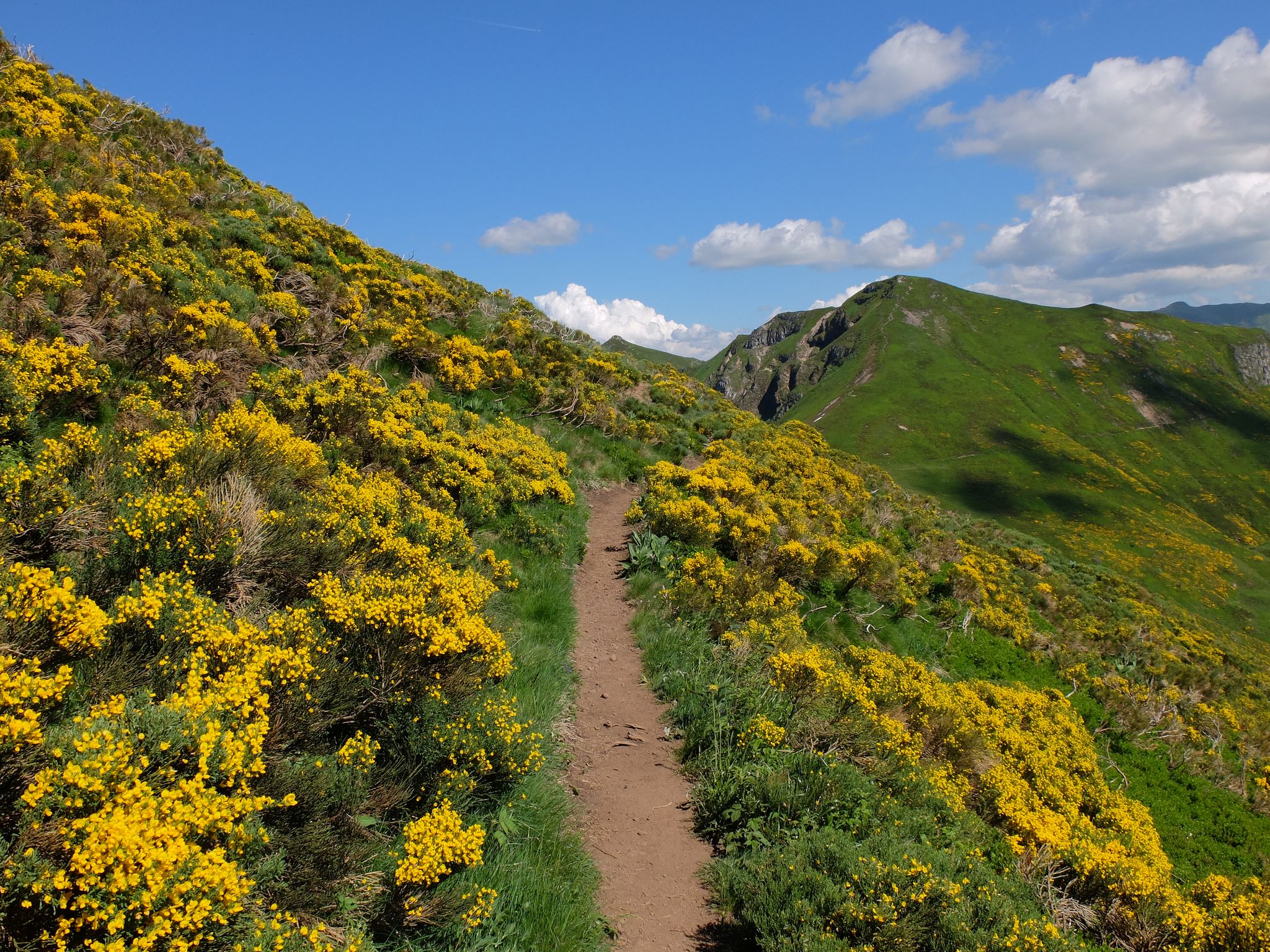
Road cycling around Le Fau, primarily located within the Cantal department of the Auvergne Volcanoes Regional Natural Park, offers diverse terrain for cyclists. The region is characterized by its ancient volcanic massif, featuring high-altitude plateaus, deep glacial valleys, and impressive peaks. Cyclists can expect routes that traverse tranquil beech forests and expansive summer pastures, providing varied landscapes. This area presents both challenging ascents over mountain passes and more relaxed rides through verdant lowlands.
Best no traffic road cycling routes around…
Last updated: May 24, 2026
4
riders
60.5km
03:17
1,160m
1,160m
Hard road ride. Very good fitness required. Mostly well-paved surfaces and easy to ride.
5.0
(6)
278
riders
73.4km
03:59
1,510m
1,510m
Hard road ride. Very good fitness required. Mostly well-paved surfaces and easy to ride.

Sign up for free
4.8
(4)
38
riders
41.7km
02:13
800m
800m
Moderate road ride. Good fitness required. Mostly well-paved surfaces and easy to ride.
35
riders
49.1km
02:57
1,110m
1,110m
Hard road ride. Very good fitness required. Some segments of this route may be unpaved and difficult to ride.
14
riders
75.1km
03:57
1,400m
1,400m
Hard road ride. Very good fitness required. Mostly well-paved surfaces and easy to ride.
Get access to more routes and recommendations from other explorers.
Sign up for free
Already have an account?
Our route recommendations are based on thousands of hikes, rides, and runs completed by other people on komoot.
Start today with a free account
Your next adventure awaits.
Login or Signup

Other adventures around Le Fau

Tips from the Community


Rain, visibility 1m, but otherwise great
0
0

Salers is a municipality in the Cantal department in the Auvergne-Rhône-Alpes region. The town is a completely preserved small town from the Renaissance period, with private and public buildings, city walls, defensive towers and a church. It was included in the association of the most beautiful villages in France. Despite its small population of around 300 inhabitants, the town is a historical, cultural and agricultural center in the sparsely populated mountain region of the Monts du Cantal. Source: https://de.wikipedia.org/wiki/Salers
3
0

Col de Légal, at an altitude of 1,231 meters, on the beautiful Route des Crêtes. It allows you to go from the Doire valley to the Bertrande valley, in the heart of the Pays de Salers. There you will find a small inn open all year round.
0
0

Classified among the “Most Beautiful Villages of France”, Salers is perched at an altitude of 950 meters, in the heart of the Cantal mountains. Its reputation is due to its terroir but also to its medieval heritage. Discover the volcanic stones of this small town and don't miss out on tasting Salers meat, renowned for its unique flavor.
1
0

I recommend the visit of the castle of Anjony overlooking the valley from its 40m high, with its 3 levels of rooms with rich furniture and its round tower!
0
0

A truffade a sweet/salty pancake
0
0

At 954 meters, the Col Saint-Georges is a 2.8 kilometer long climb from Saint Projet de Salers with an elevation gain of 153 meters and an average gradient of 5.5%.
0
0
Frequently Asked Questions
How many no-traffic road cycling routes are available around Le Fau?
There are 16 dedicated no-traffic road cycling routes around Le Fau, offering a variety of experiences. These routes range from moderate to difficult, providing options for different skill levels.
What kind of terrain can I expect on the no-traffic road cycling routes in Le Fau?
The terrain around Le Fau, particularly in the Cantal region, is characterized by its volcanic origins. You'll encounter impressive peaks, expansive high-altitude plateaus, and deep glacial valleys. Routes often feature challenging ascents over mountain passes and picturesque rides through verdant lowlands, beech forests, and summer pastures.
Are there any circular no-traffic road cycling routes in Le Fau?
Yes, many of the routes around Le Fau are designed as loops. For example, you can try the RBX Cantal Volcano Loop, which covers over 60 km, or the Salers – Col de Saint-Georges (954 m) loop from Mandailles, a challenging 73 km ride.
What are some notable landmarks or natural features I can see along the no-traffic road cycling routes?
The region is rich in natural beauty and historical sites. You can cycle past iconic features like the Puy Mary Summit and the Pas de Peyrol Pass (1,589 m). The area also features charming medieval villages such as Salers and Tournemire, which offer cultural detours.
What is the best time of year to go road cycling in Le Fau?
The summer months are generally ideal for road cycling in Le Fau, especially for tackling the higher mountain passes. This is when the summer pastures are vibrant, and the weather is most favorable for long rides. The region has a strong cycling heritage, often hosting stages of the Tour de France during this period.
Are there any easy no-traffic road cycling routes suitable for beginners in Le Fau?
While many routes in Le Fau are moderate to difficult due to the mountainous terrain, there are options like the Salers – Col de Saint-Georges (954 m) loop from Salers, which is rated as moderate. This route still offers significant elevation gain but is shorter than some of the more challenging options, making it a good starting point for those building fitness.
What do other road cyclists say about the routes in Le Fau?
The no-traffic road cycling routes around Le Fau are highly rated by the komoot community, with an average score of 4.76 stars. Reviewers often praise the stunning volcanic landscapes, the challenging yet rewarding climbs, and the peaceful, traffic-free nature of the roads, allowing for an immersive experience in the Auvergne Volcanoes Regional Natural Park.
Are there any specific mountain passes featured on these routes?
Yes, the routes often traverse significant mountain passes. You can expect to encounter passes like the Pas de Peyrol Pass (1,589 m), Neronne Pass, and Pertus Pass, which are well-known for their scenic views and challenging ascents.
Where can I park my car when starting a road cycling route in Le Fau?
While specific parking areas are not detailed for every route, most villages and popular starting points in the Auvergne Volcanoes Regional Natural Park, such as Salers or Tournemire, offer public parking facilities. It's advisable to check local information for the specific starting point of your chosen route.
Are there any routes that pass through or near medieval villages?
Absolutely. The region is dotted with picturesque medieval villages. Routes like the Col de Saint-Georges (954 m) – Col de Légal loop from Tournemire will take you through or near charming settlements, offering opportunities to explore local culture and history.
What is the typical duration and distance for a no-traffic road cycling route in Le Fau?
The routes vary significantly. For instance, a moderate route like the Salers – Col de Saint-Georges (954 m) loop from Salers is about 41 km and takes around 2 hours and 15 minutes. More difficult routes, such as the Col de la Croix de Cheules – Col de Légal loop from Rangouze, can be around 49 km and take over 2 hours and 55 minutes, depending on your pace and stops.
Most popular attractions around Le Fau

Get inspired with the komoot mobile app


Explore more
Browse the best Road cycling routes in other regions.
