The best traffic-free bike rides around Haut-Du-Them-Château-Lambert
4.2
(15)
208
riders
7
rides
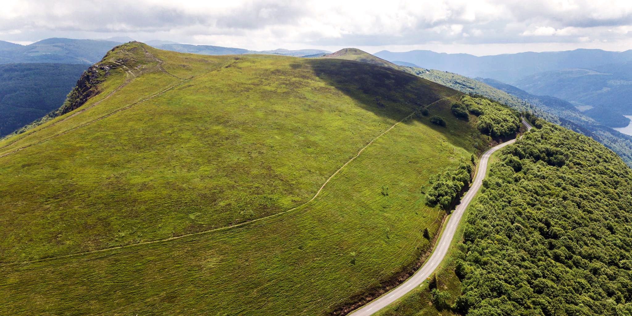
No Traffic gravel bike trails Haut-Du-Them-Château-Lambert are found within the Haute-Saône department, situated on the southern slopes of the Vosges mountains. This region offers a diverse terrain of mountains, valleys, and extensive forests, providing varied surfaces suitable for gravel biking. The landscape is characterized by challenging ascents and descents, with elevations reaching up to 1,215 meters at Ballon de Servance. Marked trails traverse these natural environments, offering off-road cycling opportunities.
Best no traffic gravel bike trails around Haut-Du-Them-Château-Lambert
- The most…
Last updated: October 8, 2026
5.0
(1)
23
riders
45.7km
03:11
1,070m
1,070m
Hard gravel ride. Very good fitness required. Mostly paved surfaces. Suitable for all skill levels.
5.0
(2)
18
riders
51.3km
03:45
1,390m
1,390m
Hard gravel ride. Very good fitness required. Mostly paved surfaces. Suitable for all skill levels.

16
riders
Hard gravel ride. Very good fitness required. Mostly paved surfaces. Suitable for all skill levels.
8
riders
34.5km
02:27
790m
790m
Hard gravel ride. Very good fitness required. Mostly paved surfaces. Suitable for all skill levels.
3.0
(3)
6
riders
Hard gravel ride. Very good fitness required. Mostly paved surfaces. Suitable for all skill levels.
Get access to more routes and recommendations from other explorers.
Already have an account?
Our route recommendations are based on thousands of hikes, rides, and runs completed by other people on komoot.
Start today with a free account
Your next adventure awaits.
Popular around Haut-Du-Them-Château-Lambert

Other adventures around Haut-Du-Them-Château-Lambert

Tips from the Community

De Col des Croix is a 679-meter-high mountain pass in the French Vogezen massif, located on the border of the Vosges and Haute-Saône departments. The pass forms an accessible connecting road (the D486) between the northern Le Thillot and the southern Servance. At the top, you will find the well-known Le Chalet Snack du Col des Croix, and the road splits towards the D16 (Route des Forts), the route that continues to the higher Ballon de Servance.
6
0
The end of the climb is somewhat disappointing. There is nothing marked. No photo opportunity. You have a small parking lot, a closed military road, and a picnic spot well hidden under the trees. At the two yellow signs (mainly for hikers) there is the only indication that you are at the Ballon de Servance and at 1158 m. The climb is "cozy". No cars, completely shaded, a few kilometer markers.
7
0
La Planche des Belles Filles is a 5.8 kilometer climb. It is a category 1 climb. It is located in Plancher Les Mines, Franche-Comté, France. The average gradient of this climb is 8.6% with a maximum of 13.6%. La Planche des Belles Filles climbs from 527 meters at the start to 1,033 meters at the summit, for a total elevation gain of 506 meters.
7
0
This 5.9-kilometer climb from the village of Plancher-les-Mines in Haute-Saône is one of the most difficult in the Vosges. Indeed, cyclists who want to try it will need to be at least somewhat trained. With a gradient of 24% towards the end of the route, it's better to be well-attached. The gradient never seems to ease, with its hairpin bends and, upon reaching the resort, the last 2 kilometers rise like a wall. However, you'll be able to say that you've done it, so come and try the climb of La Planche too!
8
0

Located at an altitude of 767m, the Chapelle des Vés de Fresse sur Moselle was built in 1863 by the farmers of the Fresse sur Moselle hill with materials from the old village church.
0
0

beautiful cycle path along the Moselle
1
0
Beautiful building in Bussang
0
0
We now follow the Moselradweg to Koblenz
0
0
Frequently Asked Questions
How many no-traffic gravel bike trails are available around Haut-Du-Them-Château-Lambert?
The region offers a good selection of traffic-free gravel bike trails, with 7 routes currently listed. These routes vary in length and elevation, providing options for different skill levels, predominantly catering to more challenging rides.
What do other gravel bikers appreciate most about the trails in Haut-Du-Them-Château-Lambert?
The komoot community rates the trails highly, with an average score of 3.9 stars. Riders often praise the diverse terrain, from challenging mountain ascents to serene forest paths, and the stunning panoramic views, especially from spots like the Ballon de Servance and the Col des Croix.
Are there any notable landmarks or viewpoints along the no-traffic gravel bike trails?
Yes, the trails often lead to or pass by significant natural and historical points. You can experience panoramic views from Ballon de Servance, the highest point in Haute-Saône, or the iconic La Planche des Belles Filles. The region also features charming chapels like Chapelle Notre-Dame-des-Neiges and the open-air Musée de la Montagne in Château-Lambert, offering cultural insights into the area's past.
Are there any family-friendly no-traffic gravel bike routes in the area?
While many routes in this guide are rated as 'difficult' due to significant elevation changes, the region does offer extensive networks of marked trails through forests and meadows that can be adapted for family rides. For a challenging family adventure, consider routes that incorporate less technical sections, keeping in mind the mountainous terrain. Always check the route details for elevation and surface type before heading out.
Can I bring my dog on these gravel bike trails?
Generally, dogs are welcome on trails in the Vosges mountains, especially on forest paths and gravel roads. However, it's crucial to keep them on a leash, particularly in areas with wildlife (like deer and roe deer, which are common) or near livestock. Always respect local signage and regulations, especially within nature reserves or protected areas.
What is the best time of year for gravel biking in Haut-Du-Them-Château-Lambert?
The best time for gravel biking is typically from spring to autumn (May to October). During these months, the weather is generally milder, and trails are clear of snow. Spring brings lush greenery and wildflowers, while autumn offers spectacular fall foliage. Winter can be challenging due to snow and ice, especially at higher elevations like the Ballon de Servance.
Are there any circular no-traffic gravel bike routes?
Yes, many of the routes are designed as loops, allowing you to start and end at the same point. For example, the "Ballon de Servance – La Planche des Belles Filles loop from Saint-Maurice-sur-Moselle" offers a substantial circular ride through varied terrain. Another option is the "Pinot Ramp – La Planche des Belles Filles loop from Réserve naturelle des Ballons Comtois" for a shorter, yet still challenging, loop.
Where can I find parking for these gravel bike trails?
Haut-Du-Them-Château-Lambert and surrounding villages like Saint-Maurice-sur-Moselle or Le Thillot typically offer public parking areas, often near village centers or trailheads. Given the region's focus on outdoor activities, you'll usually find designated spots suitable for accessing the trail network. Always check local signs for any parking restrictions.
What kind of terrain can I expect on these no-traffic gravel trails?
The terrain is highly varied, reflecting the region's position in the Vosges mountains. You'll encounter a mix of well-maintained gravel roads, forest tracks, and sometimes paved sections connecting gravel segments. Expect significant ascents and descents, as the area features mountain passes and high points like the Ballon de Servance. Surfaces can range from smooth gravel to rougher, rockier paths, so a capable gravel bike is recommended.
Are there any easy or beginner-friendly no-traffic gravel bike routes?
Most routes listed in this guide are rated as 'difficult' due to the mountainous terrain and significant elevation gain. However, the extensive network of forest roads and paths around Haut-Du-Them-Château-Lambert means that easier, flatter sections can be found, especially in the valleys or along less steep forest tracks. It's best to consult detailed route maps and elevation profiles to identify sections suitable for beginners.
Can I access these trails using public transport?
Public transport options directly to trailheads in Haut-Du-Them-Château-Lambert can be limited, as is common in more rural, mountainous regions of France. Access is generally easier by car. However, some regional bus services might connect larger towns in the Vosges to smaller villages. It's advisable to check local transport schedules in advance if you plan to rely on public transport, and confirm if bikes are allowed on board.
Most popular routes around Haut-Du-Them-Château-Lambert
Most popular attractions around Haut-Du-Them-Château-Lambert

Get inspired with the komoot mobile app


Explore more
Browse the best Gravel rides in other regions.
