The best traffic-free bike rides around Saint-Germain-De-Calberte
4.5
(80)
1,843
riders
9
rides
Road cycling around Saint-Germain-De-Calberte offers diverse landscapes within the Cévennes National Park, a UNESCO World Heritage site. The region is characterized by mountainous terrain, river gorges, and dense woodlands, providing varied backdrops for no traffic road cycling routes. Cyclists encounter winding roads and challenging climbs, with prominent peaks such as Mount Aigoual and Mount Lozère. The area's rugged beauty and varied terrain make it suitable for different cycling preferences.
Best no traffic road cycling routes around Saint-Germain-De-Calberte
- The most popular…
Last updated: July 4, 2026
29
riders
70.9km
04:09
1,660m
1,660m
Hard road ride. Very good fitness required. Mostly well-paved surfaces and easy to ride.
12
riders
Moderate road ride. Good fitness required. Mostly well-paved surfaces and easy to ride.

Sign up for free
3.0
(1)
6
riders
24.6km
01:38
580m
590m
Moderate road ride. Good fitness required. Some segments of this route may be unpaved and difficult to ride.
3.0
(1)
9
riders
37.5km
02:00
610m
610m
Moderate road ride. Good fitness required. Mostly well-paved surfaces and easy to ride.
6
riders
35.0km
01:59
780m
780m
Moderate road ride. Good fitness required. Mostly well-paved surfaces and easy to ride.
Get access to more routes and recommendations from other explorers.
Sign up for free
Already have an account?
Our route recommendations are based on thousands of hikes, rides, and runs completed by other people on komoot.
Start today with a free account
Your next adventure awaits.
Login or Signup
Popular around Saint-Germain-De-Calberte

Other adventures around Saint-Germain-De-Calberte

Tips from the Community

This metal bridge spans the Galeizon river, known for the quality of its waters, suitable for swimming.
0
0
This bridge over the Salandre offers a nice viewpoint of the watercourse below.
0
0

This small sacred monument, too, is a symbol of remembrance of the crucifixion and resurrection of Jesus Christ. However, its design is very unique and unlike the usual crosses that often crown mountain peaks. At the end of the triangular base plate, a small wall appears to have been built, its sides terminating in the shape of a stepped gable. In the center is a V-shaped cutout, the ends of which extend significantly beyond the height of the small wall. From this V emerges the longitudinal beam of the cross, which, however, has two crossbeams. This double crossbeam, as well as the lack of a corpus, is typical of the so-called "Lorraine Cross."
3
0

Nice pass to do on both sides with very beautiful views, a little gem like there are so many in our deep Cévennes..👌
0
0

Superb pass, a must-do if you're passing through the area. It's incredible from any side.
0
0

lovely swimming in the river
0
0

This village which is in the heart of the Cévennes national park is the ideal place to take a break. The fountain offers you good spring water, come and drink from it before walking along the main street of the village. The landscapes surrounding the town well represent the wild beauty of this Cévennes country.
0
0
Saint Stephen “Saint-ETIENNE” is one of the seven first deacons of the early Jerusalem community and is also the first martyr (martyr) of early Christianity. The church remembers him on Boxing Day, December 26th. When Stephen uttered his vision of the open heaven, "And being filled with the Holy Spirit, he looked up into heaven and saw the glory of God, and Jesus standing at the right hand of God" (Acts chapter 7 verse 55), the people were so indignant that that they drove him out of the city and stoned him.
1
0
Frequently Asked Questions
How many no-traffic road cycling routes are available around Saint-Germain-De-Calberte?
There are 5 dedicated no-traffic road cycling routes around Saint-Germain-De-Calberte featured in this guide. These routes offer a tranquil experience through the stunning Cévennes landscape, often with more sheep than cars.
What kind of terrain and difficulty can I expect on these no-traffic road cycling routes?
The Cévennes region is known for its mountainous terrain, offering a mix of moderate and difficult routes. You'll encounter significant ascents and descents, with winding lanes and panoramic views. For example, the Beautiful view of the Cévennes loop from Molezon is a challenging ride with over 1600m of elevation gain, while the Col d'Uglas – Panoramic view of the Cévennes loop from Mandajors offers a moderate challenge with superb views.
Are there any easy no-traffic road cycling routes for beginners or families?
While the region is generally characterized by challenging terrain, this guide features routes that vary in difficulty. Currently, all routes listed are either moderate or difficult, reflecting the mountainous nature of the Cévennes. However, the 'no traffic' aspect makes them safer for those building confidence, even if the climbs are present.
What are some notable landmarks or natural features I can see along these routes?
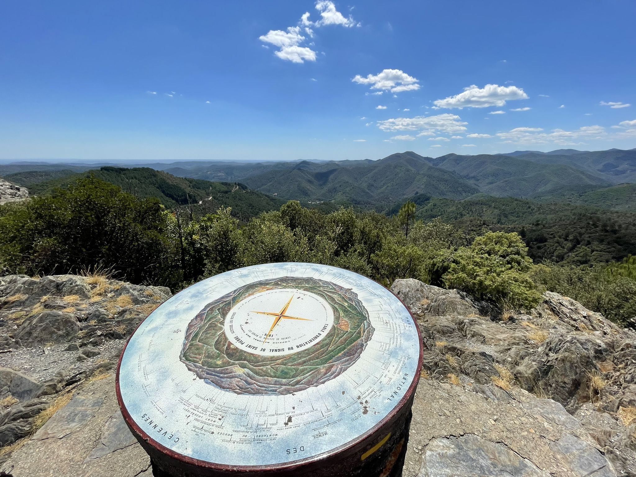
The routes offer breathtaking views of the Cévennes valleys, Mount Aigoual, and Mount Lozère. You might pass by significant mountain passes like Col d'Uglas or Col de la Croix de Berthel. Keep an eye out for viewpoints such as the Signal de Saint-Pierre Orientation Table and the Cairn and Panorama, which offer expansive vistas of the rugged landscape.
What do other road cyclists enjoy most about cycling in Saint-Germain-De-Calberte?
The area is highly rated by the komoot community, with an average score of 4.5 stars. Reviewers often praise the tranquil, traffic-free nature of the roads, the challenging climbs, and the magnificent panoramic views of the Cévennes National Park, a UNESCO World Heritage site. The feeling of being immersed in nature, often encountering more sheep than cars, is a common highlight.
What is the best time of year to cycle these no-traffic routes in Saint-Germain-De-Calberte?
The Cévennes region is ideal for cycling from spring through autumn. Spring offers lush greenery and pleasant temperatures, while autumn brings vibrant foliage and cooler air. Summer can be warm, especially in the valleys, but the higher elevations provide relief. Winter cycling can be challenging due to snow and colder conditions, particularly on the higher passes.
Are there any circular no-traffic road cycling routes available?
Yes, all the routes featured in this guide are circular, allowing you to start and end at the same point. For example, the Corbes – Anduze Town Center loop from Saint-Jean-du-Gard and the Col de la Barque – Baraque Pass (631 m) loop from Branoux-les-Taillades are both excellent circular options for experiencing the region's beauty.
Where can I find parking for these no-traffic road cycling routes?
Most routes start from villages or towns such as Saint-Jean-du-Gard, Molezon, Mandajors, Branoux-les-Taillades, or Gabriac. These locations typically offer public parking facilities. It's advisable to check local signage upon arrival for specific parking regulations and availability.
Can I reach the starting points of these routes using public transport?
Public transport options in the heart of the Cévennes National Park can be limited. While some larger towns might have bus services, direct connections to all starting points may not be available. Planning your journey in advance and checking regional transport schedules is recommended. For more general information about cycling in the Cévennes, you can visit Cévennes Tourisme.
Are there places to stop for refreshments or accommodation along the routes?
The routes pass through or near several small villages and hamlets where you can often find local cafes, restaurants, or small shops for refreshments. Accommodation options, ranging from gîtes to hotels, are also available in the larger villages and towns in the region, such as Saint-Germain-De-Calberte itself. It's a good idea to carry sufficient water and snacks, especially on longer stretches, as services can be sparse between settlements.
What is the average length of these no-traffic road cycling routes?
The routes in this guide vary in length, catering to different endurance levels. They range from approximately 19.5 km, like the Col de la Barque – Baraque Pass (631 m) loop from Branoux-les-Taillades, to longer rides of over 70 km, such as the Beautiful view of the Cévennes loop from Molezon. This allows cyclists to choose a route that fits their desired distance and time commitment.
Most popular routes around Saint-Germain-De-Calberte
Most popular attractions around Saint-Germain-De-Calberte

Get inspired with the komoot mobile app


Explore more
Browse the best Road cycling routes in other regions.
