The best traffic-free bike rides around Le Noyer
4.7
(87)
2,454
riders
5
rides
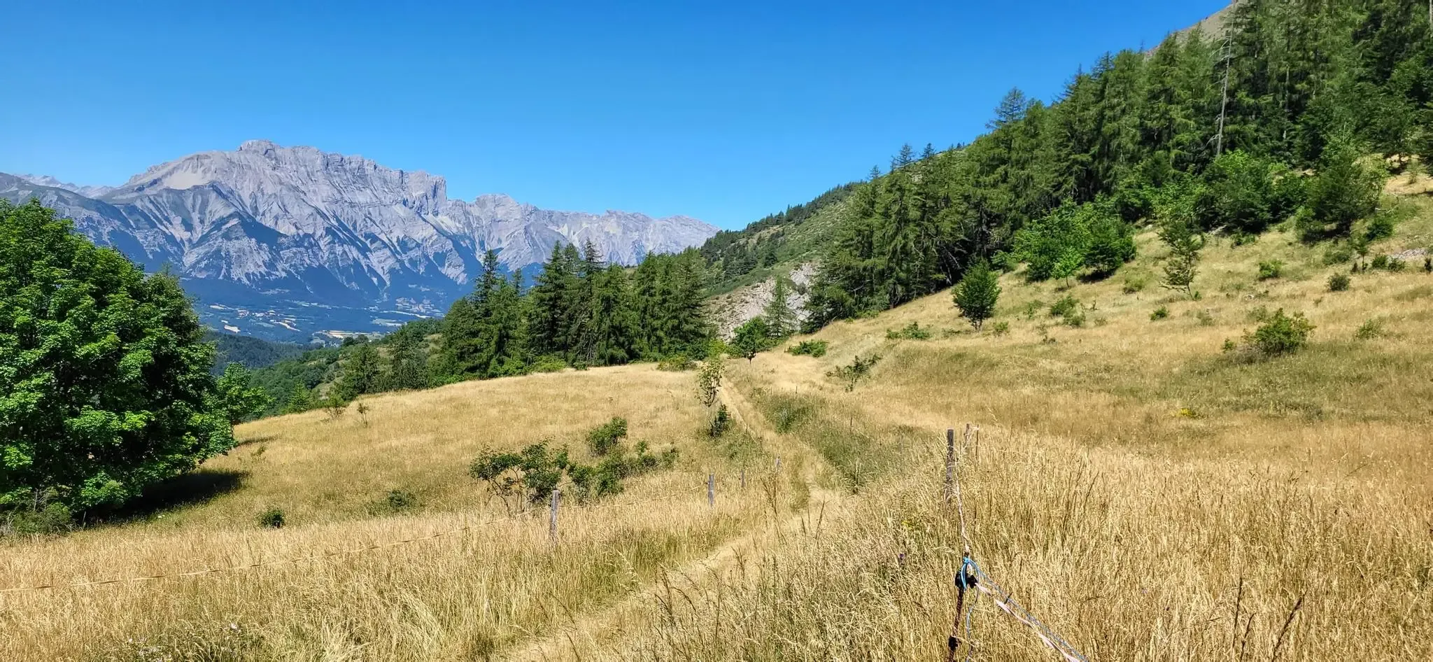
No traffic road cycling routes around Le Noyer are primarily found within the Hautes-Alpes department, characterized by an alpine environment with significant mountain passes and deep valleys. The region features narrow, winding mountain roads, often with low traffic, providing a challenging yet serene cycling experience. Terrain includes demanding ascents, such as the Col du Noyer, and offers panoramic views of the Champsaur and Dévoluy valleys.
Best no traffic road cycling routes around Le Noyer
- The most popular no traffic road cycling route is Saint-Bonnet-en-Champsaur – Insane descent loop from La Fare-en-Champsaur, a 20.0 miles (32.2 km) trail that takes 1 hour 57 minutes to complete. This moderate route features a notable descent within the alpine landscape.
- Another top favourite among local road cyclists is Insane descent – Col du Noyer (Noyer Pass) loop from Poligny, a difficult 23.0 miles (37.0 km) path. This route includes the challenging ascent of the Col du Noyer, known for its significant elevation gain and panoramic views.
- Local road cyclists also love the Corps – Sanctuary of La Salette loop from Saint-Firmin, a 31.0 miles (49.9 km) trail leading through varied alpine scenery, often completed in about 3 hours 15 minutes.
- Road cycling around Le Noyer is defined by challenging mountain passes, deep valleys, and winding alpine roads. The network offers options for different ability levels, from moderate loops to difficult ascents.
- The routes in Le Noyer are highly rated by the komoot community with an average score of 4.7 stars from more than 70 reviews. More than 2000 road cyclists have used komoot to explore Le Noyer's varied terrain.
Last updated: July 4, 2026
5.0
(2)
105
riders
32.2km
01:56
830m
830m
Moderate road ride. Good fitness required. Mostly well-paved surfaces and easy to ride.
4.7
(3)
74
riders
49.9km
03:08
1,420m
1,420m
Hard road ride. Very good fitness required. Mostly well-paved surfaces and easy to ride.

Sign up for free
19
riders
Moderate road ride. Good fitness required. Mostly well-paved surfaces and easy to ride.
9
riders
17.3km
00:54
310m
310m
Moderate road ride. Good fitness required. Mostly well-paved surfaces and easy to ride.
6
riders
12.6km
00:39
230m
230m
Easy road ride. Great for any fitness level. Mostly well-paved surfaces and easy to ride.
Our route recommendations are based on thousands of hikes, rides, and runs completed by other people on komoot.
Start today with a free account
Your next adventure awaits.
Login or Signup
Other adventures around Le Noyer

Tips from the Community

coffee, tea, pastries, cakes, ice cream, toilets, water and a warm welcome
0
0

Perfect asphalt and spectacular view.
13
0
You have to be careful on this descent and it is very technical.
13
0

Very popular sanctuary in summer, accommodation available
0
0

By bike it's a beautiful climb without too many people (worth seeing in summer anyway) with superb open landscapes
0
0
Village Isere, on the Route Napoleon, Corps takes place in the heart of the Dauphiné, eighty kilometers from Grenoble. This ancient medieval town is located on the border of the Hautes-Alpes, in the southern Alps, about 40 km from Gap and close to Saint-Firmin, Aspres-lès-Corps and Ambel.
28
0
At times challenging climb with practically non-existent traffic. Panorama of indescribable beauty.
24
0

Magnificent Switchbacks! Real mountain road. When you arrive from Devoluy, discovering the view of Champsaur is absolutely magnificent. The descent is also very beautiful and fun but beware it remains a pass open to traffic even if the latter remains very light.
0
0
Frequently Asked Questions
How many no traffic road cycling routes are available around Le Noyer?
There are 9 dedicated no traffic road cycling routes around Le Noyer, offering a variety of experiences for different skill levels. These routes are carefully selected to provide serene and enjoyable rides away from heavy vehicle traffic.
What is the best time of year for traffic-free cycling in Le Noyer?
The best time for traffic-free road cycling in Le Noyer, particularly in the Hautes-Alpes region, is typically from late spring (May/June) through early autumn (September/October). During these months, the weather is generally favorable, and mountain passes like the Col du Noyer are clear of snow, offering spectacular views and challenging ascents. Always check local conditions before heading out, especially in the shoulder seasons.
What do other road cyclists enjoy most about cycling in Le Noyer?
The komoot community highly rates the road cycling experience around Le Noyer, with an average score of 4.7 out of 5 stars from 73 ratings. Cyclists frequently praise the breathtaking panoramic views, the challenging yet rewarding climbs like the Col du Noyer, and the generally low-traffic mountain roads that make for a truly immersive cycling adventure in the alpine landscape.
Are there any easy no traffic road bike trails suitable for beginners in Le Noyer?
Yes, among the available routes, there are 2 easy routes perfect for beginners or those looking for a more relaxed ride. These trails offer a gentle introduction to the beautiful scenery around Le Noyer without demanding significant physical exertion.
Can I find longer traffic-free cycling routes near Le Noyer?
Absolutely. For those seeking a longer challenge, routes like the Lake Aulagnier – Chaillol 1600 loop from Saint-Bonnet-en-Champsaur cover over 53 km with significant elevation gain, providing an extensive and rewarding traffic-free experience through the stunning Hautes-Alpes landscape.
Are there circular no traffic road bike routes available around Le Noyer?
Many of the no traffic road cycling routes around Le Noyer are designed as loops, allowing you to start and finish at the same point. For example, the Saint-Bonnet-en-Champsaur – Insane descent loop from La Fare-en-Champsaur offers a fantastic circular ride, letting you experience diverse scenery without retracing your steps.
What kind of landmarks or attractions can I see along these routes?
The routes around Le Noyer offer access to stunning natural landmarks and viewpoints. You can encounter iconic mountain passes such as Col du Noyer (1664 m) and Col de Gleize (1691 m). There are also incredible viewpoints like Collet du Tat, offering panoramic vistas of the Champsaur valley and the Dévoluy massif.
Are the no traffic road cycling routes in Le Noyer challenging?
Yes, Le Noyer, especially in the Hautes-Alpes, is known for its challenging road cycling. The region features significant mountain climbs, including the famous Col du Noyer, which has been part of the Tour de France. Routes like the Insane descent – Col du Noyer (Noyer Pass) loop from Poligny are rated as difficult, involving substantial elevation gains and demanding ascents, perfect for experienced cyclists seeking a test of endurance.
Is there public transport access to the starting points of these bike trails?
While Le Noyer is nestled in a mountainous region, public transport options can be limited. It's advisable to check local bus schedules for connections to nearby towns like Saint-Bonnet-en-Champsaur or Poligny, which serve as starting points for some routes. However, for maximum flexibility on these traffic-free routes, personal vehicle transport is often the most convenient option.
Where can I find parking for these no traffic road bike trails?
Parking is generally available in the villages that serve as starting points for these routes, such as Saint-Bonnet-en-Champsaur, Poligny, or near Le Noyer itself. Look for designated public parking areas within these communes. Always ensure you park responsibly and respect local regulations.
Are there any cafes or places to rest along the traffic-free cycling routes?
While many of these routes traverse quieter, more natural areas, you'll often find opportunities for refreshments in the villages you pass through or at the summit of major passes. For instance, the Refuge Napoléon at the summit of Col du Noyer offers a historical point of interest and a place for respite. It's always a good idea to carry sufficient water and snacks, especially on longer or more remote sections.
What are the road conditions like on the no traffic routes around Le Noyer?
The mountain roads in the Hautes-Alpes, particularly those forming part of well-known cycling routes like the Col du Noyer, are generally well-maintained. This is partly due to their inclusion in major cycling events. While they are narrow and winding, they offer a smooth surface for road bikes. Always be mindful of potential loose gravel in mountainous areas and check for any local road closures, especially outside peak season.
Most popular routes around Le Noyer
Most popular attractions around Le Noyer

Get inspired with the komoot mobile app


Explore more
Browse the best Road cycling routes in other regions.
