The best traffic-free bike rides around Saint-Pons-De-Thomières
4.7
(177)
1,408
riders
27
rides
No traffic touring cycling routes around Saint-Pons-De-Thomières are situated within the Haut-Languedoc Regional Natural Park, offering diverse landscapes for cyclists. The region features green valleys, the foothills of the Massif Central, and a succession of forests and garrigue. Varied geology, including limestones and shales, defines the terrain, with the Jaur river winding through the landscape. Cyclists can explore the scenic Jaur valley and enjoy views of the Caroux Massif and Montagne Noire.
Best no traffic touring cycling routes around Saint-Pons-De-Thomières
…Last updated: August 28, 2026
5.0
(3)
35
riders
49.6km
03:43
1,110m
1,110m
Hard bike ride. Very good fitness required. You may need to push your bike for some segments of this route.
3.0
(1)
13
riders
24.5km
01:42
440m
440m
Moderate bike ride. Good fitness required. Mostly paved surfaces. Suitable for all skill levels.

Sign up for free
17
riders
37.6km
03:20
750m
750m
Hard bike ride. Very good fitness required. Mostly paved surfaces. Suitable for all skill levels.
4.3
(3)
17
riders
16.3km
01:06
160m
160m
Moderate bike ride. Good fitness required. Mostly paved surfaces. Suitable for all skill levels.
4.0
(1)
11
riders
27.7km
02:50
820m
820m
Hard bike ride. Very good fitness required. Mostly paved surfaces. Suitable for all skill levels.
Get access to more routes and recommendations from other explorers.
Sign up for free
Already have an account?
Our route recommendations are based on thousands of hikes, rides, and runs completed by other people on komoot.
Start today with a free account
Your next adventure awaits.
Login or Signup

Other adventures around Saint-Pons-De-Thomières


Tips from the Community

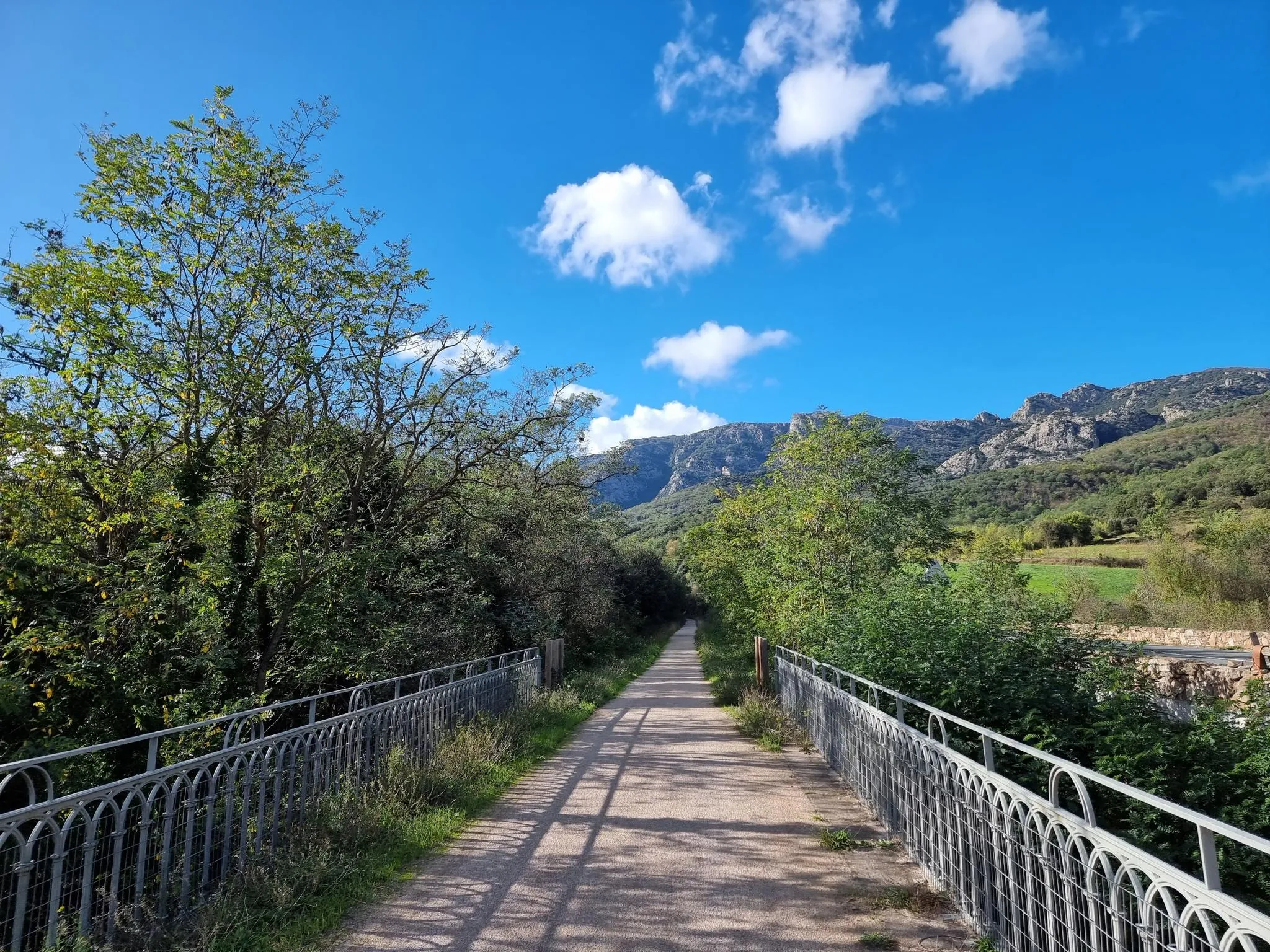
From an old railway line, a wonderful cycle path, dusty in parts with a few asphalt sections. Rode 30 km with a road bike. I would say an experience 🫠 zero traffic
1
0

The church of Saint-Sébastien de La Caminade is one of the last vestiges of the ancient heart of Prémian. Under the patronage of Saint Sebastian, it is mentioned as early as 940, when it was given to the abbey of Saint-Pons-de-Thomières. The place of worship is therefore much older than the building visible today. The Wars of Religion profoundly disrupted the site: in 1567, after the passage of Protestant troops, the church was described as "looted and razed". The current building was then rebuilt for the most part at the beginning of the 17th century. Its single nave has five bays and ends in a short choir bay and a three-sided apse. But the interest of the place also lies in its surroundings. With the old presbytery and the old town hall-school, the church forms one of the last preserved ensembles of La Caminade, the historic heart of Prémian. This name itself is attested as early as 1116 and derives from the Occitan caminada, which could designate a presbytery or a rectory.
1
0
Nestled in the mountains of Haut-Languedoc, the Vézoles lake is a dam lake. Built in the mid-20th century for hydroelectric production, it retains the waters of the upper Agout valley in a narrow and largely wooded site, characteristic of the high plateaus of the massif. Located in a transition zone between the large Atlantic and Mediterranean watersheds, this body of water is set in a unique setting.
1
0
Located in the Jaur valley, in the heart of the Hauts cantons of the Hérault, Riols is a vast rural village typical of the Haut-Languedoc. The village is intimately linked to the history of the abbey of Saint-Pons-de-Thomières, founded in the 10th century, on which it long depended. From the Middle Ages onwards, Riols was part of a network of monastic possessions. Even today, the old center retains its valley setting, crossed by the Jaur, around which the main routes and activities developed. The Pont-Vieux and several structures on the river bear witness to this close relationship between the village and its watercourse.
1
0
Vast reservoir of Haut-Languedoc, the Raviège offers a landscape mixing water, forests and hills. A peaceful setting, punctuated by beautiful openings onto the water body from the surrounding roads.
1
0
The west side of the Vézoles lake runs along the bank in a peaceful forest atmosphere, with several openings onto the reservoir's waters and the surrounding reliefs.
1
0
The Vézoles lake dam, commissioned in 1956 for hydroelectric production, holds back the waters of the Bureau stream in the heart of the Haut-Languedoc region. The site is located in a high plateau area where waters are divided between the large Atlantic and Mediterranean watersheds, giving this relief a particular dimension. From the dam, the lake appears nestled in a forest setting, in a calm and wild atmosphere, typical of the massif's mid-mountain regions.
1
0

A very beautiful trail that goes around the lake, essentially in the shade
0
0
Frequently Asked Questions
How many no-traffic touring cycling routes are available around Saint-Pons-De-Thomières?
There are over 20 dedicated no-traffic touring cycling routes around Saint-Pons-De-Thomières, offering a diverse range of experiences from easy family rides to more challenging excursions. These routes are designed to keep you away from vehicular traffic, providing a peaceful and safe cycling environment.
What is the best time of year for traffic-free touring cycling in the Haut-Languedoc Regional Natural Park?
The best months for traffic-free touring cycling in the Haut-Languedoc Regional Natural Park are typically those with pleasant temperatures and minimal rainfall. Spring (April-May) and early autumn (September-October) offer ideal conditions, with comfortable weather and vibrant landscapes. Summer can also be enjoyable, especially in the mornings or late afternoons, though it can get warm.
Are there any family-friendly no-traffic cycling routes suitable for beginners?
Yes, the region offers several easy, traffic-free routes perfect for families and beginners. A great example is the Tunnel de la Feuille – Fenille Tunnel loop from Labastide-Rouairoux, which is 14.8 km long with minimal elevation gain, making it very accessible. The Passa Païs greenway, a major car-free route, also has many sections suitable for all ages and skill levels.
What kind of natural features and landmarks can I expect to see along these routes?
The no-traffic routes around Saint-Pons-De-Thomières traverse a rich tapestry of natural beauty within the Haut-Languedoc Regional Natural Park. You can expect to see green valleys, the Jaur river, views of the Caroux Massif and Montagne Noire, and diverse geology. Notable natural sights include the Vésoles Waterfall, the Natural Tunnel of Minerve, and the scenic Lake Vésoles. You might also encounter picturesque villages like Minerve and Riols.
Are there any circular no-traffic touring cycling routes available?
Yes, there are several circular no-traffic touring cycling routes. For instance, the Riols – Notre-Dame-de-Trédos Chapel loop from Saint-Pons-de-Thomières offers a 27.2 km circular ride. Many sections of the Passa Païs greenway can also be combined with local roads to create circular loops, such as the Olargues Railway Bridge loop mentioned in regional information.
What do other touring cyclists enjoy most about the no-traffic routes in Saint-Pons-De-Thomières?
The area is highly rated by the komoot community, with an average score of 4.5 stars. Reviewers often praise the tranquility and safety of the car-free greenways, the stunning natural landscapes of the Haut-Languedoc Regional Natural Park, and the variety of routes that cater to different fitness levels. The well-maintained surfaces and scenic views along the Jaur and Orb rivers are frequently highlighted.
Where can I find parking for these traffic-free cycling routes?
Parking is generally available in the towns and villages that serve as starting points for these routes. For example, if you're planning to cycle on the Passa Païs greenway, you can often find parking in towns like Saint-Pons-De-Thomières, Riols, or Labastide-Rouairoux, which have direct access to the greenway. Always check local signage for specific parking regulations.
Can I bring my dog on these no-traffic cycling routes?
Generally, dogs are welcome on leashes on most public cycling paths and greenways in the region, including the Passa Païs. However, it's always advisable to check specific regulations for any protected natural areas or private land you might traverse. Ensure your dog is comfortable with cycling and that you carry water for both of you.
Are there any cafes or places to stop for refreshments along the no-traffic routes?
Yes, many of the no-traffic routes, especially those following the Passa Païs greenway, pass through or near charming villages where you can find cafes, bakeries, and small restaurants. Towns like Riols and Olargues are good examples of places offering refreshments and a chance to rest. It's always a good idea to carry some snacks and water, especially on longer stretches.
What is the longest traffic-free section I can cycle in the area?
The longest continuous traffic-free section is found on the Passa Païs greenway, which stretches for 80 kilometers between Mazamet and Bédarieux. This dedicated car-free path follows the Jaur and Orb rivers, offering a superb long-distance touring experience through tunnels and over bridges, entirely separated from road traffic.
Are there any routes that offer significant elevation gain for more experienced touring cyclists?
While this guide focuses on no-traffic routes, some of the more challenging options within the region, even if they incorporate short sections of quiet roads, do offer significant elevation gain. For example, the Orientation Table (Viewpoint) – Ferrals-les-Montagnes loop from Rieussec, though difficult, provides over 1100 meters of ascent, rewarding cyclists with expansive views. For purely traffic-free, the greenways are generally flatter, but the surrounding terrain offers plenty of climbs on connecting routes.
Most popular routes around Saint-Pons-De-Thomières
Most popular attractions around Saint-Pons-De-Thomières

Get inspired with the komoot mobile app


Explore more
Browse the best Cycling routes in other regions.
