The best traffic-free bike rides around Thun-Saint-Amand
4.5
(144)
3,602
riders
130
rides
No traffic road cycling routes around Thun-Saint-Amand are situated in the Nord department of the Hauts-de-France region, offering a landscape characterized by rural areas, meadows, and farmland. The region is integrated within the Scarpe-Escaut Regional Natural Park, featuring diverse ecosystems including the canalized Scarpe river. The terrain is generally flat to gently rolling, with minimal elevation changes, making it suitable for various cycling abilities. This environment provides a network of quiet country roads ideal for road cycling without vehicle traffic.
Best no traffic road cycling routes around Thun-Saint-Amand
- The most popular no traffic road cycling route is Paris-Roubaix Monument – Marchiennes State Forest loop from Brunehaut, a 40.4 miles (65.0 km) trail that takes 2 hours 53 minutes to complete. This route features sections through the Marchiennes State Forest and passes by the Paris-Roubaix Monument.
- Another top favourite among local road cyclists is Grand Large de Péronnes – Escaut Lock loop from Maulde, an easy 22.4 miles (36.0 km) path. This route offers views of the Grand Large de Péronnes and follows the Escaut Lock, providing a scenic ride along waterways.
- Local road cyclists also love the Grand Large de Péronnes – Escaut Lock loop from Bruille-Saint-Amand, a 20.6 miles (33.2 km) trail leading through the rural landscapes near the Escaut river, often completed in about 1 hour 24 minutes.
- Road cycling around Thun-Saint-Amand is defined by its rural landscapes, the canalized Scarpe river, and the green spaces of the Scarpe-Escaut Regional Natural Park. The network offers options for easy, moderate, and more challenging routes.
- The routes in Thun-Saint-Amand are highly rated by the komoot community with an average score of 4.4 stars from over 130 reviews. More than 3500 road cyclists have used komoot to explore Thun-Saint-Amand's varied terrain.
Last updated: July 2, 2026
21
riders
65.0km
02:54
210m
210m
Moderate road ride. Good fitness required. Some segments of this route may be unpaved and difficult to ride.
20
riders
35.7km
01:29
120m
120m
Easy road ride. Great for any fitness level. Mostly well-paved surfaces and easy to ride.

Sign up for free
17
riders
33.3km
01:25
100m
100m
Easy road ride. Great for any fitness level. Mostly well-paved surfaces and easy to ride.
4.0
(1)
12
riders
26.0km
01:14
120m
120m
Easy road ride. Great for any fitness level. Mostly well-paved surfaces and easy to ride.
8
riders
32.4km
01:18
70m
70m
Easy road ride. Great for any fitness level. Mostly well-paved surfaces and easy to ride.
Get access to more routes and recommendations from other explorers.
Sign up for free
Already have an account?
Our route recommendations are based on thousands of hikes, rides, and runs completed by other people on komoot.
Start today with a free account
Your next adventure awaits.
Login or Signup
Popular around Thun-Saint-Amand
Tips from the Community


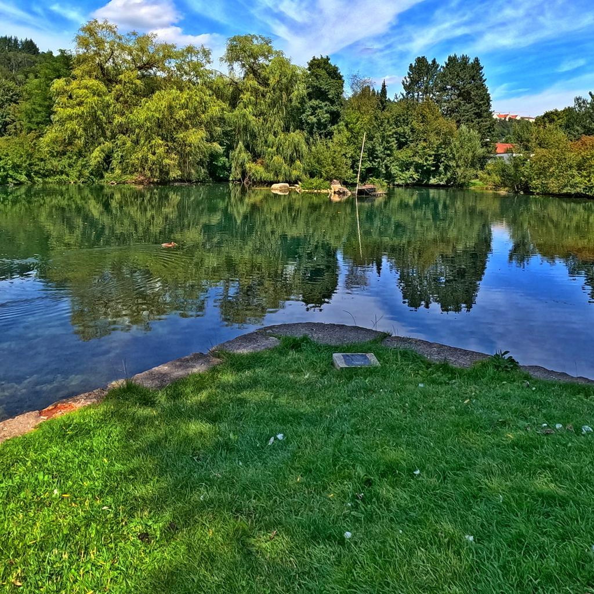
a little thirst to quench your thirst
0
0

Bridge over the Schelde at Montagne-du-Nord
2
0


Beautiful ballad
1
0

A difficult section to pass, but hey, when you love it, you don't count.
1
0
Pavement of Calvary! What a fitting name for this section of northern hell.
0
0
Frequently Asked Questions
How many no-traffic road cycling routes are available around Thun-Saint-Amand?
There are over 120 dedicated no-traffic road cycling routes around Thun-Saint-Amand, catering to various skill levels. You'll find a good mix of easy and moderate options to explore the region's quiet country roads and scenic paths.
What kind of terrain can I expect on these traffic-free routes?
The terrain around Thun-Saint-Amand is generally rural and not overly difficult, making it suitable for road cycling. You'll mostly encounter quiet country roads, often integrated into the beautiful Scarpe-Escaut Regional Natural Park, offering a mix of flat sections along canals and gentle rolling hills through farmland and meadows.
Are there any family-friendly no-traffic cycling routes?
Yes, many of the routes are suitable for families, especially those designated as 'easy'. The region's focus on quiet paths and rural roads within the Scarpe-Escaut Regional Natural Park provides a safe and enjoyable environment for cyclists of all ages. Routes like the Grand Large de Péronnes – Escaut Lock loop from Maulde offer a pleasant, less challenging experience.
What are the best times of year to go road cycling in this region?
The Hauts-de-France region, including Thun-Saint-Amand, is generally pleasant for cycling from spring through autumn. Spring offers blooming landscapes, while summer provides warm weather for longer rides. Autumn brings beautiful foliage. Winter cycling is possible, but be prepared for cooler temperatures and potentially wet conditions.
What interesting landmarks or natural features can I see along these routes?
The routes often pass through or near the Scarpe-Escaut Regional Natural Park, offering diverse natural beauty. You might encounter features like the Goriaux Pond, a haven for wildlife, or sections of the Towpath Along the Scarpe. Some routes also skirt historical points of interest, such as the famous Trouée d'Arenberg, a challenging cobbled section known from the Paris-Roubaix race.
Are there any circular no-traffic road cycling routes?
Yes, many of the no-traffic road cycling routes around Thun-Saint-Amand are designed as loops, allowing you to start and finish at the same point. For example, the Paris-Roubaix Monument – Marchiennes State Forest loop from Brunehaut is a moderate circular route that takes you through varied landscapes.
What do other road cyclists enjoy most about cycling in Thun-Saint-Amand?
The area is highly rated by the komoot community, with an average score of 4.4 stars. Reviewers often praise the tranquility of the routes, the beautiful natural scenery within the Scarpe-Escaut Regional Natural Park, and the well-maintained, traffic-free paths that make for a relaxing and enjoyable ride.
How can I access these routes using public transport?
While direct public transport links to every trailhead might be limited, the region is served by a local bus network. For specific routes, it's advisable to check local transport schedules to see if they connect to towns near your desired starting point. Many routes are also accessible from larger towns like Saint-Amand-les-Eaux, which may have better public transport connections.
Are there places to stop for refreshments or picnics along the no-traffic routes?
Given the rural nature of many routes, dedicated cafes or pubs directly on the path might be sparse. However, routes often pass through or near small villages and towns where you can find local bakeries, small shops, or cafes. Many scenic spots within the Scarpe-Escaut Regional Natural Park also offer ideal locations for a picnic, allowing you to enjoy the green spaces and forest air.
Where can I find parking for these traffic-free cycling routes?
Parking is generally available in the towns and villages that serve as starting points for these routes. Look for public parking areas in places like Brunehaut, Maulde, or Bruille-Saint-Amand. When planning your ride, it's always a good idea to check the specific starting location of your chosen route for the most convenient parking options.
Are there any routes that feature lakes or water bodies?
Yes, the region is characterized by its waterways and wetlands. Several routes, such as the Grand Large de Péronnes – Escaut Lock loop from Bruille-Saint-Amand, will take you alongside the canalized Scarpe river or past significant water bodies like the Grand Large de Péronnes or the Goriaux Pond, offering picturesque views.
Most popular routes around Thun-Saint-Amand
Most popular attractions around Thun-Saint-Amand

Get inspired with the komoot mobile app


Explore more
Browse the best Road cycling routes in other regions.
