The best traffic-free bike rides around Cáñar
4.3
(7)
30
riders
3
rides
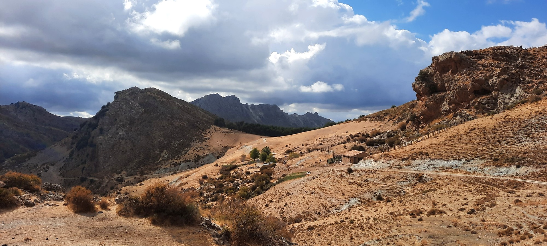
Gravel biking around Cáñar offers routes through the rugged, high-altitude environment of the Sierra Nevada Natural Park. This region features deep ravines, diverse micro-climates, and varied terrain including sweet chestnut woodlands, pine trees, and groves of almond and olive trees. Located at over 1,000 meters elevation, Cáñar provides extensive views of surrounding valleys and mountains. The area's network of rural tracks and low traffic volume create an appealing setting for no traffic gravel bike trails.
Best no traffic gravel bike…
Last updated: November 2, 2026
5.0
(2)
8
riders
71.7km
05:35
1,740m
1,740m
Hard gravel ride. Very good fitness required. Mostly paved surfaces.
2.0
(1)
4
riders
61.0km
05:06
1,710m
1,710m
Hard gravel ride. Very good fitness required. Mostly paved surfaces.

5.0
(2)
5
riders
60.5km
04:43
1,820m
1,820m
Hard gravel ride. Very good fitness required. Mostly paved surfaces.
3
riders
17.2km
01:23
480m
480m
Hard gravel ride. Very good fitness required. Mostly paved surfaces.
5.0
(2)
3
riders
71.8km
05:11
1,320m
1,320m
Hard gravel ride. Very good fitness required. Mostly paved surfaces.
Our route recommendations are based on thousands of hikes, rides, and runs completed by other people on komoot.
Start today with a free account
Your next adventure awaits.


Other adventures around Cáñar

Tips from the Community

Carretera de la Cabra, one of the most spectacular routes for road cycling and motorcycling in the province of Granada. This mountain road connects the Almuñécar and Costa Tropical area with the surroundings of the Sierras de Tejeda, Almijara y Alhama Natural Park, crossing landscapes of great beauty.
1
0
Surroundings of the Barranco de Poqueira, between the villages of Bubión, Capileira and Pampaneira, one of the most representative landscapes of the Alpujarra Granadina, on the southern slopes of Sierra Nevada.
1
0

Final point to arrive by vehicle and consider whether to go up or turn back and have something to eat comfortably seated in one of the establishments in Capileira. Another option is to take the Órgiva bus, which from Capileira goes up to the esplanade where you can descend to the Poqueira refuge, climb Mulhacén or Veleta.
0
0

Órgiva is a charming Spanish municipality located in the province of Granada, in Andalusia, and is historically considered the capital and administrative center of the western Alpujarra. This town of about 6,000 inhabitants stands at an altitude of 450 meters in the fertile valley of the Guadalfeo River, right at the foot of the Sierra Nevada Natural Park.
0
1

The La Cabra road seems to break through the rock to make its way. The open views and the ledges at the edge of the road make it a cycling classic.
1
0
The municipality of Órgiva is part of the Sierra Nevada Natural Park and is located on its southern slopes. Known as the capital of the Alpujarra region of Granada, it is an ideal destination for combining culture, nature, and gastronomy.
11
0
In Pampaneira there are several spectacular viewpoints that offer unique views of the Poqueira Gorge, the white villages of the Alpujarra and the peaks of Sierra Nevada.
2
0
What to see in Pampaneira Liberty Square The town's central hub, with bars, craft shops, and the tourist office. Church of the Holy Cross Built in the Mudéjar style in the 16th century on the site of a former mosque. Fountain of Saint Anthony ("La Chumpaneira") Famous for its legend: whoever drinks from it will find a partner. It's located next to the church. Traditional streets Such as Silence Street or Veronica Street, with Berber architecture, covered walkways, and terraced roofs. Chocolate Factory A delightful place to visit and buy handcrafted products.
6
0
Frequently Asked Questions
What kind of terrain can I expect on the no-traffic gravel bike trails around Cáñar?
The no-traffic gravel bike trails around Cáñar are characterized by challenging, rugged terrain with significant elevation gains. You'll encounter a mix of paved and unpaved surfaces, including rural tracks that climb directly into the Sierra Nevada mountains. The region is known for its demanding climbs and rewarding descents, often featuring switchbacks, all set against a backdrop of stunning natural landscapes.
Are there any specific routes that offer panoramic views?
Absolutely! Cáñar is often called the 'Balcony of the Alpujarra' or 'Viewpoint of Africa' for a reason. Many routes offer expansive views stretching to the Mediterranean coast and, on clear days, even to the Moroccan Rif mountains. While all routes in the area provide scenic beauty, the elevated positions of trails within the Sierra Nevada Natural Park grant panoramic vistas of surrounding valleys, the Sierra de Lújar, and the Guadalfeo River.
What natural features can I discover along the gravel bike trails?
The trails will take you through diverse landscapes. You can expect to ride through valleys with sweet chestnut woodlands, pine trees, and groves of almond and olive trees. The region also features natural attractions like the Dique 24 dam in the Chico River, where water plunges 30 meters, and several historic mills located along the river between the canyon and the village.
What is the best time of year for gravel biking in Cáñar?
The best time for gravel biking in Cáñar is generally during the spring and autumn months when temperatures are milder and the natural scenery is at its most vibrant. Summers can be very hot, especially at lower elevations, while winters can bring cold temperatures and snow to higher parts of the Sierra Nevada, potentially affecting trail conditions.
Are there any family-friendly or easier gravel routes available?
The gravel bike trails around Cáñar are generally described as challenging, requiring very good fitness due to significant elevation gains and demanding climbs. While the region offers varied trails, many are part of larger bikepacking routes like the Transnevada and Badlands. For those seeking a less strenuous option, it's advisable to carefully review route profiles for distance and elevation before setting out, as most listed routes are rated as 'difficult'.
Where can I park my car when starting a gravel bike ride in Cáñar?
Cáñar is a small village, and while specific designated cycling parking areas aren't widely advertised, you can typically find parking within the village itself or at the start of some of the more popular trailheads. Given the low traffic volume, especially after turning off the main road towards Cáñar, finding a suitable spot is usually manageable.
Can I reach Cáñar and the trailheads using public transport with my bike?
Public transport options to Cáñar are limited. While there are bus services to some larger towns in the Alpujarras, transporting bikes on these services can be challenging or require specific arrangements. It's recommended to check with local bus operators directly regarding their bike policies and schedules if you plan to rely on public transport.
What do other gravel bikers enjoy most about the trails in Cáñar?
The komoot community highly rates the gravel biking experience around Cáñar, with an average score of 4.0 stars. Reviewers often praise the stunning panoramic views, the challenging yet rewarding climbs, and especially the low traffic volume on the roads and tracks, which creates a safer and more enjoyable riding experience.
Are there any notable villages or attractions to visit along the routes?
Yes, the region is rich in picturesque villages and natural highlights. While exploring the trails, you might pass near or through charming settlements like Capileira Village or Bubión Village. Other points of interest include the majestic Mulhacén Summit (visible from many points) and the Monument to the Virgin of the Snows.
Are there any circular gravel bike routes available?
Yes, several routes in the area are designed as loops, allowing you to start and finish in the same general vicinity. For example, the challenging Restábal Village – Metal Bridge loop from Nigüelas offers a substantial ride, or you could explore the View of Béznar Reservoir – Restábal Village loop from Lecrín for a slightly shorter, but still difficult, option.
Are there any recreation areas or places to rest during a long ride?
Yes, the region offers some excellent spots for a break. The Puente Palo recreation area, located about 9 km from Cáñar at an elevation of 1,700m, provides picnic tables nestled among wooded pines and chestnuts, making it a perfect spot to refuel and relax during your ride. You might also find facilities at the Huerta de las Monjas Recreation Area.
Most popular attractions around Cáñar

Get inspired with the komoot mobile app


Explore more
Browse the best Gravel rides in other regions.
