The best traffic-free bike rides around Aras De Los Olmos
4.0
(2)
141
riders
21
rides
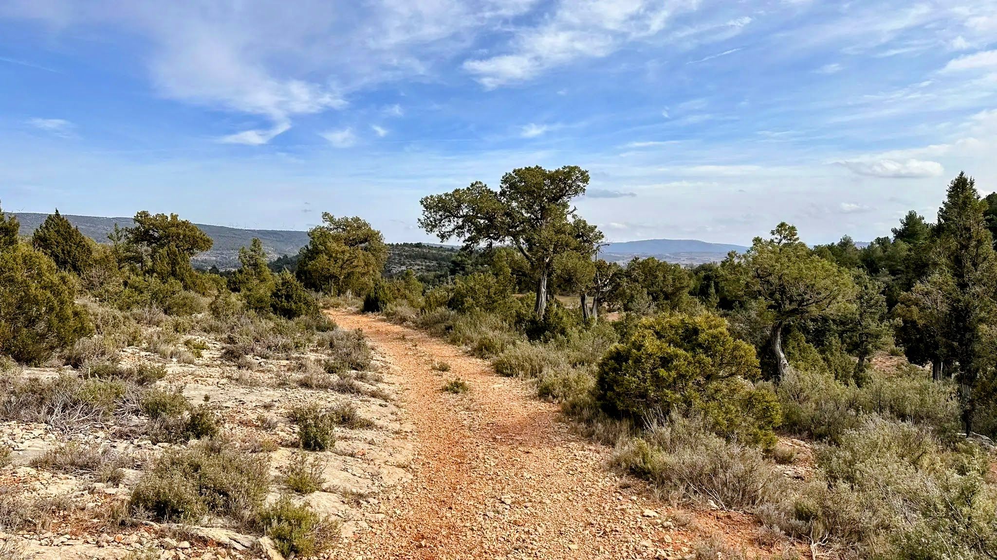
No traffic touring cycling routes around Aras De Los Olmos traverse a region characterized by varied topography, including central plains and predominantly mountainous terrain with deep ravines. The area is defined by the Turia River and its tributaries, which contribute to a rich biodiversity within extensive forest masses. Cyclists can explore routes through ancient juniper forests and experience the natural beauty of the Alto Turia Biosphere Reserve.
Best no traffic touring cycling routes around Aras De Los Olmos
- The most…
Last updated: July 15, 2026
6
riders
Hard bike ride. Very good fitness required. Mostly paved surfaces. Suitable for all skill levels.
6
riders
36.0km
03:40
810m
810m
Hard bike ride. Very good fitness required. Mostly paved surfaces. Suitable for all skill levels.

Sign up for free
5
riders
38.5km
03:43
750m
750m
Hard bike ride. Very good fitness required. Mostly paved surfaces. Suitable for all skill levels.
3
riders
22.3km
01:45
440m
440m
Hard bike ride. Good fitness required. You may need to push your bike for some segments of this route.
5
riders
36.1km
03:59
990m
990m
Hard bike ride. Very good fitness required. Mostly paved surfaces. Suitable for all skill levels.
Get access to more routes and recommendations from other explorers.
Sign up for free
Already have an account?
Our route recommendations are based on thousands of hikes, rides, and runs completed by other people on komoot.
Start today with a free account
Your next adventure awaits.
Login or Signup

Other adventures around Aras De Los Olmos

Tips from the Community

The trail through the ancient juniper forest is one of the most unique spots in the Serranía del Turia. It's part of the Ruta de la Travinas (PR CV 331) and the GR 37, and allows you to walk among juniper trees (Juniperus thurifera), some of which are large and old. The terrain is gentle, making for a peaceful walk surrounded by nature. Comfortable shoes and water are recommended, as the sun can be intense in summer.
2
0
La Yesa is a small village in the Los Serranos region, surrounded by mountains covered with holm oaks and pine forests, ideal for leisurely hikes with beautiful views of the mountains and even the sea on clear days. Its attractions include the Church of Nuestra Señora de los Ángeles, several chapels, and monumental trees such as the Carrasca Tumbada and the Pino Sombrero. The surrounding area offers trails through natural sites such as El Carrascal and El Castellar, with archaeological remains. To replenish your energy, there's nothing better than trying "Olla de pueblo" (village pot), a hearty rice dish with beans and turnips, typical of the area.
1
0
Alpuente is a picturesque town in the Los Serranos region, surrounded by mountains and ravines, making it an ideal destination for hiking enthusiasts. Its historic center preserves remains of walls, towers, and the medieval castle, as well as an interesting paleontological museum with dinosaur fossils. From the town, you can take a 46-kilometer trail that connects its numerous villages, a good option for exploring its natural and rural surroundings. The terrain is rocky and uneven, so it's advisable to wear comfortable shoes and bring water, especially in summer.
1
0
Titaguas is a small town in the Los Serranos region, surrounded by mountains covered with pine, holm oak, and juniper forests, making it an ideal location for hiking. In the surrounding area, you can discover natural springs renowned for their healthy waters, as well as archaeological sites and cave paintings dating back over 9,000 years. The old town preserves historic houses and the Renaissance church of El Salvador, while local festivals keep traditions alive with the famous Mojiganga and wine-related celebrations. It's a great destination for combining nature, heritage, and popular culture, with trails accessible from the CV-35.
1
0

cave paintings with good access
0
0
A very well-preserved snowfield, from where we have good views of the cliffs and with luck we will see some vultures.
0
0

It is between Abejuela and Los Cerezos
0
0

Beautiful views in all directions offered by the viewpoint of La Sierra. Together with the neighboring viewpoint of the Pulpitejo, they make up an entertaining track that will allow you to enjoy this area of Cuenca.
1
0
Frequently Asked Questions
How many no traffic touring cycling routes are available in Aras De Los Olmos?
There are 18 touring cycling routes around Aras De Los Olmos that focus on minimal traffic, offering a variety of experiences for cyclists seeking quiet roads and natural beauty.
Are there any easy no traffic touring cycling routes for beginners?
While many routes in the area are rated as difficult due to the mountainous terrain, there are 2 moderate routes available. The diverse topography of Aras de los Olmos, with its central plains and deep ravines, means that even moderate routes can offer a good challenge without heavy traffic.
What kind of landscapes can I expect on these quiet cycling routes?
You'll experience a diverse topography, from central plains to mountainous terrain with deep ravines. Routes often follow the Turia River and its tributaries, winding through vast forest canopies, including ancient juniper forests. Expect picturesque scenery within the Alto Turia Biosphere Reserve.
Are there any circular no traffic touring cycling routes?
Yes, many of the routes are circular, allowing you to start and end in the same location. An example is the Ancient juniper forest – Hermitage of Santa Margarita loop from El Collado, which offers nearly 50 km of scenic riding.
What are some interesting natural attractions to see along the routes?
The region is rich in natural beauty. You can explore the Dino Route of Aras de los Olmos with its ancient dinosaur footprints, or visit the serene Las Blancas (Juniper Forest). The Source of the Arcos River is another beautiful spot. For panoramic views, consider routes passing by the Mirar Bueno Viewpoint.
Are there any cultural or historical points of interest accessible by bike?
Absolutely. You can cycle towards historical sites like the Alpuente Village, which is near the Tuéjar Ice House – Azud de Tuéjar loop from Alpuente route. The region also features ancient Moorish gardens and dry stone constructions, recognized by UNESCO, adding a unique cultural dimension to your ride.
What is the best season for no traffic bike touring in Aras De Los Olmos?
Aras de los Olmos offers pleasant cycling conditions for much of the year. Spring and autumn generally provide the most comfortable temperatures for touring. Summers can be warm, but the forested areas and higher elevations offer some respite. Winters are cooler but can still be suitable, especially on sunny days.
Are there any viewpoints along the car-free cycling routes?
Yes, the mountainous terrain provides several opportunities for breathtaking panoramic views. The La Sierra Viewpoint – View from Peña Roya loop from Talayuelas route is specifically designed to take you past stunning vistas. The Mirador del Río Turia and the Ermita de Santa Catalina also offer spectacular views of the river and surrounding landscape.
What do other touring cyclists enjoy most about the no traffic routes in Aras De Los Olmos?
The area is highly rated by the komoot community, with an average score of 4.0 stars. Reviewers often praise the tranquility of the routes, the stunning natural beauty of the Biosphere Reserve, and the challenging yet rewarding climbs through diverse landscapes, all while enjoying minimal traffic.
Are there recreational areas for rest stops along the routes?
Yes, the region has numerous recreational zones such as Los Rubiales, La Araña, Los Antolines, and Los Mangranos. These areas are often equipped with amenities like tables, fountains, and barbecue facilities, making them ideal spots for a break during your touring cycling adventure.
Can I find long-distance quiet cycling trails in the area?
While the routes listed here are generally day tours, the region is home to the GR-37, a long-distance path spanning approximately 62 kilometers. This path often coincides with historical cattle trails and can be adapted for longer touring routes, providing extensive quiet sections for cycling.
Most popular attractions around Aras De Los Olmos

Get inspired with the komoot mobile app


Explore more
Browse the best Cycling routes in other regions.
