The best traffic-free bike rides around Origgio
4.5
(415)
2,137
riders
133
rides
No traffic gravel bike trails around Origgio are characterized by a network of unpaved routes through natural parks and along historic canals. The region features the extensive Parco delle Groane, offering diverse landscapes of woodlands and heathlands, alongside the Lura Park. The Villoresi Canal towpath provides largely flat, mixed-terrain routes through the Lombard countryside. These areas combine to offer varied gravel biking terrain, largely avoiding main roads.
Best no traffic gravel bike trails around Origgio
- The most popular no traffic gravel bike trail is Cycling and pedestrian bridge over the Lura – Groane Park Bike Path loop from Caronno Pertusella, a 40.4 miles (65.1 km) trail that takes 3 hours 58 minutes to complete. This route connects Parco delle Groane with Lura Park, offering extensive unpaved sections.
- Another top favourite among local gravel bikers is Villoresi Canal Cycle Path – Alzaia del Canale Villoresi loop from Cesate, a moderate 30.4 miles (48.9 km) path. This route follows the historic Villoresi Canal, providing a flat and accessible ride through the Lombard countryside.
- Local gravel bikers also love the Groane Cycle Path – Underpass loop from Caronno Pertusella, a 16.2 miles (26.1 km) trail leading through Parco delle Groane's woodlands and heathlands, often completed in about 1 hour 40 minutes.
- Gravel biking around Origgio is defined by historic canal towpaths, extensive natural parks like Parco delle Groane and Lura Park, and mixed-surface trails. The network offers options for different ability levels, from easy canal routes to more challenging park trails.
- The routes in Origgio are highly rated by the komoot community with an average score of 4.5 stars from more than 400 reviews. More than 2,600 gravel bikers have used komoot to explore Origgio's varied terrain.
Last updated: June 30, 2026
4.9
(21)
149
riders
71.3km
03:41
110m
110m
Moderate gravel ride. Good fitness required. Mostly paved surfaces. Suitable for all skill levels.
4.7
(12)
151
riders
Moderate gravel ride. Good fitness required. Mostly paved surfaces. Suitable for all skill levels.

Sign up for free
5.0
(4)
61
riders
Moderate gravel ride. Good fitness required. Mostly paved surfaces. Suitable for all skill levels.
4.2
(17)
85
riders
49.6km
02:33
110m
110m
Moderate gravel ride. Good fitness required. Mostly paved surfaces. Suitable for all skill levels.
5.0
(1)
35
riders
34.3km
01:49
110m
110m
Easy gravel ride. Great for any fitness level. Mostly paved surfaces. Suitable for all skill levels.
Get access to more routes and recommendations from other explorers.
Sign up for free
Already have an account?
Our route recommendations are based on thousands of hikes, rides, and runs completed by other people on komoot.
Start today with a free account
Your next adventure awaits.
Login or Signup
Popular around Origgio
Tips from the Community

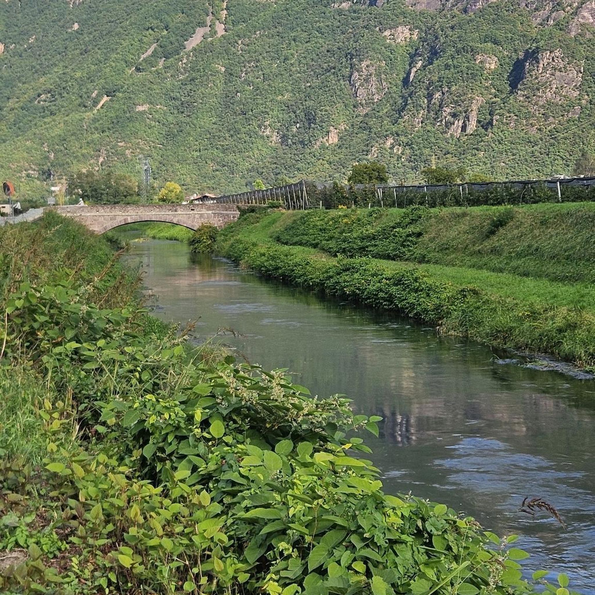
The Villoresi canal draws water from the Ticino river, in the locality of Panperduto, in the municipality of Somma Lombardo. After traveling 86 kilometers, in the provinces of Milan and Monza Brianza, it flows into the Adda river in the municipality of Cassano d’Adda. Construction work began in 1881 and was completed in 1891 to a design by Eugenio Villoresi. Originally intended exclusively for irrigation purposes, following the crisis of crops connected with silk production, the canal now allows water distribution in a plain area of approximately 85,000 hectares, through a network that totals about 3,000 kilometers. The paths, free of difficulties, accessible to everyone and certainly of interest, are part of the investments made to enhance the towpaths of the waterways, and should also be considered a fast connection route between the various Municipalities bordering the canal.
0
0

Pay attention to the GPS directions as they are not always accurate
1
0
Il Parco del Lura is a local park of supramunicipal interest established for the protection and enhancement of the Lura stream valley in the stretch that extends from Cassina Rizzardi to Lainate. The municipalities adhering to the consortium are: Bregnano, Cadorago, Caronno Pertusella, Cassina Rizzardi, Cermenate, Garbagnate Milanese, Guanzate, Lainate, Lomazzo, Rovellasca, Rovello Porro and Saronno
0
0

The intersection between the Olona river and the Villoresi Canal occurs in the Alto Milanese area, specifically between the municipalities of Parabiago, Nerviano, and San Vittore Olona. This area is characterized by the intersection of local cycle paths (such as the Olona Greenway) and the long irrigation canal, offering naturalistic and historical routes.
0
0
The Villoresi Canal cycle path runs through the Lombardy countryside, along the entire length of the Villoresi Canal, the historic waterway built for irrigation in the late 19th century by engineer Eugenio Villoresi. The canal draws water from the Ticino River near Somma Lombardo and, after an 86 km journey, returns it to the Adda River near Groppello.
0
0
The Villoresi Canal cycle path runs through the Lombardy countryside, along the entire length of the Villoresi Canal, the historic waterway built for irrigation in the late 19th century by engineer Eugenio Villoresi. The canal draws water from the Ticino River near Somma Lombardo and, after an 86 km journey, returns it to the Adda River near Groppello.
0
0
The Villoresi Canal cycle path traverses the Lombardy countryside, following the entire length of the Villoresi Canal, the historic waterway built for irrigation in the late 19th century by engineer Eugenio Villoresi. The canal draws water from the Ticino River near Somma Lombardo and, after an 86 km journey, returns it to the Adda River near Groppello.
0
0
It's an easy, flat cycling route, accessible to all types of bicycles and suitable for families with children. An ideal place for a day trip, it allows you to explore the area's rich natural and scenic beauty, cycling through cultivated fields, parks, and woods. There are several detours to explore the architectural beauty of the many municipalities along the canal, or to continue along the other cycle paths the canal crosses.
0
0
Frequently Asked Questions
How many no-traffic gravel bike trails are available around Origgio?
There are over 100 dedicated no-traffic gravel bike trails around Origgio. These routes range in difficulty, with approximately 25 easy, 50 moderate, and 40 more challenging options, ensuring a suitable ride for every skill level.
What kind of terrain and elevation can I expect on these no-traffic gravel trails?
The terrain around Origgio is quite varied. You'll find largely flat and easy cycling along the historic Villoresi Canal Cycle Path, which offers mixed surfaces including dirt roads and cycle paths. In areas like Parco delle Groane, you'll encounter diverse landscapes with woodlands, heathlands, and agricultural areas, providing varied unpaved trails and some gentle undulations. While most routes avoid significant climbs, some sections within parks like Lura Park can present more challenging sections.
Are there easy, beginner-friendly no-traffic gravel routes near Origgio?
Yes, there are many easy options perfect for beginners. For instance, the Groane Cycle Path – Underpass loop from Caronno Pertusella is an easy 26 km route with minimal elevation gain. Another great choice is the Villoresi Canal towpath – Alzaia del Canale Villoresi loop from Caronno Pertusella, offering a gentle 36 km ride along the canal.
Can I cycle along the Villoresi Canal towpath without encountering traffic?
Absolutely. The Towpath of the Villoresi Canal is a significant draw for gravel bikers precisely because it offers a largely flat and easy cycling route through the Lombard countryside, characterized by cultivated fields, parks, and forests, all while being free from vehicular traffic. It's permeable by all types of bicycles and suitable for families.
Are there no-traffic gravel routes within Parco delle Groane?
Yes, Parco delle Groane is an excellent location for no-traffic gravel biking. It features an extensive network of unpaved trails that minimize paved sections, taking riders through scenic wooded and heath areas. A good example is the Groane Cycle Path – Underpass loop from Caronno Pertusella, which provides an easy ride within the park.
What are the options for gravel biking in Lura Park?
Lura Park offers various routes suitable for cycling, some of which can present more challenging sections. It can be integrated into longer rides, such as the Cycling and pedestrian bridge over the Lura – Groane Park Bike Path loop from Caronno Pertusella, which combines both Groane and Lura Parks for a more extensive gravel biking experience through diverse natural settings.
Are there circular no-traffic gravel bike routes available?
Many of the no-traffic gravel routes around Origgio are designed as loops, allowing you to start and end at the same point. Examples include the Villoresi Canal Cycle Path – Alzaia del Canale Villoresi loop from Cesate and the Lura River in the Parco del Lura – Cycling and pedestrian bridge over the Lura loop from Saronno.
Are the no-traffic gravel trails around Origgio suitable for families?
Yes, several no-traffic gravel trails are very family-friendly. The Villoresi Canal Cycle Path, for instance, is explicitly mentioned as suitable for families due to its flat terrain and absence of vehicular traffic. Routes within Parco delle Groane also offer many easy sections ideal for family outings.
What natural features or landmarks can I see along these routes?
You'll encounter a variety of natural beauty and historical elements. Along the Villoresi Canal Cycle Path, you can appreciate the historic waterway and the surrounding Lombard countryside. In Parco delle Groane and Lura Park, you'll ride through woodlands, heathlands, and agricultural areas. The Valle Olona Cycle Path, while not exclusively gravel, features a characteristic medieval Romanesque bridge, adding a cultural attraction to a cycling excursion.
What do other gravel bikers enjoy the most about gravel biking in Origgio?
The area is highly rated by the komoot community, with an average score of 4.5 stars. Reviewers often praise the extensive network of quiet, unpaved trails, particularly the peaceful canal towpaths and the varied landscapes within Parco delle Groane and Lura Park, which allow for immersive rides away from traffic.
When is the best time of year to go gravel biking around Origgio?
Spring and autumn generally offer the most pleasant conditions for gravel biking around Origgio, with mild temperatures and beautiful scenery. Summer can be enjoyable, but it's advisable to ride earlier in the morning or later in the afternoon to avoid the midday heat. Winter rides are possible, but some trails might be muddy after rain, and cooler temperatures require appropriate gear.
Most popular attractions around Origgio

Get inspired with the komoot mobile app


Explore more
Browse the best Gravel rides in other regions.
