The best traffic-free bike rides around Lillianes
4.3
(159)
4,298
riders
8
rides
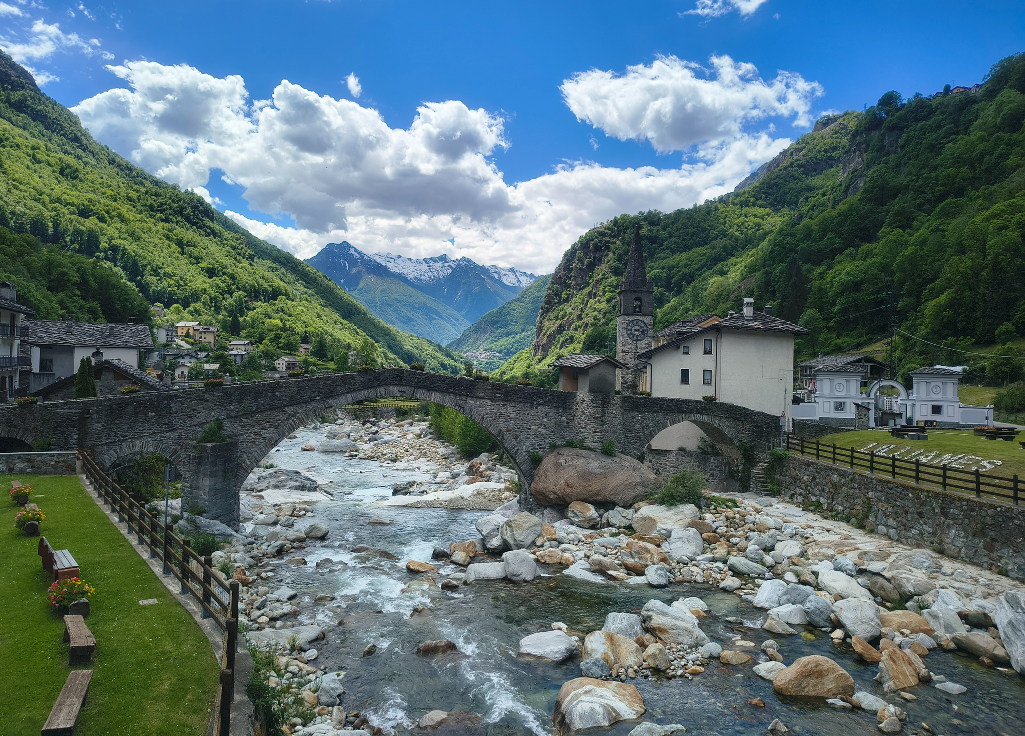
No traffic road cycling routes around Lillianes are situated in the lower Lys Valley of Italy's Aosta Valley region, at an elevation of approximately 650 meters. The area is characterized by lush forests, terraced hillsides, and imposing mountain peaks, with the Lys River flowing through its heart. The varied topography includes wooded slopes and mountain pastures, offering diverse challenges for road cyclists. This location serves as a base for exploring the southern Aosta Valley by bike.
Best no traffic road…
Last updated: August 24, 2026
2
riders
15.4km
01:12
660m
660m
Moderate road ride. Good fitness required. Mostly well-paved surfaces and easy to ride.
5.0
(4)
18
riders
22.7km
01:46
820m
820m
Moderate road ride. Good fitness required. Mostly well-paved surfaces and easy to ride.

Sign up for free
17
riders
74.0km
03:39
740m
740m
Moderate road ride. Good fitness required. Mostly well-paved surfaces and easy to ride.
4.0
(1)
10
riders
28.3km
01:45
750m
750m
Moderate road ride. Good fitness required. Mostly well-paved surfaces and easy to ride.
7
riders
25.1km
02:12
900m
900m
Moderate road ride. Good fitness required. Some segments of this route may be unpaved and difficult to ride.
Get access to more routes and recommendations from other explorers.
Sign up for free
Already have an account?
Our route recommendations are based on thousands of hikes, rides, and runs completed by other people on komoot.
Start today with a free account
Your next adventure awaits.
Login or Signup
Popular around Lillianes

Alta Via n. 1 of the Aosta Valley — a walk among Italian giants
Three days on the Cammino Balteo – The historic Aosta Valley

Cammino Balteo – castles, vineyards and trails of the Aosta Valley

Paths, castles and views of Italy’s Aosta Valley – Cammino Balteo

A walk among Italian giants — Aosta Valley High Route 1

Traffic-free bike rides around Lillianes

Traffic-free bike rides around Lillianes
Other adventures around Lillianes


Tips from the Community


The Forte di Bard seen from the bridge over the Dora Baltea river offers one of the most iconic and photographed views in the Aosta Valley. This spectacular perspective captures the imposing, craggy fortress that dominates the village below and the river waters.
0
0

Pont Saint Martin, excellent and pleasant town at the foot of the Gressoney valley. The gateway to the Aosta Valley.
0
0

The Burnel is an ancient cup-marked stone located halfway along Via Maestra, the road that crosses the center of Nomaglio. On its surface, the cup marks engraved in prehistoric times are still visible, small hemispherical cavities whose exact function remains a subject of debate among scholars — perhaps linked to propitiatory rites or cult practices. In more recent times, the stone was adapted into a fountain, with a basin carved out for water, and on the stone, you can also observe the grooves left by the blades and knives that the villagers used to come here to sharpen. The name "burnel" indicates precisely this: a fountain with a stone basin. It is an object that, in a few square centimeters, tells of centuries of daily use superimposed on prehistoric traces, and has accompanied the life of the village for times much older than the stone houses with the typical Canavese arches that surround it.
0
0
The Castello di Suzey stands on an inaccessible rocky spur, in a position that in the 14th century guaranteed absolute control over the transit of the Lys valley. The structure is a classic example of a medieval enclosure castle, dominated by a massive quadrangular tower and surrounded by the remains of a fortified village now swallowed by vegetation. This stronghold was the headquarters of the lords of Suzey, a branch of the Vallaise known for their bellicose nature and independence from central powers. A famous anecdote concerns the family's determination to defend their privileges: it is said that the lords of Suzey imposed such severe transit taxes that they sparked fierce disputes with merchants and neighboring communities, turning the castle into a sort of armed customs post. A local legend also tells that the castle was connected to the other Vallaise properties in Perloz via a network of secret passages dug directly into the rock, used to move troops and riches away from prying eyes during sieges. Another popular tale describes the castle's end as a dramatic event: a devastating fire, which broke out during an enemy attack, would have marked the definitive abandonment of the structure.
0
0

Nomaglio is a small but pleasant, characteristic village that deserves a quick stop and a bike ride.
0
0

Alpine pass with a large green plateau, where we find the path that climbs to Testa di Comagna
0
0

this is Villa Rubino
0
2
Frequently Asked Questions
How many no-traffic road cycling routes are available around Lillianes?
There are 9 dedicated no-traffic road cycling routes around Lillianes, offering a variety of experiences for different skill levels.
What is the overall difficulty level of these no-traffic road cycling routes?
The majority of the no-traffic road cycling routes in Lillianes are classified as moderate, with 8 routes falling into this category. There is also 1 difficult route for more experienced cyclists.
What natural features or landmarks can I expect to see on these no-traffic road cycling routes?
You can expect stunning natural landscapes, including lush forests, terraced hillsides, and imposing mountain peaks. The Lys River flows through the area, and you might encounter the distinctive medieval Stone Bridge of Lillianes or the suggestive Bouro stream waterfall. For routes with scenic views, consider the View of Andrate – Croce Serra Castle loop from Quincinetto.
Are there any historical or cultural points of interest along the no-traffic routes?
Yes, Lillianes and its surroundings offer cultural and historical points. You can explore traditional Alpine architecture, the 18th-century Parish Church of Saint Roch, or even a section of an ancient gold mine in the Revers hamlet. Additionally, you might pass by impressive fortifications like Fort Bard or Castello Vallaise, which are nearby attractions.
Are there challenging no-traffic road cycling routes for experienced riders?
Yes, for experienced riders seeking a challenge, there is 1 difficult no-traffic road cycling route. An example is the Waterfall in the Forest – Oropa Sanctuary loop from Andrate, which covers over 51 km with significant elevation gain.
Are there any circular no-traffic road cycling routes?
Yes, several routes are designed as loops, allowing you to start and end in the same location. Examples include the Trovinasse loop from Trovinasse and the Oropa Sanctuary – Waterfall in the Forest loop from Oropa.
What are the typical distances and durations for no-traffic road cycling routes in Lillianes?
Route distances vary, from shorter rides like the Colle Tzecore da Tilly at approximately 15 km (around 1 hour 12 minutes) to longer, more challenging routes such as the Waterfall in the Forest – Oropa Sanctuary loop from Andrate, which is over 51 km and can take around 3 hours 20 minutes.
What is the best time of year for no-traffic road cycling in Lillianes?
The Aosta Valley, where Lillianes is located, is generally best for cycling from spring through autumn. The summer months offer warm weather, while spring and early autumn provide pleasant temperatures and vibrant scenery. Winter cycling might be limited due to snow and colder conditions in the mountainous terrain.
What do other road cyclists enjoy the most about road cycling in Lillianes?
The area is highly rated by the komoot community, with an average score of 4.39 stars. Reviewers often praise the stunning natural landscapes, the serene mountainous environment, and the varied topography that offers both challenging climbs and picturesque valley rides.
Are there any routes that pass through mountain passes?
Yes, the region around Lillianes features several mountain passes that can be incorporated into or viewed from cycling routes. You might encounter passes like Ascent to Col Tzecore from Challand or Passo dell'Oca, offering challenging climbs and rewarding views. The Colle Tzecore da Tilly route specifically includes a climb to Colle Tzecore.
Most popular routes around Lillianes
Most popular attractions around Lillianes

Get inspired with the komoot mobile app


Explore more
Browse the best Road cycling routes in other regions.
