The best traffic-free bike rides around Aprica
4.5
(250)
14,436
riders
21
rides
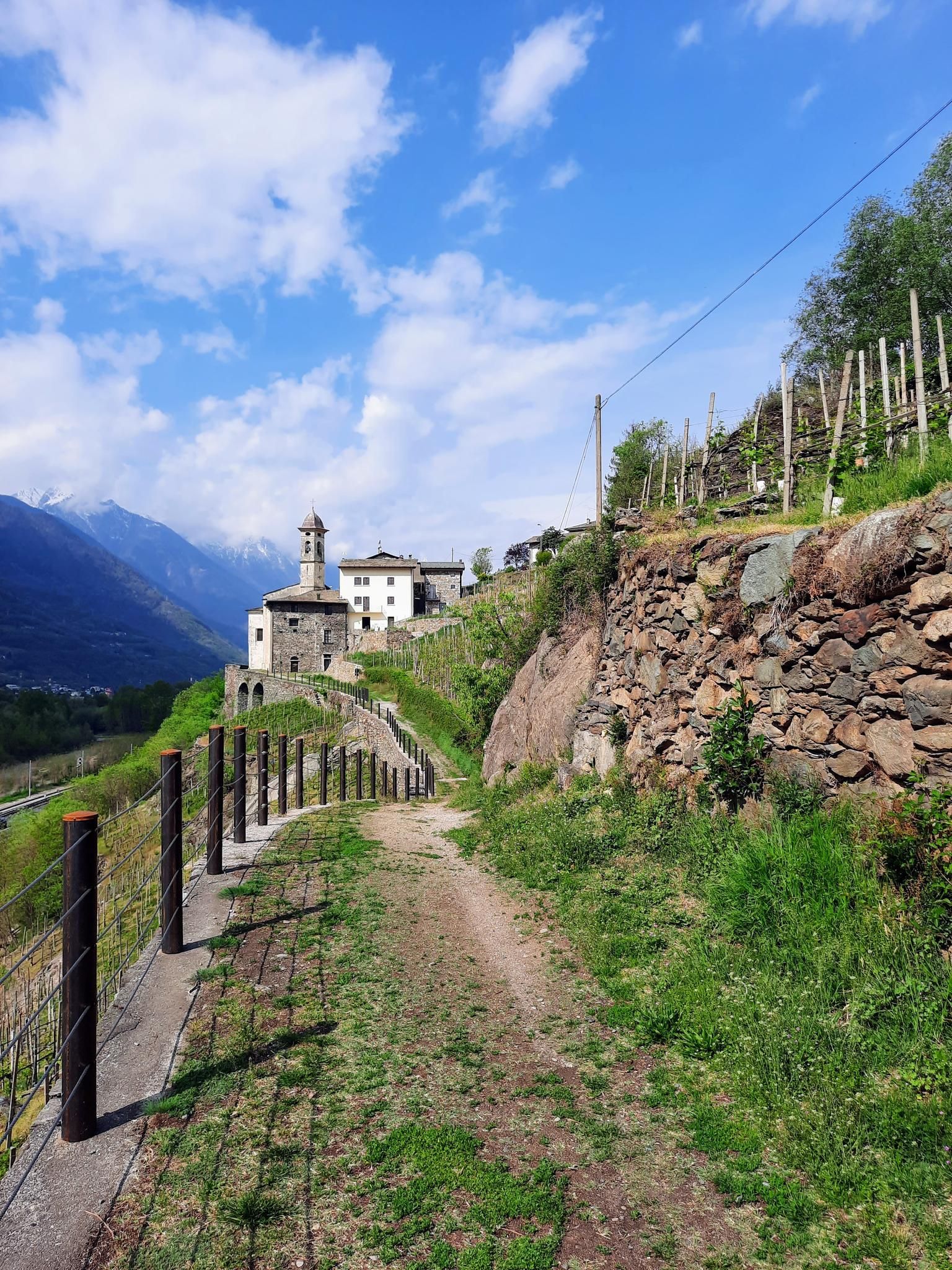
No traffic road cycling routes around Aprica are situated within the Orobie Alps in Lombardy, Italy, at an elevation of 1,180 meters on the Aprica Pass. The region connects the Valtellina and Val Camonica valleys, offering access to diverse alpine landscapes. Cyclists can navigate routes through mountain passes, alongside the Adda River in the Valtellina Valley, and through shaded woods. The terrain features significant elevation changes, characteristic of an alpine environment, with options for both challenging climbs and more leisurely, paved paths.
Best no traffic road cycling routes around Aprica
- The most popular no traffic road cycling route is Rest Area in Tresenda – Valtellina Trail loop from Castello dell'Acqua, a 28.8 miles (46.3 km) trail that takes 1 hour 58 minutes to complete. This route follows the Sentiero Valtellina, offering a smooth asphalt pathway through the valley.
- Another top favourite among local road cyclists is Aprica Town Entrance Arch – Aprica Pass loop from Aprica, a moderate 11.6 miles (18.6 km) path. This route includes an ascent of the Aprica Pass, providing views of the surrounding alpine scenery.
- Local road cyclists also love the Passo di Trivigno – View of Aprica loop from Aprica, a 13.5 miles (21.8 km) trail leading through mountain terrain with views towards Aprica, often completed in about 1 hour 22 minutes.
- Road cycling around Aprica is defined by alpine passes, the Valtellina Valley, and mountain peaks, with routes offering options for various ability levels from easy valley paths to more demanding climbs.
- The routes in Aprica are highly rated by the komoot community with an average score of 4.5 stars from more than 100 reviews. More than 9,000 road cyclists have used komoot to explore Aprica's varied terrain.
Last updated: June 30, 2026
4.8
(5)
233
riders
44.4km
03:01
1,440m
1,440m
Hard road ride. Very good fitness required. Some segments of this route may be unpaved and difficult to ride.
4.4
(8)
196
riders
40.5km
01:55
400m
400m
Moderate road ride. Good fitness required. Mostly well-paved surfaces and easy to ride.

Sign up for free
4.5
(2)
83
riders
18.8km
01:14
450m
450m
Moderate road ride. Good fitness required. Some segments of this route may be unpaved and difficult to ride.
4.2
(6)
153
riders
39.5km
01:40
260m
260m
Easy road ride. Great for any fitness level. Mostly well-paved surfaces and easy to ride.
4.8
(4)
33
riders
22.8km
01:15
410m
420m
Moderate road ride. Good fitness required. Mostly well-paved surfaces and easy to ride.
Get access to more routes and recommendations from other explorers.
Sign up for free
Already have an account?
Our route recommendations are based on thousands of hikes, rides, and runs completed by other people on komoot.
Start today with a free account
Your next adventure awaits.
Login or Signup



Other adventures around Aprica


Tips from the Community


Clean rest area with a bike rack.
0
0

The terminus of the Bernina Line. You can also reach it without the Bernina Express by regular regional train. Or by bus from Samedan or Pontresina to La Prese and then change to the regional train for the rest of the journey.
5
0

The station, located at an altitude of 429 meters above sea level, was opened on June 29, 1902, along with the newly constructed line from Sondrio. The placement of the station building on the side was a preliminary construction step for the then-planned but never-realized extension towards Bormio, the so-called Ortler Railway. Since July 1, 1908, Tirano has also served as a transfer station to the Bernina Railway. At that time, the RhB built its own station building on the forecourt of the Italian station. Passenger traffic on the Italian line is now handled by Trenord. Source: https://de.wikipedia.org/wiki/Bahnhof_Tirano
4
0
Tirano is a small Italian town at the entrance to the Veltins mountain range near the Swiss border and is known as the terminus of the Bernina Express, a UNESCO World Heritage Site. The town is home to the Madonna di Tirano pilgrimage church, a stunning 16th-century basilica. Tirano boasts a picturesque old town with stately homes, a medieval city wall, and is a center for local culinary delights and wine tastings.
2
0

A must-see. Everything to discover.
2
0

Frequently Asked Questions
How many traffic-free road cycling routes are available around Aprica?
There are over 20 dedicated traffic-free road cycling routes around Aprica, catering to various skill levels. You'll find a good mix of easy, moderate, and challenging options to explore the beautiful Orobie Alps and Valtellina Valley.
Are there any easy, traffic-free road cycling routes suitable for beginners or families in Aprica?
Yes, Aprica offers several easy, traffic-free routes perfect for beginners or families. A great option is the Valtellina Trail – Smooth Asphalt Pathway loop from Tresenda-Aprica-Teglio, which provides a gentle ride with minimal elevation gain along smooth asphalt. The Sentiero Valtellina, running alongside the Adda River, is also known for its leisurely, car-free sections through picturesque orchards.
What kind of natural features can I expect to see along the traffic-free road cycling routes near Aprica?
The routes around Aprica are rich in natural beauty. You can encounter stunning alpine scenery, lush valleys, and even waterfalls. For example, you might pass by the Vò Waterfall or the Piana del Vò and Cascata del Vò. The region also features beautiful natural monuments, lakes like Barbellino Natural Lake, and majestic mountain peaks.
Are there any circular traffic-free road cycling routes in Aprica?
Absolutely. Many of the traffic-free routes around Aprica are designed as loops, allowing you to start and finish in the same location. An example is the Aprica Town Entrance Arch – Aprica Pass loop from Aprica, offering a moderate challenge with scenic views. Another is the Passo di Trivigno – View of Aprica loop from Aprica, which provides a rewarding ride with significant elevation.
What do other cyclists enjoy most about the traffic-free road cycling routes in Aprica?
The komoot community highly rates the cycling experience in Aprica, with an average score of 4.45 stars. Cyclists often praise the stunning alpine scenery, the variety of routes from leisurely valley rides to challenging mountain passes, and the opportunity to experience iconic Giro d'Italia climbs without heavy traffic. The well-maintained surfaces and clear signage are also frequently highlighted.
Can I access the Sentiero Valtellina from Aprica for a car-free cycling experience?
Yes, Aprica offers excellent access to the Sentiero Valtellina, a renowned car-free cycling path that runs alongside the Adda River through the Valtellina Valley. This path provides a more leisurely option, winding through orchards with picturesque views and is ideal for a relaxed, traffic-free ride. You can connect to sections like the Rest Area in Tresenda – Valtellina Trail loop from Castello dell'Acqua.
Are there any specific viewpoints or landmarks to look out for on the traffic-free routes?
Many routes offer breathtaking viewpoints of the Orobie Alps and the Valtellina Valley. While cycling, you might encounter landmarks like the Aprica Pass itself, which is frequently featured in the Giro d'Italia. The Passo di Trivigno – View of Aprica loop from Aprica specifically highlights a view of Aprica. The Magnolta area, accessible by gondola, also offers stunning vistas and a reservoir.
What is the best time of year for traffic-free road cycling in Aprica?
The warmer months, typically from late spring through early autumn (May to October), are ideal for road cycling in Aprica. During this period, the snow has melted from the higher passes, and the weather is generally pleasant, offering the best conditions to enjoy the traffic-free routes and stunning alpine scenery.
Are there any challenging traffic-free road cycling routes for experienced riders?
While many routes focus on being traffic-free, some still offer significant challenges. The region is known for its legendary mountain passes like Mortirolo, Gavia, and Stelvio, which, while not entirely traffic-free, have sections or alternative routes that offer quieter ascents. The Road from Bianzone to Bratta – Bratta loop from Stazzona, for instance, presents a moderate difficulty with substantial elevation gain, providing a rewarding experience for more experienced cyclists.
Where can I find parking for my car when starting a traffic-free road cycling route in Aprica?
Aprica, being a popular outdoor destination, offers various parking options. You'll typically find designated parking areas within the town center or near the trailheads of popular routes. For routes connecting to the Sentiero Valtellina, parking might be available in towns like Tresenda or Tirano, which serve as access points to the car-free path.
Are there any cafes or places to stop for refreshments along the traffic-free routes?
Yes, many routes, especially those passing through or near villages and towns, offer opportunities for refreshment stops. The Sentiero Valtellina, for example, winds through populated areas where you can find cafes and restaurants. Even on more secluded routes, you might encounter charming mountain huts or small eateries in hamlets, perfect for a break.
Most popular attractions around Aprica

Get inspired with the komoot mobile app


Explore more
Browse the best Road cycling routes in other regions.
