The best hikes from bus stations around Parco naturale di Montevecchia e della Valle di Curone
4.5
(1367)
5,461
hikers
12
hikes
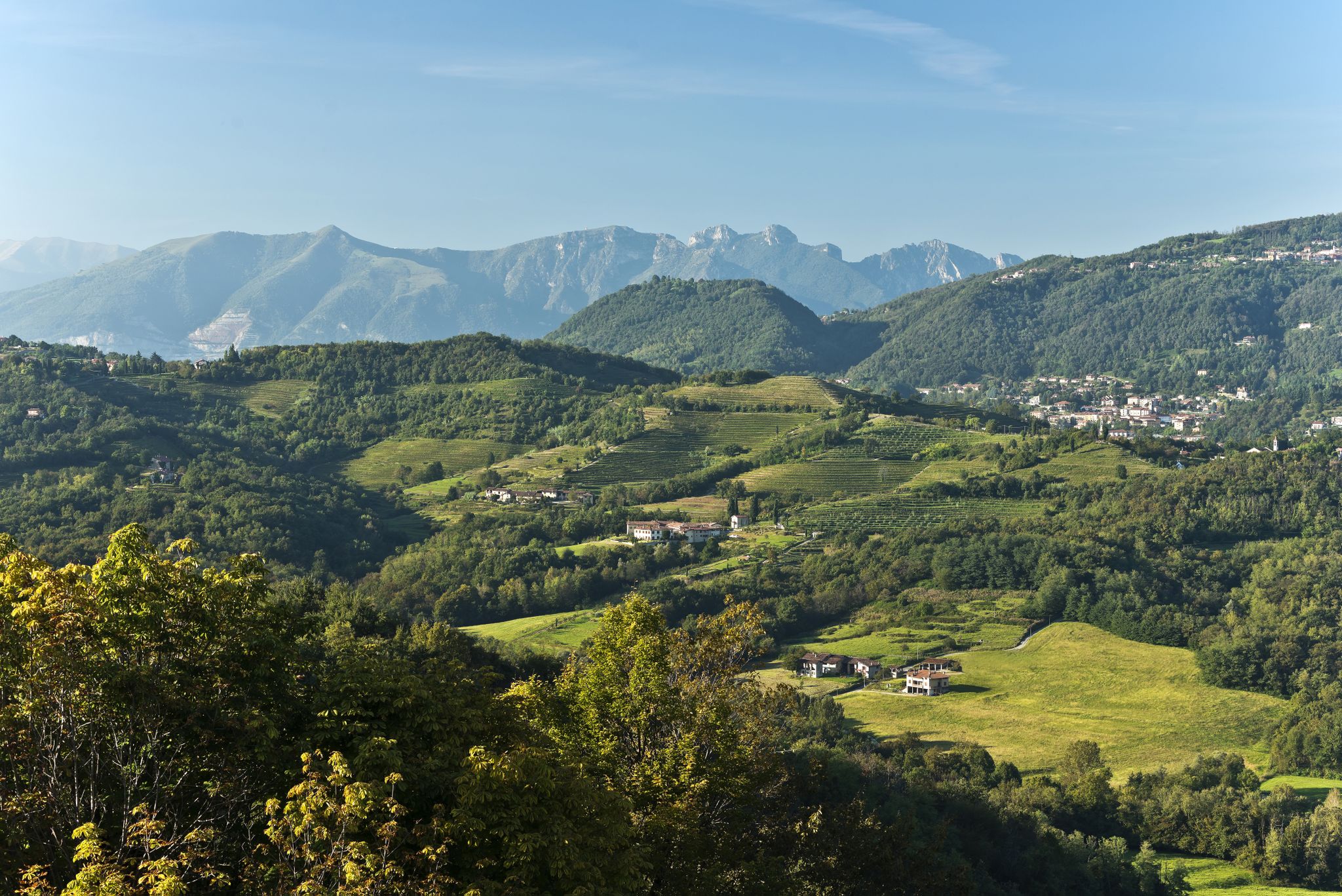
Bus station hiking trails around Parco naturale di Montevecchia e della Valle di Curone offer access to a diverse landscape of rolling hills, valleys, and dense woodlands. The region, located less than an hour from Milan, is characterized by vineyards, orchards, and meadows, with the Curone and Molgoretta torrents flowing through it. Montevecchia hill provides elevated viewpoints across the surrounding area. This protected natural park integrates agricultural zones with preserved natural habitats.
Best bus station hiking trails around Parco naturale di Montevecchia e della Valle di Curone
- The most popular bus station hiking route is Sentiero 1 from Ceregallo to Lomagna (via Curone Stream), a 14.5 miles (23.3 km) trail that takes 6 hours 24 minutes to complete. This difficult route follows the Curone Stream through varied terrain.
- Another top favourite among local hikers is Junction between Pertevano and Paravino – Bridge Over the Curone Stream loop from Merate, a moderate 3.5 miles (5.7 km) path. This loop offers views of the Curone Stream and is often completed in about 1 hour 29 minutes.
- Local hikers also love the Ca' Soldato Picnic Area – Bridge Over the Curone Stream loop from Cernusco Lombardone, a 6.6 miles (10.6 km) trail leading through woodlands and past a picnic area, often completed in about 2 hours 56 minutes.
- Hiking around Parco naturale di Montevecchia e della Valle di Curone is defined by rolling hills, stream valleys, and extensive woodlands. The network offers options for various ability levels, from easy strolls to more challenging treks.
- The routes in Parco naturale di Montevecchia e della Valle di Curone are highly rated by the komoot community with an average score of 4.5 stars from over 1100 reviews. More than 4000 hikers have used komoot to explore Parco naturale di Montevecchia e della Valle di Curone's varied terrain.
Last updated: June 29, 2026
3.5
(2)
7
hikers
23.3km
06:24
370m
370m
Hard hike. Very good fitness required. Mostly accessible paths. Sure-footedness required.
4.7
(31)
145
hikers
Moderate hike. Good fitness required. Easily-accessible paths. Suitable for all skill levels.

Sign up for free
4.7
(3)
16
hikers
Easy hike. Great for any fitness level. Easily-accessible paths. Suitable for all skill levels.
4.8
(11)
51
hikers
Moderate hike. Good fitness required. Easily-accessible paths. Suitable for all skill levels.
4.8
(5)
24
hikers
Moderate hike. Good fitness required. Mostly accessible paths. Sure-footedness required.
Get access to more routes and recommendations from other explorers.
Sign up for free
Already have an account?
Our route recommendations are based on thousands of hikes, rides, and runs completed by other people on komoot.
Start today with a free account
Your next adventure awaits.
Login or Signup
Popular around Parco naturale di Montevecchia e della Valle di Curone
Other adventures around Parco naturale di Montevecchia e della Valle di Curone

Tips from the Community

Ca' del Soldato - Park Center and picnic area
0
0

Montevecchia Alta is a charming hilltop village located about 500 meters above sea level in the heart of the Lecco Brianza region. Considered one of the most panoramic and romantic spots in Lombardy, it overlooks the splendid scenery of the Montevecchia and Curone Valley Regional Park.
0
0

The Sentiero dei Guadi, connecting Missaglia to Montevecchia, is a picturesque nature trail nestled in the Curone Valley Park. Along the way, you'll cross small streams and environments rich in biodiversity, ideal for those who love walking in nature and observing the rural landscape of Lombardy.
1
0


It is poorly signposted and is part of the return route. You need to pay a little attention to take the right path.
0
0

It's a beautiful path in the middle of Nature, I recommend it.
0
0

proverbs
0
0

New bridges. Now it's a trail without the fun part :-)
2
0
Frequently Asked Questions
How many bus station hiking trails are available in Parco naturale di Montevecchia e della Valle di Curone?
There are over 15 bus station hiking trails available in the Parco naturale di Montevecchia e della Valle di Curone, offering a variety of options for different skill levels. The komoot community has rated these routes highly, with an average score of 4.47 stars.
Are there easy bus-accessible hiking trails suitable for beginners or families?
Yes, the park offers several easy bus-accessible trails perfect for beginners or families. For example, the Junction between Pertevano and Paravino – Bridge Over the Curone Stream loop from Merate is a moderate route that is relatively short and features minimal elevation gain, making it a good choice for a relaxed outing.
What kind of terrain can I expect on these bus station hiking trails?
The trails in Parco naturale di Montevecchia e della Valle di Curone offer diverse terrain, ranging from flat agricultural zones to rolling hills and dense woodlands. You'll find paths traversing vineyards, orchards, meadows, and areas along the Curone and Molgoretta torrents. Some routes, like those ascending to Montevecchia Alta, can be steeper, such as the 'Sentiero dell'Oliva'.
Are there any circular hiking routes accessible by public transport?
Yes, many routes are designed as loops, allowing you to start and end at the same bus stop. An example is the Path to Montevecchia Alta – Ca' Soldato Picnic Area loop from Montevecchia, which offers a comprehensive experience of the park's varied landscapes.
What natural attractions or points of interest can I see along the trails?
The park is rich in natural beauty. You can discover unique features like the 'petrifying springs' and enjoy panoramic views from various points, including the Cypress Peak. The area is also home to diverse wildlife, including squirrels, salamanders, and various bird species.
Are there any historical or cultural landmarks near the bus-accessible trails?
Absolutely. The Sanctuary of Montevecchia and panoramic view, perched atop Montevecchia hill, is a prominent landmark offering breathtaking vistas. The charming hilltop village of Montevecchia itself is a picturesque stop with historical significance, and you can find preserved rural architectural elements throughout the park.
Can I bring my dog on the bus station hiking trails?
Generally, dogs are welcome on trails within Parco naturale di Montevecchia e della Valle di Curone, provided they are kept on a leash and you clean up after them. It's always a good idea to check specific trail regulations or local signage, but the park is known for being pet-friendly.
What is the best time of year to hike in Parco naturale di Montevecchia e della Valle di Curone?
The park is beautiful year-round, but spring and autumn are particularly recommended. Spring offers lush greenery and blooming wildflowers, while autumn provides stunning foliage colors, especially in the chestnut groves. Summers can be warm, so early mornings or late afternoons are best, and winters, while quieter, can have colder temperatures.
Are there any longer or more challenging bus-accessible routes for experienced hikers?
Yes, for those seeking a greater challenge, there are longer routes available. The Sentiero 1 from Ceregallo to Lomagna (via Curone Stream) is classified as difficult, covering a significant distance and elevation, making it suitable for experienced hikers looking for a strenuous trek.
Are there places to eat or get refreshments near the bus station trailheads?
The region integrates urban centers and agricultural areas, so you can often find charming farmsteads, local cheese shops, and even wineries for tastings within or near the park. The small village of Montevecchia, a common starting point or destination, also offers options for refreshments and dining.
What are the typical distances and durations for these bus station hikes?
The distances and durations vary widely. You can find shorter routes like the Curone Stream Trail – Bridge Over the Curone Stream loop from Merate, which is about 5.6 km and takes around 1.5 hours. For longer excursions, routes like the Sentiero 1 from Ceregallo to Lomagna (via Curone Stream) can be over 23 km and take more than 6 hours to complete.
Most popular routes around Parco naturale di Montevecchia e della Valle di Curone
Most popular attractions around Parco naturale di Montevecchia e della Valle di Curone

Get inspired with the komoot mobile app


Explore more
Browse the best Hikes in other regions.
