The best traffic-free bike rides around Breheimen
4.6
(88)
907
riders
5
rides
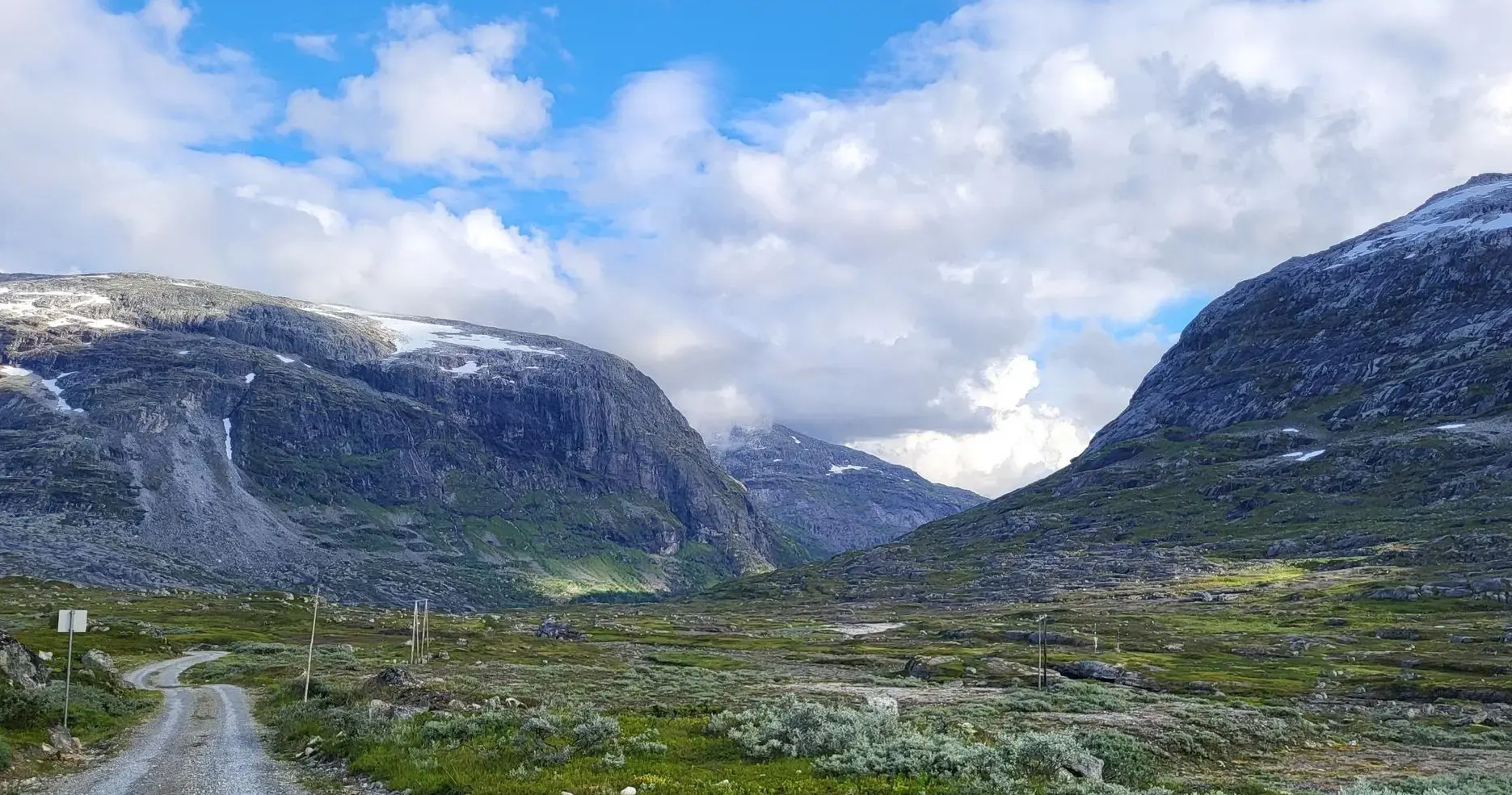
No traffic touring cycling routes around Breheimen traverse a landscape shaped by glaciers, featuring deep valleys, rugged mountains, and high-alpine terrain. The region is characterized by over 50 glaciers, numerous crystal-clear lakes, and pristine glacial rivers. Cyclists encounter a varied environment, from lush lower valleys to barren, elevated areas, offering diverse cycling experiences. This area provides extensive opportunities for touring cycling on a mix of asphalt, gravel, and forest roads.
Best no traffic touring cycling routes around Breheimen
- The most…
Last updated: May 18, 2026
5.0
(2)
22
riders
29.6km
02:50
1,300m
1,300m
Hard bike ride. Very good fitness required. Mostly paved surfaces. Suitable for all skill levels.
4.0
(2)
5
riders
34.5km
03:19
690m
690m
Hard bike ride. Very good fitness required. You may need to push your bike for some segments of this route.

Sign up for free
5.0
(2)
17
riders
28.9km
01:59
530m
530m
Hard bike ride. Very good fitness required. Mostly paved surfaces. Suitable for all skill levels.
5.0
(1)
16
riders
42.2km
03:29
1,020m
1,020m
Hard bike ride. Very good fitness required. Mostly paved surfaces. Suitable for all skill levels.
4.5
(6)
41
riders
9.96km
00:58
440m
440m
Moderate bike ride. Good fitness required. Mostly paved surfaces. Suitable for all skill levels.
Our route recommendations are based on thousands of hikes, rides, and runs completed by other people on komoot.
Start today with a free account
Your next adventure awaits.
Login or Signup
Popular around Breheimen
Other adventures around Breheimen

Tips from the Community

basic route to Galdhøppigen. When the latter is not accessible, this summit is a place of consolation.
0
0

Leirvassbu is a mecca for mountain hiking adventures. This large cabin was previously privately owned before the DNT took it over in 2023. The facilities are excellent and the surroundings are epic.
0
0

A very nice hut and a good starting point for various day hikes. Easily accessible on foot, by car, or by public bus from Lom/Fossbergom.
1
1
One of Norway's largest DNT cabins, Leirvassbu is an ideal base for exploring some of Jotunheimen's high peaks. A run from here to the scramble to the summit of Kyrkja is glorious.
0
0

Good overnight accommodation with and without a tent
0
1
Spiterstulen is a good starting point for many day trips and is also very suitable for a hut tour. The catering and the connection to public transport (bus) are positive points.
1
0

If you have a bike with you, you can save the toll and parking fees at the glacier lake. From Gjerde, it can be reached with any bike with a slight incline
0
0

from sea level to just under 1.5k from Geiranger via the Trollstigen
0
0
Frequently Asked Questions
How many no-traffic touring cycling routes are available in Breheimen?
There are 5 dedicated no-traffic touring cycling routes around Breheimen featured in this guide. These routes offer a mix of moderate and difficult challenges, allowing you to experience the region's stunning landscapes away from vehicle traffic.
What is the best time of year for no-traffic touring cycling in Breheimen?
The best time for touring cycling in Breheimen is typically during the summer months, from late June to early September. During this period, mountain roads are generally clear of snow, and the weather is most favorable, allowing access to high-alpine terrain and glacial views. Be prepared for varied conditions, as the weather in the mountains can change quickly.
Are there any circular no-traffic touring cycling routes in Breheimen?
Yes, all the no-traffic touring cycling routes in this guide are designed as loops. For example, you can enjoy the challenging Glacial Lake Near Galdhøpiggen – Juvasshytta loop from Bøverdal kyrkje or the scenic View of Nigardsbreen Glacier – View of the Glacier loop from Breheimsenteret, both offering rewarding circular journeys.
What kind of terrain can I expect on these no-traffic cycling routes?
The no-traffic touring cycling routes around Breheimen feature a diverse range of terrain. You can expect a mix of asphalt, gravel roads, and forest roads. The region is known for its hilly landscape, with significant climbs and rewarding descents, offering breathtaking views of glaciers, mountains, and valleys. Routes like the Hoftalie – Brekk loop from Røysheim showcase this varied mountain environment.
Are there any easy no-traffic touring cycling routes suitable for beginners?
While most routes in this guide are rated difficult, there is one moderate option: the Djupvatnet Frozen Lake – Dalsnibba Mountain Road loop from Djupvatnet. This route is shorter and has less elevation gain compared to the others, making it a good starting point for those looking for a less strenuous, traffic-free experience in the Breheimen area.
What natural features or landmarks can I see along the no-traffic cycling routes?
Breheimen is rich in natural beauty. Along these routes, you can encounter stunning glaciers, crystal-clear lakes, and dramatic mountain peaks. Notable highlights include the historic Gamle Strynefjellsvegen, the serene Sottjønnin lake, and the impressive Lomseggen Summit (1,289 m). Many routes offer panoramic views of the surrounding glacial landscape.
Can I bring my dog on these no-traffic touring cycling routes?
While dogs are generally welcome in many outdoor areas in Norway, specific rules apply within national parks like Breheimen. Dogs must be kept on a leash at all times to protect wildlife, especially during nesting seasons and when wild reindeer are present. Always check local regulations for the specific route or area you plan to cycle, as some protected areas may have stricter rules or seasonal restrictions.
What do other touring cyclists enjoy most about cycling in Breheimen?
The Breheimen region is highly rated by the komoot community, with an average score of 4.61 stars. Reviewers often praise the breathtaking scenery, the challenging yet rewarding climbs, and the opportunity to experience Norway's dramatic glacial landscapes away from traffic. The sense of remoteness and immersion in nature are frequently highlighted.
Are there any waterfalls along the no-traffic cycling routes?
Breheimen is known for its numerous waterfalls and pristine glacial rivers. While specific waterfalls are not directly listed as highlights on these routes, the region's landscape is shaped by glacial meltwater, meaning you are likely to encounter many smaller cascades and impressive river systems, such as those in Mørkridsdalen, adding to the scenic beauty of your ride.
What are the typical distances and elevation gains for these no-traffic routes?
The no-traffic touring cycling routes in this guide vary in length and elevation. Distances range from approximately 10 km to over 42 km. Elevation gains are significant, reflecting the mountainous terrain, with ascents ranging from around 430 meters for moderate routes to over 1300 meters for the more difficult ones. For example, the Veslbui – Sletthamnbakkan loop from Vegaskjelet covers nearly 29 km with over 500 meters of climbing.
Is public transport available to access the starting points of these routes?
Access to remote areas like Breheimen often relies on a combination of regional buses and personal transport. While specific public transport links directly to every starting point may be limited, major hubs in the vicinity, such as Lom or Stryn, often have bus connections. For detailed information on public transport options to specific trailheads, it's advisable to consult local transport providers or tourist information centers in advance, especially if you plan to reach areas like Sota Sæter.
Are there any places to eat or stay near the no-traffic cycling routes?
While the routes themselves are designed to be traffic-free and often pass through remote areas, the wider Breheimen region offers various accommodation and dining options. You can find traditional mountain farms, huts like Spørteggbu Hut (1560 m), and guesthouses in nearby villages. It's recommended to plan your stops and book accommodation in advance, especially during peak season, as services can be spread out.
Most popular routes around Breheimen
Most popular attractions around Breheimen

Get inspired with the komoot mobile app


Explore more
Browse the best Cycling routes in other regions.
