The best hikes from bus stations around Paintner Forest
4.6
(17156)
70,627
hikers
66
hikes
Bus station hiking trails around Paintner Forest offer access to a landscape featuring dense woodlands, river valleys, and historical sites such as castles. The terrain includes varied elevation changes, with routes passing through gorges and alongside cliffs. This region provides a network of paths suitable for exploring its natural and cultural features.
Best bus station hiking trails around Paintner Forest
- The most popular bus station hiking route is Tatzlwurm Wooden Footbridge – Randeck Castle loop from Schloss Prunn, a…
Last updated: June 29, 2026
4.8
(244)
836
hikers
14.0km
04:04
250m
260m
Moderate hike. Good fitness required. Mostly accessible paths. Sure-footedness required.
4.7
(183)
571
hikers
10.9km
03:06
230m
220m
Moderate hike. Good fitness required. Easily-accessible paths. Suitable for all skill levels.

Sign up for free
4.8
(123)
458
hikers
Hard hike. Very good fitness required. Mostly accessible paths. Sure-footedness required.
4.7
(57)
185
hikers
4.22km
01:08
50m
50m
Easy hike. Great for any fitness level. Easily-accessible paths. Suitable for all skill levels.
4.7
(57)
188
hikers
16.6km
04:37
310m
310m
Moderate hike. Good fitness required. Easily-accessible paths. Suitable for all skill levels.
Get access to more routes and recommendations from other explorers.
Sign up for free
Already have an account?
Our route recommendations are based on thousands of hikes, rides, and runs completed by other people on komoot.
Start today with a free account
Your next adventure awaits.
Login or Signup

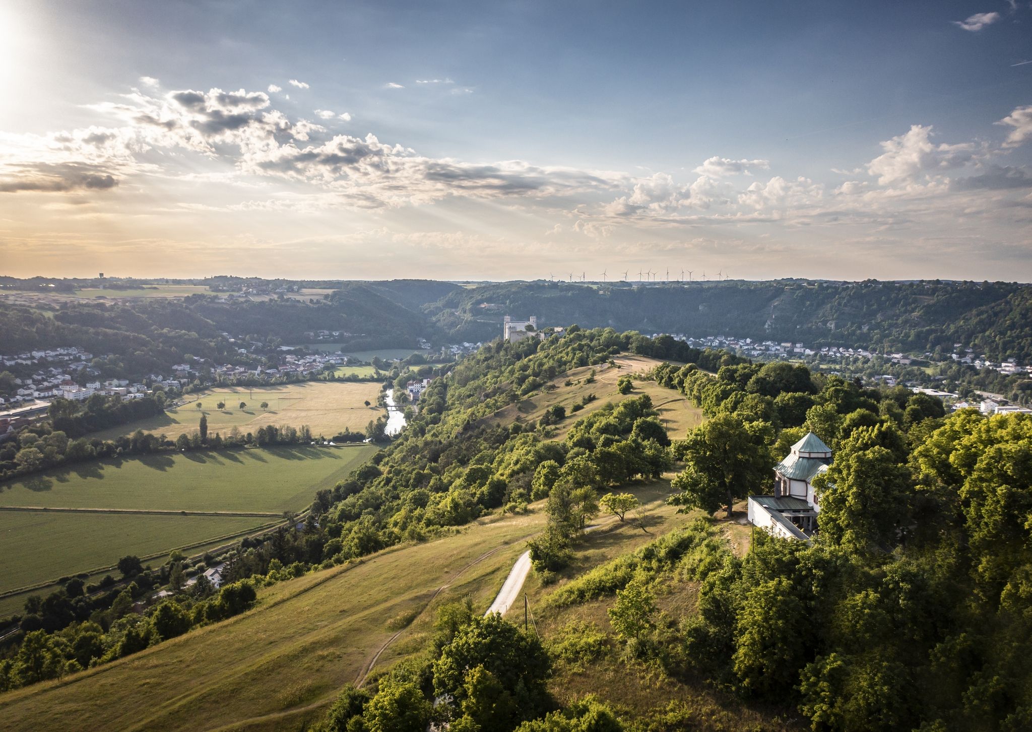
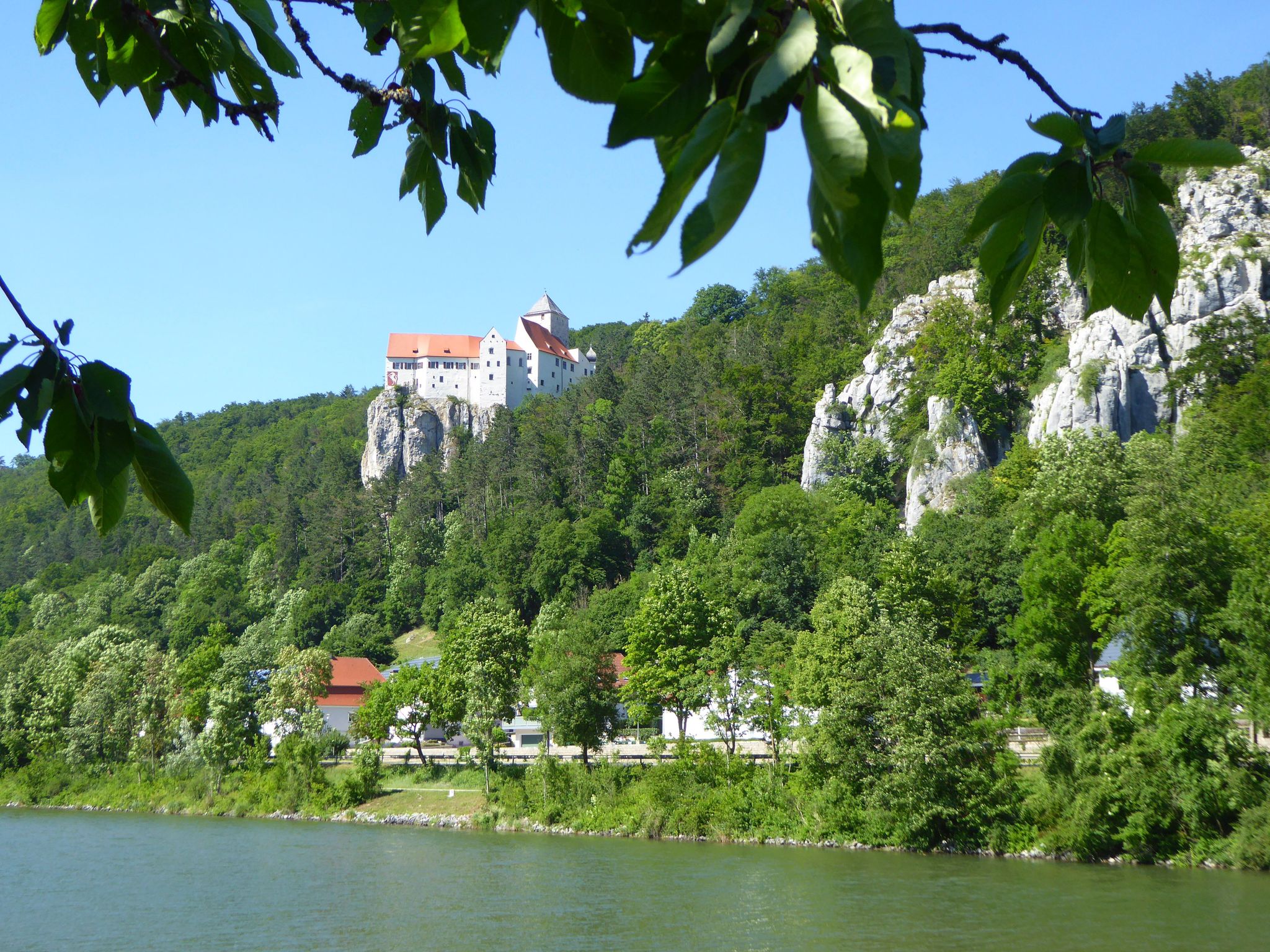


Tips from the Community

Great view ... here you can relax while hiking and lingering
0
0

Beautiful views of the town from the water.
0
0


Prunn Castle Rock > a Geotope Prunn Castle sits atop a striking limestone rock that rises high above the Altmühl Valley. The rocks were formed in the Upper Jurassic in the Malm delta and epsilon. The higher sections probably extend into the Malm zeta. The "Plumpen Felsenkalk" rocks near Prunn are among the most important landscape elements of the lower Altmühl Valley. From the castle rock, you have a sweeping view over the Altmühl Valley. Bavarian State Office for the Environment (LfU). https://www.umweltatlas.bayern.de/standortauskunft/rest/reporting/sb_geotope/generate?additionallayerfieldvalue=273R006
1
0

Beautiful and worth seeing motif
0
0

An interesting building and tower.
3
0

Information sign: Schloßfels Climbing prohibited from February 1st to June 30th due to bird breeding DAV - iG Klettern
1
0

A super beautiful view.
3
1
Frequently Asked Questions
How many bus station hiking trails are available in Paintner Forest?
There are over 70 hiking trails in Paintner Forest that are accessible from bus stations. These routes offer a variety of experiences, from easy strolls to more challenging treks.
What kind of terrain and difficulty can I expect on bus-accessible trails in Paintner Forest?
The bus-accessible trails in Paintner Forest offer diverse terrain. You'll find routes with moderate elevation changes, such as the Tatzlwurm Wooden Footbridge – Randeck Castle loop from Schloss Prunn, which has around 250 meters of ascent. More challenging options, like the Klamm and Kastlhäng Gorge – Riedenburg on the Altmühl loop from Schloss Prunn, feature significant climbs and descents, often through gorges and along cliffs. There are also easier, flatter paths available.
Are there easy hikes accessible directly from a bus stop in Paintner Forest?
Yes, Paintner Forest offers several easy hikes that are convenient to access from bus stops. An example is the Tatzlwurm Wooden Footbridge – View of Randeck Castle loop from Hacklberg, which is a relatively short and gentle route with minimal elevation gain, perfect for a relaxed outing.
Can I find circular routes that start and end at a bus station?
Many of the bus-accessible routes in Paintner Forest are designed as circular loops, allowing you to start and finish your hike at the same bus station. This makes planning your public transport journey straightforward. For instance, the Tatzlwurm Wooden Footbridge – Prunn Castle photo spot loop from Schloss Prunn is a great circular option.
What natural landmarks or viewpoints can I see on bus-accessible hikes?
Bus-accessible hikes in Paintner Forest can lead you to stunning natural features. You might encounter the impressive Schulerloch Cave or the unique Grundlose Grube (Bottomless Pit). Many trails also offer panoramic views, such as the View of the Blautopf spring (Essing) or vistas from high points like those near Essing — Village and Cliffs.
Are there historical sites or castles reachable by bus and hike?
Absolutely. The region around Paintner Forest is rich in history. Several bus-accessible routes will take you past or directly to historical sites. You can explore the impressive Randeck Castle, which also offers a fantastic View of the Altmühltal Valley from the Randeck Castle tower. Many routes also pass by the historic Klamm and Prunn Castle circular hiking trail from Riedenburg.
Are there family-friendly hiking options accessible by bus in Paintner Forest?
Yes, many of the easier and moderate bus-accessible trails are suitable for families. Look for routes with shorter distances and less elevation gain. The presence of interesting landmarks like castles or caves along the way can also make a hike more engaging for children.
Can I bring my dog on these bus-accessible trails?
Generally, dogs are welcome on hiking trails in Paintner Forest. However, it's always advisable to keep them on a leash, especially in nature reserves, near wildlife, or when passing through populated areas. Check local bus regulations regarding pet transport before your journey.
What do other hikers enjoy the most about hiking in Paintner Forest?
The Paintner Forest area is highly rated by the komoot community, with an average score of 4.57 stars from over 16,000 ratings. Reviewers often praise the diverse landscapes, the well-maintained trails, and the accessibility of many routes via public transport, making it easy to explore the region's natural beauty and historical sites.
Are there any specific safety considerations for hiking in Paintner Forest?
While many trails are well-maintained, some routes, particularly those rated 'difficult' like the Essing — Village and Cliffs – View of Randeck Castle loop from Schulerloch, can involve significant elevation changes and potentially rugged terrain. Always wear appropriate footwear, carry enough water, and check weather conditions before heading out. Some areas might have steep ascents, such as the Steep Ascent to the Castle near Randeck.
How can I find out which bus routes serve specific trailheads?
Komoot routes often provide details on public transport access points. It's recommended to check the specific tour details on komoot for information on bus stops near the trailhead. Additionally, local public transport websites or apps for the region will offer the most up-to-date bus schedules and route maps.
Most popular routes around Paintner Forest
Most popular attractions around Paintner Forest

Get inspired with the komoot mobile app


Explore more
Browse the best Hikes in other regions.
