The best hikes from bus stations around Steinwald
4.6
(9770)
36,964
hikers
17
hikes
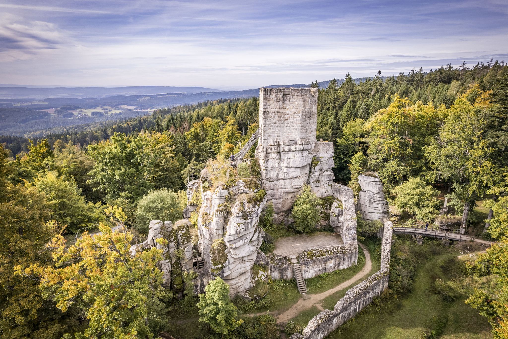
Hiking around Steinwald offers diverse landscapes characterized by a granite ridge with dramatic rock formations and mixed forests. The region features unique geological formations such as the Katzentrögel and Saubadfelsen, alongside extensive fish ponds and the picturesque Waldnaabtal Valley. Elevations reach over 900 meters, providing varied terrain for hikers.
Best bus station hiking trails around Steinwald
- The most popular bus station hiking route is Weißenstein Ruins – Kiebitzstein Rock Arch loop from Naturpark Steinwald, a 2.4 miles (3.9 km)…
Last updated: May 17, 2026
4.7
(117)
522
hikers
Easy hike. Great for any fitness level. Easily-accessible paths. Suitable for all skill levels.
4.8
(279)
923
hikers
Moderate hike. Good fitness required. Easily-accessible paths. Suitable for all skill levels.

Sign up for free
4.8
(15)
55
hikers
Moderate hike. Good fitness required. Easily-accessible paths. Suitable for all skill levels.
4.8
(31)
145
hikers
5.17km
01:28
120m
120m
Easy hike. Great for any fitness level. Easily-accessible paths. Suitable for all skill levels.
5.0
(14)
42
hikers
Moderate hike. Good fitness required. Easily-accessible paths. Suitable for all skill levels.
Get access to more routes and recommendations from other explorers.
Sign up for free
Already have an account?
Our route recommendations are based on thousands of hikes, rides, and runs completed by other people on komoot.
Start today with a free account
Your next adventure awaits.
Login or Signup

Other adventures around Steinwald


Tips from the Community

Without the tower, you don't see anything at first. Thanks to the tower, the view is gigantic
0
0

Really great view from the highest point in Steinwald
1
0

nice information board on the way to the castle ruins
0
0
Once a beautiful forest path, today a disaster thanks to harvesters, what a pity
0
1

Cotton grass in full bloom
0
0

If Dr. Snuggles and Peter Lustig were to build a house together - it would look exactly like this :-)
2
0
An information board explains that there was never a castle here, but there was a proven bar... that should be revived :-)
2
0

By clearing the trees you have a fantastic view of the Fichtelgebirge
2
0
Frequently Asked Questions
How many bus-accessible hiking trails are available in Steinwald?
There are 18 dedicated hiking routes in Steinwald that are easily accessible from bus stations. These trails offer a range of experiences, from leisurely strolls to more challenging day hikes, allowing you to explore the region's unique landscapes without a car.
Are there easy hiking options accessible by bus in Steinwald?
Yes, Steinwald offers 7 easy hiking routes that you can start directly from a bus stop. A great option for a relaxed walk is the Weißenstein Ruins – Kiebitzstein Rock Arch loop from Naturpark Steinwald, which is just under 4 km long and takes you through scenic areas.
What kind of natural features can I expect to see on bus-accessible hikes in Steinwald?
The bus-accessible trails in Steinwald showcase the region's dramatic rock formations, dense mixed forests, and tranquil water bodies. You'll encounter impressive granite structures like the Saubadfelsen and Zipfeltannenfelsen, and experience the unique geology that gives the Steinwald its character. The area is also rich in diverse flora and fauna, including berry bushes and rare wildflowers.
Are there any viewpoints or landmarks along the bus station hiking trails?
Absolutely! Many bus-accessible routes lead to significant landmarks and offer stunning views. You can hike to the Oberpfalzturm Observation Tower on Platte, which provides panoramic vistas, or explore the historic Weißenstein Castle Ruins. The trails also pass by unique rock formations such as the Saubad Rock and Zipfeltannenfelsen.
Can I find circular hiking routes starting from bus stops in Steinwald?
Yes, many of the bus-accessible routes in Steinwald are circular, allowing you to start and end your hike at the same bus stop. For example, the Oberpfalzturm Observation Tower on Platte – Weißenstein Castle Ruins loop from Pullenreuth is a moderate 14 km circular trail that lets you experience two major attractions.
What do other hikers enjoy most about hiking in Steinwald?
The Steinwald region is highly rated by the komoot community, with an average score of 4.59 stars. Reviewers often praise the dramatic rock formations, the peaceful mixed forests, and the well-maintained trails that make exploring the unique geology and natural beauty of the area a truly rewarding experience.
Are there family-friendly bus-accessible hikes in Steinwald?
Yes, Steinwald offers several family-friendly routes that are easily reached by bus. These trails are generally shorter and less strenuous, often featuring interesting natural sights or historical points that keep younger hikers engaged. The 'Steinreich' adventure trail, though not specifically listed here, is known for its family appeal in the wider region, focusing on geological features.
Are dogs allowed on the hiking trails in Steinwald, especially those accessible by bus?
Generally, dogs are welcome on the hiking trails in Steinwald. However, it's always recommended to keep them on a leash, especially in nature protection areas or when passing through villages, to protect wildlife and ensure a pleasant experience for all hikers. Public transport rules for dogs may vary, so check with the local bus operator beforehand.
What is the best time of year to hike the bus-accessible trails in Steinwald?
Steinwald is beautiful year-round, but spring and autumn are particularly popular for hiking. In spring, the forests burst with new growth, and in autumn, the deciduous trees display vibrant colors. Summer offers lush greenery, while winter can transform the landscape into a serene, snow-covered wonderland, though some trails might be more challenging due to snow and ice.
Are there any cafes or pubs near the bus-accessible trailheads in Steinwald?
While the focus of these routes is natural immersion, many villages and towns surrounding the Steinwald Nature Park, which serve as bus stops, offer local eateries and pubs. It's a good idea to check local listings for specific towns like Fuchsmühl or Pullenreuth for refreshment options near your chosen trailhead.
Do I need any special permits to hike in Steinwald Nature Park?
No, you do not need special permits to hike the public trails within the Steinwald Nature Park. The trails are freely accessible for visitors to enjoy the natural beauty and unique geological features of the region.
What is the longest bus-accessible hike in Steinwald?
One of the longer bus-accessible options is the Weißenstein Castle Ruins – Oberpfalzturm Observation Tower on Platte loop from Fuchsmühl. This moderate route covers over 16 km, offering a substantial day hike with significant elevation gain and rewarding views.
Most popular routes around Steinwald
Most popular attractions around Steinwald

Get inspired with the komoot mobile app


Explore more
Browse the best Hikes in other regions.
