The best hikes from bus stations around Mooserboden
4.6
(2182)
12,448
hikers
27
hikes
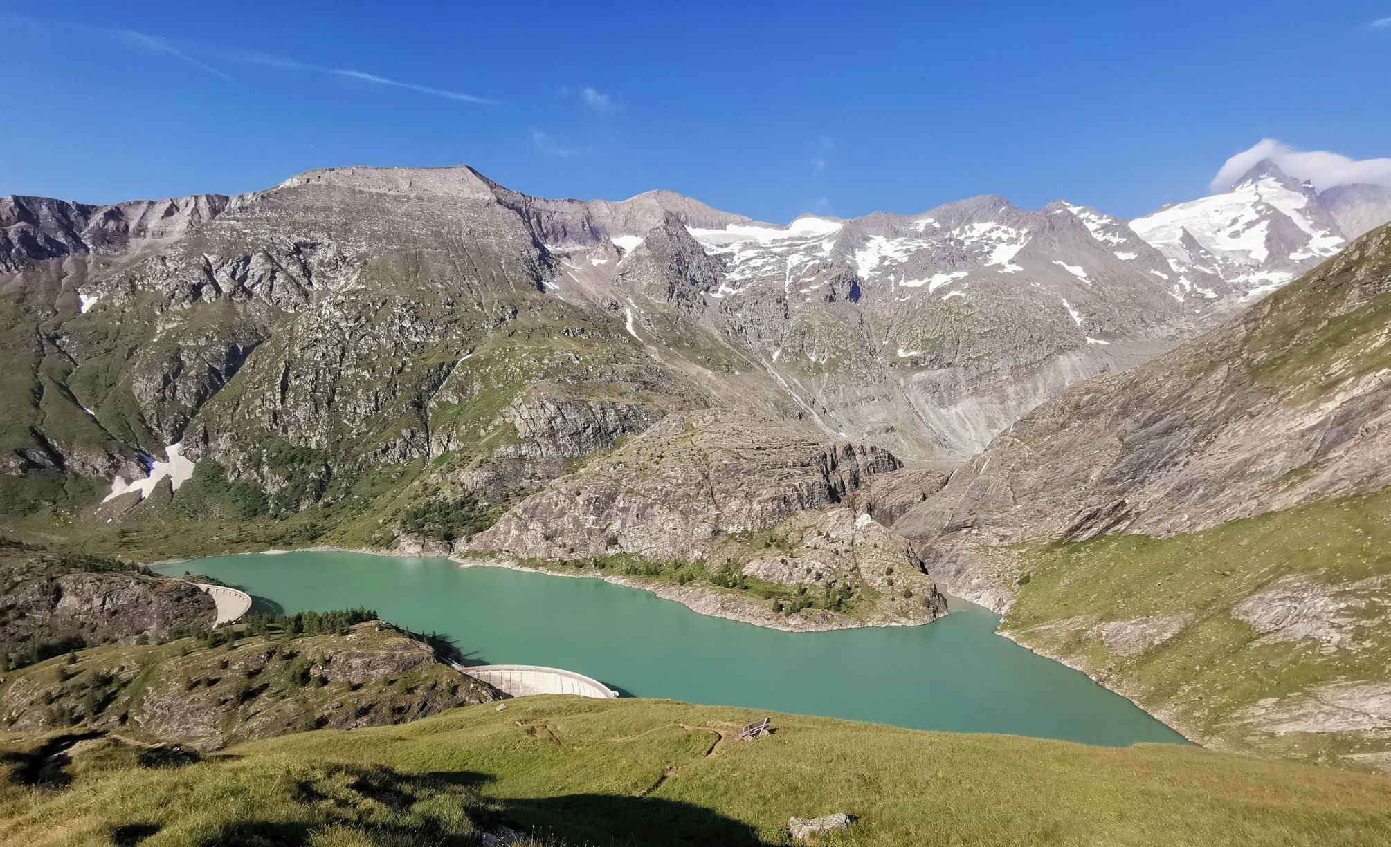
Bus station hiking trails around Mooserboden are situated in Austria's Hohe Tauern National Park, at approximately 2,040 meters above sea level. The region is characterized by high-alpine reservoirs, including Mooserboden and Wasserfallboden, set against a backdrop of 3,000-meter mountains and glaciers. Panoramic views of the Hohe Tauern and the Glockner Group are prominent features. The terrain includes diverse alpine flora and impressive dam structures.
Best bus station hiking trails around Mooserboden
- The most popular bus station hiking route is Mooserboden…
Last updated: June 29, 2026
4.9
(20)
158
hikers
8.57km
05:01
830m
830m
Hard hike. Very good fitness required. Sure-footedness, sturdy shoes and alpine experience required.
5.0
(27)
147
hikers
9.34km
03:09
200m
200m
Moderate hike. Good fitness required. Mostly accessible paths. Sure-footedness required.

Sign up for free
4.4
(19)
90
hikers
6.11km
03:41
600m
600m
Hard hike. Good fitness required. Sure-footedness, sturdy shoes and alpine experience required.
4.6
(9)
57
hikers
Moderate hike. Good fitness required. Mostly accessible paths. Sure-footedness required.
4.6
(17)
156
hikers
4.79km
01:50
230m
240m
Hard hike. Great for any fitness level. Sure-footedness, sturdy shoes and alpine experience required.
Get access to more routes and recommendations from other explorers.
Sign up for free
Already have an account?
Our route recommendations are based on thousands of hikes, rides, and runs completed by other people on komoot.
Start today with a free account
Your next adventure awaits.
Login or Signup
Popular around Mooserboden
Other adventures around Mooserboden

Tips from the Community

Here you can take a quiet walk with all the tourists
0
0

Gigantic engineering 😎
1
0

The most beautiful panorama over both reservoirs
0
0

View of the dam
0
1
impressive lake view
0
0

An experience!
0
1

Should stimulate thought, where people often just pass by carelessly...
0
0
Climbers can be seen at the dam wall 👀
0
1
Frequently Asked Questions
How many hiking trails are accessible directly from the bus station in Mooserboden?
There are 28 hiking trails around Mooserboden that are easily accessible from the bus station, offering a range of experiences from moderate walks to challenging mountain tours.
Are there any easy hiking trails from the Mooserboden bus station suitable for beginners?
Yes, there are 2 easy hiking trails starting from the Mooserboden bus station. These are perfect for beginners or those looking for a more relaxed walk amidst the stunning alpine scenery.
What kind of natural features and landmarks can I expect to see on hikes from the Mooserboden bus station?
Hikes from the Mooserboden bus station offer breathtaking views of the high-alpine reservoirs, Mooserboden and Wasserfallboden, set against the majestic peaks of the Hohe Tauern. You can also explore impressive man-made structures like the Mooserboden Dam, visit the Heathen Church Memorial, or reach the Höhenburg Summit (2,108 m) for panoramic vistas.
Are there any circular hiking routes starting from the Mooserboden bus station?
Yes, several circular routes are available. For a moderate option, consider the Mooserboden Dam – Mooserboden East Shore loop from Mooserboden, which covers about 9.3 km. For a more challenging circular hike, try the Mooserboden Dam – Heinrich-Schwaiger-Haus loop from Mooserboden.
What is the best time of year to go hiking from the Mooserboden bus station?
The best time for hiking in Mooserboden is typically during the warmer months, from late spring to early autumn, when the trails are clear of snow and the alpine flora is in bloom. The area is high-alpine, so always check local weather conditions before heading out.
Are there any family-friendly hiking options accessible from the Mooserboden bus station?
While many trails are moderate to difficult, the region offers paths like the Herb Trail (Kräuterlehrpfad Mooserboden) which is known for being family-friendly. It's a relatively easy walk showcasing diverse alpine flora.
Can I find places to eat or rest near the Mooserboden bus station after a hike?
Yes, there are mountain huts and restaurants in the area. The Bergrestaurant Mooserboden and Fürthermoar Alm offer traditional Austrian cuisine and are perfect spots for refreshment during or after your hike.
What do other hikers say about the trails around Mooserboden?
The hiking trails around Mooserboden are highly rated by the komoot community, with an average score of 4.56 stars from over 2,200 ratings. Hikers frequently praise the stunning panoramic mountain views, the impressive dam structures, and the diverse range of trails catering to different skill levels.
Are there any challenging hikes from the Mooserboden bus station for experienced hikers?
Absolutely. For experienced hikers, there are 12 difficult routes available. A challenging option is the View of the Mooserboden Dam – Little Grießkogel loop from Mooserboden, offering significant elevation gain and rewarding views.
How long do the hikes from Mooserboden bus station typically take?
Hike durations vary significantly. Shorter, moderate loops like the Mooserboden mountain restaurant – View of the Mooserboden Dam loop from Mooserboden can take around 2.5 hours. More demanding routes, such as the Mooserboden Dam – Heinrich-Schwaiger-Haus loop from Mooserboden, can take over 5 hours to complete.
Is public transport the only way to access the Mooserboden hiking trails?
Mooserboden is uniquely accessible via a scenic bus ride and Europe's largest open inclined lift, the Lärchwand inclined lift, making the journey itself part of the experience. This system ensures convenient access to the high-alpine starting points for the hiking trails.
Most popular attractions around Mooserboden

Get inspired with the komoot mobile app


Explore more
Browse the best Hikes in other regions.
